GRN grid region: N36E10
A grid 'square' of approximately 160km x 160km, part of the Global Reference Network of 19,833 grid cells covering the Earth.


Northeast Corner:
54 0'0'' N , 22 51'53'' E ( 54,22.865 )
Southwest Corner:
52 30'0'' N , 20 34'41'' E ( 52.5,20.5783 )
Select Mineral List Type
Standard Detailed Gallery Strunz Chemical ElementsCommodity List
This is a list of exploitable or exploited mineral commodities recorded at this locality.Mineral List
75 valid minerals.
Rock Types Recorded
Note: data is currently VERY limited. Please bear with us while we work towards adding this information!
Select Rock List Type
Alphabetical List Tree DiagramLocalities within grid area
- Masovian Voivodeship
- Podlaskie Voivodeship
- Podlaskie Voivodeship
- Tajno alkaline-carbonatite massif
- Tajno Podjeziorne
- ⭔Warmian-Masurian Voivodeship
- Ełk County
- Giżycko County


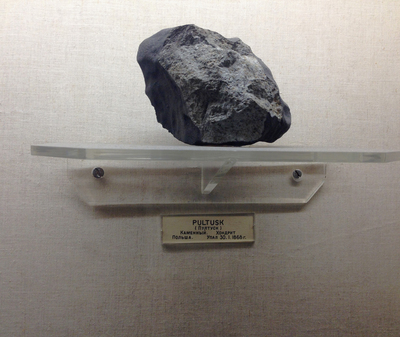
Pultusk meteorite, Pułtusk County, Masovian Voivodeship, Poland