| Locality | Latitude | Longitude | Distance | Bearing |
|---|
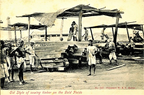
| Kolar Gold Fields, Kolar District, Karnataka, India | 12° 57' 42" N | 78° 16' 14" E | 0.8km (0.5 miles) | |
| East Lode, Central Schist Belt, Kolar Gold Fields, Kolar District, Karnataka, India | 12° 57' 13" N | 78° 15' 44" E | 1.4km (0.9 miles) | |
| Ooregaum Lode, Central Schist Belt, Kolar Gold Fields, Kolar District, Karnataka, India | 12° 57' 19" N | 78° 15' 37" E | 1.6km (1.0 miles) | |
| Mysore Mine, Central Schist Belt, Kolar Gold Fields, Kolar District, Karnataka, India | 12° 57' 1" N | 78° 15' 40" E | 1.7km (1.0 miles) | |
| Champion lode, Central Schist Belt, Kolar Gold Fields, Kolar District, Karnataka, India | 12° 57' 9" N | 78° 15' 35" E | 1.7km (1.1 miles) | |
| Central Schist Belt, Kolar Gold Fields, Kolar District, Karnataka, India | 12° 57' 53" N | 78° 15' 30" E | 2.1km (1.3 miles) | |
| Oakley's Shaft, Central Schist Belt, Kolar Gold Fields, Kolar District, Karnataka, India | 12° 56' 50" N | 78° 15' 29" E | 2.1km (1.3 miles) | |
| Mundy's deposit, Central Schist Belt, Kolar Gold Fields, Kolar District, Karnataka, India | 12° 56' 38" N | 78° 15' 33" E | 2.2km (1.4 miles) | |
| Nundydroog Mine, Central Schist Belt, Kolar Gold Fields, Kolar District, Karnataka, India | 12° 57' 38" N | 78° 15' 18" E | 2.3km (1.4 miles) | |
| Tennant's Shaft, Central Schist Belt, Kolar Gold Fields, Kolar District, Karnataka, India | 12° 56' 25" N | 78° 15' 34" E | 2.5km (1.5 miles) | |
| New Quartz Lode, Central Schist Belt, Kolar Gold Fields, Kolar District, Karnataka, India | 12° 57' 5" N | 78° 15' 5" E | 2.6km (1.6 miles) | |
| Brown lode, Central Schist Belt, Kolar Gold Fields, Kolar District, Karnataka, India | 12° 56' 3" N | 78° 15' 50" E | 2.7km (1.7 miles) | |
| West Prospect lode, Central Schist Belt, Kolar Gold Fields, Kolar District, Karnataka, India | 12° 56' 7" N | 78° 15' 26" E | 3.0km (1.9 miles) | |
| Green Lode, Central Schist Belt, Kolar Gold Fields, Kolar District, Karnataka, India | 12° 55' 39" N | 78° 15' 52" E | 3.4km (2.1 miles) | |
| Edgars Shaft, Central Schist Belt, Kolar Gold Fields, Kolar District, Karnataka, India | 12° 55' 47" N | 78° 15' 33" E | 3.4km (2.1 miles) | |
| Red Lode, Central Schist Belt, Kolar Gold Fields, Kolar District, Karnataka, India | 12° 55' 39" N | 78° 15' 49" E | 3.4km (2.1 miles) | |
| Crockers Brown Lode, Central Schist Belt, Kolar Gold Fields, Kolar District, Karnataka, India | 12° 55' 16" N | 78° 15' 59" E | 4.0km (2.5 miles) | |
| McTaggart West lode, Central Schist Belt, Kolar Gold Fields, Kolar District, Karnataka, India | 12° 54' 58" N | 78° 15' 57" E | 4.6km (2.8 miles) | |
| Mc Taggart Shaft, McTaggart West lode, Central Schist Belt, Kolar Gold Fields, Kolar District, Karnataka, India | 12° 54' 55" N | 78° 15' 55" E | 4.7km (2.9 miles) | |
| Bisanatham, Chittoor District, Andhra Pradesh, India | 12° 50' 9" N | 78° 15' 40" E | 13.5km (8.4 miles) | |
| Mallappakonda deposit, South Schist Belt, Kolar Gold Fields, Chittoor District, Andhra Pradesh, India | 12° 45' 0" N | 78° 15' 0" E | 23.1km (14.4 miles) | |
| Manigatta deposit, North Schist Belt, Kolar Gold Fields, Kolar District, Karnataka, India | 13° 10' 59" N | 78° 15' 0" E | 25.4km (15.8 miles) | |
| Chigargunta Mine (Chigarikunta Mine), South Schist Belt, Kolar Gold Fields, Kolar District, Karnataka, India | 12° 41' 59" N | 78° 15' 0" E | 28.6km (17.8 miles) | |
| Salampatti massif, Tirupattur District, Tamil Nadu, India | 12° 28' 0" N | 78° 27' 0" E | 57.6km (35.8 miles) | |
| Elagiri, Tirupattur District, Tamil Nadu, India | 12° 34' 0" N | 78° 37' 59" E | 58.2km (36.1 miles) | |
| Sevathur Massif, Tirupattur District, Tamil Nadu, India | 12° 25' 0" N | 78° 31' 59" E | 66.2km (41.1 miles) | |
| Kakangari meteorite, Krishnagiri District, Tamil Nadu, India | 12° 22' 59" N | 78° 31' 0" E | 68.9km (42.8 miles) | |
| Sevattur carbonatite complex, Krishnagiri District, Tamil Nadu, India | 12° 22' 0" N | 78° 31' 59" E | 71.3km (44.3 miles) | |
| Samalpatti carbonatite complex, Krishnagiri District, Tamil Nadu, India | 12° 19' 0" N | 78° 27' 0" E | 73.6km (45.7 miles) | |
| Pikkili, Dharmapuri district, Tamil Nadu, India | 12° 15' 0" N | 78° 0' 0" E | 84.0km (52.2 miles) | |


Champion lode, Central Schist Belt, Kolar Gold Fields, Kolar District, Karnataka, India