GRN grid region: N42E60
A grid 'square' of approximately 160km x 160km, part of the Global Reference Network of 19,833 grid cells covering the Earth.


Northeast Corner:
63 0'0'' N , 172 40'11'' E ( 63,172.67 )
Southwest Corner:
61 30'0'' N , 169 47'31'' E ( 61.5,169.792 )
Climate:
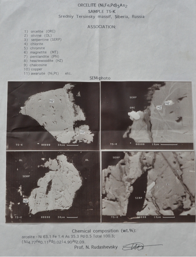
Select Mineral List Type
Standard Detailed Gallery Strunz Chemical ElementsCommodity List
This is a list of exploitable or exploited mineral commodities recorded at this locality.Mineral List
65 valid minerals. 2 (TL) - type locality of valid minerals.
Rock Types Recorded
Note: data is currently VERY limited. Please bear with us while we work towards adding this information!
Select Rock List Type
Alphabetical List Tree DiagramLocalities within grid area
- Kamchatka Krai


Chirynaisky Massif, Koryak Okrug, Kamchatka Krai, Russia