| Locality | Latitude | Longitude | Distance | Bearing |
|---|
| Bovenste Bosch quarry, Terziet, Epen, Gulpen-Wittem, Limburg, Netherlands | 50° 45' 30" N | 5° 53' 28" E | 2.4km (1.5 miles) | |
| Terziet, Epen, Gulpen-Wittem, Limburg, Netherlands | 50° 45' 37" N | 5° 54' 40" E | 3.7km (2.3 miles) | |
| Sijlerbeek, Epen, Gulpen-Wittem, Limburg, Netherlands | 50° 46' 3" N | 5° 55' 18" E | 4.3km (2.6 miles) | |
| Geuldal, Epen, Gulpen-Wittem, Limburg, Netherlands | 50° 46' 29" N | 5° 55' 18" E | 4.3km (2.7 miles) | |
| Wingberg, Vaals, Limburg, Netherlands | 50° 46' 22" N | 5° 55' 21" E | 4.3km (2.7 miles) | |
| Bommerig, Mechelen, Gulpen-Wittem, Limburg, Netherlands | 50° 46' 46" N | 5° 55' 38" E | 4.8km (3.0 miles) | |
| Heimans quarry, Vaals, Limburg, Netherlands | 50° 45' 46" N | 5° 55' 51" E | 5.0km (3.1 miles) | |
| Kamp quarry, Vaals, Limburg, Netherlands | 50° 45' 47" N | 5° 55' 57" E | 5.1km (3.1 miles) | |
| Sippenaeken, Plombières, Liège, Wallonia, Belgium | 50° 45' 2" N | 5° 56' 2" E | 5.5km (3.4 miles) | |
| Cottessen quarry, Cottessen, Vaals, Limburg, Netherlands | 50° 45' 31" N | 5° 56' 15" E | 5.5km (3.4 miles) | |
| Cottessen, Vaals, Limburg, Netherlands | 50° 45' 32" N | 5° 56' 23" E | 5.7km (3.5 miles) | |
| Terbruggen, Sippenaeken, Plombières, Liège, Wallonia, Belgium | 50° 45' 3" N | 5° 56' 32" E | 6.1km (3.8 miles) | |
| Kinkenberg, 's-Gravenvoeren, Voeren, Limburg, Flanders, Belgium | 50° 45' 46" N | 5° 46' 6" E | 6.5km (4.1 miles) | |
| Hombourg, Plombières, Liège, Wallonia, Belgium | 50° 43' 23" N | 5° 55' 11" E | 6.6km (4.1 miles) | |
| Groot Welsden quarry, Margraten, Eijsden-Margraten, Limburg, Netherlands | 50° 49' 45" N | 5° 48' 33" E | 7.6km (4.7 miles) | |
| Vogelsang, Plombières, Liège, Wallonia, Belgium | 50° 42' 1" N | 5° 54' 0" E | 8.1km (5.1 miles) | |
| Blankenberg quarry, Cadier en Keer, Eijsden-Margraten, Limburg, Netherlands | 50° 49' 13" N | 5° 46' 40" E | 8.2km (5.1 miles) | |
| Het Houbenbergske II quarry, Margraten, Eijsden-Margraten, Limburg, Netherlands | 50° 50' 3" N | 5° 48' 19" E | 8.2km (5.1 miles) | |
| Bleyberg zinc and lead smelter slag locality, Plombières, Liège, Wallonia, Belgium | 50° 44' 9" N | 5° 58' 0" E | 8.3km (5.1 miles) | |
| Het Houbenbergske I quarry, Margraten, Eijsden-Margraten, Limburg, Netherlands | 50° 50' 8" N | 5° 48' 19" E | 8.4km (5.2 miles) | |
| Bleyberg mine, Plombières, Liège, Wallonia, Belgium | 50° 44' 2" N | 5° 58' 10" E | 8.6km (5.3 miles) | |
| Rijckholt flint mines, Rijckholt, Gronsveld, Eijsden-Margraten, Limburg, Netherlands | 50° 47' 47" N | 5° 44' 45" E | 8.7km (5.4 miles) | |
| Scheve Spar I quarry, Sibbe, Valkenburg aan de Geul, Limburg, Netherlands | 50° 50' 47" N | 5° 50' 41" E | 8.7km (5.4 miles) | |
| Essenbosch I quarry, Sibbe, Valkenburg aan de Geul, Limburg, Netherlands | 50° 50' 47" N | 5° 50' 35" E | 8.7km (5.4 miles) | |
| Essenbosch II quarry, Sibbe, Valkenburg aan de Geul, Limburg, Netherlands | 50° 50' 48" N | 5° 50' 35" E | 8.7km (5.4 miles) | |
| Sibbe, Valkenburg aan de Geul, Limburg, Netherlands | 50° 50' 40" N | 5° 49' 38" E | 8.7km (5.4 miles) | |
| Essenbosch III quarry, Sibbe, Valkenburg aan de Geul, Limburg, Netherlands | 50° 50' 49" N | 5° 50' 35" E | 8.8km (5.4 miles) | |
| Val-Dieu, Aubel, Liège, Wallonia, Belgium | 50° 41' 55" N | 5° 48' 17" E | 8.8km (5.4 miles) | |
| Essenbosch IV quarry, Sibbe, Valkenburg aan de Geul, Limburg, Netherlands | 50° 50' 50" N | 5° 50' 38" E | 8.8km (5.5 miles) | |
| Scheve Spar II quarry, Sibbe, Valkenburg aan de Geul, Limburg, Netherlands | 50° 50' 52" N | 5° 50' 47" E | 8.8km (5.5 miles) | |
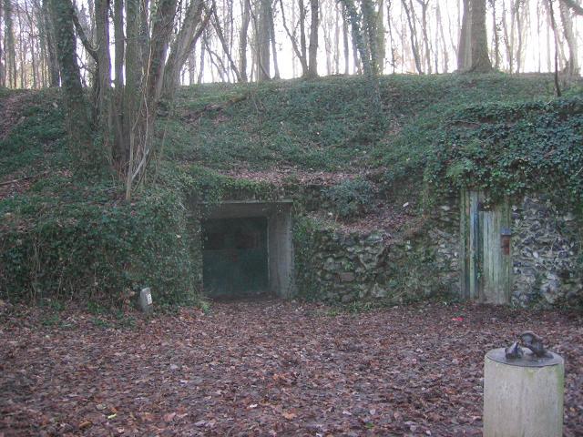


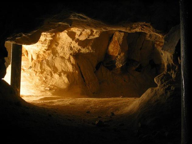


Rijckholt flint mines, Rijckholt, Gronsveld, Eijsden-Margraten, Limburg, Netherlands