| Locality | Latitude | Longitude | Distance | Bearing |
|---|
| Haverstraw, Rockland County, New York, USA | 41° 10' 32" N | 73° 57' 6" W | 2.6km (1.6 miles) | |
| Haverstraw Quarry (Tilcon New York; Appalachian Stone), Haverstraw, Rockland County, New York, USA | 41° 10' 32" N | 73° 57' 6" W | 2.6km (1.6 miles) | |
| Dunderberg Mine, Stony Point (Woodbury), Rockland County, New York, USA | 41° 14' 27" N | 73° 58' 14" W | 4.9km (3.0 miles) | |
| Tomkins Cove Quarry, Stony Point (Woodbury), Rockland County, New York, USA | 41° 14' 47" N | 73° 58' 55" W | 5.7km (3.5 miles) | |
| Verplanck Point, Verplanck, Cortlandt Township, Westchester County, New York, USA | 41° 15' 1" N | 73° 57' 57" W | 5.9km (3.6 miles) | |
| Verplanck, Cortlandt Township, Westchester County, New York, USA | 41° 15' 10" N | 73° 57' 37" W | 6.1km (3.8 miles) | |
| Croton-on-Hudson, Cortlandt Township, Westchester County, New York, USA | 41° 12' 30" N | 73° 53' 24" W | 6.3km (3.9 miles) | |
| Montrose, Cortlandt Township, Westchester County, New York, USA | 41° 15' 8" N | 73° 55' 53" W | 6.7km (4.2 miles) | |
| Crugers Emery Mine, Montrose, Cortlandt Township, Westchester County, New York, USA | 41° 15' 14" N | 73° 55' 18" W | 7.2km (4.5 miles) | |
| Rockland Lake Landing, Rockland Lake, Haverstraw, Rockland County, New York, USA | 41° 8' 17" N | 73° 55' 20" W | 7.5km (4.6 miles) | |
| Dickey Brook, Peekskill, Westchester County, New York, USA | 41° 16' 22" N | 73° 56' 29" W | 8.6km (5.3 miles) | |
| Ladentown, Town of Ramapo, Rockland County, New York, USA | 41° 11' 8" N | 74° 4' 4" W | 8.7km (5.4 miles) | |
| Ossining (Sing Sing), Westchester County, New York, USA | 41° 9' 46" N | 73° 51' 42" W | 9.4km (5.9 miles) | |
| New York City Aquaduct openings, Ossining (Sing Sing), Westchester County, New York, USA | 41° 9' 46" N | 73° 51' 42" W | 9.4km (5.9 miles) | |
| DiRubbo Emery Quarry, Cortlandt Township, Westchester County, New York, USA | 41° 14' 39" N | 73° 52' 5" W | 9.6km (6.0 miles) | |
| Grape Swamp Mountain, Harriman State Park, Rockland County, New York, USA | 41° 14' 31" N | 74° 4' 4" W | 10.0km (6.2 miles) | |
| Sparta Mine, Ossining (Sing Sing), Westchester County, New York, USA | 41° 8' 59" N | 73° 51' 44" W | 10.0km (6.2 miles) | |
| New York Traprock Quarry, West Nyack, Clarkstown, Rockland County, New York, USA | 41° 6' 20" N | 73° 57' 29" W | 10.2km (6.4 miles) | |
| September Mine, Peekskill, Westchester County, New York, USA | 41° 16' 59" N | 73° 55' 0" W | 10.3km (6.4 miles) | |
| Wesley Hills, Town of Ramapo, Rockland County, New York, USA | 41° 10' 9" N | 74° 5' 0" W | 10.5km (6.5 miles) | |
| Peekskill meteorite, Peekskill, Westchester County, New York, USA | 41° 17' 11" N | 73° 54' 59" W | 10.7km (6.6 miles) | |
| De Luca Mine (McCoy Mine), Peekskill, Westchester County, New York, USA | 41° 17' 23" N | 73° 55' 14" W | 10.9km (6.8 miles) | |
| Peekskill, Westchester County, New York, USA | 41° 17' 23" N | 73° 55' 14" W | 10.9km (6.8 miles) | |
| Mohegan Quarries, Peekskill, Westchester County, New York, USA | 41° 17' 30" N | 73° 55' 0" W | 11.2km (7.0 miles) | |
| McCoy's Gold Mine, Camp Smith, Peekskill, Westchester County, New York, USA | 41° 17' 59" N | 73° 56' 30" W | 11.5km (7.2 miles) | |
| Iona Island, Bear Mountain State Park, Rockland County, New York, USA | 41° 18' 23" N | 73° 58' 54" W | 12.2km (7.6 miles) | |
| Strang Emery Pit, Toddville, Cortlandt Township, Westchester County, New York, USA | 41° 17' 30" N | 73° 53' 15" W | 12.3km (7.6 miles) | |
| Toddville, Cortlandt Township, Westchester County, New York, USA | 41° 17' 37" N | 73° 53' 18" W | 12.4km (7.7 miles) | |
| Bear Mountain, Bear Mountain State Park, Orange County, New York, USA | 41° 18' 46" N | 74° 0' 24" W | 13.3km (8.3 miles) | |
| Beechy Bottom Mine, Bear Mountain State Park, Rockland County, New York, USA | 41° 18' 10" N | 74° 2' 24" W | 13.3km (8.3 miles) | |


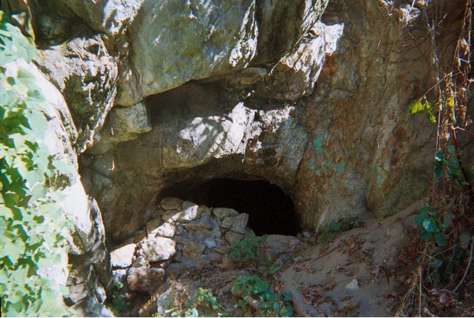


Sparta Mine, Ossining, Westchester County, New York, USA