| Locality | Latitude | Longitude | Distance | Bearing |
|---|
| Merrimack, Hillsborough County, New Hampshire, USA | 42° 51' 59" N | 71° 29' 36" W | 0.1km (0.1 miles) | |
| Litchfield, Hillsborough County, New Hampshire, USA | 42° 50' 34" N | 71° 27' 17" W | 4.0km (2.5 miles) | |
| Litchfield Sand & Gravel Quarry, Litchfield, Hillsborough County, New Hampshire, USA | 42° 52' 57" N | 71° 26' 21" W | 4.8km (3.0 miles) | |
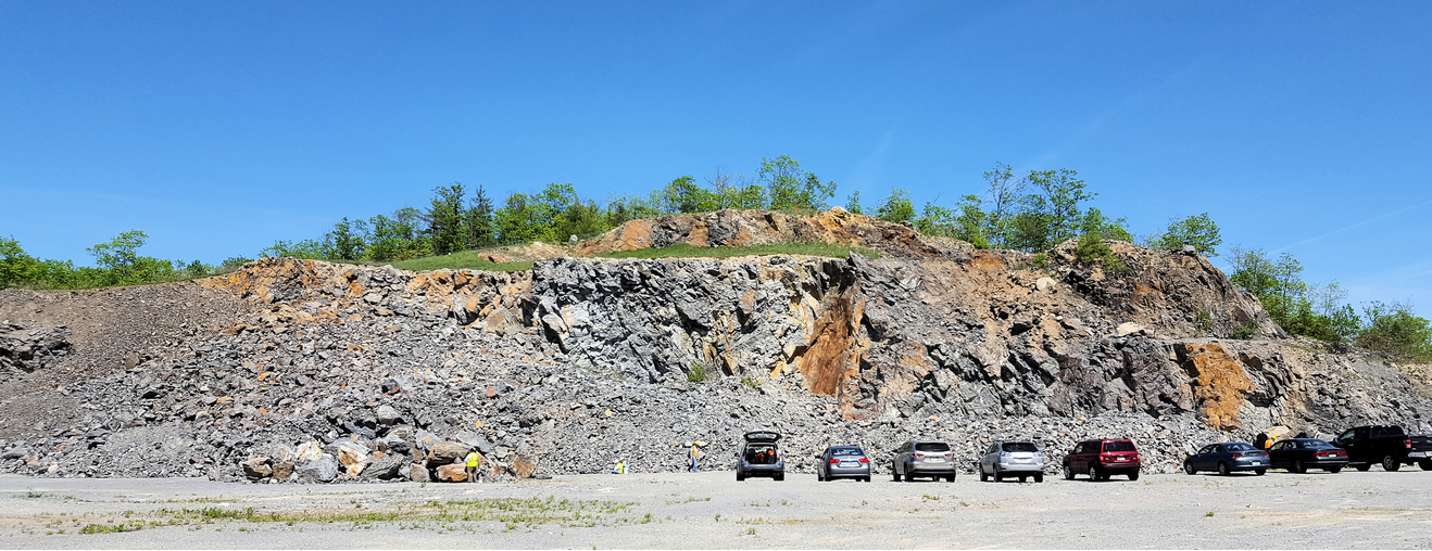
| Audley Quarry, Merrimack, Hillsborough County, New Hampshire, USA | 42° 48' 36" N | 71° 29' 49" W | 6.1km (3.8 miles) | |
| Continental Paving Quarry, Londonderry, Rockingham County, New Hampshire, USA | 42° 49' 40" N | 71° 25' 32" W | 6.9km (4.3 miles) | |
| Route 101 magnetite locality, Bedford, Hillsborough County, New Hampshire, USA | 42° 54' 25" N | 71° 34' 0" W | 7.6km (4.7 miles) | |
| Route 101A construction site, Merrimack, Hillsborough County, New Hampshire, USA | 42° 48' 15" N | 71° 32' 59" W | 8.2km (5.1 miles) | |
| Bedford, Hillsborough County, New Hampshire, USA | 42° 56' 47" N | 71° 30' 56" W | 9.2km (5.7 miles) | |
| Londonderry, Rockingham County, New Hampshire, USA | 42° 51' 54" N | 71° 22' 26" W | 9.7km (6.1 miles) | |
| Joppa Hill, Amherst, Hillsborough County, New Hampshire, USA | 42° 56' 2" N | 71° 34' 54" W | 10.5km (6.5 miles) | |
| Amherst, Hillsborough County, New Hampshire, USA | 42° 51' 41" N | 71° 37' 31" W | 10.8km (6.7 miles) | |
| Route 101/101A road cuts, Amherst, Hillsborough County, New Hampshire, USA | 42° 49' 23" N | 71° 36' 52" W | 10.9km (6.8 miles) | |
| Pulpit Road locality, Bedford, Hillsborough County, New Hampshire, USA | 42° 56' 39" N | 71° 35' 26" W | 11.8km (7.4 miles) | |
| Hudson, Hillsborough County, New Hampshire, USA | 42° 45' 52" N | 71° 26' 22" W | 12.0km (7.4 miles) | |
| Cortland Drive road cuts, Bedford, Hillsborough County, New Hampshire, USA | 42° 56' 50" N | 71° 35' 26" W | 12.1km (7.5 miles) | |
| Nashua, Hillsborough County, New Hampshire, USA | 42° 45' 27" N | 71° 27' 51" W | 12.2km (7.6 miles) | |
| Hollis Gold Mine, Hollis, Hillsborough County, New Hampshire, USA | 42° 45' 51" N | 71° 33' 59" W | 12.7km (7.9 miles) | |
| Milford Granite Company Quarries, Milford, Hillsborough County, New Hampshire, USA | 42° 49' 35" N | 71° 38' 26" W | 12.7km (7.9 miles) | |
| Young Quarry, Milford, Hillsborough County, New Hampshire, USA | 42° 49' 9" N | 71° 38' 19" W | 12.9km (8.0 miles) | |
| Milford, Hillsborough County, New Hampshire, USA | 42° 50' 7" N | 71° 38' 56" W | 13.1km (8.1 miles) | |
| Hayden Quarry, Milford, Hillsborough County, New Hampshire, USA | 42° 48' 47" N | 71° 38' 16" W | 13.1km (8.2 miles) | |
| Souhegan Quarry, Milford, Hillsborough County, New Hampshire, USA | 42° 48' 3" N | 71° 38' 21" W | 13.9km (8.6 miles) | |
| Tonella Old Quarry, Milford, Hillsborough County, New Hampshire, USA | 42° 48' 43" N | 71° 38' 58" W | 14.0km (8.7 miles) | |
| Manchester, Hillsborough County, New Hampshire, USA | 42° 59' 26" N | 71° 27' 48" W | 14.2km (8.8 miles) | |
| Kittredge Quarry, Milford, Hillsborough County, New Hampshire, USA | 42° 48' 42" N | 71° 39' 24" W | 14.6km (9.1 miles) | |
| Pease Quarry, Milford, Hillsborough County, New Hampshire, USA | 42° 48' 50" N | 71° 39' 38" W | 14.8km (9.2 miles) | |
| Lovejoy Quarry, Milford, Hillsborough County, New Hampshire, USA | 42° 48' 31" N | 71° 39' 39" W | 15.0km (9.3 miles) | |
| Bishop Quarry, Milford, Hillsborough County, New Hampshire, USA | 42° 51' 10" N | 71° 40' 41" W | 15.1km (9.4 miles) | |
| Carlton Quarry, Milford, Hillsborough County, New Hampshire, USA | 42° 51' 13" N | 71° 41' 5" W | 15.6km (9.7 miles) | |
| Ledge Road, Windham, Rockingham County, New Hampshire, USA | 42° 48' 13" N | 71° 19' 13" W | 15.7km (9.7 miles) | |


Route 101A construction site, Merrimack, Hillsborough County, New Hampshire, USA