| Locality | Latitude | Longitude | Distance | Bearing |
|---|
| Wall Shaft Mine, Castleton, High Peak, Derbyshire, England, UK | 53° 20' 26" N | 1° 46' 50" W | 0.0km (0.0 miles) | |
| Peakshole Sough, Castleton, High Peak, Derbyshire, England, UK | 53° 20' 26" N | 1° 46' 44" W | 0.1km (0.1 miles) | |
| Peak Cavern, Castleton, High Peak, Derbyshire, England, UK | 53° 20' 24" N | 1° 46' 42" W | 0.1km (0.1 miles) | |
| Cavedale, Castleton, High Peak, Derbyshire, England, UK | 53° 20' 20" N | 1° 46' 39" W | 0.3km (0.2 miles) | |
| Cave Dale, Castleton, High Peak, Derbyshire, England, UK | 53° 20' 22" N | 1° 46' 35" W | 0.3km (0.2 miles) | |
| Shackhole Scrin, Castleton, High Peak, Derbyshire, England, UK | 53° 20' 20" N | 1° 47' 17" W | 0.5km (0.3 miles) | |
| Cowlow Nick, Castleton, High Peak, Derbyshire, England, UK | 53° 20' 17" N | 1° 47' 18" W | 0.6km (0.4 miles) | |
| Slate Scrin Mine, Castleton, High Peak, Derbyshire, England, UK | 53° 20' 17" N | 1° 47' 21" W | 0.6km (0.4 miles) | |
| Speedwell Mine (Oakden Level), Castleton, High Peak, Derbyshire, England, UK | 53° 20' 28" N | 1° 47' 31" W | 0.8km (0.5 miles) | |
| Kirk Grove (incl. Clark Grove), Nether Dirtlow Mines, Dirtlow Rake, Castleton, High Peak, Derbyshire, England, UK | 53° 20' 2" N | 1° 46' 32" W | 0.8km (0.5 miles) | |
| Royse Grove, Nether Dirtlow Mines, Dirtlow Rake, Castleton, High Peak, Derbyshire, England, UK | 53° 20' 7" N | 1° 46' 19" W | 0.8km (0.5 miles) | |
| Needham Grove, Nether Dirtlow Mines, Dirtlow Rake, Castleton, High Peak, Derbyshire, England, UK | 53° 20' 4" N | 1° 46' 22" W | 0.8km (0.5 miles) | |
| Smith Grove, Nether Dirtlow Mines, Dirtlow Rake, Castleton, High Peak, Derbyshire, England, UK | 53° 20' 8" N | 1° 46' 15" W | 0.8km (0.5 miles) | |
| Ashton Grove, Nether Dirtlow Mines, Dirtlow Rake, Castleton, High Peak, Derbyshire, England, UK | 53° 20' 10" N | 1° 46' 7" W | 0.9km (0.6 miles) | |
| How Grove (incl. Nall Grove), Dirtlow Rake, Castleton, High Peak, Derbyshire, England, UK | 53° 19' 54" N | 1° 46' 49" W | 1.0km (0.6 miles) | |
| Fire Scrin, Castleton, High Peak, Derbyshire, England, UK | 53° 20' 12" N | 1° 45' 58" W | 1.0km (0.6 miles) | |
| Red Seats Mine (Red Seats Vein), Castleton, High Peak, Derbyshire, England, UK | 53° 20' 25" N | 1° 45' 52" W | 1.1km (0.7 miles) | |
| Siggate Head Mine, Castleton, High Peak, Derbyshire, England, UK | 53° 20' 13" N | 1° 45' 56" W | 1.1km (0.7 miles) | |
| Winnats Pass, Castleton, High Peak, Derbyshire, England, UK | 53° 20' 25" N | 1° 47' 48" W | 1.1km (0.7 miles) | |
| Kytle End Vein (incl. Clogg Buckle Grove; Luck-at-Last Mine), Castleton, High Peak, Derbyshire, England, UK | 53° 20' 17" N | 1° 45' 47" W | 1.2km (0.7 miles) | |
| Old Tor Mine, Castleton, High Peak, Derbyshire, England, UK | 53° 20' 29" N | 1° 47' 53" W | 1.2km (0.7 miles) | |
| Pindale Old Engine Shaft (Pindale Old Engine Mine), Castleton, High Peak, Derbyshire, England, UK | 53° 20' 16" N | 1° 45' 47" W | 1.2km (0.7 miles) | |
| Treak Cliff Cavern (Treak Cliff Mine), Castleton, High Peak, Derbyshire, England, UK | 53° 20' 42" N | 1° 47' 49" W | 1.2km (0.8 miles) | |
| Dirtlow Stone Mine (incl. Bennett Grove; Bullock Grove), Dirtlow Rake, Castleton, High Peak, Derbyshire, England, UK | 53° 19' 47" N | 1° 47' 6" W | 1.2km (0.8 miles) | |
| Pindale Quarry, Bradwell, Derbyshire Dales District, Derbyshire, England, UK | 53° 20' 12" N | 1° 45' 47" W | 1.2km (0.8 miles) | |
| Pindale End Mine, Castleton, High Peak, Derbyshire, England, UK | 53° 20' 19" N | 1° 45' 37" W | 1.4km (0.8 miles) | |
| Laporte Minerals openpit, Dirtlow Rake, Castleton, High Peak, Derbyshire, England, UK | 53° 19' 47" N | 1° 46' 56" W | 1.4km (0.9 miles) | |
| Hope Quarry, Bradwell, Derbyshire Dales District, Derbyshire, England, UK | 53° 19' 48" N | 1° 46' 4" W | 1.4km (0.9 miles) | |
| Ashton's Mine (Pindale Mine), Hope, High Peak, Derbyshire, England, UK | 53° 20' 21" N | 1° 45' 28" W | 1.5km (0.9 miles) | |
| Hollandtwine Mine, Dirtlow Rake, Castleton, High Peak, Derbyshire, England, UK | 53° 19' 41" N | 1° 47' 28" W | 1.6km (1.0 miles) | |
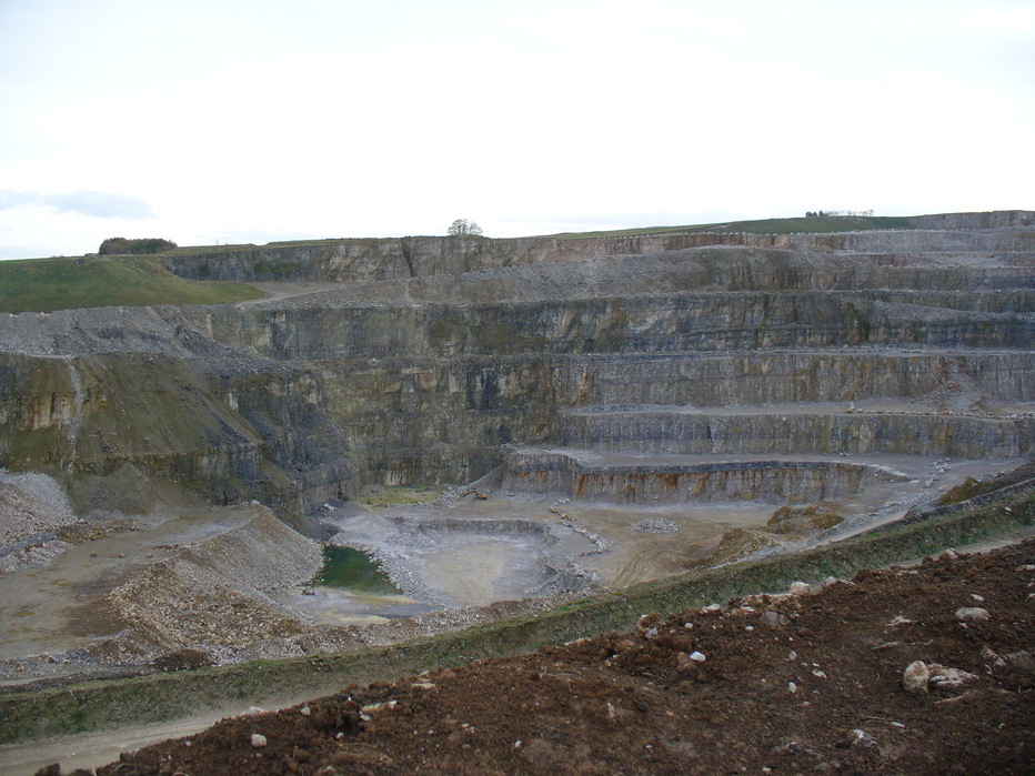


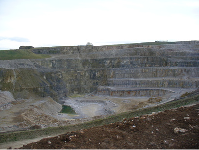


Hope Quarry, Bradwell, Derbyshire Dales District, Derbyshire, England, UK