| Locality | Latitude | Longitude | Distance | Bearing |
|---|
| Ultra Hill, Sopron, Győr-Moson-Sopron County, Hungary | 47° 40' 2" N | 16° 31' 2" E | 4.7km (2.9 miles) | |
| Nádor-magaslat, Sopron, Győr-Moson-Sopron County, Hungary | 47° 40' 45" N | 16° 33' 27" E | 4.9km (3.0 miles) | |
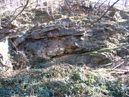
| Gloriette Quarry, Sopron, Győr-Moson-Sopron County, Hungary | 47° 40' 24" N | 16° 33' 28" E | 5.4km (3.3 miles) | |
| Új hill, Sopron, Győr-Moson-Sopron County, Hungary | 47° 39' 39" N | 16° 31' 40" E | 5.6km (3.5 miles) | |
| Deák-kút Quarry, Sopron, Győr-Moson-Sopron County, Hungary | 47° 40' 5" N | 16° 33' 47" E | 6.1km (3.8 miles) | |
| Récényi Quarry, Sopron, Győr-Moson-Sopron County, Hungary | 47° 39' 33" N | 16° 33' 2" E | 6.4km (4.0 miles) | |
| Sopron-Brennbergbánya lignite mines, Sopron, Győr-Moson-Sopron County, Hungary | 47° 39' 13" N | 16° 29' 20" E | 6.4km (4.0 miles) | |
| Hermes shaft, Sopron-Brennbergbánya lignite mines, Sopron, Győr-Moson-Sopron County, Hungary | 47° 39' 10" N | 16° 28' 23" E | 6.9km (4.3 miles) | |
| Várisi Quarry, Sopron, Győr-Moson-Sopron County, Hungary | 47° 40' 6" N | 16° 34' 47" E | 7.0km (4.3 miles) | |
| Helenen shaft, Ritzing lignite mines, Ritzing, Oberpullendorf District, Burgenland, Austria | 47° 38' 57" N | 16° 28' 46" E | 7.1km (4.4 miles) | |
| Kaltes Bründl quarry, Neckenmarkt, Oberpullendorf District, Burgenland, Austria | 47° 38' 35" N | 16° 31' 8" E | 7.4km (4.6 miles) | |
| Kő-bérc, Sopron, Győr-Moson-Sopron County, Hungary | 47° 38' 47" N | 16° 33' 33" E | 7.9km (4.9 miles) | |
| Freiberger quarry, Neckenmarkt, Oberpullendorf District, Burgenland, Austria | 47° 38' 4" N | 16° 31' 23" E | 8.4km (5.2 miles) | |
| Boglár hill limestone quarries, Fertőrákos, Győr-Moson-Sopron County, Hungary | 47° 43' 54" N | 16° 37' 46" E | 9.3km (5.8 miles) | |
| Harkai Hill, Harka, Győr-Moson-Sopron County, Hungary | 47° 38' 44" N | 16° 36' 14" E | 10.0km (6.2 miles) | |
| Fertőrákosi quarry, Fertőrákos, Győr-Moson-Sopron County, Hungary | 47° 43' 32" N | 16° 38' 34" E | 10.1km (6.3 miles) | |
| Kő hill quarry, Kópháza, Győr-Moson-Sopron County, Hungary | 47° 39' 17" N | 16° 37' 57" E | 11.0km (6.9 miles) | |
| Gneiss quarry, Schneidergraben, Mörbisch am See, Eisenstadt-Umgebung District, Burgenland, Austria | 47° 45' 11" N | 16° 38' 33" E | 11.1km (6.9 miles) | |
| Ritzing lignite mines, Ritzing, Oberpullendorf District, Burgenland, Austria | 47° 36' 35" N | 16° 30' 1" E | 11.1km (6.9 miles) | |
| Schneidergraben, Mörbisch am See, Eisenstadt-Umgebung District, Burgenland, Austria | 47° 45' 4" N | 16° 38' 42" E | 11.1km (6.9 miles) | |
| Sieggrabener Kogel (Sieggrabner Kogel), Sieggraben, Mattersburg District, Burgenland, Austria | 47° 39' 43" N | 16° 21' 59" E | 12.0km (7.4 miles) | |
| Peridotite outcrop, Auwiesenbach valley, Sieggraben, Mattersburg District, Burgenland, Austria | 47° 39' 48" N | 16° 21' 55" E | 12.0km (7.4 miles) | |
| Föllig hill, Großhöflein, Eisenstadt-Umgebung District, Burgenland, Austria | 47° 48' 49" N | 16° 27' 20" E | 12.2km (7.6 miles) | |
| Sieggrabner Kogel, Sieggraben, Mattersburg District, Burgenland, Austria | 47° 39' 38" N | 16° 21' 43" E | 12.3km (7.7 miles) | |
| Schwarzenbach marble quarry, Kobersdorf, Oberpullendorf District, Burgenland, Austria | 47° 38' 9" N | 16° 22' 7" E | 13.4km (8.3 miles) | |
| Forchtenstein calcite occurrence, Forchtenstein, Mattersburg District, Burgenland, Austria | 47° 42' 17" N | 16° 19' 43" E | 13.6km (8.4 miles) | |
| Lackendorf sand pits, Lackendorf, Oberpullendorf District, Burgenland, Austria | 47° 35' 5" N | 16° 29' 26" E | 14.0km (8.7 miles) | |
| Römersteinbruch, St. Margarethen, Eisenstadt-Umgebung District, Burgenland, Austria | 47° 48' 15" N | 16° 38' 2" E | 14.0km (8.7 miles) | |
| Schimmelberg, Zillingtal, Eisenstadt-Umgebung District, Burgenland, Austria | 47° 49' 44" N | 16° 23' 2" E | 16.3km (10.1 miles) | |
| Lignite deposit, Zillingdorf, Wiener Neustadt-Land District, Lower Austria, Austria | 47° 50' 24" N | 16° 22' 30" E | 17.6km (11.0 miles) | |
Minerals recorded nearby (within 17.6 km)
Warning: mysqli::query(): (HY000/3024): Query execution was interrupted, maximum statement execution time exceeded in /home/mindat/www/locsearch_class.php on line 264
ⓘ Almandine
Rock types recorded nearby (within 17.6 km)
Entries shown in red are rocks recorded for this region.


Gloriette Quarry, Sopron, Győr-Moson-Sopron County, Hungary