West Esgair Lead Mine, Upper Llanfihangell-y-Creuddyn, Ceredigion, Wales, UKi
| Regional Level Types | |
|---|---|
| West Esgair Lead Mine | Mine |
| Upper Llanfihangell-y-Creuddyn | Parish |
| Ceredigion | County |
| Wales | Country |
| UK | Country |
This page is currently not sponsored. Click here to sponsor this page.

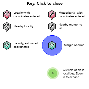
Key
Latitude & Longitude (WGS84):
52° 24' 53'' North , 3° 48' 3'' West
Latitude & Longitude (decimal):
UK National Grid Reference:
SN772813
Locality type:
Köppen climate type:
Nearest Settlements:
| Place | Population | Distance |
|---|---|---|
| Capel Bangor | 256 (2017) | 11.6km |
| Pontrhydfendigaid | 712 (2017) | 15.3km |
| Bow Street | 1,572 (2017) | 15.7km |
| Llanilar | 1,085 (2017) | 16.6km |
| Llanidloes | 2,929 (2017) | 18.1km |
Other/historical names associated with this locality:
Upper Llanfihangel-y-Creuddyn, Dyfed; Cardiganshire
Name(s) in local language(s):
Esgair Lle Mine
Beside the A44, 1.5km east of Ponterwyd where the small side road turns south to Devil's Bridge.
The mine appears to have worked an east-west lode that runs obliquely up the hillside and is marked by a series of fenced off shaft collars and towards the crest of the hill by a large scar (behind the large shed at the time of writing), possibly left when a stope collapsed below ground. An engine house stands centrally in the site and adjacent to this is a wheel pit. The 1887 OS map shows an aqueduct feeding the wheel with branched aqueducts further up the hillside.
The foreground of the site between the engine house and the A44 road is principally mounds of stamp sand which has been spread over time to cover most of the area in a thin dressing. When the small river runs along the bottom of the site the deposits can be seen as distinct layers with fine slimes at the bottom and coarser sand washed over the top.
The tips appear to have been more extensive until quite recently with a great deal of fresh digging and levelling having taken place on the slope between the engine house and the shafts. The tips offer abundant sphalerite, whilst chalcopyrite and galena are found as occasional grains.
Further buildings including possibly a wheelpit are at SN778814, 500m east-north-east of the engine house and are also shown as part of the West Esgair Mine on the 1887 OS map. These are presently in the corner of a grassy field without any open tips.
Select Mineral List Type
Standard Detailed Strunz Dana Chemical ElementsCommodity List
This is a list of exploitable or exploited mineral commodities recorded at this locality.Mineral List
4 valid minerals.
Detailed Mineral List:
| ⓘ Calcite Formula: CaCO3 Reference: Chris Popham Collection |
| ⓘ Chalcopyrite Formula: CuFeS2 Reference: Chris Popham Collection |
| ⓘ Galena Formula: PbS Reference: Chris Popham Collection |
| ⓘ Sphalerite Formula: ZnS Reference: Chris Popham Collection |
List of minerals arranged by Strunz 10th Edition classification
| Group 2 - Sulphides and Sulfosalts | |||
|---|---|---|---|
| ⓘ | Chalcopyrite | 2.CB.10a | CuFeS2 |
| ⓘ | Galena | 2.CD.10 | PbS |
| ⓘ | Sphalerite | 2.CB.05a | ZnS |
| Group 5 - Nitrates and Carbonates | |||
| ⓘ | Calcite | 5.AB.05 | CaCO3 |
List of minerals arranged by Dana 8th Edition classification
| Group 2 - SULFIDES | |||
|---|---|---|---|
| AmXp, with m:p = 1:1 | |||
| ⓘ | Galena | 2.8.1.1 | PbS |
| ⓘ | Sphalerite | 2.8.2.1 | ZnS |
| AmBnXp, with (m+n):p = 1:1 | |||
| ⓘ | Chalcopyrite | 2.9.1.1 | CuFeS2 |
| Group 14 - ANHYDROUS NORMAL CARBONATES | |||
| A(XO3) | |||
| ⓘ | Calcite | 14.1.1.1 | CaCO3 |
List of minerals for each chemical element
| C | Carbon | |
|---|---|---|
| C | ⓘ Calcite | CaCO3 |
| O | Oxygen | |
| O | ⓘ Calcite | CaCO3 |
| S | Sulfur | |
| S | ⓘ Sphalerite | ZnS |
| S | ⓘ Chalcopyrite | CuFeS2 |
| S | ⓘ Galena | PbS |
| Ca | Calcium | |
| Ca | ⓘ Calcite | CaCO3 |
| Fe | Iron | |
| Fe | ⓘ Chalcopyrite | CuFeS2 |
| Cu | Copper | |
| Cu | ⓘ Chalcopyrite | CuFeS2 |
| Zn | Zinc | |
| Zn | ⓘ Sphalerite | ZnS |
| Pb | Lead | |
| Pb | ⓘ Galena | PbS |
Other Regions, Features and Areas containing this locality
British IslesGroup of Islands
Eurasian PlateTectonic Plate
EuropeContinent
UK
- Wales
- Cambrian MountainsMountain Range
This page contains all mineral locality references listed on mindat.org. This does not claim to be a complete list. If you know of more minerals from this site, please register so you can add to our database. This locality information is for reference purposes only. You should never attempt to
visit any sites listed in mindat.org without first ensuring that you have the permission of the land and/or mineral rights holders
for access and that you are aware of all safety precautions necessary.


