| Locality | Latitude | Longitude | Distance | Bearing |
|---|
| New Engine Mine, Eyam, Derbyshire Dales District, Derbyshire, England, UK | 53° 17' 35" N | 1° 39' 53" W | 2.3km (1.4 miles) | |
| Red Rake, Calver, Derbyshire Dales District, Derbyshire, England, UK | 53° 15' 43" N | 1° 38' 29" W | 2.3km (1.4 miles) | |
| Glebe Mine, Eyam, Derbyshire Dales District, Derbyshire, England, UK | 53° 17' 5" N | 1° 40' 22" W | 2.5km (1.6 miles) | |
| Darlton Quarry, Stoney Middleton, Derbyshire Dales District, Derbyshire, England, UK | 53° 16' 35" N | 1° 40' 28" W | 2.7km (1.7 miles) | |
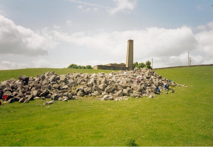
| Ladywash Mine, Eyam, Derbyshire Dales District, Derbyshire, England, UK | 53° 17' 41" N | 1° 40' 20" W | 2.8km (1.7 miles) | |
| Sallet Hole Mine, Great Longstone, Derbyshire Dales District, Derbyshire, England, UK | 53° 15' 52" N | 1° 40' 0" W | 2.9km (1.8 miles) | |
| Back Dale wood quarry, Calver, Derbyshire Dales District, Derbyshire, England, UK | 53° 15' 27" N | 1° 38' 51" W | 2.9km (1.8 miles) | |
| Backdale Quarry, Longstone Edge, Great Longstone, Derbyshire Dales District, Derbyshire, England, UK | 53° 15' 27" N | 1° 39' 11" W | 3.0km (1.9 miles) | |
| Deep Rake, Great Longstone, Derbyshire Dales District, Derbyshire, England, UK | 53° 15' 30" N | 1° 39' 51" W | 3.3km (2.0 miles) | |
| Harrybecca Lead Mine, Hassop, Derbyshire Dales District, Derbyshire, England, UK | 53° 15' 18" N | 1° 39' 45" W | 3.5km (2.2 miles) | |
| Broadlow Mine, Eyam, Derbyshire Dales District, Derbyshire, England, UK | 53° 17' 42" N | 1° 41' 6" W | 3.6km (2.2 miles) | |
| Hanging Flats mine, Stoney Middleton, Derbyshire Dales District, Derbyshire, England, UK | 53° 16' 49" N | 1° 41' 38" W | 3.9km (2.4 miles) | |
| High Rake Quarry (Bow Rake; Longstone Edge West), Great Longstone, Derbyshire Dales District, Derbyshire, England, UK | 53° 15' 31" N | 1° 40' 52" W | 4.0km (2.5 miles) | |
| Cavendish Mill, Stoney Middleton, Derbyshire Dales District, Derbyshire, England, UK | 53° 16' 26" N | 1° 41' 41" W | 4.0km (2.5 miles) | |
| Black Hole Mine, Eyam, Derbyshire Dales District, Derbyshire, England, UK | 53° 17' 34" N | 1° 41' 43" W | 4.1km (2.6 miles) | |
| Moorwood Mine, Eyam, Derbyshire Dales District, Derbyshire, England, UK | 53° 17' 48" N | 1° 42' 16" W | 4.9km (3.0 miles) | |
| Arthurton West Open Pit, Longstone Edge, Great Longstone, Derbyshire Dales District, Derbyshire, England, UK | 53° 15' 19" N | 1° 41' 48" W | 5.1km (3.2 miles) | |
| Watersaw mine, Longstone Edge, Great Longstone, Derbyshire Dales District, Derbyshire, England, UK | 53° 15' 24" N | 1° 42' 11" W | 5.3km (3.3 miles) | |
| Moor Road Quarry, Longstone Edge, Great Longstone, Derbyshire Dales District, Derbyshire, England, UK | 53° 15' 13" N | 1° 42' 0" W | 5.4km (3.3 miles) | |
| Arthurton West Extension, Longstone Edge, Great Longstone, Derbyshire Dales District, Derbyshire, England, UK | 53° 15' 20" N | 1° 42' 10" W | 5.4km (3.3 miles) | |
| Baslow Colliery, Baslow and Bubnell, Derbyshire Dales District, Derbyshire, England, UK | 53° 14' 42" N | 1° 34' 53" W | 5.5km (3.4 miles) | |
| White Rake, Great Longstone, Derbyshire Dales District, Derbyshire, England, UK | 53° 15' 43" N | 1° 42' 54" W | 5.7km (3.6 miles) | |
| Moor Edge Colliery, Sheffield, South Yorkshire, England, UK | 53° 18' 25" N | 1° 33' 26" W | 5.9km (3.7 miles) | |
| Totley Firebrick Works Pit, Sheffield, South Yorkshire, England, UK | 53° 18' 30" N | 1° 33' 27" W | 5.9km (3.7 miles) | |
| Longstone Edge, Great Longstone, Derbyshire Dales District, Derbyshire, England, UK | 53° 14' 26" N | 1° 41' 51" W | 6.2km (3.9 miles) | |
| Hassop Station quarry, Hassop, Derbyshire Dales District, Derbyshire, England, UK | 53° 13' 54" N | 1° 40' 40" W | 6.3km (3.9 miles) | |
| Strawberry Lea No.2 Colliery, Sheffield, South Yorkshire, England, UK | 53° 19' 6" N | 1° 33' 28" W | 6.5km (4.1 miles) | |
| Dore Colliery, Sheffield, South Yorkshire, England, UK | 53° 19' 6" N | 1° 33' 28" W | 6.5km (4.1 miles) | |
| Hucklow Edge, Great Hucklow, Derbyshire Dales District, Derbyshire, England, UK | 53° 18' 0" N | 1° 43' 51" W | 6.6km (4.1 miles) | |
| Milldam Mine, Great Hucklow, Derbyshire Dales District, Derbyshire, England, UK | 53° 17' 56" N | 1° 44' 13" W | 7.0km (4.3 miles) | |


Ladywash Mine, Eyam, Derbyshire Dales District, Derbyshire, England, UK