| Locality | Latitude | Longitude | Distance | Bearing |
|---|
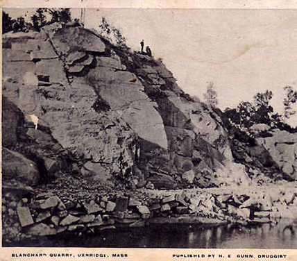
| Blanchard Quarries, Uxbridge, Worcester County, Massachusetts, USA | 42° 5' 5" N | 71° 39' 39" W | 2.7km (1.7 miles) | |
| Scadden Silver Mine (Uxbridge Silver Mine; Tucker Prospect), Uxbridge, Worcester County, Massachusetts, USA | 42° 1' 40" N | 71° 40' 41" W | 6.8km (4.2 miles) | |
| Purgatory Chasm, Sutton, Worcester County, Massachusetts, USA | 42° 7' 37" N | 71° 42' 57" W | 9.0km (5.6 miles) | |
| Kimball Sand Co. quarry, Blackstone, Worcester County, Massachusetts, USA | 42° 3' 21" N | 71° 30' 54" W | 9.8km (6.1 miles) | |
| Waterford, North Smithfield, Providence County, Rhode Island, USA | 42° 0' 45" N | 71° 32' 20" W | 10.4km (6.5 miles) | |
| Spring Lake, Harrisville, Burrillville, Providence County, Rhode Island, USA | 41° 59' 4" N | 71° 39' 44" W | 10.7km (6.6 miles) | |
| Glendale, Burrillville, Providence County, Rhode Island, USA | 41° 58' 33" N | 71° 37' 59" W | 11.2km (7.0 miles) | |
| Woonsocket, Providence County, Rhode Island, USA | 42° 0' 29" N | 71° 30' 57" W | 12.1km (7.5 miles) | |
| Harrisville, Burrillville, Providence County, Rhode Island, USA | 41° 58' 6" N | 71° 40' 48" W | 12.8km (7.9 miles) | |
| Burrillville, Providence County, Rhode Island, USA | 41° 58' 5" N | 71° 40' 59" W | 12.9km (8.0 miles) | |
| Oakland, Burrillville, Providence County, Rhode Island, USA | 41° 57' 25" N | 71° 38' 52" W | 13.4km (8.3 miles) | |
| North Smithfield, Providence County, Rhode Island, USA | 41° 58' 0" N | 71° 32' 57" W | 14.0km (8.7 miles) | |
| Pascoag, Burrillville, Providence County, Rhode Island, USA | 41° 57' 27" N | 71° 42' 20" W | 14.7km (9.1 miles) | |
| Rocky Woods Range quarries, Milford, Worcester County, Massachusetts, USA | 42° 9' 41" N | 71° 29' 22" W | 14.9km (9.3 miles) | |
| Fletcher Quarry (Milford Pink Quarry), Hopkinton, Middlesex County, Massachusetts, USA | 42° 11' 26" N | 71° 31' 14" W | 15.5km (9.6 miles) | |
| Maple Ridge Drive, Cumberland, Providence County, Rhode Island, USA | 42° 0' 9" N | 71° 27' 35" W | 16.3km (10.1 miles) | |
| Manville Quarry (Riverview Quarry; CQC Quarry; Forte Brothers Quarry; Todesca Quarry), Cumberland, Providence County, Rhode Island, USA | 41° 58' 50" N | 71° 28' 49" W | 16.4km (10.2 miles) | |
| Iron Mine Hill quarry, Cumberland, Providence County, Rhode Island, USA | 42° 0' 17" N | 71° 27' 24" W | 16.4km (10.2 miles) | |
| Sneech Pond copper mines (Copper Mine Hill), Cumberland, Providence County, Rhode Island, USA | 42° 0' 2" N | 71° 26' 45" W | 17.4km (10.8 miles) | |
| Beacon Pole Hill quarry, Cumberland, Providence County, Rhode Island, USA | 41° 59' 42" N | 71° 26' 37" W | 17.9km (11.1 miles) | |
| Manville, Lincoln, Providence County, Rhode Island, USA | 41° 57' 42" N | 71° 28' 27" W | 18.2km (11.3 miles) | |
| Blackstone Valley shopping center site, Millbury, Worcester County, Massachusetts, USA | 42° 11' 58" N | 71° 46' 40" W | 18.3km (11.4 miles) | |
| Chepachet, Glocester, Providence County, Rhode Island, USA | 41° 54' 53" N | 71° 40' 17" W | 18.4km (11.4 miles) | |
| Cumberland Hill, Cumberland, Providence County, Rhode Island, USA | 41° 58' 14" N | 71° 27' 34" W | 18.4km (11.4 miles) | |
| Smithfield, Providence County, Rhode Island, USA | 41° 55' 18" N | 71° 33' 0" W | 18.5km (11.5 miles) | |
| Diamond Hill Granite Company quarry (Catamint Hill quarry; Calumet Hill quarry), Diamond Hill, Cumberland, Providence County, Rhode Island, USA | 42° 0' 14" N | 71° 25' 31" W | 18.8km (11.7 miles) | |
| Staples Road, Cumberland, Providence County, Rhode Island, USA | 41° 59' 0" N | 71° 26' 21" W | 18.9km (11.7 miles) | |
| Staples Road Manganese bed, Cumberland, Providence County, Rhode Island, USA | 41° 59' 0" N | 71° 26' 21" W | 18.9km (11.7 miles) | |
| Grants Mills, Cumberland, Providence County, Rhode Island, USA | 42° 0' 24" N | 71° 25' 16" W | 18.9km (11.8 miles) | |
| Interstate highway 295 & State Route 7 intersection, Smithfield, Providence County, Rhode Island, USA | 41° 55' 0" N | 71° 33' 0" W | 19.0km (11.8 miles) | |


Purgatory Chasm, Sutton, Worcester County, Massachusetts, USA