| Locality | Latitude | Longitude | Distance | Bearing |
|---|
| Snaisgill Mine, Middleton-in-Teesdale, County Durham, England, UK | 54° 38' 10" N | 2° 4' 38" W | 1.3km (0.8 miles) | |
| Low Skears Mine, Middleton-in-Teesdale, County Durham, England, UK | 54° 38' 36" N | 2° 4' 55" W | 2.0km (1.3 miles) | |
| High Skears Mine, Middleton-in-Teesdale, County Durham, England, UK | 54° 38' 58" N | 2° 4' 38" W | 2.8km (1.7 miles) | |
| Marlbeck Mine, Middleton-in-Teesdale, County Durham, England, UK | 54° 39' 11" N | 2° 4' 39" W | 3.1km (2.0 miles) | |
| Coldberry Mines, Middleton-in-Teesdale, County Durham, England, UK | 54° 39' 27" N | 2° 5' 6" W | 3.6km (2.3 miles) | |
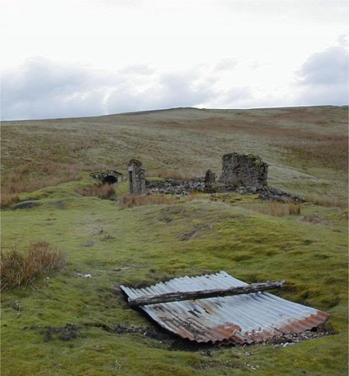
| Coldberry Gutter, Coldberry Mines, Middleton-in-Teesdale, County Durham, England, UK | 54° 39' 20" N | 2° 6' 24" W | 3.8km (2.3 miles) | |
| Lodgesike Mine, Middleton-in-Teesdale, County Durham, England, UK | 54° 39' 31" N | 2° 4' 22" W | 3.8km (2.4 miles) | |
| Red Grooves Lead Mine (Red Groves), Newbiggin, County Durham, England, UK | 54° 39' 20" N | 2° 6' 58" W | 4.0km (2.5 miles) | |
| Scoberry Bridge, Newbiggin, County Durham, England, UK | 54° 38' 26" N | 2° 8' 27" W | 4.2km (2.6 miles) | |
| Hudeshope Head Mine, Middleton-in-Teesdale, County Durham, England, UK | 54° 39' 46" N | 2° 5' 29" W | 4.3km (2.6 miles) | |
| Grace Cottage Drift, Romaldkirk, County Durham, England, UK | 54° 35' 49" N | 2° 2' 3" W | 4.4km (2.7 miles) | |
| Racketgill Vein, Middleton-in-Teesdale, County Durham, England, UK | 54° 39' 56" N | 2° 5' 46" W | 4.6km (2.9 miles) | |
| Holwick Mines, Newbiggin, County Durham, England, UK | 54° 38' 42" N | 2° 8' 55" W | 4.8km (3.0 miles) | |
| Bowlees Quarry, Newbiggin, County Durham, England, UK | 54° 39' 2" N | 2° 8' 38" W | 4.9km (3.0 miles) | |
| East Rake Hush, Middleton-in-Teesdale, County Durham, England, UK | 54° 39' 33" N | 2° 2' 0" W | 4.9km (3.1 miles) | |
| West End Colliery, Romaldkirk, County Durham, England, UK | 54° 36' 1" N | 2° 0' 50" W | 5.2km (3.2 miles) | |
| Manorgill Mine, Middleton-in-Teesdale, County Durham, England, UK | 54° 39' 57" N | 2° 2' 19" W | 5.3km (3.3 miles) | |
| Wiregill Mine, Middleton-in-Teesdale, County Durham, England, UK | 54° 40' 3" N | 2° 2' 30" W | 5.4km (3.4 miles) | |
| Bleagill Mine, Newbiggin, County Durham, England, UK | 54° 40' 0" N | 2° 7' 48" W | 5.6km (3.5 miles) | |
| Whitehouse a Colliery, Eggleston, County Durham, England, UK | 54° 36' 28" N | 1° 59' 27" W | 6.2km (3.8 miles) | |
| Gill Field Colliery, Hunderthwaite, County Durham, England, UK | 54° 34' 40" N | 2° 1' 45" W | 6.3km (3.9 miles) | |
| Flushiemere Mine (Flushamere Mine), Newbiggin, County Durham, England, UK | 54° 40' 25" N | 2° 8' 22" W | 6.6km (4.1 miles) | |
| Briscoe Colliery, Cotherstone, County Durham, England, UK | 54° 34' 14" N | 2° 2' 30" W | 6.6km (4.1 miles) | |
| California Mine, Eggleston, County Durham, England, UK | 54° 40' 26" N | 2° 1' 6" W | 6.8km (4.2 miles) | |
| Cornpack Colliery, Cotherstone, County Durham, England, UK | 54° 34' 17" N | 2° 0' 55" W | 7.3km (4.6 miles) | |
| Pike Law Mines, Newbiggin, County Durham, England, UK | 54° 40' 38" N | 2° 9' 12" W | 7.4km (4.6 miles) | |
| Blackton Colliery, Cotherstone, County Durham, England, UK | 54° 33' 25" N | 2° 6' 29" W | 7.7km (4.8 miles) | |
| East Binks Pits, Forest and Frith, County Durham, England, UK | 54° 40' 22" N | 2° 10' 10" W | 7.7km (4.8 miles) | |
| White House Colliery, Marwood, County Durham, England, UK | 54° 36' 59" N | 1° 57' 46" W | 7.7km (4.8 miles) | |
| Force Garth Quarry, Forest and Frith, County Durham, England, UK | 54° 38' 55" N | 2° 11' 48" W | 7.8km (4.9 miles) | |
Minerals recorded nearby (within 7.8 km)
Rock types recorded nearby (within 7.8 km)
Entries shown in red are rocks recorded for this region.


Coldberry Mines, Middleton-in-Teesdale, County Durham, England, UK