 | | Journal (article/letter/editorial) | | Sandstonesof the Permian Rush SpringsFormation, Cement District, SouthwestOklahoma RoY F. ALLEN SohioPetroleumCompany...geochemicalinvestigationswere conductedthroughoutthe Cement district. Uranium occurrences reportedin the literature...SINCE1917, the Cement oil field centeredupon the Cement anticline in southwestern Oklahoma has been undertooka...undertooka hydrogeochemical surveyof the Cement area as part of a geochemicalstudy of uraniumin southcentralOklahoma... 1974) to the genesisof the uranium deposit at Cement. Olmsted'simportantwork was later incorporatedinto | 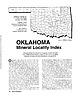 | | Journal (article/letter/editorial) | | Houston, Texas 77036 ROBERT 0. FAY Oklahoma Geological Survey Norman, Oklahoma 73019 Downloaded by [The Aga...713 15th Street NW Ardmore, Oklahoma 73401 OKLAHOMA Figure 1. Oklahoma counties. Mineral Locality...roses, Oklahoma also boasts a variety of other species, including beautiful specimens of calcite, brochantite...unaware of the variety of minerals available from Oklahoma and think primarily of the prolific gypsum crystals...hundred years, extends into the northeast corner of Oklahoma and has produced notable specimens. Unfortunately |  | | Report (issue) | | Direct Detection Experiment at Cement and Garza Oil Fields, Oklahoma and Texas, using enhanced LANDSAT...THE TEST SITES .......................... 6 The Cement Oil Field .................... 6 The Garza Oil.... 20 RESULTS ............................. Cement Oil Field 29 ...................... 29 Garza...Geologic and location map, Cement area, Oklahoma ... 5 2. Soil map, Cement area ................. 8...Rush Springs Sandstone along southern flank of Cement anticline ....................... 5. Contact |  | | Report (issue) | | GEOLOGY OF THE CEMENT OIL FIELD, CADDO COUNTY, OKLAHOMA. By FRANK REEVES. INTRODUCTION. The area discussed...discussed in this report is in Caddo County, in the southwestern part of Oklahoma, in the drainage basin of...location with reference to the producing fields of Oklahoma and to districts in the State that'have been described...pronounced anticline at Cement and anticlinal folds at Lawton and to the south in Cotton County support this belief...belief. The production of oil at Cement proves not only that the structure at that locality is of the |  | | Report (volume) | | Director Bulletin 808 GEOLOGY OF THE DE QUEEN AND CADDO GAP QUADRANGLES, ARKANSAS BY HUGH D. MISER AND...pattern of the De Queen and Caddo Gap quadrangles, Arkansas and Oklahoma...............________________...Geologic map of the De Queen and Caddo Gap quadrangles, Arkansas and Oklahoma._________________________ In...the Paleozoic rocks exposed in the De Queen and Caddo Gap quadrangles, Arkansas and Oklahorna....___._...of Cretaceous rocks exposed in the De Queen and Caddo Gap quadrangles, Arkansas and Oklahoma_________ |  | | Report (volume) | | resembles both calcite and talc; however, it does not effervesce in hydrochloric acid as calcite does, and...most apt to be pure, though it may contain some calcite which is hot readily visible. Massive gypsum is...gypsum is used primarily as a retarder for portland cement and as an agricultural mineral. Gypsum improves... to a lesser extent, as a retarder in portland cement. In Europe, anhydrite is roasted with coke, sand...aluminum-bearing shale8 to produce sulfuric acid and cement clinker; it is also used in making ammonium sulfate |  | | Report (issue) | | OE B 3 7bb htfi OKLAHOMA OJSULUOlCAL SURVEY Governor C. N. Haskell, State Superintendent E* D...PRELIMINARY REPORT ON THE MINERAL RESOURCES OF OKLAHOMA BY CHAS. N. GOULD L. L. HUTCHISON AND GAYLORD...Ix ' ^A nHivR5\tY ^IfOW*!*- EXCHANGE OKLAHOMA GEOLOGICAL SURVEY (V Governor C N. Hasfcell...PRELIMINARY REPORT ON THE MINERAL RESOURCES OF OKLAHOMA BY CHAS. N. GOULD L. L. HUTCHISON AND GAYLORD...Clay and Shale, by Chas. N. Gould 13. Portland Cement Rock, by Chas. N. Gould 14. Road 15. Sand and |  | | Journal (issue) | | I-Can lacquer thinner 1- Tube Dupont's Household cement I - Bottle India Ink and pen, for labels I - Small...much experimentation I .find Dupont's Household Cement the best medium. It comes in a collapsible tube...alcohol and water proof. If in the event some of ~e cement accidently comes in contact_ with the crystal surface...sure of the proper clearance. Now spread a little cement on the bottom of the cork and place it in the exact...of the Shenandoah River at Riverton, in Warren County, Virginia. The bridges are on Route U. S. 522, |  | | Journal (article/letter/editorial) | | about 35 miles northwest of Flagstaff, in Coconino County, a pineforested volcanic area. The elevation is...in California recently I visited the Los Angeles County Museum in Los Angeles to see the famous collection...in Los Angeles can walk across the lawn to the County Museum for another thrill—the display of some of...Leadville (Lake Co.). Colo., almost at the end of Lake County, I found a specimen of small radiating chrysocolla...of Culloden, and one mile S. of the Monroe-Lamar County line. The cordierite occurs in knots and irregularshaped |  | | Report (issue) | | Pennsylvanian) Age in Northwestern Arkansas and Adjacent Oklahoma GEOLOGICAL SURVEY PROFESSIONAL PAPER 594-H...Pennsylvanian) Age in Northwestern Arkansas and Adjacent Oklahoma By LLOYD G. HENBEST SHORTER CONTRIBUTIONS TO...and causes of diagenetic interactions between calcite, aragonite, and quartz are indicated UNITED STATES...Morrow Series and adjacent rocks in Washington County, Ark _____________ _ 2. 3. 4. 5. 6. 7. 8. 9. 10...11. 12-13. 14. 15. H3 Ooliths with granular calcite in nuclei_ ___________________________________ |  | | Book | | ROCKHOUND'S GUIDE TO THE GEMS & MINERALS OF OKLAHOMA © E.L.GILMORE 1992 No part of this book may...rockhounds to know where to look for minerals in Oklahoma. who would like This data has been drawn from...from many sources: The publications of the Oklahoma Geological Survey; Scientific publications; the observations...from the author’s own experience in rockhounding Oklahoma for the past 30 years. Some parts of this book...desire of the author to list all minerals found in Oklahoma. The work on this book has covered a period of |  | | Report (issue) | | MANGANESE DEPOSITS OF THE CADDO GAP AND DE QUEEN QUADRANGLES, ARKANSAS. By HUGH D. MISER. INTRODUCTION...mountainous parts of the Caddo Gap and De Queen quadrangles, Arkansas and Oklahoma. 12 miles wide, extending...west-southwestward from Pulaski County, at the center of the State, to Polk County, on the west border. Eecent...CONTBIBUTIONS TO ECONOMIC GEOLOGY, 1917, PART I. Caddo Gap and De Queen quadrangles, in western Arkansas...west-central Arkansas and the adjoining part of Oklahoma and some of the more important papers on the geology |  | | Report (volume) | | Member and the Colony Creek Shale Member of the Caddo Creek Formation. The Cisco Group is represented...sandstone and conglomerate, some of which have opaline cement. In the Wayland quadrangle large amounts of oil...Fort Worth. It lies almost wholly within Stephens County, but in the southern part of the area (fig. 1)...of Eastland County that is about 15 miles long and 1 mile wide. Breckenridge, the county seat of Stephens...Stephens County, lies just to the north of the quadrangle. The communities of Necessity, Gunsight, and Wayland |  | | Report (issue) | | volcanoes were present near Murfreesboro, in Pike County. They found here not ,only the rocks that ~nce..., nud Brnckett, R. N., The I1eridotite of Pike County, Ark.:Am. Sel., 311 sel'., vol. 38, pp. 50-59,... and Purdue, A. n., Ol'll\'el deposit.s of the Caddo Oap and De Queen quadrangles, Ark.: U, S. 0001....Ross, C. S., Diamond bCllring peridotite in Pike County, Ark.: U. S. Geol. Survey Bull. 735, pp. 291-292...volcanic material in the Gulf series of southeastern Oklahoma; in N ovem ber and December, 1923, Ross and Miser |  | | Journal (article/letter/editorial) | | in the Ouachita foreland shelf in mid-continent USA: an overview of widespread effects of a Variscan-equivalent...regional. The sandstone paragenesis includes siderite cement (early stage), quartz overgrowths (intermediate...feldspar and carbonates, followed by minor Fe calcite, pore-filling kaolinite and sub-poikilotopic Ca...paragenesis includes calcite cement (early stage); megaquartz, chalcedony, and Fe calcite spar (intermediate... Lawrence, KA 66045, USA C.E. Barker US GeologicalSurvey, Denver, CO 80225, USA Present address: 1 Shell |  | | Report (issue) | | --------------------~----------------~ '\ I OKLAHOMA r TENNESSEE ARKANSAS I ~- - - - t .SO I_ _...the report area from the west in southern Bowie County, Tex. The .south Arkansas fault system extends...the Rodessa, .strikes northeastward across Marion County, Tex., and adjacent parts of Louisiana and Arkansas...Lafayette and Miller Counties, Ark.; and Bossier, Caddo, and DeSoto Par- Rotary drill cuttings and (or)...elevation (feet above sea level) Location TEXAS Bowie County 1_ _____________ 2 _______________ 3 _______________ |  | | Report (issue) | | GRAVEL DEPOSITS OF THE CADDO GAP AND DE QUEEN QUADRANGLES, ARKANSAS. By HUGH D. MISER and A. H. PURDUE...narrow belt is embraced in the southern parts of the Caddo Gap and De Queen FIGURE 5. Map showing location...the south side of the Caddo Gap and De Queen quadrangles, Arkansas and Oklahoma. quadrangles, Ark. This...Hempstead County, in southwestern Arkansas, and a strip along the east edge of McCurtain County, in southeastern...southeastern Oklahoma. The gravels are of Lower Cretaceous, Upper Cretaceous, and Quaternary age, and 15 |  | | Report (issue) | | deposits, three of which are in Pike County and four in Sevier County, in southwestern Arkansas, were examined...the progress of the field work for the De Queen-Caddo Gap folio, which is now in preparation. These deposits...about 2£ miles south-southeast of Pike, in Pike County. Of the other six deposits only three have been...GENERAL RELATIONS. S The asphalt deposits in Pike County are near Pike, Delight, and Murfreesboro. Pike...Dallas & Gulf Railroad. The deposits in Sevier County are between Dierks, the terminus of the De.Queen |  | | Report (volume) | | Twenty-five years ago the imports of Portland cement were four times the domestic production, and the...natural rock cement was five tunes the combined production and imports of Portland cement. To-day the...the Portland cement industry is distributed generally over the United States, and the production amounts...The production of natural rock cement and the imports of foreign cement are so small as to be negligible...minerals of wide distribution, such as quartz and calcite, have been omitted, except those that by some unusual |  | | Journal (article/letter/editorial) | | n u Downloaded by [University of Oklahoma Libraries] at 22:24 29 March 2015 LOUIS1ANA SChLZ - YKE1...minerals, neither is Downloaded by [University of Oklahoma Libraries] at 22:24 29 March 2015 Figure 2. Typical...Cretaceous chalk on a piercement salt dome; barite, calcite, marcasite as concretions (Spooner 1926). Rayburns...MaylJune 1994 157 Downloaded by [University of Oklahoma Libraries] at 22:24 29 March 2015 Figure 4. A...Bellevue; goethite as hollow concretions (Zodac 1942). Caddo Parish Greenwood area, goethite as hollow concretions |  | | Book | | Geological Society, Inc. 2745 E. 15th Street Tulaa, Oklahoma 74104 Editor: Norman J. Hyne Professor of Petroleum...Petroleum Geology University of Tulsa Tulsa, Oklahoma 74104 --- 0 ---------- c. ,o 2Qv--,.... ) ...mid-continent regional meeting held In Tulsa, Oklahoma on October 79, 1979. The five Introductory chapters...Environments and Diagenesis. Morrow Sands. Cimarron County (Oklahoma), and Significance to Regional Exploration...Pennsylvanian Upper Marchand Sandstones, Northern Caddo County, Oklahoma Randall K. Baker 195 Desmoinesian Depositional |  | | Report (chapter) | | Kansas, 1475 Jayhawk Boulevard, Lawrence, KS 66045, USA 2 Present address: Anadarko Petroleum Corporation... CO 80202, USA 3 Kansas Geological Survey, 1930 Constant Avenue, Lawrence, KS 66047, USA *Corresponding...et al. 2001). Mississippian reservoirs of Kansas, USA, include porous chert facies, and muddy dolomite...Mississippian ramp margin location from NW Cherokee County, Kansas, USA (Fig. 1a, b) with the purpose of examining:...stain was used to distinguish between calcite, ferroan calcite, dolomite and ferroan dolomite (Dickson |  | | Report (chapter) | | Geology and Geophysics, University of Oklahoma, Norman, OK 3019, USA *Corresponding author (e-mail: devin...and star shows the location of cores in Johnson County (Freddy Lynn 1 and Spencer Trussel 1). Modified...which are tectonically adjacent to the Southern Oklahoma Aulacogen (Thomas 1993). Palaeozoic rocks of the...(Meckel et al. 1992). The Muenster Arch and Southern Oklahoma Aulacogen may have exerted an important early...very fine quartz silt and as siliceous cement. The silica cement is interpreted to be sourced from a combination |  | | Report (chapter) | | of hydrothermal fluid flow in the midcontinent, USA: the relationship between inverted thermal structure...Kansas, 1475 Jayhawk Boulevard, Lawrence, KS 66045, USA 2 Present address: ConocoPhillips Company, 550 Westlake...Boulevard, 12099 Two Westlake, Houston, TX 77079, USA *Corresponding author (e-mail: Brad.D.King@ConocoPhillips...the study area (south Kansas) and elsewhere in the USA, including direct dates of late-stage cements Region...Pray (1970). Folk (1965) was used to describe calcite textures and Gregg & Sibley (1984) was used to |  | | Report (volume) | | ............................................. Oklahoma.................................................Twenty-five years ago the annual imports of Portland cement were four times the domestic production, and the...natural rock cement was five times the combined production and imports of Portland cement. To-day the...the Portland cement industry is distributed generally over the United States, and the annual production...The production of natural rock cement and the imports of foreign cement are so small as to be negligible |
|


