 | | Journal (issue) | | Collector's Newsletter $2.00 from the Mill Creeli. Quarry Polk County, Oregon John Cornish 40 Cedar Glen Lane...central western Oregon are several mineral producing localities. The Mill Creek quarry is one of these...these. The Mill Creek quarry is located in Polk County, off of Highway 22, just east of Buell (Fig. 2). From...Highway 22 tum onto the well-marked Mill Creek road which parallels Mill Creek. Approximately two miles from...from the highway one passes the county-maintained Mill Creek Picnic Area. Just beyond the picnic area the |  | | Journal (issue) | | Barrel Calcites from Lohr Quarry Dennis W. Haas DennisDWH2001@aol.com Calcite comes in diverse crystal...variety is the barrel-shaped calcite. In Keokuk, Iowa area geodes the barrel calcite does not seem to be a dominate...Lohr Quarry one finds barrel-shaped calcites irr geodes from the Warsaw Formation. Lohr Quarry is located...Illinois on Illinois Route 267. The walls of the quarry are Salem Limestone and St. Louis Limestone. Below...makes up most of the floor of the quarry, found in the center of the quarry in an area that is not being actively |  | | Journal (issue) | | WASHINGTON May 3, 2014 9:00 am to 5:00 pm Clark County P. U. D. Building 1200 Fort Vancouver Way Vancouver... cookies, pie, or cake to add to the lunch. PUD Mill Plain Blvd. 1:30 pm Showing of pictures of minerals...Bridge Columbia River County Buffet in Vancouver. Please join us if you can. Oregon 2 Hello from your...G. Howard, editor 356 SE 44th Avenue Portland, Oregon, 97215 e-mail: pogodh@hei.net DUES: $15 per year...“Kelly” Starnes 1276 SE Goodnight Avenue Corvallis, Oregon, 97333 e-mail: bikeklein@yahoo.com 3 Mineralogy |  | | Journal (issue) | | ORE.- BIN Vol.20, No.4 April 1958 33 Portland, Oregon STATE OF OREGO N DEPARTMENT OF GEOLOGY AND MINERAL...Head Office: 1069 State Office Bldg., Portland 1, Oregon Telephone: CApital 6-2161, Ext. 488 Field Offices...************ LIMESTONE OCCURRENCES IN WESTERN OREGON The Department has received numerous requests in...areas in which I imestone has been found in western Oregon. Accompanying the maps are brief remarks on the...commodi ty in Oregon. A similar report on limestone in northeastern and central Oregon has been prepared |  | | Journal (article/letter/editorial) | | com Figure 1 (top left). Calcite, 5.5 cm high, Elmwood mine, Smith County. Terry Huizing specimen, Jeff...(above). Fluorite, 13.1 cm wide, Elmwood mine, Smith County. Francis Benjamin specimen, Jeff Scovil photo....Smith County. Terry Huizing specimen and photo. Figure 4 (right). Cumberland mine, Smith County. Travis...earths to make saltpeter, at Nicojack Cave in Marion County, then nitromagnesite at the same location (Shepard...Sevier County (Coskren and Lauf 2000). The following index is arranged alphabetically by county. It is |  | | Journal (volume) | | PA R ER TM N S O IE RE INDUSTR 19 3 7 OREGON DEPARTMENT OF GEOLOGY AND MINERAL INDUSTRIES VOLUME...Mountain caldera, Ochoco National Forest, Crook County, Oregon 25 Field trip guide to the Oligocene Crooked...supervolcano, Crook, Deschutes, and Jefferson Counties, Oregon 45 Field trip guide to the Neogene stratigraphy...the ancestral Crooked River, Crook County, Oregon 73 Portland, Oregon, geology by tram, train, and foot...for 2008-2009 68 Mined Land Reclamation Awards 70 Oregon seismicity in 2007 and 2008 TO OUR READERS From |  | | Journal (issue) | | Weber by the Natural History Museum of Los Angeles County (see February 2005 Mineral News - Ed.). Between...noted for the mounted specimens acquired by the LA County Museum, the collection provides a solid reference...An Excep1ional Calcile from !he Mill Creek Quarry. Polk Co., Oregon, 21-6: IO. Dague, Joe: Lininger Colleclion...Haas, Dennis W.: Barrel Calci1es from the Lohr Quarry, 21-6:1. Haynes, Patrick E.: Microminerals from...Origins by H. Wenk & A. Bulakh, 21-1:9. Los Angeles County Musuem Acquires Oulslanding Micromount Collection | 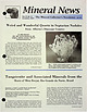 | | Journal (issue) | | Fig. 3 steep slopes along the coulees of Meeting Creek and the Battle River in the vicinity of Donalda...Museum, but they have been found in the Meeting Creek coulee. A common geological horizon, the Upper Cretaceous...After receiving comments that the Goodall Farm Quarry, also known as the Sanford vesuvianite locality...News, P.O. Box 2043, Coeur d'Alene, ID 83816-2043 USA Phone: 208-664-2448 • 3 E-mail: lream@comtch.iea...shrinkage cracks which, when filled with honey~colored calcite, show the typical internal structure of septanan |  | | Journal (issue) | | OREGON GEOLOGY published by the Oregon Department of Geology and Mineral Industries NOVEMBER 1994 VOLUM...the President Mine, Bohemia mining district. Lone County, p. 123 • Late Cenozoic tectonics and paleogeography...metropolitan area, p. 1'29 In memoriam: Norm Peterson OREGON GEOLOGY Nonnan V. Peterson. District Geologist...Grants (I$SN Ol6A-3Xl4) Pass field office of the Oregon Department of Geology and Mineral VOLUME 56, NUMBER...K.£. Neuendorf Main Office: Suite 96S. 800 NE Oregon Sired 97232, phoroe (~03) 731-4100, FAX (SO) 73 |  | | Journal (article/letter/editorial) | | Occurrence in Carroll County, Georgia" (November/December 1988). Banks County 184 ROCKS & MINERALS...Bentley provided many of the photographs. Baldwin County Milledgeville district—between the State Sanitarium...pit—east of S.R. 243 near the Baldwin-Wilkerson County line: kaolinite (Martin and Stafford, 1972). Cheatham...property—Route 3, Commerce, 4.8 km from the Jackson County line, 8 km east of Commerce on S.R. 59, and 0.8...Barrow County Arnold mine—1.6 km northeast of Statham, near the head quarters of Fair Creek: anthophyllite |  | | Book (edition) | | in the muscovite, (mica) chromite, corundum, calcite, piedmont and mountain beds in most of the eastern...Phospuranyltte. 130. Yttrotantalite* 150. Autimite. 166. Calcite. 131. Samarslfite. 151. Nitre. 167. Dolomite...ities and suggestions from Mrs. H, A. Burdick county, of Mr. J. of A. D. Stephenson of Statesville...Catawba, Caldwell, Burke, McDowell, Rutherford, Polk, Cleaveland, Cherokee, Jackson, Transyvania aud... have been found at the Reid Mine, in Cabarrus county, the Crump Mine and the Swift Island Mine, in Montgomery |  | | Book (edition) | | Burdiek, Macon Prof. J. T. I From am of county, of Mr. J. A. D. Stevenson, of States- Humphreys...Catawba, Caldwell, Burke, McDowell, Rutherford, Polk, Cleveland, Cherokee, Jackson, Transylvania It ...their size, Cabarrus county, the Montgomery with have been Crump Mine county, (at the lat- octahedral...the Gaston county, and the Little John Caldwell county, and Pax Hill in Burke county. Very Shemwell...been obtained from the The vein in Rutherford county. variety, "electrum," contain- ing from 36 to |  | | Report (volume) | | minerals of wide distribution, such as quartz and calcite, have been omitted, except those that by some unusual...Oberlb Oklahoma........Prof. D. W. Ohern, Norman. Oregon............Prof. A. J. Collier, Eugene. Pennsylvania...See Bauxite and Hallpysite. Asbestos. Tallapoosa County, with corundum deposits near Dudleyville; not found...commercial quantity or quality. Asphalt. Colbert County, small quantity has been shipped from near Leighton;...following localities: Bibb County, Pratts Ferry; Calhoun County, near Tampa; Clay County, T. 20, Pv. 7 E.; Jefferson |  | | Report (issue) | | _..... : . ................... _-....... - .. . Polk Bayou limestone __ ... __ ... _... _.... __ .. _..._______ . _____ ••. _. ___________ . ___ •. _. Rush Creek fault . _. _. ________ • ______________________...____________________________________________ Mill Creek .fault __________________________________ .....______ ........ _..... _... _______ - ___ .. - _---Calcite, or tiff. ____________ . ___ . _____ ._ .. ___............................. ~ .....•..... Boone County .....•........... _....... _... _............. |  | | Report (volume) | | meridian of 76° 30', from Tompkins County, New York, to Bradford County, Pennsylvania, by Henry S. "Williams...cents. 16. On the Higher Devonian Faunas of Ontario County, New York, by John M. Clarke. 1885. 8°. 86 pp....57 pi. Price 25 cents. 38. Peridotite of Elliott County, Kentucky, by J. S. Diller. 1887. 8°. 31 pp. 1................................................ Calcite .................................................Oatawba, Oaldwell, Burke, McDowell, Rutherford, Polk, Cleveland, Cherokee, Jackson, Transylvania, and |  | | Report (volume) | | .............................................. Oregon. ................................................that are widely distributed, such as quartz and calcite, have been omitted, except those that by reason...of Arkansas, California, Colorado, New Mexico, Oregon, South Dakota, Tennessee, and Texas; to list all...2, 1914. Mitchell, John Graham, Minerals of Oregon: Oregon Univ. Bull., new ser., vol. 13, No. 3, 1915...See Bauxite and Halloysite. Asbestos. Tallapoosa County, with corundum deposits near Dudleyville; not found |  | | Book (edition) | | thickness; mmed at Broken Arrow aud Trout creek, in Sc. Clair county. The strata in this field are more faulted...south prong of Canoe creek, in St. Clair county, to Ha\sop creek, in Bibb county, a distance of 60 miles...miles. Down to Helena, in Shelby county, the field has an average width of 5 or 6 miles. Below that point...miles being in the latitud" of Blocton, in Bibb county. The south ern end of this field has a greater...Jefferson county; Helena, Montevallo, and Brierfield, Shelby county; and at Blocion. Bibb county. The Warrior |  | | Book (volume) | | the western counties, especially the Clay Center Quarry 12 miles southeast of Toledo but in Ottawa Co....ASHTABULA COUNTY CONNEAUT, area pits, quarries, rd. cuts, etc.⎯cone-in-cone Calcite. CLERMONT COUNTY MILFORD...MILFORD, area creek gravels and alluvial deposits, rare⎯Diamond. CLINTON COUNTY WILMINGTON, area of Todd’s...Todd’s Ford, a mineral deposit⎯Hematite. COSHOCTON COUNTY AREA, townships of Washington, Virginia, Bedford...Keene, Mill Creek and Tuscarawas, as hard dark gray to black nodules⎯flint. CUYAHOGA COUNTY CHAGRIN |  | | Book (volume) | | the western counties, especially the Clay Center Quarry 12 miles southeast of Toledo but in Ottawa Co....ASHTABULA COUNTY CONNEAUT, area pits, quarries, rd. cuts, etc.⎯cone-in-cone Calcite. CLERMONT COUNTY MILFORD...MILFORD, area creek gravels and alluvial deposits, rare⎯Diamond. CLINTON COUNTY WILMINGTON, area of Todd’s...Todd’s Ford, a mineral deposit⎯Hematite. COSHOCTON COUNTY AREA, townships of Washington, Virginia, Bedford...Keene, Mill Creek and Tuscarawas, as hard dark gray to black nodules⎯flint. CUYAHOGA COUNTY CHAGRIN |  | | Report (volume) | | THE GEOLOGY AND OIL PROSPECTS OF NORTHWESTERN OREGON BY CHESTER W. WASHBURNE WASHINGTON GOVERNMENT....... County descriptions....................................................... Clatsop County.........Southwestern Clatsop County.................................. Northwestern Clatsop County....................................................... Tillamook County....................................................................................... Columbia County............................................... |  | | Report (edition) | | https://books.google.com GEORGIA ILMER MARBLE ,.COUNTY BLUFF FRONTISPIECE I. PLATE GEOLOGICAL SURVEY... W. HARRISON, State Printer, Manager 1894 G .COUNTY EORGIA MARBLE ,BLUFF ILMER FRONTISPIECE I. PLATE... 21 THE MARBLES OF FANNIN COUNTY... IV. THE MARBLES OF GILMER COUNTY........ V. VI. 9 13 30 THE...THE MARBLES OF PICKENS COUNTY .... 35 THE MARBLES OF CHEROKEE COUNTY……... 50 VII. THE SEMI-CRYSTALLINE...DEVELOPMENT OF THE MARBLE INDUSTRY IN PICKENS COUNTY, GEORGIA. In 1840, Fritz T. Simmons began quarrying |  | | Report (volume) | | amounts of galena, sphalerite, chalcopyrite, and calcite. Deposits not described in the literature as to...district, Calhoun County: 2, 65, 102, 118. 2. r Beaver Creek Valley, St. Clair County and Greens Valley...Valley, Etowah County: 2, 102, 118. 3. r Leeds, Jefferson County: 2, 102. 4. r Longview-Saginaw district...district, Shelby County: 2, 102. 5. r Sinks district, Bibb County: 2, 28, 54, 67, 74, 102, 118, 143. 6. v Southeastern...Southeastern corner, Cherokee County: 1, 2, 54, 74, 102. 7. v Southern Cleburne County: 1, 2, 54, 74, 102. 8 |  | | Book (volume) | | of the Pine Ridge Escarpment and along Whiteclay Creek near the Sioux Indian community of the same name...and breaks in the hills along the Minnechaduza Creek and the Niobrara, as well as all tributary canyons...investigate for geodes, chert nodules, fossils, Calcite crystals, Marcasite and Pyrite cubes. The area...chalcedony, jasper and gem petrified wood. BUFFALO COUNTY KEARNEY, area gravel bars and pits along the Platte...petrified wood. CASS COUNTY WEEPING WATER, SE, on rd. to Nehawka, in the Snyderville Quarry chalcedony, jasper |  | | Report (issue) | | FRONT COVER PHOTO : Gold nugget from Dukes Creek, White County, weight 5 oz., 12 dwt., approx. 2x. BACK...approx. 1.5x. Lower left - Goethite from Pulaski County, approx. lx. Right - Magnetite crystal face showing... . . . . . . . . . . . . . . . . . . . . . 75 Calcite ........................................................................................... 170 County Index ...........................................from Washington and Bleck ley counties to Irwin county. Some minerals described herein have never been |  | | Book (volume) | | Missouri, Montana, Nebraska, North Dakota, — ; Oregon, South Dakota, Washington, and Wyoming ~ AllanW...Minnesota, Missouri, Montana, Nebraska, North Dakota, Oregon, South Dakota, Washington, and Wyoming VOLUME...Minnesota, Missouri, Montana, Nebraska, North Dakota, Oregon, South Dakota, Washington, and Wyoming by Allan...Minnesota Missouri Montana Nebraska North Dakota Oregon South Dakota Washington vi Contents Wyoming...volumes, through very precise directions and accurate county maps, to get you to the best and most accessible |
|


Mill Creek Quarry, Mill Creek, Polk County, Oregon, USA