 | Marvin, Richard F., Naeser, C. W., Bikerman, Michael, Mehnert, H. H., Ratte, James C. (1987) Isotopic ages of post-Paleocene igneous rocks within and bordering the Clifton 1° x 2° quadrangle, Arizona-New Mexico. Bulletin 118. New Mexico Bureau of Geology and Mineral Resources doi:10.58799/b-118 | Report (issue) |
| New Mexico Bureau of Mines & Mineral Resources A DIVISION OF NEW MEXICO INSTITUTE OF MINING & TECHNOLOGY...bordering the Clifton 1° x 2° quadrangle, Arizona—New Mexico by R. F. Marvin¹, C. W. Naeser¹, M. Bikerman2...1987 11 NEW MEXICO INSTITUTE OF MINING & TECHNOLOGY Laurence H. Lattman, President NEW MEXICO BUREAU OF...Ex Officio Garrey E. Carruthers, Governor of New Mexico Alan Morgan, Superintendent of Public Instruction...W. LOVE, Environmental Geologist FRANK CAMPBELL, Coal Geologist JANE A. CALVERT LOVE, Associate Editor |
 | | Report (issue) |
| Paleozoic and Mesozoic Rocks Exposed in Central Elko County, Nevada By Keith B. Ketner Open-file report No... ----------- 7 Silurian, Devonian--Roberts Mountains Formation------------------ 47 Devonian--Nevada...Devonian--Coal Creek sequence------------------------------------ 65 Mississippian--Camp Creek sequen...Coash (1967) has been reinterpreted in the light of new data from adjacent areas. Mountain area was mapped...the stratigraphy and structure of central Elko County. These specialists are acknowledged individually |
 | | Report (issue) |
| New Mexico Bureau of Mines & Mineral Resources A DIVISION OF NEW MEXICO INSTITUTE OF MINING & TECHNOLOGY...and stratigraphy of New Mexico Part III Compiled by Donald L. Wolberg New Mexico Bureau of Mines & Mineral...Mineral Resources Socorro, New Mexico 87801 SOCORRO 1988 11 NEW MEXICO INSTITUTE OF MINING & TECHNOLOGY...TECHNOLOGY Laurence H. Lattman, President NEW MEXICO BUREAU OF MINES & MINERAL RESOURCES Frank E. Kottlowski...Ex Officio Garrey E. Carruthers, Governor of New Mexico Alan Morgan, Superintendent of Public Instruction |
 | | Book (edition) |
| channels of trade, transportation and consumption, new utilizations, and recent discoveries, have, to a...most part, have been progressive. In addition to new finds of valuable deposits, many of the occurrences...has therefore seemed advisable to pre sent such new information as may bring the whole subject more nearly...clearness, though the more exten sive deposits, such as coal and iron fields, gold belts, etc., are mentioned...gas fields occur in almost every State except in New England and a few Southern States, but the discoveries |
 | | Report (volume) |
| extensive deposits of some others, such as clay, coal, and iron ore, are mentioned only in general terms...Deposits of minerals of wide distribution, such as quartz and calcite, have been omitted, except those that...Prof. H. E. Gregory, Sheffield Scientific School, New Haven. Delaware.........Prof. B. L. Miller, Lehigh...Tangier Smith, Berkeley, Cal. New Jersey...... .Dr. H. B. Kummel, Trenton. New York.........Mr. D. H. Newland...See Bauxite and Hallpysite. Asbestos. Tallapoosa County, with corundum deposits near Dudleyville; not found |
 | | Report (volume) |
| ...... New Hampshire........................................................... 190 201 New Jersey.............. New Mexico............................................................. New York. .........F. C. Schrader: Besides giving several thousand new localities of mineral deposits and adding more than...extensive deposits of some others, such as clay, coal, and iron ore, are mentioned only in general terms...of minerals that are widely distributed, such as quartz and calcite, have been omitted, except those that |
 | | Journal (article/letter/editorial) |
| owners and users. (Even the private land in the upper New England states is generally more accessible than...pegmatite was mined at Barringer Hill in Llano County in the early 1900s but was flooded by Lake Buchanan..."The Weeks Pegmatite Mine, Wakefield, Carroll County, New Hampshire" (March/April 1991). i i • I i...66, May/June 1991 197 LOCALITIES BY COUNTY Bastrop County KEY mm T * ? — — — — best occurrence..."specimen quality" questionable occurrence Angelina County Lufkin, 1 mile N of Lufkin in railroad cuts, in |
 | | Report (issue) |
| resources of a large area in and around the Tusher Mountains in Utah; marine and brackish water strata in the...StaircaseEscalante National Monument; and the Pine Valley Mountains, which are cored by what may be the largest known...Miocene Extensional Strain Field, Northern Virgin Mountains, Nevada/Arizona Trip Leaders: Mark Quigley, Karl...Gravity Slides, And Volcanic Rocks, Pine Valley Mountains And Iron Axis, Southwestern Utah Trip Leaders:...And Ground-Water Conditions Of The Tertiary Muddy Creek Formation In The Lower Virgin River Basin Of Southeastern |
 | | Journal (article/letter/editorial) |
| University of Texas at Austin, Austin, Texas 78712, USA The 1.0-1.2 b.y. old rocks of the southeastern Llano...contain large blocks of serpentinized peridotite (Coal Creek serpentinite) and coarse hornblendite and metagabbro...intruded as dikes into the folded rocks. The Coal Creek serpentinite contains both syntectonic and late-kinematic...Llano Uplift, central Texas. Long-short dashes." county lines. After Muehlberger et al. (1967) I equivocally...the much thinner (401,000 m) recta-rhyolitic Lost Creek Gneiss (Ragland 1960; Mutis-Duplat 1972; Droddy |
 | | Report (volume) |
| Lexicon of New For mal Geologic Names of the United States 1976-1980 By GWENDOLYN W. LUTTRELL, MARILYN...GEOLOGICAL SURVEY BULLETIN 1564 A compilation of the new geologic names intmduced into the litrrature from...Luttrell, Gwendolyn Lewise Werth, 1927Lexicon of new formal geologic names of the United States, 1976-1980...Geological Survey bulletin ; 1564) "A compilation of the new geologic names introduced into the literature from...Group on the Precambrian for the United States and Mexico, J. E. Harrison, Chairman. The chart is intended |
 | | Report (volume) |
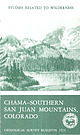
| MINERAL RESOURCES OF THE CHAMA-SOUTHERN SAN JUAN MOUNTAINS WILDERNESS STUDY AREA, MINERAL, RIO GRANDE, ARCHULETA...northwest across the crest of the southern San Juan Mountains. The heavily timbered valley in the middle foreground... Mineral Resources of the Chama-Southern San Juan Mountains Wilderness Study Area, Mineral, Rio Grande, Archuleta...Mineral resources of the Chama-Southern San Juan Mountains wilderness study area-Mineral, Rio Grande, Archuleta...of Mines-Geology of the Chamasouthern San Juan Mountains wilderness study area Colorado by Maurice R. Brock |
 | | Journal (article/letter/editorial) |
| GeologicalSciences,Universityof Texas, Austin, Texas 78712, USA Abstract. Two major episodes are evident in the...We have supplemented these data with more than 50 new K - A r and R b - S r analyses. Two foliated plutons...Economic Geology,Universityof Texas, Austin, TX 78712, USA the eastern Llano Uplift. A metasedimentary Valley...overlain by the much thinner metarhyolitic Lost Creek Gneiss. These gneisses in turn are overlain by a...garnet and clinopyroxene in a metagabbro in the Lost Creek Gneiss indicate that locally temperatures may have |
 | | Report (issue) |
| GEOLOGY OF A PART OF THE SOUTHERN APP A LACH IAN COAL FIELD BY HAROLD R. WANLESS University of Illinois...Petros, Tennessee, who had studied the Tennessee coal field for many years, gave the writer useful information...GENERAL CHARACTERISTICS OF nIE SOUTHERN APPALACHIAN COAL FIELD . . . . . . . . . 2 Topography .... . ....and Tennessee coal fields northwest of Pine Mountain ................. . Cross Mountain coal field, Tennessee...... . ... .... . . . ...... .. . .... . Duskin Creek formation .. . . ...... . . ................... |
 | | Report (volume) |
| Lexicon of New Formal Geologic Names of the United States 1981-1985 U. S. G E 0 L 0 G I C A L S U R V...V E Y B U L L E T I N 1565 .I I Lexicon of New Formal Geologic Names of the United States 1981-1985...RV EY BU LL ET I N 156 5 A compilation of the new formal geologic names introduced into the literature...Luttrell, Gwendolyn Lewise Werth, 1927Lexicon of new formal geologic names of the United States 1981-1985/...Geological Survey bulletin ; 1565) "A compilation of the new formal geologic names introduced into the literature |
 | | Report (issue) |
| UTAH SALT LAKE CITY, UTAH GEOLOGY OF EASTERN IRON COUNTY, UTAH BY HERBERT E. GREGORY Published in cooperation...Geological and Mineralogical Survey was placed within the new State Department of Publicity and Industrial Development...and uses, such as: the ores of the various metals, coal, oil, shale, hydro-carbons, oil, gas, industrial...UTAH SALT LAKE CITY, UTAH GEOLOGY OF EASTERN IRON COUNTY, UTAH BY HERBERT E. GREGORY Published in cooperation................ Distribution of mineral resources Coal deposits ...................................... |
 | | Report (volume) |
| GEOLOGICAL SURVEY BULLETIN 1520 A compilation of the new geologic names introduced into the literature·from...and Roger W. Swanson INTRODUCTION This lexicon of new geologic names is a record of lithostratigraphic...EXPLANATION OF ANNOTATION FORMAT This lexicon introduces a new and intentionally compact format that covers all...contains a formal proposal or good description of the new name unit. The author, date, publication name, and...Highway 49 (Skyway Road) near town of Abel, Cleburne County. Absaroka Supergroup/Volcanic Supergroup U ABRK03 |
 | Medig, K.P.R., Thorkelson, D.J., Davis, W.J., Rainbird, R.H., Gibson, H.D., Turner, E.C., Marshall, D.D. (2014) Pinning northeastern Australia to northwestern Laurentia in the Mesoproterozoic. Precambrian Research, 249. 88-99 doi:10.1016/j.precamres.2014.04.018 | Journal (article/letter/editorial) |
| of the supercontinent Columbia. Using Ac ce p new detrital zircon data from the lower Fifteenmile group...and on other continents, demonstrate a compelling new linkage between Australia and Laurentia, and provide...Proterozoic Coal Creek inlier in the western Ogilvie Mountains of Yukon, Canada (Fig. 1). The Coal Creek inlier...are not known (Thorkelson et al., 2005). The Coal Creek inlier is bound to the south by the ip t north-verging...muddy matrix (10-15%). Framework grains include quartz (20-40%), muscovite, biotite, chlorite, feldspar |
 | | Journal (article/letter/editorial) |
| Rough Ridge Formation (PacksaddleGroup) along White Creek in the southeasternLlano Uplift, central Texas....abundanceof this nearly pure iron staurolite at White Creek contrastswith nearby evidence for early crystallization...metamorphism. The White Creek rocks also record incomplete reaction of staurolite + quartz to produce almandine...northwest. OccunnnNcE AND cHEMTCALcoMposrrroN White Creek in the southeasternLlano Uplift (Fig. l) exposeswithin...amphibolites, the metasedimentarypackageat White Creek (Universal Transverse Mercator coordinates 14RNJ487775)includes |
 | | Report (issue) |
| SULPHUR AND PYRITE. THE COVE CREEK SULPHUR BEDS, UTAH. By WILLIS T. LEE. GENERAL STATEMENTS. Location...old Cove Fort and are locally known as the Cove Creek sulphur beds. They are conveniently reached by team...nearest exposures are at the north end .of Mineral Mountains and in the Beaver River range to the west, where...TO ECONOMIC GEOLOGY, 1906, PAET I. The Tushar Mountains, near the north end of which the sulphur beds...SULPHUR BEDS, UTAH. 489 Analysis of water from Cove Creek sulphur beds. [Parts per million.] Dissolved solids |
 | | Report (issue) |
| ............... Big Thompson River ................................. St. Vrain Creek ........................................ Left Hand Creek .................................... BoulderCreek .......................................... South Boulder Creek ................................. 1 2 3 3 6 6 6 8...35 35 Page Urban mineral resources Continued Coal Creek ......................................... Beebe................. Clear Creek ......................................... Bear Creek .................... |
 | | Report (issue) |
| United States Geological Survey of Colorado and New Mexico, 1869, by F. V. Hayden Edited by Kevin C. McKinney...along the eastern flank of the Rocky Mountains to Santa Fe, New Mexico, and returned north via Fort Garland...United States Geological Survey of Colorado and New Mexico. The field report contains identifiable contributions...United States Geological Survey of Colorado and New Mexico and the complete volume of Elliott’s sketches...UNITED STATES GEOLOGICAL SURVEY OF COLORADO AND NEW MEXICO, CONDUCTED UNDER THE AUTHORITY OF HON. J. D. |
 | | Report (volume) |
| to continue the compilation of geologic names as new names or re.. visions of old names appeared in the...pertinent geologic publications for preparation of a new lexicon. After the review had been brought up to...publish quickly some of the essential data concerning new names that had been published since 1935, the cutoff...Wilmarth Lexicon. Bulletin 1056-A listed about 5,000 new names introduced for use in North America, the Pacific...not the definitions) of geologic units of Canada, Mexico, the West Indies, LEXICON OF GEOLOGIC NAMES OF |
 | | Report (volume) |
| -Academia Nacional de Ciencias, Memorias y Revista. Mexico City. Acad. Nat. Sci. Phila. Notulae Naturae; Proc...Mass. Am. Alpine Jour.-American Alpine Journal. New York. Am. Antiquity-American Antiquity. Menasha,...Mining and Metallurgical Engineers Transactions. New York. Am. Jour. Botany-American Journal of Botany...Pa. Am. Jour. Sci.-American Journal of Science. New Haven, Conn. Am. Midland Naturalist--American Midland...Novitates-American Museum of Natural History Bulletin; Novitates. New York. Am. Philos. Soc. Proc.; Trans.-American Philosophical |
 | | Report (issue) |
| and Uncompahgre National Forests........... Elk Mountains-Collegiate (2-180)..............................Wilderness (NF-180)........................ Elk Mountains-Collegiate (2-180)....................................... Drift Creek (2-182).......................................... Perham Creek (2-183)...........(2-185)................................... Clear Creek (2-186)...........................................(2-191)..................................... Salt Creek (2-192)........................................ |
 | | Report (issue) |
| Rice. Back cover: Beta-form quartz from the tonstein of the Fire Clay coal bed. Photograph by H. E. Belkin...Palynostratigraphy of Selected Middle Pennsylvanian Coal Beds in the Appalachian Basin ............ 0 cece...The central Appalachian basin, which extends from New York to Alabama (Fig. 1), contains a variety of terrigenous...basin northwest of the ancestral Appalachian mountains along the southeastern margin (present direction)...traced across Pennsylvania into Ohio. Many of the county and other geologic reports concerning the Pennsylvanian |


