 | | Journal (article/letter/editorial) | | localities. Minerals of limited oc currence include anhydrite, galena, honessite, millerite, pyrrhotite, smithsonite...first re ported occurrence of smythite was from Indiana ( E r d , 1957), where it was found as inclusions...geodes. Other species reported as occurring in Indiana, 136 ROCKS AND MINERALS { RICHARD E . RUSSELL... 4 cm across; Meshberger Stone, Inc. quarry, Bartholomew County. Richard Russell specimen and photo....largest crystal 3.5 cm across; Berry Materials quarry, Jenn ings C o . J . Kielbaso specimen; R . Russell | 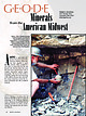 | | Journal (article/letter/editorial) | | along old IN-37, near Harrodsburg, Monroe County, Indiana. Note the semispherical opening, lower left...modern coastal plains in the Persian Gulf where anhydrite nodules occur today (Chowns and Elkins 1974)....are now broadly described as the Borden Group in Indiana, the Fort Payne, WarsawSalem, and Borden formations...commercial geode mine at St. Francisville, Clark County, Missouri. This specimen appeared on the dust jacket...quartz geode, from a locality near Revere, Clark County, Missouri. Cincinnati Museum Center specimen (No |  | | Journal (issue) | | written content Paul E. Desautels Washington, DC Pete J. Dunn Washington, DC Peter G. Embrey British Museum...Weber Mamaroneck, N.Y. Articles Celestite from Salem, Indiana..............................................uncommon lithium-mica from Coyote Peak, Humboldt County, California .....................................tour of the mineral facilities at the Los Angeles County Museum of Natural History (where Tony is curator)...Record, January-February, 1983 Celestite from Salem, Indiana by Lawrence D. Wells 761 Bravington Way Lexington |  | | Journal (article/letter/editorial) | | State Park 201 West Riverside Drive Clarksville, Indiana 47129 agoldstein@dnr.in.gov Figure 1. Twinned calcite...calcite, 8 cm, Caldwell Stone Company quarry, Danville, Boyle County. Terry Huizing specimen and photo....Appalachians (Harlan County) at 4,139 feet. The lowest point is the floor of the Reed quarry near Grand Rivers...Rivers (Livingston County) in western Kentucky, at 100 feet below sea level. There are some noteworthy mineral...small, nondiamondiferous kimberlite in Elliott County in eastern Kentucky and alnöite intrusions in Crittenden |  | | Report (issue) | | MINERALS OF INDIANA by RICHARD C. ERD AND SEYMOUR S. GREENBERG Indiana Department of Conservation GEOLOGICAL...GEOLOGICAL SURVEY Bulletin No. 18 1960 STATE OF INDIANA HAROLD W. HANDLEY, GOVERNOR DEPARTMENT OF CONSERVATION...________________________________ MINERALS OF INDIANA BY RICHARD C. ERD AND SEYMOUR S. GREENBERG PRINTED...PRINTED BY AUTHORITY OF THE STATE OF INDIANA BLOOMINGTON, INDIANA September 1060 _____________________...______________ For sale by Geological Survey, Indiana Department of Conservation, Bloomington, Ind. Price |  | | Journal (article/letter/editorial) | | Calgary] at 13:58 04 February 2015 Maybee Quarry, Monroe County, Michigan C elestine, the only commercially...water. These include bedded deposits of gypsum, anhydrite, and halite; salt-dome caprock; marine carbonates... Celestine, Michigan Stone Company quarry, Maybee, Monroe County, Michigan. Unusual celestine and associated...Stone Company quarry, also known as the Woolmith quarry, Borin Brothers quarry, Maybee quarry, and Scofield...Scofield quarry. Here, celestine occurs in pockets and crevices ranging from a few inches to several feet |  | | Report (issue) | | Crushed Stone Aggregate Resources of Indiana BULLETIN 42-H SCIENTIFIC AND TECHNICAL STAFF OF THE GEOLOGICAL...Paleontologist Clerk Crushed Stone Aggregate Resources of Indiana By DONALD D. CARR, ROBERT R. FRENCH, and CURTIS...AUTHORITY OF THE STATE OF INDIANA BLOOMINGTON, INDIANA: 1971 STATE OF INDIANA Edgar D. Whitcomb, Governor...Genevieve Limestone / 19 St. Louis Limestone / 20 Salem Limestone / 21 Harrodsburg Limestone / 22 Devonian...Devonian crushed stone sources (northern Indiana) / 22 Traverse Formation / 22 Detroit River Formation / 23 |  | | Report (issue) | | Lake and Lost River Drainage Basins in Southern Indiana By Nancy R. Hasenmueller, Carl B. Rexroad, Richard...Buehler, and John L. Bassett Guidebook 15 Indiana University Indiana Geological Survey 611 N. Walnut Grove...site: http://igs.indiana.edu/ Bloomington, Indiana: 2003 Indiana Geological Survey Staff Administration...head of the Environmental Geology Section at the Indiana Geological Survey; Carl B. Rexroad and Richard...affiliates of the Indiana Geological Survey; Mark A. Buehler is a graduate student in the Indiana University |  | | Journal (article/letter/editorial) | | as specimens. Clarksville is in southern Johnson County in N / W Arkansas. COLORADO — "Recently we took...located one mile west of Wilbur Springs in S/W Colusa County in North California. The ore of the Manzanita Mine..." — from Henry G. Schef- 30 "Even though this quarry has been collected in for many years, with a little...garnet mine at Roxbury Falls, in Southern Litchfield County of western Connecticut. Mrs. Scheffer's crystal...schist. GEORGIA — At Maysville, in southern Banks County in N.E. Georgia, nice quartz xls occur, so we have |  | | Book | | Fossil and Mineral Trails Lakes States Wisconsin, Indiana, Illinois, Michigan, by June Culp Zeitner $5...knowledge and enjoyment of this great owners, mine and quarry operators and science by collecting. Thanks too...species of fossils have been collected in Illinois, Indiana, and Michigan. Dow Chemical has reported finding...and Huron virtually surrounding it. Illinois and Indiana are bordered in part by Lake Michigan, and Ohio...peninsula of Michigan. Southern Illinois, southern Indiana and southern Ohio have milder winters than the |  | | Report (issue) | | Resources of the Blue River Group (Mississippian) of Indiana BULLETIN 52 SCIENTIFIC AND TECHNICAL STAFF OF...Resources of the Blue River Group (Mississippian) of Indiana By DONALD D. CARR, R.K. LEININGER, and MARGARET...PRINTED BY AUTHORITY OF THE STATE OF INDIANA BLOOMINGTON, INDIANA: 1978 ST ATE OF INDIAN A Otis R. Bowen...River Group in Indiana 71 Appendix 2. Underground mines in the Blue River rocks in Indiana 72 Appendix 3...from the Blue River bedrock area on file at the Indiana Geological Survey 73 Appendix 4. Selected published |  | | Report (issue) | | Mineral Resources of Washington County, Indiana BULLETIN 39 ,·, STATE OF INDIANA DEPARTMENT OF NATURAL...Geologist Geology and Mineral Resources of Washington County, Indiana By JACK A. SUNDERMAN DEPARTMENT OF NATURAL...AUTHORITY OF THE STATE OF INDIANA BLOOMINGTON, INDIANA: 1968 STATE OF INDIANA Roger D. Branigin, Governor...Limestone - - - - - - - - - - - - - - - - - - - - - 23 Salem Limestone - - - - - - - - - - - - - - - - - - -...Structure- -Continued Structural features in Washington County - - - - - - - - - - - - 42 Mt. Carmel Fault |  | | Book | | ACPL ITEM DISCARDED Indiana I■ 3 1833 04665 0583 ROADSIDE EOLOGY Of INDIANA Mark J. Camp Graham...n Data Camp, Mark J., 1947Roadside geology of Indiana / Mark J. Camp, Graham T. Richardson. p. cm. —...paper) 1. Geology—Indiana Guidebooks. I. Richardson, GrahamT., 1946QE109.36 . 2. Indiana Guidebooks. II... We respectfully dedicate this volume to the Hoosier geologists who collected the data that made our...our work possible, and to the citizens of Indiana. . . I_ake Michigan , Michigan / MICHIGAN C'% |  | | Report (issue) | | AND PRODUCTION IN INDIANA DURING 1954 by T. A. DAWSON AND G. L. CARPENTER Indiana Department of Conservation...Mineral Economics Series No. 1 1955 STATE OF INDIANA George N. Craig, Governor DEPARTME NT OF CONSERVATION...SERIES NO. 1 OIL DEVELOPMENT AND PRODUCTION IN INDIANA DURING 1954 by T. A. DAWSON AND G. L. CARPENTER...STATE OF INDIANA BLOOMINGTON, INDIANA July 1955 For free distribution by Geological Survey, Indiana Department...Department of Conservation, Bloomington, Indiana FOOTNOTES TO COLUMN HEADINGS TABLE I a All fields to |  | | Report (issue) | | Annotated Bibliography of Indiana Geology 1956 Through 1975 State of Indiana Department of Natural Resources...sketch of Cataract Falls on Mill Creek in Owen County by David Dale Owen (1807-60) . The original engraving...in " Report of a Geological Reconnaissance of Indiana, Made During the Years 1859 and 1860 Under the...1862 by Richard Owen. Annotated Bibliography of Indiana Geology 1956 Through 1975 By NANCY R. HASENMUELLER...AUTHORITY OF THE STATE OF INDIANA BLOOMINGTON , INDIANA: 1987 STATE OF INDIANA Robert D. Orr, Governor |  | | Report (issue) | | Group (Mississippian) in Indiana and Adjacent Kentucky BULLETIN 51 STATE OF INDIANA DEPARTMENT OF NATURAL...Paleontology of the Sanders Group (Mississippian) in Indiana and Adjacent Kentucky By ROBERT S. NICOLL and CARL...AUTHORITY OF THE STATE OF INDIANA BLOOMINGTON, INDIANA: 1975 STATE OF INDIANA Otis R. Bowen, Governor...4 Muldraugh Formation 5 Harrodsburg Limestone 8 Salem Limestone 9 St. Louis Limestone 10 Summary of revisions...boundaries and ranges of key guide species in Indiana and the Mississippi Valley relative to conodont |  | | Report (issue) | | . . . . . . . . . . . . . . . . . . . . . . 1 County Listings. . . . . . . . . . . . . . . . . . . .... . . . . . . . 4 Mineral Localities Listed by County . . . . . . . . . . . . . . . . . . . . . . . .... . . . . . . . . . . . . . . . . . . 7 Beaver County . . . . . . . . . . . . . . . . . . . . . . . ... . . . . . . . . . . . . . . . . . 7 Box Elder County . . . . . . . . . . . . . . . . . . . . . . . .... . . . . . . . . . . . . . . . . . . 10 Cache County . . . . . . . . . . . . . . . . . . . . . . . |  | | Book (volume) | | beds, excavations, etc.Selenite roses. BRULE COUNTY AREA: in the Oacoma zone of the Pierre Fm. On Elm...gray Barite rosette up to 5 or 6 inches. CAMPBELL COUNTY MOUND CITY, W to the Missouri R., regional hillsides...gravels, etc.petrified wood, wood opal. CORSON COUNTY LITTLE EAGLE: area ridges, slopes, stream beds...Guide for Rock Hounds in the United States CUSTER COUNTY AREA: The November Mine, 1.2 mi. SE of the Needles...minesColumbite, Gold, Silver, etc.; and (2) Old Marble Quarry on the Needles Hwy. 5.5 mi. NEScheelite, and deep |  | | Journal (issue) | | Fluorapatite, 3.3-cm crystal, from the Pulsifer quarry, Maine. Collected by Terry Szenics; Jeff Scovil...rosette, with prehnite, 14 cm, from the Centreville quarry, Fairfax, Virginia. Smithsonian Institution collection...C6649; Lee Boltin photo. Fairfax Quarry, Virginia, 1967 The Fairfax quarry in Virginia is a classic locality...northeastern corner of the Fairfax quarry in Centreville, Virginia. I visited the quarry the next weekend. Nothing...15 feet to the left, parallel to the wall of the quarry. This tube varied from 6 inches to 2 feet wide |  | | Report (issue) | | Compendium of Rock-Unit Stratigraphy in Indiana BULLETIN 43 ember tone ember Dean dsburg d Dolo mo...Formation all Coal Member ne: Mattoo Mi STATE OF INDIANA DEPARTMENT OF NATURAL RESOURCES GEOLOGICAL SURVEY...Clerk Compendium of Rock-Unit Stratigraphy in Indiana By ROBERT H. SHAVER, ANN M. BURGER, GARY R. GATES..., and CHARLES E. WIER And dedicated to EARLY INDIANA STRATIGRAPHERS DEPARTMENT OF NATURAL RESOURCES...AUTHORITY OF THE STATE OF INDIANA BLOOMINGTON, INDIANA: 1970 STATE OF INDIANA Edgar D. Whitcomb, Governor |  | | Report (issue) | | Paleozoic Rock-Unit Stratigraphy in Indiana-A Revision State of Indiana Department of Natural Resources... Compendium of Paleozoic Rock-Unit Stratigraphy in Indiana - A Revision By ROBERT H. SHAVER, CURTIS H. AULT...and CHARLES E. WIER And rededicated to EARLY INDIANA STRATIGRAPHERS DEPARTMENT OF NATURAL RESOURCES...AUTHORITY OF THE STATE OF INDIANA BLOOMINGTON, INDIANA: 1986 STATE OF INDIANA Robert D. Orr, Governor...Plate Page 1 2 3 4 170 197 Page 1 Map of Indiana showing locations of type sections, localities |  | | Journal (issue) | | 6 (Right) - Sheet Copper – Flambeau Mine (Rusk County, WI) Figure 2—Dr. Weis’s Personal Memorabilia... If you have ever had the desire to detonate a quarry blast or create an earthquake you will be able...Figure 7—Manganoan Calcite – Montreal Mine (Iron County, WI). Figure 3 (left) - “Wonderful World of Agates”...mineral specimens from the Montreal Mine (Iron County, Wisconsin). Most of the specimens came from the...An unusual specimen from the Flambeau Mine (Rusk County, Wisconsin) is a sheet copper (figure 6). One of |  | | Book | | ADULARIA Adu Iaria from the Howard-Montgomery quarry, Howard County, Maryland (by J. S. White) 25:53-54 AFGHANISTAN...Iron-manganese phosphates of the Williams pegmatites, Coosa County, Alabama (by P. B. Leavens & T. A. Simpson) 6:66-73...ALICE GLORY HOLE The Alice glory hole, Clear Creek County, Colorado (by T. A. Hanson & W. B. Craft) 18:185187...Hawleyite and phosphate minerals from Bethel Church, Indiana, including a second occurrence for ferrostrunzite...--and W. Hunt: The Tonopah-Belmont mine, Maricopa County, Arizona 19:139-144 ALLGOOD, GENNE MYERS --and |  | | Report (issue) | | STRUCTURE AND ISOPACH MAPS OF THE PALEOZOIC ROCKS OF INDIANA Special Report 48 7 z ut do not conr given as...Bloomington, Indiana 47405. Structure and Isopach Maps of the Paleozoic Rocks of Indiana By JOHN A. RUPP...AUTHORITY OF THE STATE OF INDIANA BLOOMINGTON, INDIANA: 1991 STATE OF INDIANA Evan Bayh, Governor DEPARTMENT...Geological Survey, 611 Walnut Grove, Bloomington, Indiana 47405 Price $5.00 CONTENTS Page Introduction...Plate 1 Stratigraphic correlation chart for Indiana 2 Cross sections A-A' and B-B' showing subsurface |  | | Report (issue) | | OF SERVICE BY THE GEOLOGICAL SURVEY State of Indiana Department of Natural Resources AUTHORS OF THIS...Carl B. Rexroad, Indiana Geological Survey; N. Gary Lane, Department of Geology, Indiana University; John...and Robert H. Shaver, Indiana Geological Survey and Department of Geology, Indiana University; and Charles...Charles E. Wier, formerly Indiana Geological Survey. FRONT COVER Two photographs representing earlier days...Geological Survey wing of the Geology Building on the Indiana University campus in Bloomington, construction |
|


