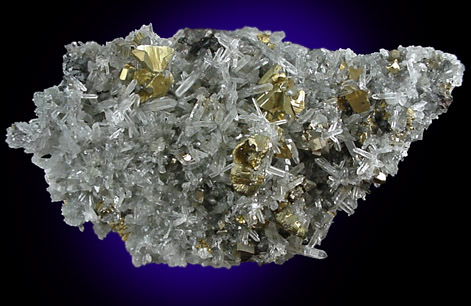
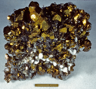
Chalcopyrite from selected localities.


USA | |
| USGS Map I-1310-B Mineral Deposit Map Silver City 1x2 Quad U.S. Geological Survey (2005) Mineral Resources Data System: U.S. Geological Survey, Reston, Virginia. |
| Econ Geol (1987) 82:523-545; Lasky, S. G., (1930) Geology and Ore Deposits of the Ground Hog Mine, Central District, Grant County, New Mexico. NMBMGMR Circular 2 U.S. Geological Survey (2005) Mineral Resources Data System: U.S. Geological Survey, Reston, Virginia. |
| USGS Bull 859 | |
| Singer, D.A., Berger, V.I., and Moring, B.C. (2008): US Geological Survey Open-File Report 2008-1155. |
| U.S. Geological Survey (2005) Mineral Resources Data System: U.S. Geological Survey, Reston, Virginia. | |
| U.S. Geological Survey (2005) Mineral Resources Data System: U.S. Geological Survey, Reston, Virginia. | |
| USGS Map I-1310-B Mineral Deposit Map Silver City 1x2 Quad U.S. Geological Survey (2005) Mineral Resources Data System: U.S. Geological Survey, Reston, Virginia. | |
| USGS Map I-1310-B Mineral Deposit Map Silver City 1x2 Quad U.S. Geological Survey (2005) Mineral Resources Data System: U.S. Geological Survey, Reston, Virginia. | |
| USGS Map I-1310-B Mineral Deposit Map Silver City 1x2 Quad |
| Sillitoe, R.H. (1985) Ore-related breccias in volcanoplutonic arcs. Economic Geology, 80:6, 1467-1514. Econ Geol (1980) 75:229-250; Econ Geol (1985) 80:1328-1347; Singer, D.A., Berger, V.I., and Moring, B.C. (2008): US Geological Survey Open-File Report 2008-1155.; Rocks & Minerals 84:492-500 U.S. Geological Survey (2005) Mineral Resources Data System: U.S. Geological Survey, Reston, Virginia. |


Ground Hog Mine, Vanadium, Central Mining District, Grant County, New Mexico, USA