| Locality | Latitude | Longitude | Distance | Bearing |
|---|
| Deákipuszta, Nyirád, Ajka District, Veszprém County, Hungary | 46° 59' 17" N | 17° 23' 26" E | 7.6km (4.7 miles) | |
| Nyírespuszta, Nyirád, Ajka District, Veszprém County, Hungary | 46° 58' 37" N | 17° 22' 13" E | 7.7km (4.8 miles) | |
| Sándor Mine, Nyirád, Ajka District, Veszprém County, Hungary | 47° 0' 6" N | 17° 26' 44" E | 10.3km (6.4 miles) | |
| Nyirád Mine, Nyirád, Ajka District, Veszprém County, Hungary | 47° 0' 0" N | 17° 27' 0" E | 10.7km (6.7 miles) | |
| Sarvaly Hill, Sümeg, Sümeg District, Veszprém County, Hungary | 46° 55' 59" N | 17° 18' 0" E | 11.6km (7.2 miles) | |
| Sarvaly Hill quarry, Sümeg, Sümeg District, Veszprém County, Hungary | 46° 55' 50" N | 17° 17' 16" E | 12.1km (7.5 miles) | |
| Szőlő Hill, Sümeg, Sümeg District, Veszprém County, Hungary | 46° 55' 42" N | 17° 13' 56" E | 13.7km (8.5 miles) | |
| Karikás Hill quarry (Kalapos Hill), Prága Hill, Bazsi, Sümeg District, Veszprém County, Hungary | 46° 55' 5" N | 17° 15' 59" E | 13.8km (8.6 miles) | |
| Level 300m, Karikás Hill quarry (Kalapos Hill), Prága Hill, Bazsi, Sümeg District, Veszprém County, Hungary | 46° 55' 0" N | 17° 16' 2" E | 13.9km (8.7 miles) | |
| Szőc bauxite deposit, Szőc, Ajka District, Veszprém County, Hungary | 47° 0' 38" N | 17° 30' 4" E | 14.1km (8.7 miles) | |
| Halimba bauxite deposit, Halimba, Ajka District, Veszprém County, Hungary | 47° 1' 54" N | 17° 30' 57" E | 14.9km (9.2 miles) | |
| Tátika Hill, Zalaszántó, Keszthely district, Zala County, Hungary | 46° 54' 22" N | 17° 15' 34" E | 15.2km (9.5 miles) | |
| Hemán-tó Hill, Zalaszántó, Keszthely district, Zala County, Hungary | 46° 54' 30" N | 17° 13' 23" E | 16.0km (10.0 miles) | |
| Láz Hill mine, Uzsa, Tapolca District, Veszprém County, Hungary | 46° 53' 28" N | 17° 19' 30" E | 16.2km (10.1 miles) | |
| Halápi Hill (Haláp Hill), Zalahaláp, Tapolca District, Veszprém County, Hungary | 46° 55' 29" N | 17° 27' 27" E | 16.3km (10.1 miles) | |
| Basalt quarry, Várvölgy, Keszthely district, Zala County, Hungary | 46° 53' 17" N | 17° 18' 59" E | 16.5km (10.3 miles) | |
| Szántói Hill, Zalaszántó, Keszthely district, Zala County, Hungary | 46° 53' 52" N | 17° 12' 59" E | 17.3km (10.8 miles) | |
| Kovácsi Hill, Zalaszántó, Keszthely district, Zala County, Hungary | 46° 54' 48" N | 17° 10' 41" E | 17.4km (10.8 miles) | |
| Orom Hill, Halimba, Ajka District, Veszprém County, Hungary | 47° 1' 1" N | 17° 33' 10" E | 17.8km (11.1 miles) | |
| Tik Hill, Taliándörögd, Tapolca District, Veszprém County, Hungary | 46° 58' 50" N | 17° 33' 21" E | 19.0km (11.8 miles) | |
| Scree Mine, Lesenceistvánd, Tapolca District, Veszprém County, Hungary | 46° 51' 59" N | 17° 21' 0" E | 19.1km (11.9 miles) | |
| Várvölgy quarry, Várvölgy, Keszthely district, Zala County, Hungary | 46° 51' 17" N | 17° 16' 12" E | 20.6km (12.8 miles) | |
| Kissomlyó Hill, Kissomlyó, Celldömölk District, Vas County, Hungary | 47° 8' 53" N | 17° 5' 55" E | 20.8km (12.9 miles) | |
| Bondoró Hill, Kapolcs, Tapolca District, Veszprém County, Hungary | 46° 57' 22" N | 17° 34' 25" E | 21.3km (13.2 miles) | |
| Csinger Valley coal mine, Ajka, Ajka District, Veszprém County, Hungary | 47° 5' 57" N | 17° 36' 11" E | 22.6km (14.0 miles) | |
| Hajagos Quarry, Tapolca, Tapolca District, Veszprém County, Hungary | 46° 53' 2" N | 17° 31' 10" E | 22.8km (14.2 miles) | |
| Szent-György Hill, Kisapáti, Tapolca District, Veszprém County, Hungary | 46° 50' 30" N | 17° 26' 53" E | 23.8km (14.8 miles) | |
| Kelemen Stone quarry, Szentbékkálla, Tapolca District, Veszprém County, Hungary | 46° 53' 26" N | 17° 33' 20" E | 24.2km (15.0 miles) | |
| Pula quarry, Pula, Veszprém District, Veszprém County, Hungary | 47° 0' 0" N | 17° 38' 4" E | 24.2km (15.1 miles) | |
| Little Hungarian Plain Volcanic Field, Devecser District, Veszprém County, Hungary | 47° 15' 0" N | 17° 15' 0" E | 24.3km (15.1 miles) | |
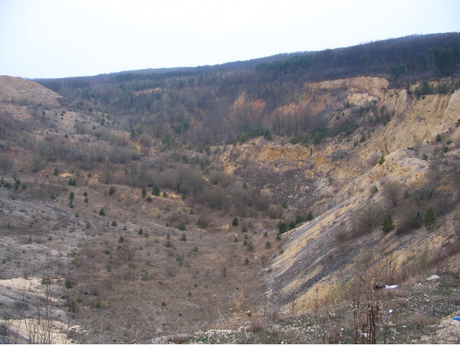
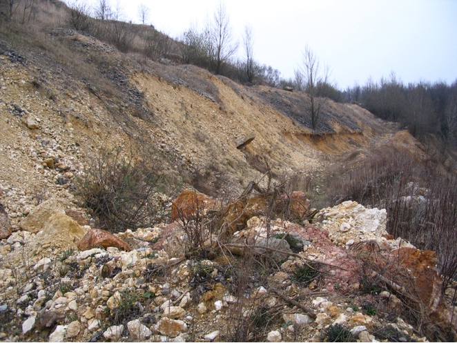
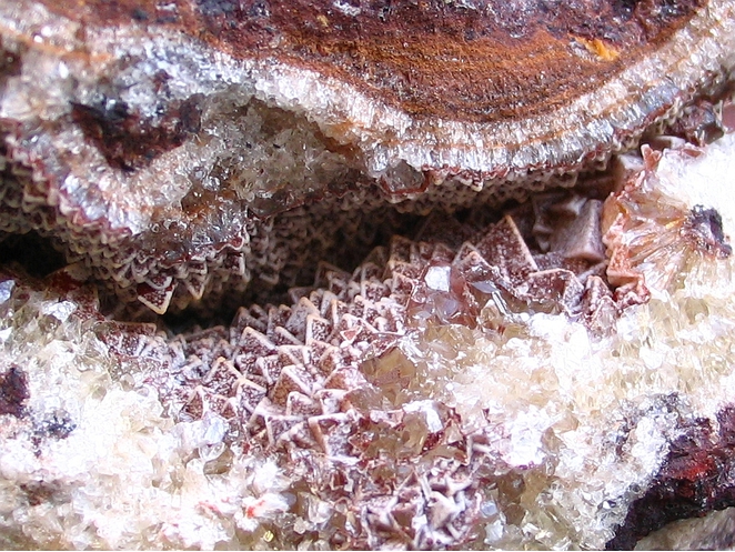


Nyírespuszta, Nyirád, Ajka District, Veszprém County, Hungary