| Locality | Latitude | Longitude | Distance | Bearing |
|---|
| Hartcliffe Rocks, Felton, Winford, North Somerset, England, UK | 51° 23' 31" N | 2° 40' 32" W | 1.4km (0.9 miles) | |
| Winford Redding Pits, Winford, North Somerset, England, UK | 51° 22' 13" N | 2° 40' 13" W | 1.6km (1.0 miles) | |
| Winford Ochre Pit, Winford, North Somerset, England, UK | 51° 22' 10" N | 2° 40' 14" W | 1.7km (1.0 miles) | |
| Freemans Quarry, North Somerset, England, UK | 51° 23' 53" N | 2° 41' 59" W | 3.2km (2.0 miles) | |
| South Liberty Colliery, Bristol, England, UK | 51° 25' 43" N | 2° 37' 36" W | 5.6km (3.5 miles) | |
| Providence Iron Mine, Long Ashton, North Somerset, England, UK | 51° 26' 3" N | 2° 40' 8" W | 5.7km (3.5 miles) | |
| Frayne’s Colliery, Bristol, England, UK | 51° 26' 17" N | 2° 37' 24" W | 6.6km (4.1 miles) | |
| Ashton Vale Colliery, Bristol, England, UK | 51° 26' 22" N | 2° 37' 34" W | 6.7km (4.2 miles) | |
| New Colliery, Bristol, England, UK | 51° 26' 10" N | 2° 36' 51" W | 6.7km (4.2 miles) | |
| Bishop Sutton Old Colliery, Bath and North East Somerset, England, UK | 51° 20' 0" N | 2° 35' 50" W | 7.1km (4.4 miles) | |
| Malago Vale Colliery, Bristol, England, UK | 51° 26' 12" N | 2° 36' 11" W | 7.2km (4.5 miles) | |
| Bishop Sutton New Colliery, Bath and North East Somerset, England, UK | 51° 19' 50" N | 2° 35' 58" W | 7.2km (4.5 miles) | |
| New Pit, North Somerset, England, UK | 51° 25' 7" N | 2° 45' 0" W | 7.3km (4.6 miles) | |
| Bromley Colliery, Bath and North East Somerset, England, UK | 51° 21' 13" N | 2° 33' 59" W | 7.3km (4.6 miles) | |
| Bedminster, Bristol, England, UK | 51° 26' 19" N | 2° 36' 10" W | 7.4km (4.6 miles) | |
| Amberlands Pit, North Somerset, England, UK | 51° 25' 12" N | 2° 44' 58" W | 7.4km (4.6 miles) | |
| East End Colliery, North Somerset, England, UK | 51° 25' 42" N | 2° 44' 42" W | 7.7km (4.8 miles) | |
| Bucklands Batch Pit, North Somerset, England, UK | 51° 25' 30" N | 2° 45' 1" W | 7.7km (4.8 miles) | |
| Deanland Colliery, Bristol, England, UK | 51° 26' 31" N | 2° 36' 3" W | 7.8km (4.8 miles) | |
| New Farlers Pit, North Somerset, England, UK | 51° 25' 31" N | 2° 45' 10" W | 7.9km (4.9 miles) | |
| Young Wood Colliery, North Somerset, England, UK | 51° 25' 11" N | 2° 45' 34" W | 8.0km (4.9 miles) | |
| Golden Valley Pit, North Somerset, England, UK | 51° 25' 55" N | 2° 44' 45" W | 8.0km (5.0 miles) | |
| Hotwells, Clifton, Bristol, England, UK | 51° 26' 58" N | 2° 36' 54" W | 8.0km (5.0 miles) | |
| Pensford Colliery, Bath and North East Somerset, England, UK | 51° 21' 42" N | 2° 33' 0" W | 8.1km (5.0 miles) | |
| Middle Engine Pit, North Somerset, England, UK | 51° 25' 55" N | 2° 44' 51" W | 8.1km (5.0 miles) | |
| White Oak Colliery, North Somerset, England, UK | 51° 25' 20" N | 2° 45' 42" W | 8.2km (5.1 miles) | |
| Scotch Horn Colliery, North Somerset, England, UK | 51° 25' 50" N | 2° 45' 10" W | 8.3km (5.1 miles) | |
| Compton Martin Ochre Mine, North Somerset, England, UK | 51° 18' 27" N | 2° 39' 30" W | 8.4km (5.2 miles) | |
| Burrington Ham Mine, North Somerset, England, UK | 51° 19' 17" N | 2° 43' 54" W | 8.4km (5.2 miles) | |
| Portbury Lane Quarry, North Somerset, England, UK | 51° 27' 13" N | 2° 42' 54" W | 8.7km (5.4 miles) | |

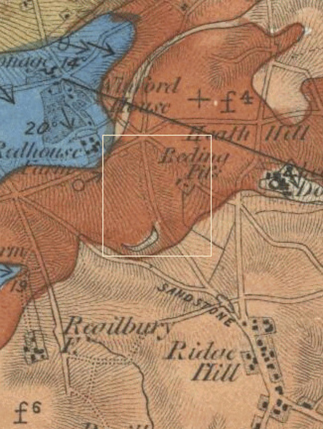


Providence Iron Mine, Long Ashton, North Somerset, England, UK