 | | Report (volume) | | Economic Geology of the Idaho Springs District Clear Creek and Gilpin Counties, Colorado GEOLOGICAL (=) I...Geology of the Idaho Springs District Clear Creek and -i ;i ?i Gilpin Counties, Colorado By ROBERT H. MOENCH...___________ Mines and prospects in the Idaho Springs district ________________ Previous studies.____...are in pocket] PLATE 1. Map of the Idaho Springs district, Colorado, showing location of mines and distribution...Generalized geologic map and sections of the Idaho Springs district. 3. Geologic section along the Big Five |  | | Report (issue) | | Bldg., 2600 corridor, 18th and CSts.,NW. DENVER, Colorado-Federal Bldg., Rm. 169,1961 Stout St. LOS ANGELES...(Stop 533), Rm. 3128. 345 Middlefield Rd. RESTON, Virginia-503 National Center, Rm. 1C402,12201 Sunrise Valley...ROLLA, Missouri-1400 Independence Rd. DENVER, Colorado-Map Distribution, Bldg. 810, Federal Center FAIRBANKS...Replacement Deposits Part I Bald Mountain Gold Mining Region, Northern Black Hills, South Dakota By JAMES...Park City Mining District, Utah By CALVIN S. B ROM FIELD Gold in the Eureka Mining District, Nevada By |  | | Journal (article/letter/editorial) | | with its representation of mining tools clearly proclaim Montana’s mining origins. Montana’s production...published describing the occurrence, collecting, mining, and cutting of the two state gemstones. Figure...Granville Stuart established Montana’s first mining camp at Gold Creek in 1860. Geologic Provinces The state...MICHAEL J. GOBLA 19055 East Bethany Place Aurora, Colorado 80013 gobla@copper.net Unless otherwise noted...Indian Queen mine ca. 1905 at Farlin, Beaverhead County. 208 ROCKS & MINERALS Downloaded by [University |  | | Report (issue) | | Ore Deposits of the· Kokomo-Tenmile District, Colorado By M. H. BERGENDAHL and A. H. KOSCHMANN . I...PAPER 652 Prepared in cooperation with the Colorado Mining Industrial Development Board .. 1\ UNITED...Page PLATE 1. Geologic map of Kokomo-Tenmile district------------------------------------------------------...pocket FIGURE 1. Index map of Kokomo-Tenmile district ___________________________________________________________..._________________ _ 14. Map of Kokomo-Tenmile district showing areas of garnet and epidote alteration |  | | Journal (article/letter/editorial) | | Photographs JanuarylFebruary: Copper, Ray, Pinal County, Arizona. Les Presmyk specimen, Jeff Scovil photo...quartz and albite, Tourmaline Queen mine, San Diego County, California. Houston Museum of Natural Science...claims, Farncomb Hill, Breckenridge district, Summit County, Colorado. Denver Museum of Natural History...malachite ring, Flambeau mine, Ladysmith, Rusk County, Wisconsin. Dan Behnke specimen and photo. NovemberDecember:...calcite, and chalcopyrite, Sweetwater mine, Reynolds County, Missouri. Marvin Rausch specimen, Jeff Scovil |  | | Report (issue) | | . . . . . . . . . . . . . . . . . 1 Chapter I. Mining Districts of Counties and the State of Utah. .... . . . . . . . . . . . . . . . . . . . . . . 1 County Listings. . . . . . . . . . . . . . . . . . . ... . . . . . . . . . . . . . . . . 1 Chapter II. Mining Districts of Utah . . . . . . . . . . . . . . .... . . . . . . . 4 Mineral Localities Listed by County . . . . . . . . . . . . . . . . . . . . . . . .... . . . . . . . . . . . . . . . . . . 7 Beaver County . . . . . . . . . . . . . . . . . . . . . . . |  | | Book (volume) | | beds, excavations, etc.Selenite roses. BRULE COUNTY AREA: in the Oacoma zone of the Pierre Fm. On Elm...gray Barite rosette up to 5 or 6 inches. CAMPBELL COUNTY MOUND CITY, W to the Missouri R., regional hillsides...gravels, etc.petrified wood, wood opal. CORSON COUNTY LITTLE EAGLE: area ridges, slopes, stream beds...Guide for Rock Hounds in the United States CUSTER COUNTY AREA: The November Mine, 1.2 mi. SE of the Needles...outcropsRose Quartz; S along US 385 for 32 mi. to Hot Springs in Fall River Co., all regional side rds., look |  | | Report (volume) | | GEOLOGY AND ORE DEPOSITS OF THE WOOD RIVER REGION, IDAHO BY JOSEPH B. UMPLEBY, LEWIS G. WESTGATE AND CLYDE...D. F. HEWETT Prepared in cooperation with the Idaho Bureau of Mines and Geology Francis A. Thomson,.....______.__________-_--__--_--_.____--._ Trail Creek formation.....___..._ __.______.--. General features...Granodiorite and related rocks on upper Wildhorse Creek __ Massive granodiorite________-------__-----________...monzonite on Deer Creek-__-------_----____-___ Soda granite on Warm Springs Creek..__________________ |  | | Report (issue) | | designate the papers for advance publication] (A) Some mining districts of eastern Oregon, by James Gilluly,...deposits of the Takilma-Waldo district, Oreg., including the Blue Creek district, by Philip J. Shenon________...Shenon________ (C) The Climax molybdenum deposit, Colorado, by B. S. Butler and J. W. Vanderwilt, with a section...deposits in the northwestern part of the Boise Basin, Idaho, by Clyde P. Ross_________________________ Inde...ILLUSTRATIONS PLATE 1. Index map showing location of mining districts in eastern Oregon. 8 2. Topographic and |  | | Report (volume) | | OF BOISE BASIN, IDAHO BY ALFRED L. ANDERSON Prepared in cooperation with the IDAHO BUREAU OF MINES AND...________________-____--_-______---_---_--_------Idaho batholith and its facies (Mesozoic)......---.--------------Quartz..._______________________ Rocks younger than the Idaho batholith-________________________ Early Tertiary...-'__-_-.---_-.________.___________--__-.._ 265 Mayflower raine__._-_------_---_--__________---____----...relations.--__-________________.________ 267 Mayflower lode..____-___!..______________________..-__ 268 |  | | Report (issue) | | Report for the Abandoned and Inactive Mines in Idaho on U.S. Forest Service Lands (Region 4), Boise National...Counties, Idaho (Selected Properties) Field Inspection by: Dave Leppert Mike Berwick Virginia S. Gillerman...Leppert Mike Berwick Virginia S. Gillerman Staff Report 07-4 January 2007 Idaho Geological Survey Morrill...Morrill Hall, Third Floor University of Idaho Moscow, Idaho 83844-3014 Site Inspection Report for the...the Abandoned and Inactive Mines in Idaho on U.S. Forest Service Lands (Region 4), Boise National Forest: |  | | Report (issue) | | ........... 27 Geologic history 29 Gold placer mining operations ......................................History .......................... 31 Boston & Idaho Gold Dredging Company ................................................................ 32 Moline Mining Co...................................................... ................................. 34 Marcasite . 34 Pq~rEotite . . . ........................................... 38 . . . . . . . . . 8 IDAHO BLXEAU OF MINES AND GEOLOGY Economic Geology-Continued |  | | Report (issue) | | Selected Mining Districts of Utah by Carl L. Ege Headframe of Centennial Eureka mine, Tintic mining district... . . . . . . . . . . . . . . .1 What is a mining district? . . . . . . . . . . . . . . . . . . . . .... . . . . . . . . . . . . . . . . . .1 How many mining districts are there in Utah and are they still...mineral resources are mined in Utah’s most productive mining districts . . . . . . . . . . . . . . . . . . ...most common types of ore deposits found in Utah’s mining districts? . . . . . . . . . . . . . . . . . . |  | | Report (issue) | | Geology and Ore Deposits of the Boulder County Tungsten District Colorado GEOLOGICAL SURVEY PROFESSIONAL ... Geology and Ore Deposits of the Boulder County Tungsten District Colorado By T. S. LOVERING and OGDEN TWETO...State of Colorado through the Colorado Geological Survey Board and the Colorado Metal Mining Fund UNITED...of the district.________________________ Pre-Cambrian rocks_____________________________ Idaho Springs...Age_ __________________________________ Boulder Creek granite and related rocks. ____ Distribution and |  | | Book (volume) | | Dolomite crystals, Fluorite (fluorescent), , Galena, Marcasite, Pyrite, Selenite and Sphalerite. A few alluvial...ASHTABULA COUNTY CONNEAUT, area pits, quarries, rd. cuts, etc.⎯cone-in-cone Calcite. CLERMONT COUNTY MILFORD...MILFORD, area creek gravels and alluvial deposits, rare⎯Diamond. CLINTON COUNTY WILMINGTON, area of Todd’s...deposit⎯Hematite. COSHOCTON COUNTY AREA, townships of Washington, Virginia, Bedford, Jackson, Jefferson...Keene, Mill Creek and Tuscarawas, as hard dark gray to black nodules⎯flint. CUYAHOGA COUNTY CHAGRIN FALLS |  | | Book (volume) | | Dolomite crystals, Fluorite (fluorescent), , Galena, Marcasite, Pyrite, Selenite and Sphalerite. A few alluvial...ASHTABULA COUNTY CONNEAUT, area pits, quarries, rd. cuts, etc.⎯cone-in-cone Calcite. CLERMONT COUNTY MILFORD...MILFORD, area creek gravels and alluvial deposits, rare⎯Diamond. CLINTON COUNTY WILMINGTON, area of Todd’s...deposit⎯Hematite. COSHOCTON COUNTY AREA, townships of Washington, Virginia, Bedford, Jackson, Jefferson...Keene, Mill Creek and Tuscarawas, as hard dark gray to black nodules⎯flint. CUYAHOGA COUNTY CHAGRIN FALLS |  | | Report (issue) | | description of the geology, mining history, and production of the major gold-mining districts in 21 States...relations ---------------------------History of gold mining and trends in production_ J\labama -----------...--------------Cleburne County ----------~----------------- Tallapoosa County --------------------------Alaska...------------------Cochise County -----------------------------Gila County --------------------------------Greenlee...ee County ----------------------------R[aricopa County ----------------------------R[ohave County -- |  | | Book (volume) | | ae TONITE TN263. Au. =American Institute of Mining, Metallurgical, V.2 and Petroleum Engineers Ore...Inst! itute i an Americ ie Lye 2 of llurgical, Mining, Meta m Engineers and Petroleu © f the Ore deposiits...AND ZINC (1936) 134, MILLING METHODs 141, METAL MINING (1939) (1937-40) BLAST FURNACE, COKE OVEN AND...AIME TRANSACTIONS VOLUME 178, MINING GEOLOGY AIME TRANSACTIONS 181, MINING, INDUSTRIAL MINERALS, EDUCATION...I! Published by : : The American Institute of Mining, Metallurgical, and Petroleum Engineers, Inc. NEW |  | | Book | | URANIUM GUIDEBOOK FOR THE PARADOX BASIN, UTAH AND COLORADO TABLE OF CONTENTS Page THE PARADOX BASIN OVERVIEW...AND MINING AREAS SLICK ROCK DISTRICT GYPSUM VALLEY DISTRICT BULL CANYON DISTRICT URAVAN DISTRICT GATEWAY...GATEWAY DISTRICT (EASTERN GATEWAY AREA) MC ELMO CREEK DRAINAGE AREA LA SAL CREEK AREA PARADOX DISTRICT BEAVER...VALLEY (BIG INDIAN) DISTRICT MOAB DISTRICT GREEN RIVER DISTRICT THOMPSONS DISTRICT INTER-RIVER REGION...RICHARDSON-DEWEY AREA LOWER KANE SPRINGS AREA INDIAN CREEK REGION DRY VALLEY DISTRICT COTTONWOOD AND BUTLER WASH |  | | Report (volume) | | Deposits Of the Lawson-DumontFall River District Clear Creek County Colorado By C. C. HAWLEY and FRANK BAKER...of the district which forms the northwestern part of the important Central City-Idaho Springs mineralized...section of the Lawson-Dumont-Fall River district, Clear County, Colo. 2. ~ap showing major faults (veins)...(veins) of the Lawson-DumontFall River district projected to a horizontal plane having an elevation of 8...PLATE 3. Map of the Lawson-Dumont-Fall River district, showing location of mines and distribution of |  | | Book (volume) | | Northwest States VOLUME 2 Alaska Idaho Arizona California Colorado lowa Minnesota Montana Hawaii Kansas...VOLUME 4 Northeast States Connecticut Delaware District of Columbia Illinois Indiana Louisiana Maine...North Carolina South Carolina Tennessee Virginia West Virginia Vermont Wisconsin “ NE i fe € IWNIOA...Safety Precautions ........0.0... 0000 cece sees Mining Techniques - serena cere one ee Notes on Gem Faceting...the early 1600s, when English settlers reached Virginia, they had been instructed “to searche for gold |  | | Report (volume) | | ............................................. Colorado........................................................................................ 102 District of Columbia .................................................................................. Idaho................................................................................................ Virginia......................................................................................... West Virginia.............................................. | 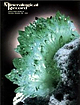 | | Journal (issue) | | R. Kampf Natural History Museum of Los Angeles County Arthur Roe Tucson, AZ Abraham Rosenzweig University...Fluorapatite from the King Lithia mine, Custer County, South Dakota .. 361 by M. L. Wilson, J. B. Paces...80044 303-695-7600 Superb W orldwide Specimens Colorado School o f Mines G olden, CO 80401 303-273-3823...olden, CO 80401 303-233-4188 Largest Stock in Colorado Collector's Stope Jim & Patti McGlasson 7387...303-794-7803 Colorado-Utah Minerals Keith & Brenda Williams P .O . Box 1599 Idaho Springs, CO 80452 303-567-4647 |  | | Book | | MINES AND MINERALS OF THE GREAT AMERICAN RIFT (COLORADO-NEW MEXICO) Sine —_—< ¢ te om At _SHT 40...MINES AND MINERALS OF THE GREAT AMERICAN RIFT (COLORADO-NEW MEXICO) Richard Walker Holmes and Marrianna...Mines and minerals of the Great American Rift (Colorado-New Mexico). Bibliography: p. Includes index...index. 1. Mines and mineral resources—Colorado. 2. Mines and mineral resources—New Mexico. I. Kennedy, Marrianna...netlaneaiveme beneigs ony Snir » be = Ba and a Creek: oe * Md 8 _ yo ae Ve ja rete: _ |  | | Report (issue) | | Bldg.. 2600 corridor, 18th and CSts.,NW. DENVER, Colorado-Federal Bldg., Rm. 169, 1961 Stout St. LOS ANGELES...(Stop 533), Rm. 3128, 345 Middlefield Rd. RESTON, Virginia-503 National Center, Rm. 1C402.12201 Sunrise Valley...ROLLA, Missouri-1400 Independence Rd. DENVER, Colorado-Map Distribution, Bldg. 810, Federal Center FAIRBANKS...Terranes Part I Geographic Distribution of Gold Mining Regions and Types of Deposits in the United States...Associated with the Trans-Challis Fault System, Idaho ByTHOR H. KIILSGAARD, FREDERICKS. FISHER, and EARL |
|


