 | | Report (issue) |
| River, between Anvik and Andreafski rivers. The area covered by surveys in 1916, extending from longitude...Sixteen days was also spent in the vicinity of Marshall in studying the mineral resources and in topographic...18 Bull. 662 22 333 334 MINERAL RESOURCES OF ALASKA, 1916. UPLANDS. The uplands are scarcely of sufficient...though the highest and most conspicuous peak in the area, is only 4 miles from the Yukon. It lies 8 miles...Kuskokwim. Pilcher Mountain, about 5 miles east of Marshall, rises well above the immediately adjacent hills |
 | | Report (volume) |
| 683 THE ANVIK-ANDREAFSKI REGION ALASKA (INCLUDING THE MARSHALL DISTRICT) BY GEORGE L. HARRINGTON WASHINGTON................. 28 Koserefslu River to Mountain Creek............................ 29 Dogfish Village...........:...y.............................. 30 Marshall.................................................................................... History of mining development.............":.:............................ . Economic factors affecting mining..................................... Gold placers....... |
 | | Report (volume) |
| Placer Deposits of Alaska By EDWARD H. COBB GEOLOGICAL SURVEY BULLETIN 1374 An inventory of the...the placer mines and prospects of Alaska, their history and geologic setting UNITED STATES GOVERNMENT...and method of presentation __ Definitions _-____ Alaska Peninsula region Aleutian Islands region ________...Anchorage district _ Redoubt district ___-_ _ Valdez Creek district __ _ Willow Creek district Yentna district...district _____________ _ ____ __________ _____ Copper River region __ _ _ _ Chistochina district Nelchina |
 | | Report (issue) |
| OTHER MAFIC-ULTRAMAFIC METALLOGENIC PROVINCES IN ALASKA (WEST OF THE 141st MERIDIAN) By Jeffrey Y. Foley1...Mines, Alaska Field Operations Center. Present address: 3301 C Street, Suite 525, Anchorage, Alaska, 99503-3935...Introduction Metallogenic provinces Northern and western Alaska Western Brooks Range metallogenic province Seward...metallogenic province Alaska Range Eastern Alaska Range metallogenic province Central Alaska Range metallogenic...metallogenic province Southwestern Alaska metallogenic province South-Central Alaska Border Ranges metallogenic |
 | | Report (issue) |
| SELECTED NONMETALLI FERGUS MINERAL DEPOSITS IN CENTRAL ALASKA TO ACCOMPANY OPEN-FILE MAP 77-1680 This report...SELECTED NONMETALLI FERGUS MINERAL DEPOSITS IN CENTRAL ALASKA (To accompany Open-file Map 77-168D) By G. Donald...accompanying map have been prepared under the Regional Alaska Mineral Resource Appraisal Program (RAMRAP) to...nonmetal1iferous deposits, both lode and placer, in central Alaska. Specifically excluded are the fossil fuels (petroleum...government and private sectors, discussions with mine operators, and the firsthand knowledge of the authors |
 | | Report (issue) |
| Stratigraphy of Slick Rock District and Vicinity San Miguel and Dolores Counties, Colorado GEOLOGICAL...Commission PAPER 576-A Stratigraphy of Slick Rock District and Vicinity San Miguel and Dolores Counties,...ARCHBOLD GEOLOGICAL INVESTIGATIONS IN THE SLICK ROCK DISTRICT SAN MIGUEL AND DOLORES COUNTIES, COLORADO GEOLOGICAL...strata of Paleozoic and Mesozoic age underlying the district forms the background for understanding the origin...Summerville Formation________________________ Junction Creek Sandstone.________-___-----_---_ Morrison Formation |
 | | Report (issue) |
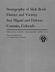
| HAKEINGTON. SUMMARY OF MINING OPERATIONS. t A resume of the history of tin mining in Alaska up to 1914 has been...his report. Stream tin was first found on Buhner Creek, a tributary of Anikovik River, in 1900, and there...since 1902. In 1911 a dredge was installed on Buck Creek which has been in operation each season since. Two...following season. A second dredge was installed on Buck Creek in 1915 and has worked each summer since that date...hull in 1916 and installed on a dredge on Swanson Creek, a tributary of Agiapuk Eiver. The hull was carried |
 | | Report (issue) |
| GEOLOGY AND ORE DEPOSITS OF THE KLONDIKE RIDGE AREA, COLORADO by J. D. Vogel U. S. Geological Survey...i''-^-^''.'!''-?,-' Disappointment Valley , . ,, »« .* .;>.f. ;.H^!;^j£ Dry Creek baain;;;i.x ;.: :':...Stratigraphic sections measured in the Klondike Ridge area, San Miguel and Dolores Counties, Colorado. . ....Descriptions of selected carnotite deposits. ..... Penju mine ..................... Deposit #440 ...............analyses of carnotite deposits in the Klondike district . . . D. Chemical and semiquantitative spectrographic |
 | | Report (issue) |
| COSNA-NOWITNA REGION. By HENRY M. EAKDST. INTRODUCTION. The area here called the Cosna-Nowitna region extends southward...general way the 1 Hcrron, J. S., Explorations in Alaska, 1899: War Dept., Adjt. General's Office, No. 31...1-77, maps, 1901. 211 212 MINERAL RESOURCES OF ALASKA, 1915. Yukon-Kuskokwim divide. A pack train of...Geologic mapping was extended over practically the same area. The resulting maps will be published in connection...the eastern part. Still farther east, beyond the area surveyed, several small isolated ranges and hills |
 | | Report (issue) |
| H. MANNING. Director I HE MINING INDUSTRY IN THE TERRITORY OF ALASKA DURING THE CALENDAR YEAR 1915... BY SUMNER S. SMITH United States Mine Inspector for Alaska ENGINEERING \Y* WASHINGTON GOVERNMENT...MINES H. MANNING. Director THE MINING INDUSTRY IN THE TERRITORY OF ALASKA DURING THE CALENDAR YEAR 1915... BY SUMNER S. SMITH United Stales Mine Inspector for Alaska WASHINGTON GOVERNMENT PRINTING 1917 ...prohibits the CONTENTS. Page. Introduction New gold-mining districts Mineral production Placer gold Lode gold |
 | | Report (issue) |
| LODE MINING AND PROSPECTING ON SEWARD PENINSULA. By J. B. MERTIE, Jr. INTRODUCTION. The lodes of Seward...most part undeveloped. The Big Hurrah mine, in the Solomon district, produced gold from 1903 to 1907 but...been made from the Sliscovich mine, on Manila Creek, in the Nome district, but these were more in the nature...development is still in the stage of prospecting. Lode mining of some of the semiprecious and base metals, however...GOLD. SLISCOVICH. The Sliscovich mine, near the head of Manila Creek, has been described in some detail |
 | | Report (volume) |
| Geological Survey investigations in northwestern Alaska._______ Expedition of 1923.._._.____-________ ...Shungnak River.____.______--_------__-__--_----. Dahl Creek.................-..--------...-...-... Kogoluktuk...321 321 322 324 325 325 327 330 331 331 Midas Creek region......__......._____.._.._. Koyukuk Valley...showing progress of investigations in northwestern Alaska._____________________________________________ 8...head of Kivalina River; B, Sea cliffs near Niak Creek, Cape Lisburne region._____________________ 40 7 |
 | | Report (issue) |
| Uranium-Vanadium Deposits of the Slick Rock District, Colorado U.S. Geological Survey Professional Paper...Geological Survey Cover photograph: Burro No. 7 mine, Slick Rock, Colorado. Photograph by Jim Cappa,...Slick Rock District, Colorado By Daniel R. Shawe With a section on Appendix on District Production By...Chenoweth GEOLOGIC INVESTIGATIONS IN THE SLICK ROCK DISTRICT, SAN MIGUEL AND DOLORES COUNTIES, COLORADO GEOLOGICAL...2011, Uranium-vanadium deposits of the Slick Rock district, Colorado: U.S. Geological Survey Professional |
 | | Report (issue) |
| Northwestern Alaska EXPLORATION OF NAVAL PETROLEUM RESERVE NO. 4 AND ADJACENT AREAS, NORTHERN ALASKA, 1944-53... Geology of the Utukok-Corwin Region Northwestern Alaska By ROBERT M. CHAPMAN and EDWARD G. SABLE EXPLORATION...PETROLEUM RESERVE NO. 4 AND ADJACENT AREAS, NORTHERN ALASKA, 1944-53 PART 3, AREAL GEOLOGY GEOLOGICAL SURVEY...Upper Cretaceous series Colville group______ Prince Creek formation__________________ Quaternary system.....-_____-_____--__Recent deposits..___________________ Coastal area west of Cape Beaufort.______ Petrography ______ |
 | | Report (issue) |
| outcrops are common along the many small streams in the area. In addition, an extensive network of private logging...others, 1981; Glicken, 1986) are present in Castle Creek in the extreme northeast part of the quadrangle...probably correlative with the extensive Hayden Creek Drift (Crandell and Miller, 1974) on the basis of...Kalama River. Surficial deposits shown as the Hayden Creek Drift on slopes in the Kalama River valley locally...indicating that they are correlative with the Evans Creek Drift deposited during the Fraser glaciation, the |
 | | Report (issue) |
| BAY-CHIGNIK DISTRICT. By W. R. SMITH and ARTHUR A. BAKER. INTRODUCTION. LOCATION AND AREA. The area described...in this report lies on the southeast side of the Alaska Peninsula west of Kodiak Island and extends from...peninsula to the northeast side of Chignik Bay. This area lies between meridians 155° and 158° west and parallels...northeastern portion of the area includes a part of the Cold Bay district, which has already been described...Capps.1 Cold Bay lies on the southeast side of the Alaska Peninsula at longitude 155° 30' west and latitude |
 | | Report (volume) |
| location and means of access to all the metallic mining districts in the State, as well as a large number...documented summary of the beginning of Colorado mining history. Part of his summary is given here in the...galena that had been recently found in the Tenmile district, Summit County. In his booklet, which today would...lists of the mines and mining districts that were active at the time in Clear Creek, Gilpin, and Summit...only reports the early history and status of the mining industry, but includes a list of all the species |
 | | Report (volume) |
| it helpful to refer to Survey Bulletin 507, "The mining districts of the western United States," and to...abundant, it may have been completely exhausted by mining or quarrying. Deposits of minerals of wide distribution...because they occur in sufficient quantity to warrant mining for their usual products but because they furnish...working in pure white clay at Eureka V ALABAMA. 7 mine 4 miles northeast of Valley Head. Etowah County...groups of beds Black Creek, Brookwood, Mary Lee, and Pratt coal groups. Black Creek coal group mined at |
 | | Report (volume) |
| ....................................... 102 District of Columbia ....................................to refer to Geological Survey Bulletin 507, "The mining districts of the western United States," and to...abundant it may have been completely exhausted by mining or quarrying. Deposits of minerals that are widely...because they occur in sufficient quantity to warrant mining for their usual products, but because they furnish...STATES ALABAMA. H ing in pure white clay at Eureka mine, 4 miles northeast of Valley Head. Etowah County |
 | | Report (issue) |
| stratigraphy, structure, and geomorphology of an area characterized by large salt-cored anticlines, with......................... . Fanglomerate~ in West Creek valley ....................... . Lake ( ? ) deposits.......... . Dry Creek basin syncline ................................ .. Disappointment syncline ............................... :.............. .. Ute Creek graben ...........................................the Colorado Plateau showing location of report area................................................ |
 | | Report (issue) |
| Geologic History of the Slick Rock District and Vicinity, San Miguel and Dolores Counties, Colorado GEOLOGICAL...Commission Geologic History of the Slick Rock District and Vicinity, San Miguel and Dolores Counties...SHAWE GEOLOGIC INVESTIGATIONS IN THE SLICK ROCK DISTRICT, SAN MIGUEL AND DOLORES COUNTIES, COLORADO GEOLOGICAL...Daniel R. 1925Geologic history of the Slick Rock district and vicinity, San Miguel and Dolores Counties...Colorado. (Geologic investigations in the Slick Rock District, San Miguel and Dolores Counties, Colorado) (Geological |
 | | Report (volume) |
| Mineral Resources of the Idaho Primitive Area and Vicinity, Idaho By F. W. CATER, D. M. PINCKNEY, W....MINES With a section on the THUNDER MOUNTAIN DISTRICT By B. F. LEONARD, U.S. GEOLOGICAL SURVEY, and...1304 An evaluation of the mineral potential of the area UNITED STATES GOVERNMENT PRINTING OFFICE, WASHINGTON...System, but the act provided that each primitive area should be studied for its suitability for incorporation...results of a mineral survey of the Idaho Primitive Area, Idaho, and some adjoining national forest lands |
 | | Report (volume) |
| famous mining districts, such as those at Rico and La Plata, but there is no significant mining being...leasable minerals are concentrated in a small southern area of the Forest that overlaps the energy-rich San...Foley, and Anthony B. Gibbons Exploration and Mining History ............................................................................... . Mining Districts ............................................................................. . Slick Rock District ............................................. |
 | | Report (issue) |
| ------Significance of Triassic ostracodes from Alaska and Nevada, by I. G. Sohn_______________________________________...alteration in the Upper Mississippi Valley zinc-lead district, by J. W. Hosterman, A. V. Heyl, and J. L. Jo...Aeromagnetic interpretation of the Globe-Miami copper district, Gila and Pinal Counties, Arizona, by Anna Jespersen__...a well drilled through permafrost near Bethel, Alaska, by A. J. Feulner and R. G. SchUPP------------...after sending thin flows of shelly pahoehoe over an area of about 8,000 square yards. During the night, activity |
 | | Report (issue) |
| southeastern Alaska. View southeast from head of Tracy Arm. The United States Geological Survey in Alaska: Accomplishments...resources of Alaska, by Edward H. Cobb _________________1 Landsat color mosaic of Alaska, by Nairn R....data interpretation of various AMRAP quadrangles, Alaska by Nairn R. D. Albert, Wm. Clinton Steele and James...____________________4 Geochemical exploration studies in Alaska, by G. C. Curtin, T. D. Hessin, R. M. O'Leary,... S. Anderson _______________________? Northern Alaska _____________________? The Arrigetch Peaks and |


