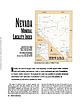
 | | Journal (article/letter/editorial) | | 31 December 2014 NEVADA MINERAL STEVEN PULLMAN 1755 Circle Drive NW Reno, Nevada 89509 RICHARD THOMSSEN...THOMSSEN P.O. Box 1656 Carson City, Nevada 89702 Map showing Nevada counties, by William W.Besse. N evada...year. Nevada is one of the few western states without a published state mineralogy; thus, mineral collectors...collectors are aware of its mineral specimen wealth from only a few well-known and collected localities,...reasonably expect to obtain a specimen in the current mineral market. We have chosen not to include commercial |  | | Report (issue) | | INTERIOR GEOLOGICAL SURVEY MINERAL DEPOSITS OF THE RENO 1° x 2° QUADRANGLE, NEVADA, with a comprehensive bibliography...Figure 1. Location map of mining districts in the Reno 1° x 2° quadrangle, Nevada..........................Known production from mining districts in the Reno 1° x 2° quadrangle, Nevada..........................Occurrences of mineral deposits in mining districts of the Reno 1° x 2° quadrangle, Nevada................prospects, and claims in the Reno 1° x 2° quadrangle, Nevada.......................................... 19 21 |  | | Book | | - f. MIMING DISTRICTS and MINERAL RESOURCES of NEVADA by FRANCIS CHURCH LINCOLN i r r i i ... ; 'jxt . 1 — \ MINING DISTRICTS and MINERAL RESOURCES of NEVADA by FRANCIS CHURCH LINCOLN...LINCOLN 0 ll ; RENO NEVADA NEWSLETTER PUBLISHING COMPANY 1923 PREFACE Earlier Works. The object of...infor mation concerning the mining districts and mineral resources of Nevada. No comprehensive work of...peared for a number of years. In the early days of Nevada min ing, from 1866 to 1878, the field was covered |  | | Report (issue) | | MINERALS OF NEVADA MINERALS OF NEVADA Peer Hen By CASTOR oan eGORY.C.oFER DOCK NEVADA AND BUREAU... UNIVERSITY Reno & Las Vegas OF NEVADA PRESS GEOLOGY Nevada Bureau of Mines and Geology Special...University of Nevada Press, Reno, Nevada 89557 USA Copyright © 2004 by University of Nevada Press Photographs...otherwise noted Map of Mining Districts and significant mineral occurrences of Nevada by Nevada Bureau of Mines...Cataloging-in-Publication Data Castor, Stephen B, Minerals of Nevada / Stephen B. Castor and Gregory C. Ferdock.— Ist | | | Report (issue) | | MINERALS OF NEVADA MINERALS OF NEVADA STEPHEN B. CASTOR and G R EGOR Y C . F E R D OC K l NEVADA BUREAU...association with the UNIVERSITY OF NEVADA PRESS Reno & Las Vegas Nevada Bureau of Mines and Geology Special...University of Nevada Press, Reno, Nevada 89557 USA Copyright© 2004 by Uni versity of Nevada Press Photographs...Districts and si gnificant minernl occurrences of Nevada by Nevada Bureau of Mines and Geology All rights reserved...-Publ ication Dat,i Castor, Stephen B. Minerals of Nevada/ Stephen B. Castor and Gregory C. Ferdock.- rst |  | | Journal (article/letter/editorial) | | of quartz and carbonate minerals across northern Nevada using ASTER thermal infrared emissivity data—Implications...data—Implications for geologic mapping and mineral resource investigations in well-studied and frontier areas... Denver Federal Center, Denver, Colorado 80225, USA ABSTRACT ASTER (Advanced Spaceborne Thermal Emission...imagery over a 389 km × 387 km area in northern Nevada (38.5°–42°N, 114°–118.5°W) was analyzed to evaluate...emissivity products of 108 overlapping scenes. These mineral maps were mosaicked into a single coverage that |  | | Report (issue) | | Copper Deposit and Surrounding Area, Lander County, Nevada GEOLOGICAL ) SURVEY PROFESSIONAL PAPER...Copper Deposit and Surrounding Area, Lander County, Nevada By TED G. THEODORE and DAVID W. BLAKE GEOCHEMISTRY...COPPER ENVIRONMENT IN THE BATTLE MOUNTAIN MINING DISTRICT, NEVADA GEOLOGICAL SURVEY PROFESSIONAL PAPER...Structural and stratigraphic features of the mining district Geology of the Copper Canyon area ...........Altered granodiorite of the Wilson-Independence mine area .......................................... |  | | Report (issue) | | Geology of the Cerro Gordo Mining District Inyo County, California By C. W. MERRIAM , GEOLOGICAL SURVEY...Gordo mine _____________________________ _ History of the Cerro Gordo mine ____________ _ Mine development...Production of the Cerro Gordo mine _________ _ 8 Geology of the Cerro Gordo mine ____________ _ 8 Rocks of...of the Cerro Gordo mine __________ _ Sedimentary rocks _________________ _ 9 Igneous rocks _____________________...strike __ _ 17 Ore occurrence in the Cerro Gordo mine __ _ Union chimney ____________________ _ 18 Jefferson |  | | Report (volume) | | DIRECTOE 4:14: NOTES ON SOME MINING DISTRICTS IN HUMBOLDT COUNTY, NEYADA BY FREDERICK LESLIE RANSOME.............................. General history of mining development..................................................................... Seven Troughs district.................................................Outlook for the district................................................. Rosebud district................................................... Red Butte district.............................................. |  | | Report (issue) | | STATE OF NEVADA Open-file Report 79-235 1979 Prepared by the U.S. Geological Survey for the Nevada Operations...SURVEY INVENTORY OF GRANITIC MASSES IN THE STATE OF NEVADA Compiled by Richard W. Spengler, Florian Maldonado...-----------------------------------------Clark County-----------------------------------------------...---------------------------------------Lincoln County-----------------------------------------------...----------------------------------Southern Nye County----------------------------------------------- |  | Doebrich, Jeff L., Albino, G.V., Barker, C.E., Duffield, W.A., Dunn, V.C., Hanna, W.F., McFarlan, J.P., McGuire, D.J., Miller, M.S., Peters, S.G., Plouff, Donald, Raines, G.L., Sawatasky, D.L., Spanski, G.T. (1994) Resource assessment of the Bureau of Land Management's Winnemucca District and Surprise Resource Area, Northwest Nevada and Northeast California. Open-File Report Vol. 1994 (94-712) US Geological Survey doi:10.3133/ofr94712 | Report (issue) | | MANAGEMENT'S WINNEMUCCA DISTRICT AND SURPRISE RESOURCE AREA, NORTHWEST NEVADA AND NORTHEAST CALIFORNIA...Field Office, Mackay School of Mines, University of Nevada, Reno, NV 89557-0047 2U.S. Geological Survey, Unit...Metallic Mineral Resources ................................... 6 Assessment for Non-Metallic Mineral Resources............................................. 20 Mineral Resource Data System (MRDS) .......................... 21 APPENDIX 1. Suggested Guidelines for Mineral Resource Studies on Public Lands.............. |  | | Book (volume) | | fossils, Illinois has little to offer gem and mineral collectors, even though the state produces more...Most specimen collecting is done in the Lead-Zinc mining dists. of northwestern Illinois, the glacial drift...600 to 800 feet thick in the north. ALEXANDER COUNTY FAYVILLE, area stream gravels⎯agate, jasper, rare...⎯agate, jasper; d RR siding of Clay⎯agate. CALHOUN COUNTY AREA, shores of the Mississippi R., in the Warsaw...crystals). CRAWFORD COUNTY PALESTINE, area deposits⎯Siderite. EDWARDS COUNTY AREA, T. 1 S, R. 10 E |  | | Book (volume) | | fossils, Illinois has little to offer gem and mineral collectors, even though the state produces more...Most specimen collecting is done in the Lead-Zinc mining dists. of northwestern Illinois, the glacial drift...600 to 800 feet thick in the north. ALEXANDER COUNTY FAYVILLE, area stream gravels⎯agate, jasper, rare...⎯agate, jasper; d RR siding of Clay⎯agate. CALHOUN COUNTY AREA, shores of the Mississippi R., in the Warsaw...crystals). CRAWFORD COUNTY PALESTINE, area deposits⎯Siderite. EDWARDS COUNTY AREA, T. 1 S, R. 10 E |  | | Journal (article/letter/editorial) | | MINERALS (PART GOOCHLAND By PHILIP East Derry, COUNTY In N edge of the James R., W of Richmond and bordering...Line Creek Mills. Extensive gold mining formerly on ex treme W and county line around Rte 605 to Rte 606...inclined shafts-Manning and Old Stevens. Telluric Gold Mining Co. Sev eral stamp mills operated into the 1930's...are flooding this area. After the initial placer mining an adit was driven 400 ft. into the Oak Hill vein...while Maple Hill had 300 ft. of drifts. Hydraulic mining on slopes. Some placer gravels have not been worked |  | | Report (issue) | | one sense it comprises the so-called Rockwood district and may be considered to extend as far southward...ore is invariably left for roofs or pillars in mining operations, and much is necessarily impossible...Appalachians, ROCKWOOD DISTRICT. i LOCATION AND EXTENT. The Rockwood district lies in the Tennessee River...about 10 miles. The area is principally in Roane County. Ore has been mined in many places along the west...near Welker post-office. Geologic maps of the district are contained in the Kingston folio (No. 4) of |  | | Book (volume) | | chalcedony, jasper and gem petrified wood. BUFFALO COUNTY KEARNEY, area gravel bars and pits along the Platte...townagate, chalcedony, jasper, petrified wood. CASS COUNTY WEEPING WATER, SE, on rd. to Nehawka, in the Snyderville...chalcedony, jasper, fossils. CHERRY COUNTY VALENTINE, in the Sandhills county along the Niobrara R. and Minnechaduza...gem qualityagatized and opalized wood. DAWES COUNTY CHADRON, in N part of Co. and as far W as Crawford...woods, etc. DAWSON COUNTY GOTHENBURG, in sand pitspetrified palm wood. DEUEL COUNTY CHAPPELL, all regional |  | | Journal (article/letter/editorial) | | Contributions to Mineralogy and Petrology Contrib Mineral Petrol (1982) 81:277-289 9 Springer-Verlag 1982...Marialitic Scapolite in the Humboldt Lopolith, N.W. Nevada David A. Vanko* and Finley C. Bishop Department...Sciences, Northwestern University, Evanston, IL 60201, USA Abstract. The occurrence and origin of marialitic...as a poikiloblastic mineral in scapolitite dikes;and as a fracture-filling mineral with analcime, albite...cubic kilometer igneous complex in northwestern Nevada (Speed 1976). Various aspects of the lopolith, |  | | Book | | stumble over a valuable nugget and stake your own mining claim? Indeed it to is, and author book Jay...points out, is in abandoned mining districts, where valuable mineral ores are present and man generally...commercial ores and secondary minerals by state, county, township, and geologic range. For easy identification...provides a comprehensive, alphabetical listing of 400 mineral species and an outline of the essential chemical...RANSOM 1875-1948 An to the Eastern '‘Schoolmarm” Mining Camps of the Old West I I a s I \ h K |  | | Report (issue) | | deposit. Table 4, part B, gives an alphabetic list of mine and properties followed by the deposit name. CHARACTERISTICS...fissure fillings, i.e., deposits in the Sierra Nevada, California (Clark, 1970); Klamath Mountains, California-Oregon...ore is associated with some veins in the Sierra Nevada and was locally worked with the vein deposits (Clark...deposits used in Table 1 may represent a major mine, district name, or local town name or other prominent...been reported in just a single mine in the East Belt of the Sierra Nevada foothills (Knopf, 1929). Newhouse |  | | Report (issue) | | Antler Peak Quadrangle Humboldt and Lander Counties, Nevada GEOLOGICAL SURVEY PROFESSIONAL PAPER 459-B Ore...Counties, Nevada By RALPH J. ROBERTS and D. C. ARNOLD GEOLOGY OF THE ANTLER PEAK QUADRANGLE, NEVADA GEOLOGICAL...precious-metal deposits in the Battle Mountain mining district UNITED STATES GOVERNMENT PRINTING OFFICE...tory of mining _______ - - - - - - - - - - - - - - - - - - - - - - - Future of the district _____ --...---Copper Canyon mine (9) - - - --------Iron Canyon mine (17)·-------------N evada mine (22) ____ ---- |  | | Journal (issue) | | 1987 No.1 VIRGINIA MINERAL LOCALITY INDEX D. Allen Penick, Jr. This Virginia mineral locality index is...intended to list the best known and most significant mineral occurrences in the State. In line with a project...in 1976, the list is intended to assist amateur mineral collectors as well as professional mineralogists...eventual goal of this project is to develop a mineral locality index for each state followed by a world-wide...world-wide locality index The localities are listed by county, followed by a listing of the most prominent minerals |  | Peters, S.G., Nash, J.T., John, D.A., Spanski, G.T., King, H.D., Connors, K.A., Moring, B.C., Doebrich, J.L., McGuire, D.J., Albino, G.V., Dunn, V.C., Theodore, T.G., Ludington, S.D. (1996) Metallic mineral resources in the U.S. Bureau of Land Management's Winnemucca District and Surprise Resource Area, northwest Nevada and northeast California. Open-File Report Vol. 1996 (96-712) US Geological Survey doi:10.3133/ofr96712 | Report (issue) | | SURVEY Metallic mineral resources in the U.S. Bureau of Land Management's Winnemucca District and Surprise...Surprise Resource Area, northwest Nevada and northeast California by Stephen G. Peters 1, J. Thomas Nash2,...Ludington3 Open-File Report 96-712 1996 1 Reno, Nevada 89557 2 Denver, Colorado 80228 3 Menlo Park, California...Canada 7 U.S. Bureau of Land Management, Winnemucca, Nevada 89445 This report is preliminary and has not been..............................................l3 MINERAL DEPOSIT MODELS................................ |  | | Book (volume) | | .......................................... xi Mineral Locations by State Alabama .................................................................283 Nevada ................................................................548 Table of Maps Page Alabama County Map ...................................................................................4 Alaska County and Stream Map ..................................Co. Mining Districts ............................................................22 Arizona County Map |  | | Book (volume) | | ............................................v Mineral Locations by State Alabama .................................................................243 Nevada ............................................................477 Appendix F - Classification of Mineral Deposits ........................................year I vacation in the field, collecting gem and mineral samples somewhere in the United States or Canada...enough information to be useful to most gem and mineral collectors. Generally, Minerals are capitalized |  | | Book (volume) | | ............................................v Mineral Locations by State Alabama .................................................................243 Nevada ............................................................479 Appendix F - Classification of Mineral Deposits ........................................year I vacation in the field, collecting gem and mineral samples somewhere in the United States or Canada...enough information to be useful to most gem and mineral collectors. Generally, Minerals are capitalized |
|


