 | | Report (issue) | | ORE o, /J / \ I DEPOSITS UPPER WEARDALE, DURHAM ' I.JILES -:•••..... . ...___ •• • •:•• ...Structure of Ore-bodies lviineralo gy I. Weardale, Co. Durham 1. Carricks 11ine - 2. Rowantree A - 3. Rowantree...·vfearhead - 6. Queensberry - 7. Snodberry 8. Killhope - 9. Mines on Slitt Vein (Elmford, Levelgate,...- 21. E. Dryburn - 22. Bollihope Teesdale, Co. Durham 1. Langdon - 2. Bands 5. Bow Lee - 6. Snaisgill...Tynehead) - 3. Loo Gill 4. Horse Edge - Park Fell Veins (Horse Edge, Park Fell, Wooa.lands, 1/Ianor House) - |  | | Book (edition) | | Stainmore The northern one-third of the Backbone of England, that ridge of hilly country known since last century...a cavity in the Great Limestone flats, Boltsburn Mine. Collected by Sir Arthur Russell and now in the...sheets 19 and 25, and parts of 13, 24, 26, 31, 32 (England and Wales) LONDON: HMSO 1990 . I\. © C,rown...sheets 19 and 25 and parts of 13, 24, 26, 31, 32 (England and Wales). Author Sir Kingsle_y Dunham, DSc, SD...FRS, FEng, FIMM Charleycroft, QuarryheadsLane) Durham DHJ 3D Y Other publications of the Survey dealing | 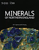 | | Book | | publishers. Beamish, The North of England Open Air Museum,County Durham [Beamish]: pages 41, 46, 54, 59(x2)...University of Durham: page_26 C H. Emeleus,University of Durham: page 26 Friends of Killhope Archive, Killhope...Valley ................... The Northumberland and Durham Coalfield ............. The Northern Pennine Orefield................... 201 72 Foreword ORTHERN England, an area of great natural beauty, is additionally...Pennines, Cumbria, various regions of north-east England, and North Yorkshire. Such a diverse expanse naturally |  | | Book (edition) | | MEMOIRS OF THE GEOLOGICAL SURVEY OF GREAT BRITAIN ENGLAND AND WALF�S GEOLOGY OF THE NORTHERN PENNINE OREFIELD...inserted on the six-inch maps, and all available mine-sections were reduced to the common scale of 200...made by him. The willing co-operation of all the mine-owners and operators and their staffs made possible... B. Laporte & Co., the Owners of Settlingstones Mine Ltd., Holmside ·& South Moor Colliery Co. Ltd.,...Plan of the North Central flats, Rotherhope Fell Mine 82 11. Cross-section of Burtrec Pasture Vein |  | | Journal (volume) | | 57-61 The mineralogy of a small flat deposit at Killhope, Weardale, with the first record of dundasite...Bridges 61-65 A report on Westernhope Old Mine, Weardale, Co. Durham Trevor F. Bridges Journal of the Russell...from around 40 to over 110, including the ‘first UK occurrences’ of a number of minerals, such as fornacite...Långban in Sweden, the Kombat Mine in Namibia, and the Mammoth St. Anthony Mine in Tiger, Arizona. • Production...Track, Allington, Salisbury, Wiltshire SP 4 0DD, UK Michael S. RUMSEY Mineralogy Department, Natural |  | | Journal (issue) | | JOURNAL MANAGER: Stand in:: Jim Robinson, 21 Woodside Park Drive, Horsforth, Leeds LS18 4TG. EDITORIAL BOARD:...Ovington, UK NJ Elton, St Austell, U.K. N.J. Fortey, Keyworth, U.K. RA. Howie, Matlock, UK RJ. King...Typography and Design by: Jim Robinson, 21 Woodside Park Drive, Horsforth, Leeds, LS18 4TG Printed by: St...Media, (A division of St. Ives Group), Leeds, England. Published by The Russell Society. Registered Charity...Mud-filled fluorite vugs in Greenlaws mine, Weardale, Co. Durham Stephen Moreton Gearksutite, a second |  | | Book | | PO Box 315. Harpenden. Hertfordshire AL5 2ZD. England Telephone: +44 (0)1582 762413 Fax: +44 (0)870 055...onNewMinerals,Nomenclature andClass::ication. Co. County. EMPElectronmicroprobe - an instrument usedto ...with older fluorite specimens from Weardale in County Durham being a case in point. Many of these specimens..."Cumberland", "Alston" or "Alston Moor" (Cumberland as a county no longer exists, as it was merged with Westmorland...Westmorland in the mid- I 970s to form the new county of Cumbria). The confusion appears to have occurred during |  | Dunham, K. C., Wilson, A. A. (1985) Geology of the Northern Pennine Orefield (1st ed.) Vol. 2 - Stainmore to Craven - Economic memoir covering the areas of one-inch and 1:50 000 geological sheets 40, 41 and 50, and parts of 31, 32, 51, 60 and 61, New Series. Natural Environment Research Council, London. | Book (volume) | | of vein 0.35 m , BRITISH GEOLOGICAL SURVEY England and Wales K. C. DUNHAM and A. A. WILSON CONTRIBl;·roRS...Authors DSc, FRS, FEng Charleycrojt,QuarryheadsLane, Durham DHJ 3DY SIR KINGSLEY DuNHAM, PhD British GeologicalSurvey... Sheet 31 British Regional Geology Northern England ( 4th edition) Maps 1:625 000 Solid geology, south...GeologicalSurvey, London • .. ' Printed in the UK for Hl\fSO Ud 737385 (~20 3/85 V CONTENTS 1...on veins 85 20 Longitudinal section of Turf Moor Mine, Arkengarthdale 86 - 8 7 21 Map to illustrate the |
|


