 | | Journal (article/letter/editorial) | | Figure 1. Postcard view of the Waukon iron mine, Allamakee County, cia. 1912. John Taylor collection. ARTHUR...Unfortunately. with today’s environmental laws and mine and quarry regulations. the prolific collecting...HAROLD L. PRlOR P.O. Box 111 Columbus Junction, Iowa 52738 halprior@ louisacomm.net When we began this...too, could be cited with many other localities. Iowa contains the type locality for one mineral, iowaite...December 2014 Figure 2. Map of Iowa showing the counties. Courtesy Iowa Geological Survey. ACKNOWLEDGMENTS |  | | Report (issue) | | I s { IOWA ft 7 ■■• A * i . ;» \ P* A 7-. ■ «*"V ' r * < •+ ' 1 ’ T, / • k’-/ 5...i S' s I . " * • * «r- ‘ ; ' Geologist, Iowa Geological Survey ' .*4** =»*' I Paul*J. Horick...Jithill * v'v* l* Iowa Geolo^ica^Survey Educational Series 2 V . - -■' ( J Iowa Geological Survey...Educational Series 2 THE MINERALS OF IOWA by Paul J. Horick Geologist Iowa Geological Survey edited by Otto...STATE OF IOWA 1974 Library of Congress Catalog Card Number: 74-620075 Available from the Iowa Geological |  | | Report (issue) | | AREA 38, WESTERN REGION, INTERIOR COAL PROVINCE IOWA AND MISSOURI CHARITON RIVER DESMOINES RIVER THOMPSON...AREA 38, WESTERN REGION, INTERIOR COAL PROVINCE IOWA AND MISSOURI BY MARK G. DETROY, JOHN SKELTON AND...OPEN-FILE REPORT 82-1014 ROLLA, MISSOURI IOWA CITY, IOWA MAY 1983 UNITED STATES DEPARTMENT OF THE...Survey P. O. Box 1230 400 South Clinton Street Iowa City, Iowa 52244 or U. S. Geological Survey 1400 Independence...................... 48 Jerri V. Davis 5.8 Acid-mine drainage ...................................... | 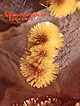 | | Journal (issue) | | Epitaxial Overgrowths of Tennantite on Octahedral Pyrite from Quiruvilca, Peru.................................177 Richard S. Mitchell Brown Calcite from Iowa...................................................quartz from an abandoned pyrophyllite mine near Snow Camp, Alamance County, North Carolina. Di ameter of lower...it. The efforts of clubs to promote safety during mine and quarry visits should be stressed. As a good...assemble a suite of properly labelled specimens for the mine or quarry office. Many of us know of localities |  | | Book (volume) | | seams the collector may often find Marcasite and Pyrite. The measures are 1,200 to 1,400 feet thick in...600 to 800 feet thick in the north. ALEXANDER COUNTY FAYVILLE, area stream gravels⎯agate, jasper, rare...⎯agate, jasper; d RR siding of Clay⎯agate. CALHOUN COUNTY AREA, shores of the Mississippi R., in the Warsaw...crystals). CRAWFORD COUNTY PALESTINE, area deposits⎯Siderite. EDWARDS COUNTY AREA, T. 1 S, R. 10 E...deposits⎯Siderite. FULTON COUNTY FARMINGTON, W 6 mi. on Rte. 116 to the Rapatee No. 5 strip mine⎯pyritized gastropods |  | | Book (volume) | | seams the collector may often find Marcasite and Pyrite. The measures are 1,200 to 1,400 feet thick in...600 to 800 feet thick in the north. ALEXANDER COUNTY FAYVILLE, area stream gravels⎯agate, jasper, rare...⎯agate, jasper; d RR siding of Clay⎯agate. CALHOUN COUNTY AREA, shores of the Mississippi R., in the Warsaw...crystals). CRAWFORD COUNTY PALESTINE, area deposits⎯Siderite. EDWARDS COUNTY AREA, T. 1 S, R. 10 E...deposits⎯Siderite. FULTON COUNTY FARMINGTON, W 6 mi. on Rte. 116 to the Rapatee No. 5 strip mine⎯pyritized gastropods |  | | Book (volume) | | Virginia VOLUME 3: THE NORTHWESTERN QUANDRANT Idaho, Iowa, Kansas, Minnesota, Missouri, Montana, Nebraska...TREASURES VOLUME ep The Northwestern Quadrant Idaho, Iowa, Kansas, Minnesota, Missouri, Montana, Nebraska...volumes, through very precise directions and accurate county maps, to get you to the best and most accessible...for the county in which it is located. This site number also appears under the given county in the text...pegmatite, shoreline, quarry, gravel pit, prospect, mine, etc.). Let’s take, as an example, under the heading |  | | Journal (article/letter/editorial) | | established Montana’s first mining camp at Gold Creek in 1860. Geologic Provinces The state can be divided...view showing the Indian Queen mine ca. 1905 at Farlin, Beaverhead County. 208 ROCKS & MINERALS Downloaded...mines at Butte in Silver Bow County and the Black Pine mine in Granite County have produced many fine crystal...Beaverhead County, the pegmatites of Jefferson County, and the Snowbird mine in Mineral County continue...Highlands Centennial Nugget in 1989 in Silver Bow County. The seventh largest gold nugget found in Montana; |  | | Journal (article/letter/editorial) | | dependent on Eh/pH conditions. Sulfur isotopes in pyrite traditionally have been employed to distinguish...isotopes from pyrite coprecipitated with uranium in two Wyoming roll-front deposits: Lost Creek and Willow...Willow Creek Mine Unit 10. The results document contrasting isotopic fractionation that correlates with pyrite...behavior with pyrite morphology has been attributed to distinct temporal episodes of pyrite formation, driven...trends identified in this study, where the two pyrite morphologies appear coeval in both deposits. Moreover |  | | Journal (article/letter/editorial) | | are: (1) the occurrenceof barite, sphalerite,and pyrite associated with synsedimentary collapsebrecciaswhich...pre-MiddleOrdovicianunconformity at the Lost Creekbarite mine in Union County; (2) baritein basalMiddleOrdovi...the Trotter prospectnear DouglasDam in Sevier County; and (4) oolitic hematiteand pyritiferousbedsnear...and we interpret certain barite, sphalerite,and pyrite-hematiteoccurrences as having formed nearly contemporaneously...laminated breccia sphalerite at the Lost Creek mine in Union County; matrix that conformsto beddingin the |  | | Report (volume) | | Edward Barrett, Indianapolis. Iowa.............. Prof. George F. Kay, Iowa City. Kansas............Prof...See Bauxite and Hallpysite. Asbestos. Tallapoosa County, with corundum deposits near Dudleyville; not found...commercial quantity or quality. Asphalt. Colbert County, small quantity has been shipped from near Leighton;...following localities: Bibb County, Pratts Ferry; Calhoun County, near Tampa; Clay County, T. 20, Pv. 7 E.; Jefferson...Jefferson County, at Elyton; Lee County, at Chewacla lime works; St. Clair County, at Gfeensport; Shelby |  | | Journal (article/letter/editorial) | | uranium deposits of the Great Divide Basin, Wyoming, USA M. Z. Abzalov* and O. Paulson The Great Divide basin...in the southern part of the state of Wyoming in USA. Wyoming is the second largest uranium province in...Wyoming is a second largest uranium province in the USA after the Colorado Plateau (Dahlkamp, 1993). Uranium...Uplifts: BH – Bighorn, WR – Wind River, OC – Owl Creek, LM – Laramie, RW – Rawlins, RS – Rock Springs,...Schroeckingerite, 9 – Jab, 10 – Antelope, 11 – Lost Soldier, 12 – Lost Creek, 13 – ENQ/B Trend, 14 –Sweetwater, 15 |  | | Report (volume) | | ..'........................................ 126 Iowa...................................................Barrett, Indianapolis. Iowa___ __Prof. George F. Kay, Iowa City. Kansas_____Prof. Erasmus Haworth, Lawrence...See Bauxite and Halloysite. Asbestos. Tallapoosa County, with corundum deposits near Dudleyville; not found...commercial quantity or quality. Asphalt. Colbert County, small quantity has been shipped from near Leighton;...following localities : Bibb County, Pratts Ferry; Calhoun County, near Tampa; Clay County, T. 20 S., R. 7 E.; |  | | Report (volume) | | Resources of the Eastern Pioneer Mountains, Beaverhead County, Montana U.S. GEOLOGICAL SURVEY BULLETIN 1766...Resources of the Eastern Pioneer Mountains, Beaverhead County, Montana By R. C. PEARSON, B. R. BERGER, H. E....resources of the Eastern Pioneer Mountains, Beaverhead County, Montana. (U.S. Geological Survey bulletin ; 1766)...10 Map of eastern Pioneer Mountains, Beaverhead County, Montana, and vicinity 3 20 Generalized geologic...Resources of the Eastern Pioneer Mountains, Beaverhead County, Montana By R. C. Pearson, B. R. Berger, H. E. |  | | Journal (article/letter/editorial) | | (top left). Calcite, 5.5 cm high, Elmwood mine, Smith County. Terry Huizing specimen, Jeff Scovil photo...(above). Fluorite, 13.1 cm wide, Elmwood mine, Smith County. Francis Benjamin specimen, Jeff Scovil photo...(left). Fluorite, 2.5 cm on edge, Elmwood mine, Carthage, Smith County. Terry Huizing specimen and photo. Figure...Figure 4 (right). Cumberland mine, Smith County. Travis Paris photo (2004). Figure 5 (far right page)...barite specimens at the Elmwood zinc mine in middle Tennessee. This mine, opened in 1975, and other nearby |  | | Report (volume) | | the Goodrich quartzite, Palmer area, Marquette County, Michigan, by R. C. Vickers. --(G) Wall-rock control...pitchblende deposits in Golden Gate Canyon, Jefferson County, Colorado, by John W. Adams and Frederick Stugard...uranium deposits in the Red Desert, SweBtwater County, Wyoming, by Donald G. Wyant, William N. Sharp...in oolitic limestone near I /Tayoworth, Johnson County, Wyoming, by R. R. Guilinger and P. K. Theobald...Uranium and copper deposits, Coyote district, Mora County, New Mexico, by C. M. Tschanz_________. (M) Description |  | | Journal (article/letter/editorial) | | locations. Certainly such common minerals as quartz, pyrite, garnet and others occur in crystal form at a great...abandoned. Many good specimen locations are therefore lost to the mineralminded public. The well-publicized...Amcnnpijiite: In the Emery Mining district (Powell County) the mineral is found in wellformed crystals in...Mining district near Jardine (Park County). At the Kennebec mine in the Crevasse Mountain district (see...encountered in the Jardine mine (see above). Noteworthy is the No. 1 vein of the mine on Mineral Hill. It is |  | | Report (issue) | | . . . . . . . . . . . . . . . . . . . . Sunset mine . . . . . . . . . . . . . . . . . . . . . . . .... . . . . . . . . . . . . . . . . . . Non-Farell mine . . . . . . . . . . . . . . . . . . . . . . . .... . . . . . . . . . . . . . . Ethel Consolidated mine. . . . . . . . . . . . . . . . . . . . . . . . .... . . . . . . . . . . . . . Kittanning mine . . . . . . . . . . . . . . . . . . . . . . . . . . . . .... . . . . . . . . . . . . . . . Merchant mine . . . . . . . . . . . . . . . . . . . . . . . . . . . |  | | Journal (article/letter/editorial) | | amount of Riverdistrict,including theNewProspect mine,thelargest included organicmatter(Craiget al., 1983;Kettler...•3 2• . 3o• et al., 1971). Mineralizationat Lost Creek consistsof barite • withminorpyriteandis thought...Loxver Ordox4cian Lost Creek district Lost Creek Lost Creek Lost Creek Lost Creek LC-1 LC-2 LC-3 LC-4...LC-4 Lost Creek Lost Creek Lost Creek TN6-1 TN6-1 TN6-6A Lost Creek TN6-6B Lost Creek TN6-7 Lost...IN-61-490A IN-61-490B IN-61-490C IN-61-490D Sphalerite Pyrite Sphalerite Sphalerite Sphalerite Sphalerite Sphalerite |  | | Book | | On a spectacular find of crocoite in the Adelaide mine, Dundas, Tasmania (by A. H. Chapman) 3:111-113 ADOLFSSON...Iaria from the Howard-Montgomery quarry, Howard County, Maryland (by J. S. White) 25:53-54 AFGHANISTAN...AJO Famous mineral localities: the New Cornelia mine, Ajo, Arizona (by W. J. Thomas & R. B. Gibbs) 14:283-298...Iron-manganese phosphates of the Williams pegmatites, Coosa County, Alabama (by P. B. Leavens & T. A. Simpson) 6:66-73...ALICE GLORY HOLE The Alice glory hole, Clear Creek County, Colorado (by T. A. Hanson & W. B. Craft) 18:185187 |  | | Journal (article/letter/editorial) | | view of the Tenderfoot mine (about 19131, Esterbrook copper district, Albany County. John Taylor collection...and Grace Dyck and wus titled “The Sunrise Iron Mine near Hartville, Wyoming”; it appeared in the MaylJune...“The Copper Mountain Pegmatite District, Freniont County, Wyoming” and was in the JulylAugust 2001 issue...most notable ones. The localities are listed by county and then in alphabeticnl order. Where numerous...names are from Hausel (1986). Localities by County Albany County Allanite pegmatite, 12 miles W of Bosler |  | | Report (issue) | | Juab County, Utah ......................... 15 Geologic map and section of the Burlington mine, Jamestown...Geologic maps of the Fluorine Queen property, Juab County, Utah............................ .17 Chart showing...upper cut, East Slope no. 2 uranium prospect, Piute County, Utah...... 23 Map showing location of secondary........... 27 Section of cliff face, Oyler mine, Wayne County, Utah......................................minerals. At the Stalin's Present prospect, Pershing County, Nev., a narrow band of lime-silicate rock in granite |  | | Report (volume) | | upon Ty.ue, England.. Iowa Geological Survey: Bulletin noi 5: Des. Moines*, Iowa.. Japan, Imperial Eartliquake...Maryland Geological Survey: vol.. 10; Anne Aruiidel. County. Baltimore, Md. Mazama, vol. 5; no. 3.. Poutkind...Chicago, 111. West Virginia Geological Survey: County Reports, Barbour-Upshur:Randolph. Morgantown, W...on back of topographic map], New York (Suffolk County), Moriches quadrangle (Camp Upton edition), U....a petrographic collection of rocks from Cripple Creek, Colorado; a petrographic interpretation of the |  | | Report (issue) | | QUADRANGLE AND ADJACENT BROWN1 S LAKE AREA, BEAVERHEAD COUNTY, MONTANA A preliminary report by W^ B* Myers ...~"~--"~~~''~-"~~-"~"~" Copper »- .Jndiani Queen mine ..............~~.~...~..~~.~.... ~~.«...~.~..~....the NWi of the ^£S:^^A^^^ quadrangle, Beaverhead County; ^^^^^^f^r^^Maatwaa... ": . .-. . In pocket tc...QUADRANGLE AND ADJACENT BROWN1 S LAKE AREA, BEAVERHEAD COUNTY, -,' *; MONTANA A preliminary report by W, B....Rattlesnake Creek, the southernmost, flows southeast to the Beaverhead River* Birch Creek and Willow Creek in |  | | Report (issue) | | . . . . . . . . . . . . . . . . 6 3. Dakota Creek Valley from Cemetery Hill, Dakota, Minnesota. ....37 7. The Galesville-Ironton Contact at Snake Creek, near Kellogg.. 38 8. The Taylors Falls :Member........................... 41 10. The Nicollet Creek Member of the St. Lawrence Formation in the Olel...the Ordovician Section of Minnesota to Those of Iowa and Illinois. . . . . . . . . . . . . . . . . ....Platteville Limestone West of Spring Gro,'e, Houston County ..... ,....................................... |
|


