 | | Report (volume) |
| 741 THESJARBIDGE MINING DISTRICT, NEVADA WITH A NOTE ON THE CHARLESTON DISTRICT BY FRANK C. SCHRADER...features __ __ Great Basin province. Snake River valley 1 _ _ Jarbidge Mountains _ Geology Sedimentary...Occurrence and distribution _______________________ West vein system_______________________________ East...rock_________________:__________ Mines and prospects on the west veins__________________ Long Hike mine_________...Mineral deposits Continued. Mines and prospects on the west veins Continued, Page. Pavlak mine : 59 Pick and |
 | | Report (issue) |
| topob ra~hy and ve~etation in c ~ =son Sink Valley, with R&t tl e s nak e Hi ll ( a basal ti c lava...1644 and 1645) showing topography and ro cks in the west front of the Augusta Range, north of Wo nder. Looking...and mineral• bearing rocks and mines of Wonder district. From monument at top of Wonder MOuntain, 6200...pages. . 4 : 1628 Twin Peaks in left; Wonder Valley and Fairview Mountain in center; and part of Victor...Looking s. 20° w. 5 1629 Victor Range west of Wonder; Hercules Valley in foreground and part of Stillwater |
 | | Report (volume) |
| province__________________________ 14 19 19 Snake River valley province Jarbidge Mountains_____________________...distribution___________________ 42 42 44 44 46 47 47 48 48 West system______ ____ ________..__ East system______... 58 __.____ 64 4 CONTENTS. The Jarbidge district Continued. Page. Description of properties._________..._________ ________________ 66 Properties on the west system of veins______________ 66 Pavlak mine. ________1_______...White Quartz vein 94 CONTENTS. 5 The Jarbidge district Continued. Description of properties Continued |
 | | Report (volume) |
| Detrital-Sacramento Valley___________________ Hualpai Valley.____________________________ Big Sandy Valley_...Introduction _______________________________ 49 Chloride district-______________________________ 51 I vocation ______________...Continued. Cerbat Range Continued. Mineral Park district Continued. Tyler mine Lady Bug niine__ Rural and...Continued. Cerbat Range Continued. Stockton Hill district Continued. General outline Continued. Page. Topography...Stockton Hill " area_____________ 118 Gold Basin district ____________________________ 118 General feat |
 | | Report (volume) |
| Cal______________________________ 49 Cl if ton-Mo reuci district, Ariz__________ ,______ 50 Beaver County, Utah...and HOYT S. GALE. INTRODUCTION. If DISCOVERY. | An important deposit of alunite, whieh has but recently...Salt Lake in November, 1910, were later forwarded to an eastern chemist, who is said to have recognized the...United States, but it may prove to be an important factor in providing an American supply that will perhaps...material at the outcrop, however, is more or less of an amorphous texture and commonly sheared to a foliated |
 | | Journal (article/letter/editorial) |
| alteration............ Freibergite replacing quartz and adularia.................................................633 ABSTRACT _This paper presents the results of an investigation of the geology and mineraliza tion...drawn to more active mining districts. Thus this district, even to the present day, has lacked the geological...1934 and 1935 were devoted to field study of the district. Since existing maps of the northeastern Hum...comprises about 85 square miles on the northeastern slope of the northern division of the Humboldt Range, |
 | | Journal (article/letter/editorial) |
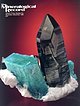
| SOCIETY OF GEOLOGISTS MAY, 1944 No. ROCK," AN UNUSUAL BEARING RICHARD TACTITE. 3 BERYLLIUM•...remarkablepyrometasomatic depositsin.the Iron Mountain district, New Mexico, have from time to time drawn the...and semi-permanent structures,is situatedat the west base of the mountain ten miles north of Winston...thorough prospectingof all promisingparts of the district prior to the writer'sarrival,wasmostgenerous...Discovery Gulch. 3--Composite chip sample, northeast slope of North Peak. 4--Systematic five-foot channelsample |
 | | Report (volume) |
| districts.____-_--_-----_____-______---_ Bohemia district.._i_-_-__--_---_-_--_---___-______-_____---_--...areas and mining districts Continued. Bohemia district Continued. Mineral deposits._________________...areas and mining districts Continued. Bohemia district Continued. Mines and prospects Continued. Tall...___-_-___.-______-_-_____.__________._ Quartzville district..______-_----._______-_____-.-________-_-Location...areas and mining districts Continued. Quartzville district Continued. Mines and prospects Continued. Lawler |
| | Report (issue) |
| • ~ ~ • 1 -'' r ; f • The region lies in an area of ~· :-!:J.&. --...~ ·~pallY_ ~eso~oic ~d..._east J?ase of 'the Stillwater ·range·: in Dixie Valley• . : :r. ... L ·t.:. ~- ..... As the ·writer'...of ,t he Jurassic ·rocks during l~:· derived from an uplift.ed Paleozoic landmass in eastern -~:-. ;~i~flf~iad...·. ' continuation, the Sand Springs and Gabbs Valley··:;ranges ·and --- . - . : ' . ~~;;~~t_;.:j]....,. .. ·' ! ·. , ... P~ge as consisting of an Archaean ~ucleus, surroUnded l. ,;aL~conf |
 | | Report (volume) |
| GEOLOGY, SURVEY BULLETIN 1951 973-E Geology of an important domestic source of quartz for optical and..._____________________________ 215 33. A, Quartz and adularia vein intergrowth developed in sandy shale on Miller...brecciated fragments of shaly wall rocks rimmed with adularia. _____________-..____"________________ 228 34...6____-----______________ 229 35. Geologic map and sections of the West Chance quartz crystal area, Garland County, Ark...workings of the Metals Reserve Company on the north slope of Miller Mountain._____ In pocket 38. Geologic |
 | | Report (volume) |
| veins Origin of the shoots Milling High Grade district, Modoc County, Cal Location History of mining...replacements in glassy rhyolite Future of the district Winters district, Modoc County, Cal Location and accessibility...64 Future of the districts 64 Battle Mountain district, Lander County, Nev 2 Location and accessibility... Mining districts—Continued. Battle Mountain district, Lander County, Nev.—Continued. Geology—Continued...deposits 2 Properties at north end of Battle Mountain district, including Cottonwood Canyon, Licking Canyon, |
 | | Report (issue) |
| the Tushar Mountains, and in Beaver County, on the west side, but only those in Piute County are at present...miles northeast of Beaver, in the Newton mining district. (See fig. 13.) Marysvale, at the terminus of...range between the valley of Sevier River on the east and a broad desert valley on the west. The floor of...of Sevier Valley near Marysvale has an elevation of about 5,600 feet and that of Beaver Creek at Milford...like the ranges of the Great Basin province to the west. However, the bedded rocks, including sediments |
 | | Book |
| Mount Malosa, Chilwa alkaline province, Zomba district. "Illite" is the name of a series of incompletely...COLUMBIA Ice River complex. The Ice River complex is an intrusive body of alkaline igneous rocks where sodalite...ilmenite specimens have come from an unusual calcite vein-dike occurrence with an exposure very near, indeed...2008, when extensive blasting for construction of an extension to High,, ay 5 revealed veins of massive...(Weibel, 1980). The Maderanertal drainage flows west-southwest from a mountain massif to join the Reuss |
 | | Report (volume) |
| DIRECTOR BULLETIN 601 OF THE NATIONAL MINING DISTRICT, NEVADA BY WALDEMAR LINDGREN WASHINGTON GOVERNMENT........................... 17 National mining district.................................................44 44 230912 4 CONTENTS. National raining district Continued. Mineral deposits Continued. Detailed...shaft........'...................... 49 Indian Valley tunnel...........................................ILLUSTRATIONS. PLATE I. Geologic map of the National district............................... II. A, General |
 | | Report (issue) |
| afford a better idea of the work which the Survey as an organization is carrying on for the direct advancement...are sold at 25 cents each, except such as contain an unusual amount of matter, which are priced accordingly...shows the folios issued since January 1, 1907, and in an advanced state of preparation, also the economic...Pisgah........ ...... N.C.-S.C..... 148 Joplin district...... Mo.-Kans .... 476 149 Penobscot Bay ...Mineral Resources. From 1883. to. JL894, inclusive, an octavo cloth-bound volume bearing the above title |
 | | Report (volume) |
| Director Bulletin 906-D GEOLOGY OF THE SEARCHLIGHT DISTRICT CLARK COUNTY, NEVADA BY EUGENE CALLAGHAN Contributions...___.-_-___-_______-_________. Outlook for the district...----____-__._-_-_-_-_______-_________. Mines...main part of the district._________ Mines and prospects in the eastern part of the district.__-_-.______...Geologic map of the main part of the Searchlight District, Clark County, Nev____._-_-_-_-._.___.-_-.__________...Cross sections through Quartette mine, viewed from west to east_____________ __---_. _--------.___ 47. Plan |
 | | Journal (issue) |
| Nelly Bariand Paris, France Wemer Lieber Heidelberg, West Germany Olaf Medenbach Bochum, Germany Eric Offermann...and location b. Your name and mailing address c. “AM” for “ amateur” or “ PRO” for “ professional.” Only...Record a complete set of Goldschmidt’s Atlas der Kristallformen, an invaluable reference which should provide...BANNOCKBURN ELDORADO' H WY 7 O T T A W A MADOC AM / X \ \ CD \ HW Y 401 -------------------------...Sizes W rite F o r B im o n th ly Lists Call us for an appointment when you're in Honolulu JO HN J. M E |
 | | Journal (article/letter/editorial) |
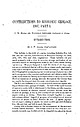
| U.S. Coast and Geodetic Survey. The Mogollon District, New Mexico. By HENRY G. FERGUSON. Bulletin... figs. 2. The Mogollon (Mo-go-yohn) or Cooney district lies in southwestern New Mexico, about fourteen...fourteen miles from the Arizona line. The district was discovered in 1875, when James Cooney found rich silver-copper...rugged, especially on the eastern edge of the district, which lies along the Mogollon Range. The rocks...present front of the range, with downthrow on the west. Renewed erosion followed this last orogeny. The |
 | | Report (issue) |
| Springs, Desert Peak, Brady, and Oxbow in Dixie Valley) are currently in production or development within...rift zone exists beneath the Carson Sink and Dixie Valley and that the crust in the Basin and Range is about...a layered mafic intrusion that crops out in the West Humboldt, Stillwater, and Clan Alpine Ranges. Previous...interpretation of the complex as a lopolith or possibly as an ophiolite has a significant bearing on the mineral...work in 1987. The Cleaver Peak magnetic anomaly is an aeromagnetic high that trends WNW through the southwestern |
 | | Report (volume) |
| Director Bulletin 743 GEOLOGY OF THE OATMAN GOLD DISTRICT ARIZONA BY F. L. RANSOME WASHINGTON GOVERNMENT...ILLUSTKATIONS. Page.. PLATE I. Geologic map of tbe Oatman district, Ariz_____________ II. Topography of the Black...CONTENTS. PLATE III. Topography of the Oatinan district: A, General view to the northwest over the central...central and northwestern part of the district, from Ute Mountain; B, Leland Hill from the southeast IV...IV. Topography of the Oatman district: A, Mountains on the northwest side of Times Gulch; B, Ruth and Moss |
 | | Report (issue) |
| occurrence of alunite. The mineral is disseminated in an altered granite prophyry at a locality 5 miles south...mines, which are situated in the Palmetto mining district, in Santa ' Cruz County, about 10 miles north...Railroad. RELIEF. The 3 R mines are on the upper west slope of the north end of the Patagonia Mountains,...north-south desert ranges of the Great Basin type, at an elevation of about 5,400 feet. .The topography, as...From the border of the gently westward sloping valley plain of Sonoita Creek, at the northwest base of |
 | | Report (issue) |
| Olivenite, 1.6-cm cluster, Majuba Hill Mine, Antelope district, Pershing County. N. Prenn collection. Photograph...Jr. and John Gibson, to mineral resources. It is an honor for both graduates of the Mackay School of...vada’s natural and cultural heritage for future an agency of the U.S. Department of the Interior. This... Davis The Goodsprings (Yellow Pine) Mining District, Clark County John C. Kepper 91 References ...Nightingale district Quartz epimorph after Calcite Agardite Grossular, Buena Vista district Quartz (amethyst) |
 | | Journal (issue) |
| MINERAL NAMES The new book will be published as an update of Minerals o f California, Bulletin 189 (last...sells for 50 French francs (about $8.50 U.S.), plus an additional 20 Ff for airmail. They do accept Visa... LOCATION Trumbull Peak is located on the western slope of the Sierra Nevada Range in NEV4 Sec. 9, T3S,...Merid ian, about 67 km northeast of Merced and 8 km west of El Portal, the gateway to the Yosemite National...area is located about 200 meters down the steep slope to the northwest. There are no physical landmarks |
 | | Report (issue) |
| districts . Alder district-Aura district -Beaver district Black Mountain district Bootstrap district Burner district...Basin district-- -Carlin district Cave Creek district ----Charleston district_--Coal Mine district~ Contact...Contact district Cornucopia district - -Corral Creek district - Decoy district Delano district Delker districtDivide...districtDivide district - Dolly Varden district --Edgemont district---Elk Mountain district-----Elko district ' Ferber...Ferber district -Ferguson Spring district Gilbert Canyon area-----Gold Basin district Gold Circle district |
 | | Report (volume) |
| ................................... Bay Horse district.................................................CONTENTS. Mining districts Continued. Bay Horse district Continued. Mines and principal prospects Continued.................................... Yankee Fork district................................................. CONTENTS. 7 Mining districts Continued. Yankee Fork district Continued. Mines and principal prospects Continued.................................. 89 Loon Creek district.............................................. |


