 | | Report (issue) |
| BULLETIN 71 Mineral Resources of Taos County, New Mexico by JOHN H. SCHILLING Description of mineral...RESOURCES NEW MEXICO INSTITUTE OF MINING & TECHNOLOGY CAMPUS STATION SOCORRO, NEW MEXICO NEW MEXICO INSTITUTE...INSTITUTE OF MINING 8c TECHNOLOGY E. J. Workman, President STATE BUREAU OF MINES AND MINERAL RESOURCES...Burroughs ...........................Governor of New Mexico Tom Wiley .................................................... Albuquerque For sale by the New Mexico Bureau of Mines & Mineral Resources Campus Station |
 | | Report (issue) |
| Eagle Nest Area New Mexico Photo on title page: Lake Fork valley from Frazer mine, Twining Fairview...Fairview Mountain at right NEW MEXICO STATE BUREAU OF MINES AND MINERAL RESOURCES BULLETIN 94 1972 GEOLOGY...EAGLE NEST AREA, NEW MEXICO by KENNETH F. CLARK and CHARLES B. READ iv New Mexico State Bureau of Mines...Baker, Jr., Director A Division of New Mexico Institute of Mining and Technology Stirling A. Colgate...OF REGENTS Ex Officio Bruce King, Governor of New Mexico Leonard DeLayo, Superintendent of Public Instruction |
 | | Journal (article/letter/editorial) |
| Western side of Stapleton Gulch in the Argenta district. The Stapleton workings are visible in the lower...vanadinite, 8 mm across, Blackhawk mine, Radersburg district, Broadwater County. 340 ROCKS & MINERALS Christopher...avid field collector specializing in discovering new localities as well as working on well-known localities...wulfenite-producing mining districts in Montana Figure 3. Map of Montana showing locations of mining districts...mineralization is not generally associated with the mining districts of Montana, a few localities have produced |
 | | Report (volume) |
| ....................................... 102 District of Columbia .......................................... New Hampshire........................................................... 190 201 New Jersey.............. New Mexico............................................................. New York. .........F. C. Schrader: Besides giving several thousand new localities of mineral deposits and adding more than...to refer to Geological Survey Bulletin 507, "The mining districts of the western United States," and to |
 | | Report (volume) |
| it helpful to refer to Survey Bulletin 507, "The mining districts of the western United States," and to...exhausted by mining or quarrying. Deposits of minerals of wide distribution, such as quartz and calcite...because they occur in sufficient quantity to warrant mining for their usual products but because they furnish...Prof. H. E. Gregory, Sheffield Scientific School, New Haven. Delaware.........Prof. B. L. Miller, Lehigh...Tangier Smith, Berkeley, Cal. New Jersey...... .Dr. H. B. Kummel, Trenton. New York.........Mr. D. H. Newland |
 | | Journal (article/letter/editorial) |
| Plata meaning “gold and silver,” and the state seal with its representation of mining tools clearly proclaim...Montana’s mining origins. Montana’s production of copper, coal, gold, lead, manganese, phosphate, silver, talc...published describing the occurrence, collecting, mining, and cutting of the two state gemstones. Figure...2. Granville Stuart established Montana’s first mining camp at Gold Creek in 1860. Geologic Provinces...view showing the Indian Queen mine ca. 1905 at Farlin, Beaverhead County. 208 ROCKS & MINERALS Downloaded |
 | | Report (volume) |
| SURVEY GEORGE OTIS SMITH, DIRECTOR BuiiIiETIN 574 MINING DISTRICTS OF THE DILLON QUADRANGLE, MONTANA AND................................................. Mining districts...................................................................................... Mining development. ...................... .. - - ' -..................................... 18 Placer mining....... ~................................................................ 20 Present status of mining .....:........................................ |
 | | Report (volume) |
| GEORGE OTIS SMITH, DIRECTOR BULLETIN 594 SOME MINING DISTRICTS IN NORTHEASTERN CALIFORNIA AND NORTHWESTERN...GEORGE OTIS SMITH, DIRECTOR BULLETIN 594 SOME MINING DISTRICTS IN NORTHEASTERN CALIFORNIA AND NORTHWESTERN...deposits 2 22 Early Tertiary ( ?) deposits 2 23 Gold-silver deposits 2 23 Deposits of the early Tertiary (...of the late Tertiary epoch of metallization 23 Silver-lead deposits 2 25 2 Copper deposits 26 Deposits...of the ore deposits 2 27 30 Mining districts 2 Hayden Hill, Lassen County, Cal 2 30 30 Location and accessibility |
 | | Report (issue) |
| ................................. Gold-bearing quartz veins and related gold deposits in the western........................................ Mayflower mine.............................................. Virginia........ Silver Star district........................................ Rochester (Rabbit) district................. Dyce Creek, the Argenta district, and the Bannack district....................................the western Tobacco Root Mountains, gold-bearing quartz veins, replacement deposits, and associated placer |
 | | Journal (issue) |
| town lay from the ever changing river channel he was looking for a new site where the cost of unloading...high bluff there that permanently determined the river channel. Mike had the town laid out and plats drawn...old books of the freight company and petitions for new post offices, etc. BARRY M. GOLDWATER. Thanks, Mr...region. In all probability it was introduced into Mexico and South America during, or very soon after the...surely do know their dinosaurs. —R. H. Explorers Club New York City Editor Desert: In England a kit fox is |
 | | Journal (issue) |
| -·····-·····--···-······-····-------------------' New Mineral Finds in the First Half of 1998 News from...Massapequa, New York 11758-5707 • It is a great pleasure to report again some interesting new finds in...(found or located) by the writer, except some of the new Jachymov phases. We have completed our 41/z years...Rosasite, light blue, field of view 12 mm, Hecia District, Melrose, Montana, photo by L. R. Ream. A Si...Martin Morong 117 Piscataqua Bridge Road Madbury, New Hampshire 03820-6805 A means to measure the specific |
 | | Report (issue) |
| Resource Area (including the Virginia City mining district), Madison and Beaverhead Counties, southwest...Muddy mining district Blacktail mining district Cherry Creek mining district Chinatown mining district...Prairie mining district Medicine Lodge mining district Monida mining district Pony mining district Red Bluff...Bluff mining district Revenue mining district Ruby Mountains mining district Sheridan mining district Silver...Silver Star mining district Virginia City mining district Mapleton mine Browns Gulch area Alameda-Cornucopia-U |
 | | Report (issue) |
| 31 University of Nevada Press, Reno, Nevada 89557 USA Copyright © 2004 by University of Nevada Press Photographs...copyright © 2004 unless otherwise noted Map of Mining Districts and significant mineral occurrences of...Olivenite, 1.6-cm cluster, Majuba Hill Mine, Antelope district, Pershing County. N. Prenn collection. Photograph...production of environmental protection equipment. Mining and the discovery, identification, and development...to Nevada in 1929 and was actively involved in mining in the state and the western U.S. for the rest |
 | | Report (issue) |
| deposits________________________ Quartz-tungsten veins......._____________________ Quartz-gold veins.._________..._________________ ___. Nevada ___________ Elko County. - ______ ... _ Star mine, Harrison Pass _____ ____ Pag« 59...63 Good Hope barite mine, Tuscarora Range _____ _ ._. ________ Humboldt County Golconda manganese-tungsten...Ltd., mine...... --_--______.______ Lincoln County__-__-----_-----_-----___ Tern Piute district.........district____ .________..__ Nevada Scheelite mine.. _ ______ Hooper No. 2 mine __ _____ _ _ Yankee Girl mine_______________ |
| | Report (issue) |
| 3i University of Nevada Press, Reno, Nevada 89557 USA Copyright© 2004 by Uni versity of Nevada Press Photographs...te, r.6-cm cluster, Majuba Hill Mine, Antelope district, Pershing County. N. Prenn coJlection. Photograph...percent of the state. Nevada's public lands offer mining, livestock grazing, wild horse viewing, .scenic...Road and Geologic Tours in th<' Las Vegas Area. Mining and the discovery, identification, and development...Vavis The Goodsprings (Yellow Pine) Mining District, Clark County John C. Kepper MINERAL CATALOG 91 |
 | | Journal (article/letter/editorial) |
| deeper than the exposed crustal rocks. We present new lead isotope data on 16 sulfide ore samples and 24...1992; Sanford and Wooden, 1995). In this study, a new group of mineral deposits having Pb isotope compositions...arenaceous rocks are represented by the Clayton Mine Quartzite and the Kinnikinic Quartzite (Table 1;...between the Pioneer Mountains on the east and Wood River on the west (Fig. 3). The FIG. 1. Generalized geologic...locations of Bayhorse area (box marked as Fig. 4), Wood River area (box marked as Fig. 2), Beaver Creek area (box |
 | | Journal (article/letter/editorial) |
| specimens, are either inaccessible or are in closed mining districts, or are closed for political reasons... '<, • Boise I Dismal SW!fP \.J. Silver City-D~Lamar Mining Dlstricts / J\. I,' -r-, - L........ ~ rl.. kl \ , 50 I 100 I Miles old mining and geologic data have not been recently prospected...providing the collector with specimens of smoky quartz, aquamarine. topaz, and other minerals. Unfortunately...scientific significance. In this index, the better known mining districts that have produced many high-quality |
 | | Report (issue) |
| 1.--Map showing location of 339 exploration or mining sites in Washington. ............................of 339 sites representing mineral activities for mining and mineral exploration in the State of Washington...of Geology and Earth Resources, annually reports mining, development, and mineral exploration activities...obtained from a voluntary questionnaire survey of mining companies and individuals, published information...were an incomplete measure of Washington state mining activities. These results were published annually |
| | Report (issue) |
| 1.--Map showing location of 339 exploration or mining sites in Washington. ............................of 339 sites representing mineral activities for mining and mineral exploration in the State of Washington...of Geology and Earth Resources, annually reports mining, development, and mineral exploration activities...obtained from a voluntary questionnaire survey of mining companies and individuals, published information...were an incomplete measure of Washington state mining activities. These results were published annually |
 | | Journal (issue) |
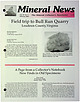
| ewslett. Field trip to Bull Run Quarry Loudoun County, Virginia Brander Robinson P.O. Box 76 1 Midd lesburg...Quarry, Loudoun County, Vi rgini a. This quarry has been in operation . 1ce 1957, "trap" mining from a Triassic-age...stilbite, and calcite, and has been a favorite of mine for a number of years. Less commonly, molybdenite...with minor stilbite , Bull Run Quarry, Loudoun County, Virginia collected by Brander Robinson, July 1998...Continued on p. 6 A Page from a Collector's Notebook New Finds in Old Specimens Arthur Smith 9118 Concho Street |
 | | Book |
| PISTOLS i !?' A J.-. N ; 'jxt . 1 — \ MINING DISTRICTS and MINERAL RESOURCES of NEVADA by ...present authentic infor mation concerning the mining districts and mineral resources of Nevada. No comprehensive...United States Geological Survey in 1912. Plan. “Mining Districts and Mineral Resources of Nevada”, as...parts:—one on mining districts and the other on mineral resources. The section on mining districts is...but gives more extended descriptions and includes mining as well as geological information. The map which |
 | | Report (volume) |
| ........................ 5 5 Distribution of mining districts.................................................................................... New Mexico........................................................................ PART II. Catalogue of mining districts, by J. M. Hill..................................................... Classification of mining districts.................................................................................... New Mexico. ....... j.................................. |
 | McLemore, Virginia T., Donahue, Kelly, Breese, Michael, Jackson, Meghan I., Arbuckle, Jeffrey, Jones, Glen (2001) Introduction to mineral-resource assessment of Luna County, New Mexico. Open-file Report 459. New Mexico Bureau of Geology and Mineral Resources doi:10.58799/ofr-459 | Report (issue) |
| MINERAL-RESOURCE ASSESSMENT OF LUNA COUNTY, NEW MEXICO Virginia T. McLemore, Kelly Donahue, Michael...Report OF-459 New Mexico Bureau of Geology and Mineral Resources New Mexico Institute of Mining and Technology...Technology Socorro, New Mexico 87801 September 2001 Prepared for the New Mexico State Land Office 1 SUMMARY... SUMMARY Luna County, in southwestern New Mexico (Fig. 1) is not well known for its mineral potential...metals and nonmetals have been produced from the county from 1876 to 2000. Much of this production has |
 | | Report (issue) |
| 101 PRICE $3.00 AUGUST 1973 CONTENTS Page County Maps Showing Location of Operators: Beaver . .... . . . . 66 Page Commodities and Operators by County: Beaver . . . . . . . . . . . . . . . . . . . ...oil and gas industry as well as those engaged in mining activities of Utah. The directory is a general...which lists producers alphabetically by county, and within the county, by commodity and by operator. The compiler...Commission Mineral Property Tax Division; Utah Mining Association; and the Department of Natural Resources |
 | | Report (issue) |
| description of the geology, mining history, and production of the major gold-mining districts in 21 States...relations ---------------------------History of gold mining and trends in production_ J\labama -----------...--------------Cleburne County ----------~----------------- Tallapoosa County --------------------------Alaska...Inlet-Susitna region --------------------Copper River region -------------------------Kuskokwim region...------------------Cochise County -----------------------------Gila County --------------------------------Greenlee |


