 | | Report (issue) |
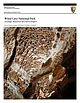
| National Park Service U.S. Department of the Interior Natural Resource Program Center Wind Cave National...National Park Geologic Resources Inventory Report Natural Resource Report NPS/NRPC/GRD/NRR—2009/087 THIS...ON THE COVER: On the Candlelight Tour Route in Wind Cave boxwork protrudes from the ceiling in the Council...Austin, inside photo by Even Blackstock Wind Cave National Park Geologic Resources Inventory Report Natural...March 2009 U.S. Department of the Interior National Park Service Natural Resource Program Center Denver |
 | | Report (issue) |
| Denver, Colorado 9 ^University of South Dakota Vermillion, South Dakota INTRODUCTION This bibliography...references on geology of the Black Hills in South Dakota and Wyoming. For purposes of this report, the... the area does not include the Bad Lands of South Dakota nor the bulk of the Powder River Basin in Wyoming...included in the bibliography. References for South Dakota are more complete than those for Wyoming. Both...potential and geology of the Black Hills National Forest, South Dakota and Wyoming, with a section on Salable |
 | | Journal (article/letter/editorial) |
| 1. Entrance sign to the Crater of Diamonds State Park in Arkansas. Midwest Places of Geologic Interest...predominantly of calcite. Crater of Diamonds State Park: 209 State Park Road, Murfreesboro, 71958; http://www.c...about 100 million years ago. Crowley’s Ridge State Park: 2092 AR-168 North, Paragould, 72450; http://www...pegmatites. 92 ROCKS & MINERALS leysridge/. This park is located on Crowley’s Ridge, a narrow ridge composed...eastern Mississippi Embayment. Devil’s Den State Park: 1333 W. AR-74, West Fork, 72774; http://www.arkansasstateparks |
 | | Book |
| logyoO0000grie &N ROADSIDE % JEOLOGY of South Dakota John Paul Gries Mountain Press Publishing...Gries, John Paul, 1911- Roadside geology of South Dakota / John Paul Gries. p. cm. Includes bibliographical...(pbk. : alk. paper) 1. Geology—South Dakota—Guidebooks. 2. South Dakota— Guidebooks. I. Title. QE163.G68...interpreting the details of the surface geology of South Dakota. My model is Nathaniel Horatio Darton, geologist...depth to groundwater in the western half of South Dakota. Even in this day of gadgetry, field studies |
 | | Journal (issue) |
| the Geology and Resources of the Black Hills of Dakota with Atlas, Washington. 1879-1880, quarto, pp....Preliminary Report of Ex plorations in Nebraska and Dakota. in the Years 1855-56-57. Washington. I 875. Oc...Black Hills, and adjacent pans of the Nebraska and Dakota regions was originally as an appendix to the Humphrey...topographic and geographic features from Kansas in the south to the Canadian border on the north. The map extends...com PO Box 455 • Poncha Springs, Colorado 81242 USA Phone: 719-539-4113 • Fax 719-539-4542 SUMMER 2002 |
 | | Report (issue) |
| THE NATIONAL GAZETTEER. OF THE UNITED STATES OF AMERICA SOUTH DAKOTA 1989 THE NATIONAL GAZETTEER OF...STATES OF AMERICA SOUTH DAKOTA 1989 "The Pulpit," Badlands National Park, South Dakota. Apparently named...complex features characteristic of South Dakota Badlands. In South Dakota, the term "badlands" is generally...that is often spectacularly carved by water and wind into unusual landforms. On older maps of the area...Geological Survey.) THE NATIONAL GAZETTEER OF THE UNITED STATES OF AMERICASOUTH DAKOTA 1989 U.S. GEOLOGICAL |
 | | Report (volume) |
| Hot Springs Quadrangle Fall River and Custer Counties, South Dakota 7 ' -. ... . . . ..-.._ r^ O OQ...Hot Springs Quadrangle Fall River and Custer Counties, South Dakota By DON E. WOLCOTT GEOLOGY AND URANIUM...___________________________________________ Minnekahta Limestone _---_-_-_---_--_--_-_-_-___-_____-____ Permian...Member____________________________________ Minnewaste Limestone Member_________._______________ Fuson Member_...QUADRANGLE, FALL RIVER AND GUSTER COUNTIES, SOUTH DAKOTA By DON E. WOLCOTT ABSTRACT The Hot Springs |
 | | Report (volume) |
| DIRECTOR BULLETIN 472 RESULTS OF SPIRIT LEVELING SOUTH DAKOTA 1896 TO 1910, INCLUSIVE R. B. MARSHALL, CHIEF...Hermosa, Oelrichs, Eapid, and Sundance quadrangles (Custer, Lawrence, Meade, and Pennington counties) ......- PLATE I .RESULTS'OF SPIRIT LEVELING IN SOUTH DAKOTA, 1896 TO 1910, INCLUSIVE. R. B. MARSHAIX, Chief...tlie work. All results of spirit leveling in South Dakota previous^ published by the United States Geological...substantial masonry 5 6 SPIRIT LEVELING IN SOUTH DAKOTA, 1896 TO 1910. structure. The second form (F |
 | | Book (edition) |
| EDITION SOUTH DAKOTA MINNESOTA KANSAS • INDIANA • • MISSOURI ILLINOIS • NORTH DAKOTA • OHIO...includes SOUTH DAKOTA • MICHIGAN • ILLINOIS • IOWA WISCONSIN • OHIO • KANSAS • NORTH DAKOTA NEBRASKA...Jasper 25 Golden Barite - 13 Black Agates The Custer Area Tepee Canyon Agate Page 8 12 Ardmore Agate...32 State Park Agates 31 _. Minnesota 32 Wisconsin 39 Nebraska 40 North Dakota 43 Indiana...you are a tourist in the IMack Hills of Soutli Dakota, the highest mountain region east of the Rockies |
 | | Book (edition) |
| COVER -- Pairburn agates from South Dakota. Photo courtesy South Dakota School of Mines Museum. > 1...includes 1 SOUTH DAKOTA • MICHIGAN • ILLINOIS • IOWA WISCONSIN • OHIO • KANSAS • NORTH DAKOTA NEBRASKA...2 KANSAS Foreword 4 How To Use This Book SOUTH DAKOTA 6 New Finds ................ Fairburn Type...AGATE BEDS 11 OELRICHS AGATE BED .. 12 THE CUSTER AREA ......... Tepee Canyon Agate ... Garnets ...RED RIVER VALLEY .... 32 NORTH DAKOTA .. 30 WESTERN NORTH DAKOTA Badlands and Buttes........... Gems |
 | | Book |
| ere MerieresUm ee Tt:JER LENE yi Vii Chapter 1 South Dakotas Faiburn, Beginning the Exploration... Chapter...and for tending to business while I explored South Dakota. Project Coordinator: Marcia Lorenzen Project...is named for the small community of Fairburn, South Dakota. The agate is known for its spectacular variety...just across the South Dakota line. I have heard of them being found from as far south as Gordon, Nebraska...are blessed with huge areas of National Grasslands and Black Hills National Forest lands that are open to |
 | | Journal (issue) |
| search for ancient Kentish Man Betteshanger Country Park—Field trip to Black Gold or Fossil Fool_The state...Cliff End.. (Field trip to ) Dinosaures - a theme park in France Columnar Basalt Echinodermata Eclipse...Muck above the Chalk (feedback from…) North Western USA Fossil Sights #1 3 11 12 13 02 08 08 01 03 12 06...editions 01-13 cont... North Western USA Fossil Sights #2 North Western USA Fossil Sights #3 Old Chalk Pits...that got away. The Ostracods. Focus on Paracus National Park, Peru Peters Pit, Wouldham. Trip to _ May 12th |
 | | Journal (issue) |
| SUCCESS SELENIUM, CUSTER & The Battle of Little Bighorn EASTER GEM STORIES CAVES NATIONAL PARKS + OF THE...2022 16 CAVES OF THE NATIONAL PARKS 50 FOR WANT OF A MINERAL: SELENIUM, CUSTER & THE BATTLE OF LITTLE...many adventures and one of my favorites was to a cave that was not open to the public. We would crawl...make our way through the extensive cave system. It was a legit cave with a stream, cliffs, stalactites...stalactites and stalagmites. We’d eat lunch in the cave, spend time without any light, etc. We were messy at the |
 | | Report (issue) |
| .................................... 12 NCKRI National Seed Grants................................................................................. 23 Cave and Karst Studies at NMT..........................Lab......................................... 24 Cave and Karst Research Fellowships for NMT Undergraduates............... 27 National Park Service - NCKRI Liaison Program.............. 28 Cave and Karst Resources.................................. 29 Timpanogos National Monument Resource Stewardship Strategy....... |
 | | Report (issue) |
| PC8SEMENT 30 1 The Black Hills area of western South Dakota (fig. 1) is a valuable resource center. The...(USGS), the South Dakota Department of Environment and Natural Resources (DENR), and the West Dakota Water...Development District. West Dakota represents the various local and county cooperators. This report describes...Hydrology Study is on aquifers in the Madison Limestone and Minnelusa Formation because of stream waterloss...Aquifers in the Deadwood Formation and Minnekahta Limestone have a lower priority because of their lesser |
 | | Book |
| Igneous Rocks and General Geology Blacks Hills, South Dakota to Bear Lodge Mountains, Wyoming July 1-7, 1989...the geology and resources of the Black Hills of Dakota: U.S. Geographical and Geological Survey of the...and North Dakota G e o l o g i c a l Survey 58202 U.S.A. U n i v e r s i t y o f North Dakota, Grand Forks...Region. Hot S p r i n g s Mammoth S i t e and Wind Cave.................. Frank R. Karner and Richard...Hydrothermal Events. Bear Lodge Mountains, Crook County. Wyoming Gordon A. J e n n e r .............. |
 | | Report (issue) |
| STATE OF SOUTH DAKOTA Nils Boe, Governor MINERALOGY OF THE BLACK HILLS by WILLARD LINCOLN ROBERTS...Associate in Mineralogy Museum of Geology, South Dakota School of Mines and Technology and GEORGE RAPP...Department of Geology and Geological Engineering, South Dakota School of Mines and Technology With the Editorial...Mineralogy South Dakota School of Mines and Technology BULLETIN NUMBER 18 of the South Dakota School of...of Mines and Technology Rapid City, South Dakota PUBLICATIONS STAFF F. L. Partlo J. T. Thomas President |
 | | Book (edition) |
| Minor time divisions are not included except for national parks where the terms significance. Adapted from...President, Director of National Book Program Alfred C. Grisanti Assistant Director of National Book Program Paul...Contents Preface xi Acknowledgments xiii U.S. National Parks Location Map xiv Part | ScENERY DEVELOPED...The Geologic View of Time 5 1. Grand Canyon National Park Geologic Features 10 Box 1.1 How Rocks Are...CLASSIFIED Geologic History 5. Canyonlands National Park 7 13 19 Box 1.2 AN OUTLINE OF THE GEOLOGIC |
 | | Report (volume) |
| Director Bulletin 643 SPIRIT LEVELING IN SOUTH DAKOTA 1896 TO 1915, INCLUSIVE R. B. MARSHALL, CHIEF...Hermosa, Oelrichs, Rapid, and Sundance quadrangles (Custer, Lawrence, Meade, and Pennington counties). 13... Sisseton, and White Rock quadrangles (Roberts County)__ _ 53 Appendix A: Elevations adjusted by the...there is no rock. PLATE 1 SPIRIT LEVELING IN SOUTH DAKOTA, 1896 TO 1915, INCLUSIVE. R. B. MARSHALL, Chief...publication. All results of spirit leveling in South Dakota previously published by the United States Geological |
 | | Book |
| 551.4 Gr Graf, Mike. Cave story an underground adventure tBr2 5 19S OCT i»^ "M J-3. j^N Qa ...enthusiasm and knowledge, and letting me stay alone in a cave for the beingalone experience. Paul Bernard not...critique Cave Story and get it to the final version it is in now. Without any of the above. Cave Story would...Report, National Parks He World's Best Places. is currently working Projects, on Park adventure...Chapters 37 Chapter 7 40 Appendix 44 National Park Caves 44 Cave Surveying and Mapping 44 Longest Caves |
 | | Book (edition) |
| ~ ele Or WHITMAN COLLEGE LIBRARY GEOLOGY OF NATIONAL PARKS PENROSE MEMORIAL LIBRARY Whitman College...Class of 1957 25th ~ Reunion Fund GEOLOGY OF NATIONAL PARKS Third Edition Ann G. Harris Youngstown...eastern tip of Anacapa Islands in Channel Islands National Park, California. The bedrock is volcanic. Photograph...Photograph courtesy Channel Islands National Park Collection. The drawings by Genevieve Shimer on pages 1...475, and 497 are maps of the national parks from A Guide to the National Parks—Their Landscape and Geology |
 | | Journal (article/letter/editorial) |
| bel' 9 we anchored one end of the net head to the wind, leaving the other free to float in the breakers...and iron buoys, and ex posed to the force of the wind and sea. (1) From the 21st to the 30th of January...1900. THE WIND CAVE OF SOUTH DAKOTA. By E. O. HOVEY. THE Black Hills, in the south western part...part of South Dakota, form a region which has so many natural beauties and wonders that it must become a...led into a cavern, which was christened the "Wind Cave" on account of the circumstance which led to its |
 | | Report (issue) |
| Cavern development How caves are formed Cave maps...... . Erosional cave features... . Phreatic features Vadose...features Depositional cave featuree Breakdown Other features. . The cave environment Cave temperature Man and...and the cave environment Fauna Wyoming geologic history and origins of caves Limestone deposition Paleokarst...Overview Perspective. . . . . . . . . . . . Part II-Cave descriptions Southeastern Wyoming Laramie Range...Black Hills and vicinity. . . . . Wind River and Owl Creek Mountains Wind River Mountains Owl Creek Mountains |
 | | Journal (issue) |
| and our author, summer resident geologist at Wind Cave, makes them sound most interesting indeed. 13...CONVENTION TIMI Convention time ts here again. One National and six Regional Conclaves, widely scattered throughout...ve Wd and HAVILL, Fossils” (Age 10 years) Park Falls, Wisconsin 1 collect fossils, I collect roc...as a source of salt petre for gun powder. Other cave life includes crickets, beetles, salamanders, fish...between the an nual mean temperature outside/ the cave and the more or less constant ;tempera ture within |
 | | Book |
| Health, but It Doesn’t Have to Be.101 Chapter 7 Cave Rescue.107 Chapter 8 Taking It Home on Film.117...photographs that grace the pages of this book. To the National Park Service, special thanks for the use of photos...the most incredible of all cave formations in the United States. The National Speleological Society graciously...more than 100 local clubs affiliated with the National Speleological Society (NSS), there has been no...perspective. While some caves are indeed cold, the average cave temperature is about 50° F., and this temperature |


