 | | Report (issue) | | No. 12: Bolivia ht of Mineral Collecting N 978-0-9790998-5-4 Publisher Lithographie, LLC Denver, Colorado...specimen 'being sold with the shrine when he was in Bolivia buying mineral specimens in the 1970s. He took...Ph08pl,ophyllite; 5. 2 cm tall Cerro Rico, Potosi, B,atillo province, Potosi Andy Seibel col/action Jejf-SC...wp11�. Yaalte: 12.5 cm wide Siglo XX Mine, ,U� Bustillo province, Potosi Malty Zinn colkdknt (ex Marv...640 200 100 600 The Political Divisions of Bolivia (after United Nations Map No. 3875, Peacekeeping | 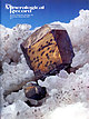 | | Journal (issue) | | Articles Famous mineral localities: The Bristol copper mine, Connecticut......................................in the U.S.A. notesfrom th r EDITORS OLD YUMA MINE Another great mineral locality has now been closed...longfamous Old Yuma mine near Tucson (see R. L. Jones, “Famous mineral localities: the Old Yuma mine,” in vol....period of activity, access to the mine was cut off in 1984. In 1996 the mine area was absorbed into the Saguaro...and Mining Company for the sum of $558,000. The mine is now owned outright by the Federal Government |  | Litherland, M., Annells, R. N., Appleton, J. D., Berrangé, J. P., Bloomfield, K., Burton, C. C. J., Darbyshire, D. P. F., Fletcher, C. J. N., Hawkins, M. P., Klinck, B. A., Llanos, A., Mitchell, W. I., O'Connor, E. A., Pitfield, P. E. J., Power, G., Webb, B. C. (1986) The geology and mineral resources of the Bolivian Precambrian shield. Overseas Memoir 9. British Geological Survey | Report (volume) | | Geologico de Bolivia, Regional Santa Cruz, Casilla 3015, Santa Cruz de la Sierra, Bolivia ISBN O 11 884415...Brasiliano cycles 89 Andean-trending belts in eastern Bolivia 89 Evolution of the enlarged Andean chain 90 Seven:...Complex 94 The Candelaria Alkaline Complex 98 The Cerro Manom6 Carbonatitic Complex 98 Quartz breccia reefs...Chernical analyses of 4 Chemical analyses of and Cerro Manom6 5 Rubidium-Strontiu,n Index the Lomas Maneches...17 18 View from Cerro Pelado south to the Lomas Maneches hills 2 View south from Cerro Diamantina, a bald |  | | Report (issue) | | Apatite rough (3.7 cm tall) and cut (24.61 carats) Cerro de Mercado, Durango, Mexico John Lucking collection... Werner's apatite samples originated in the tin mine in the town ofEhrenfriedersdorfin the Erzgebirge...Mimetite; San Francisco Mine, Magdalena, Sonora, Mexico Pyromorphite; Les Farges Mine, Correze, France Fluorapatite...Fluorapatite, 3 cm tall; Golconda Mine, Minas Gerais, Brazil Fluorapatite in Calcite; Liscombe Property...apatite structure is complex and contains three district sites on which the cations sit. The calcium and |  | | Report (issue) | | .................. 2. Photo imagery showing Cerro Grande fire, Los Alamos, New Mexico, as seen by Landsat7...showing field trip to an area burned during the Cerro Grande fire.................................................. 4. Photograph showing aftermath of Cerro Grande fire..........................................to recently burned areas associated with the Cerro Grande Fire near Los Alamos also were conducted (figs...species, fire severity, and so forth) Figure 2. Cerro Grande fire, Los Alamos, New Mexico, as seen by Landsat |  | | Journal (article/letter/editorial) | | back of the guide for the In the bed of the Rio Grande dolomites and trachytes pre- distance from the...oil holder, for this access of air, as already Cerro Grande, at lYhich latter point it may be considered...million to one; but certain experiments the Rio 'Grande, which begins near there and runs toward the tube...the maximum or gneiss. At the month of the Rio Grande, a little west of ' a rule, to break or injure...light, and have kept the light j ust to the lowest Cerro de Ancon, a mile or so distant, IS for the most |  | | Report (volume) | | building used also as assay office of Camas No. 2 mine; iron post stamped "5788 ".................................. 5,293.425 Willow Creek and Buttercup mine roads, junction of, southeast corner of log house;.......................... 5,526. 274 From Smoky District to head of Soldier Creek. Trail Creek and branch...stamped '' 6640 ".......... 6,635. 852 From Smoky District along south Boise trail toward Atlanta. Worswick's...Short Line R. R. to point ZA miles northwest of Cerro Grande. Moreland Junction, 3.8 miles northwest of |  | | Report (volume) | | rock types 133 Cross section through the Kalavos district Cyprus showing relationship of massive sulfide...based on considerations that extend far beyond the mine itself, in some instances relating to the overall...subject, as in a scale model of the workings of a mine, to a unifying concept that explains or describes...represents an individual deposit (or, rarely, a district), cumulated in ascending grade or tonnage. Where...government believed might someday be economic ta mine. Stratiform deposits of large areal extent, such |  | | Report (issue) | | North American plate margin in México. It is this province that is the subject of the paper by Ferrari et...for the first time, a comprehensive view of the province, including its structural and stratigraphic characteristics...of the magmatic and tectonic evolution of the province as well as a discussion of the age-old debate...The Mesa Central (Mexican Plateau) is a geologic province whose stratigraphy and structure are very different...propose the crustal structure of this geologic province, taking into account the tectonics of the oceanic |  | | Book (edition) | | Brazil, H Page 2: Vivianite, I 00 mm, Huanzala, Bolivia, H Page 3: Liddicoatite, polished, 70 mm, Anjanabonoina...Linopolis, Brazil, H Page 13: Gold, 35 mm.Eagle's est Mine, California, G Publi!>hed by Grdllit.u.o. Stefanikova43...expressed in abbreviations: Rep. (republic), prov. (province), co. (county), munic. (municipio), pref. (prefecture)...dept. (departement), dept. (departamento), dist. (district). Less common terms are not abbreviated, e.g....the revolution in 1997. Its mineral rich Katanga province was renamed Shaba by Mobutu, and is now the Katanga |  | | Report (issue) | | biostratigraphy of the La Casita Formation (Upper Jurassic), Cerro Los Panales, Chihuahua, Mexico .Ill G. Olmstead...the eastern Gulf of Mexico province and the western Pacific Mexico province, where Gulf of Mexico-driven...geologic provinces in Mexico. In the Gulf of Mexico province, the tectonic evolution is dominated by passivemargin...provinces of Mexico, the eastern Gulf of Mexico province and the western Pacific Mexico prov¬ ince, and...the eastern Gulf of Mexico province and the western Pacific Mexico province, and therefore allows one |  | | Report (issue) | | Geology and tungsten mineralization of the Bishop district, California: U. S. Geological Survey Professional...gold-bearing quartz-adularia veins in the Bodie Mining District, Mono County, California: Economic Geology, v...Tertiary igneous rocks, eastern Basin and Range Province, western Utah, eastern Nevada, and vicinity, U...Craters of the Moon area North Robbers flow Cerro Grande Hells Half Acre Wapi Kings Bowl 43°25' 43°23'...17CA by new geophyalcal data (1400 Vgg). tya on Slate Mountain Shadow area and voluaea ao derived highly |  | | Book | | Field Guide to the Southeast Idaho Phosphate District 269 Ray M. Petrun 17. Regional Geology and...arenite above the Hoodoo in the Cobalt mining district, previously mapped as Yellowjacket Formation,...emergent Dillon block of the crystalline Wyoming province concurrent with the deposition of the Prichard...name Yellowjacket to rocks around the Blackbird mine east of the Hoodoo Quartzite outcrop, but said (1962...similar rocks that extend from the Yellowjacket mine across the Salmon River Mountains, north to Lost |  | | Book | | on the geological reconnaissance of the mining district of Sultepec, now a municipality in the southern...marine Antimonio Formation, in the E] Antimonio district in northwestern Sonora state, Named Shastasaurus...Shastasauridae) from the Upper Triassic of the El Antimonio District, northwestern Sonora, Mexico. Journal of Paleontology... Dollfus, M. M., and E. de Montser- Campanian Cerro del Pueblo Forma- tion, Coahuila, Mexico. Journal...Madrid, Spain, 251 pp. rat. 1867. Etude sur le District de Hilton, R. P. 2003. Dinosaurs and Other exploration: | 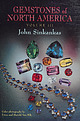 | | Book (volume) | | cushion cut rhodochrosite (25.56 ct), Sweet Home Mine, Colorado; colorless scheelite (19.66 ct), Kern...operators, Morefield Mine, Amelia, VA; Max & Suzy Berchtold, Royal Rainbow Mine, Laytonville, CA; Ralph...Hollywood, CA; David C. & Barbara T. Smith, Four Clover Mine, Castro Valley, CA; Lita R. Smith-Gharet, Steel...Entrance to the La Toca amber mine, Dominican Republic... Figure 5. Blood Mine of-Korite: ltd: near Lethbridge...$3522.3,sne-aseseeateeMine in'San Benito County, Can tess ccraccacaerscsascn |  | | Book (volume) | | 210 213 Chapter 6. The Central Andes: Peru and Bolivia Edwin John Cobbing I. Introduction ..............The South Bismark Province and New Britain ......... D. The North New Guinea Province. . . . . . . . ....Late Pliocene-Recent: Central Chain and Marginal Province. . . . . . . . . . . . . . . . . . . . . . . ...Pelagic Red Clay Province The pelagic red clay province is the largest sedimentary province in the North...less than 1 mm/10 3 years (Fig. 22). Much of this province is carpeted with manganese nodule fields (Fig | | | Book (volume) | | operators, Morefield Mine, Amelia, VA; Max & Suzy Berchtold, Royal Rainbow Mine, Laytonville, CA; Ralph...Hollywood, CA; David C. & Barbara T. Smith, Four Clover Mine, Castro Valley, CA; Lita R. Smitl1-Gharet, Steel...Toca amber mine, Dominican Republic........................... I3 Fig,.1re 5. Blood Mine of Ko rite....................... 15 Figure 6. Dallas Gem Mine in San Benito County, CA........................... .. ... .. .. .. .. 52 Figure 14. Red Beryl mine in the Wah Wah mountains, UT .................. |  | | Book | | Blue and Wallowa mountains of Oregon divide the province into northern and southern parts. Most of the...Ee The northern part of the Basin and Range Province. across areas that encompass large parts of a...the valleys that separate them wider. The entire province is growing. It is tearing the continent apart...As nearly as can be told, the Basin and Range province started developing 17 million years ago, almost...Ores One of the problems in the Coeur d’Alene district is that the ores appear to be older than the veins |  | | Book (volume) | | of a geographic feature, the name of a state or province, or the name of a city, then the name of the country...Agosto Street (Campo Grande, Mato Grosso do Sul, Brazil) USE Rua 26 de Agosto (Campo Grande, Mato Grosso do...Maryland— Antiquities (Okla.) 101 Ranch Historic District (Okla.) 101 Ranch 228 East Capitol Street (Washington...(Okla.) One Hundred and One Ranch BT Historic District (Okla.) One Hundred One Ranch Historic districts...—Washington (D.C.) 2,4,5-T (Herbicide) Historic USE District (Okla.) House and Headquarters (New (State) |  | | Report (issue) | | Cieede and Del Norte quadrangles. MINERAL, BIO GRANDE, AND SAGUACHE COUNTIES. " During the season of...intersections, all on North American datum. BARN, BIO GRANDE COUNTY, COLO. (Not occupied.) South end of barn...meters. 4.21825 3.95097 4.11416 BELLEVIEW, RIO GRANDE COUNTY, COLO. Situated on east end of Belleview...2007172 4. 1906878 Miles. 9.864 9.639 BENNETT, RIO GRANDE COUNTY, COLO. Situated in the highest part of...33541 Miles. 26.023 16. 805 13.451 CHIMNEY, RIO GRANDE COUNTY, COLO. (Not occupied.) Chimney on new house |  | | Report (issue) | | . . . . . . . . . . . 55 Srratigraphy of rhe Grande Ronde Basalt, Columbia River Basalt Group, From...of the Snake River Plain- Yellowstone Plateau Province, Idaho and Wyoming: An Overview and Petrologic...of the Snake River Plain- Yellowstone Plateau Province, Idaho and Wyoming: A Summary of Petrogeneiic...few localities, for example, near the Yellowjacket mine, the pink porphyry is extremely coarse grained,...1949, Silver-gold deposits of the Yankee Fork district, Custer County, Idaho: Idaho Bureau of Mines and |  | | Book (volume) | | Panamanian province of Darien are entered under the name heading Darien (Panama : Province). — History...NT Cruz de M6rito da Causa Monirquica — Quebec (Province) NT Ordre national du Quebec — Russia NT Voennyl...yucatanicus De’emi Copper Mine (China) UF De’emi Tong Kuang (China) Te-erh-ni Copper Mine (China) [Former heading]...mining—China De’emi Tong Kuang (China) USE De’emi Copper Mine (China) Deerpark Farm (England) BT Farms—England...NT Patia River Delta (Colombia) — Costa Rica NT Grande de T6rraba River Delta (Costa Rica) — Egypt NT |  | | Report (issue) | | and Restoration Projects information for the Rio Grande Basin, southern Colorado, New Mexico, and Texas:...the 2007 Witch and Poomacha Fire perimeters, Mesa Grande Quadrangle, San Diego County, California: U.S....assessing water reactivity and leaching potential of mine wastes, soils, and other geologic and environmental...willow flycatcher breeding habitat along the Rio Grande, New Mexico: U.S. Geological Survey Open-File Report...surface cover, soils, and burn severity at the Cerro Grande fire, New Mexico, using hyperspectral and multispectral |  | | Report (issue) | | pounds in water, eastern part of A & B Irrigation District, Minidoka County, Idaho: U.S. Geological Survey...lowstone hotspot and adjacent Basin and Range province: Tectonics, v. 17, p. 221-234. Pierce, K.L., and... Evolution of the Snake River Plain Volcanic Province: Idaho Geological Survey Bulletin 30, p. 30. ..., Bentley, R.D., and Anderson, J.L., 1989, The Grande Ronde Basalt, Columbia River Basalt Group: Stratigraphic...and tectonism in the Columbia River Flood-Basalt Province, Geo¬ logical Society of America Special Paper |
|


