| Locality type: | Mine |
| Classification |
|---|
|
| Type: | Chert |
| Confirmation |
|---|
|
| Validity: | Believed Valid |
| Data |
|---|
|
| Mineral Data: | Click here to view Chert data |
| Locality Data: | Click here to view Frank Brunson Mine, Ouachita Mountains Manganese Mining District, Pike County, Arkansas, USA |
| Data Identifiers |
|---|
|
| Mindat Occurrence Record ID: | 1378896 |
| Long-form Identifier: | 1:3:1378896:8 |
| GUID (UUID V4): | 919c33bb-dd7e-4101-a16e-aea273e98c8b |
| Nearest other occurrences of Chert |
|---|
|
|
| 6.9km (4.3 miles) | ⓘWatkins-White Mine, Ouachita Mountains Manganese Mining District, Pike County, Arkansas, USA |
| 33.7km (21.0 miles) | ⓘAmerican Mine (Kimberlite Mine), Murfreesboro, Pike County, Arkansas, USA |
| 44.4km (27.6 miles) | ⓘHe Mountain - Coon Creek, Polk County, Arkansas, USA |
| 58.9km (36.6 miles) | ⓘMalvern Minerals Company Mine, Garland County, Arkansas, USA |
| 61.2km (38.0 miles) | ⓘMcKnight placers, Hot Spring County, Arkansas, USA |
| 63.3km (39.3 miles) | ⓘRutherford deposit (Moses Hill; Cemetery deposit; Miller deposit), Magnet Cove, Hot Spring County, Arkansas, USA |
| 63.4km (39.4 miles) | ⓘChristy property (Christy Brookite deposit; Magnet Cove Rutile Mine; Mo-Ti; Wynn O; Christy Titania), Magnet Cove, Hot Spring County, Arkansas, USA |
| 64.4km (40.0 miles) | ⓘMagnet Cove Rutile Company deposits (Titanium Corporation of America Mine; Beaver Lake Estates), Magnet Cove, Hot Spring County, Arkansas, USA |
| 64.4km (40.0 miles) | ⓘKilpatrick and Adams Mine (Hardy-Walsh Brookite deposit), Magnet Cove, Hot Spring County, Arkansas, USA |
| 96.2km (59.8 miles) | ⓘWallis Mine (Wallis Soapstone pit), Salem, Saline County, Arkansas, USA |
| References |
|---|
|
|
| Reference Search (possible matching items) |
|---|
 | | Journal (article/letter/editorial) | | crystals, Arkansas also boasts an array of other minerals, as evidenced by this county-by-county description...R K A N S A S H A S A R I C H M I N E R A L and mining heri tage that started in the early 1800s with...of Magnet Cove, continued with mining in north ern and western Arkansas and Magnet Cove during the Civil...extensive collecting in Magnet Cove. In the 1900s, mining and minerals continue to play important roles in...the state, with obvious peaks in exploration and mining having occurred during World Wars I and I I . | 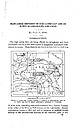 | | Report (issue) | | MANGANESE DEPOSITS OF THE CADDO GAP AND DE QUEEN QUADRANGLES, ARKANSAS. By HUGH D. MISER. INTRODUCTION...being offered for manganese ores have stimulated interest in the little-exploited manganese deposits of westcentral...westcentral Arkansas. These deposits are found at intervals in a belt 4 to Scale zs so Miles FIGURE...quadrangles, Arkansas and Oklahoma. 12 miles wide, extending west-southwestward from Pulaski County, at the...the center of the State, to Polk County, on the west border. Eecent exploitation, begun in 1915 and still |
|


