 | | Report (issue) |
| and San Lorenzo quadrangles, Grant and Sierra Counties, New Mexico By D. C. Hedlund 1 Open-File Report...... Mining districts........................................................ Hillsboro district...................................................... Mining history................................................. Kingston district.................................................. Mining history..................... Black Colt mine.......................................... Comstock mine.................... |
 | | Report (volume) |
| Mineral Belts in Western Sierra C:ourlty, New Mexico, Suggested by Mining Distri.cts, Ceologyt and c... Mineral Belts in Western Sierra County, New Mexico, Suggested by Mining Districts, Geology, and Geochemical...on mineral belts in western Sierra County, New Mexico, indicates many new areas favorable for mineral...1921Mineral belts in western Sierra County, New Mexico, suggested by mining districts, geology, and geochemical...and mineral resources-New Mexico-Sierra County. 2. Geology-New Mexico-Sierra County. I. Heyl, Allen Van |
 | | Report (issue) |
| Office of Scientific Publications froms Subject: New USGS open-file report The following report was·...map of the Hil1sbo.ro quadrangle, Sierra and Grant Counties, New Mexico;. AUTlDR(S) 1 D. c. Hedlund ·...Texas 75202 _uses, 223 (;eology Bldg.·,· Univ. New Mexico, Albuquerque, N.Mex. 87106 RECEIVED USGS WRD...Map of the Hillsboro Quadrangle, Sierra and Grant Counties, New Mexico Description of Map Units ~I By...MAP OF THE HILLSBORO QUADRANGLE, SIERRA AND GRANT COUNTIES, NEW MEXICO By D. c.·Hedlund DESCRIPTION OF |
 | | Report (issue) |
| Hillsboro and San lorenzo Quadrangles, Sierra and Grant Counties, New Mexico Background Information to Accompany...Hillsboro and San Lorenzo Quadrangles, Sierra and Grant Counties, New Mexico By D.C. Hedlund, with sections on...Silver City and Las Cruces 1° by 2 quadrangles, New Mexico---------4. Parallel-surface-continued aeromagnetic...quadrangles-------5. Map of magnetic anomaly in the Hillsboro district with north-south section showing the measured...of magnetic anomaly of the Carpenter (Swartz) district with east-west section showing the measured field |
 | | Report (issue) |
| NEW MEXICO STATE BUREAU OF MINES AND MINERAL RESOURCES Don H. Baker, Jr., Director Frank E. Kottlowski...Geologist Plus more than z8 undergraduate assistants New Mexico Tech Staff Advisors GALE BILLINGS, Geoscience...Geoscience PAIGE W. CHRISTIANSEN, Historian-Mining ALLAN R. SANFORD, Geophysics F RA N K B. TITU S , Hydrology...Ore Deposits of Sierra County, New Mexico by GEORGE TOWNSEND HARLEY 1934 New Mexico State Bureau of...of Mines and Mineral Resources New Mexico State Bureau of Mines and Mineral Resources Don H. Baker, Jr |
 | | Report (issue) |
| BULLETIN 71 Mineral Resources of Taos County, New Mexico by JOHN H. SCHILLING Description of mineral...RESOURCES NEW MEXICO INSTITUTE OF MINING & TECHNOLOGY CAMPUS STATION SOCORRO, NEW MEXICO NEW MEXICO INSTITUTE...INSTITUTE OF MINING 8c TECHNOLOGY E. J. Workman, President STATE BUREAU OF MINES AND MINERAL RESOURCES...Burroughs ...........................Governor of New Mexico Tom Wiley .................................................... Albuquerque For sale by the New Mexico Bureau of Mines & Mineral Resources Campus Station |
 | | Report (issue) |
| of New Mexico by JOHN H. SCHILLING 1965 STATE BUREAU OF MINES AND MINERAL RESOURCES NEW MEXICO INSTITUTE...INSTITUTE OF MINING & TECHNOLOGY CAMPUS STATION SOCORRO, NEW MEXICO NEW MEXICO INSTITUTE OF MINING Sc TECHNOLOGY................................... Governor of New Mexico Leonard DeLayo ................................................... Socorro For sale by the New Mexico Bureau of Mines and Mineral Resources Campus............................................... 7 Mining .............................................. |
 | | Report (issue) |
| of Stream Sediments in Central Colorado, from New Mexico to Wyoming Open-File Report 2015–1025 U.S....of Stream Sediments in Central Colorado, from New Mexico to Wyoming By Robert G. Eppinger, Stuart A. Giles...of stream sediments in central Colorado, from New Mexico to Wyoming: U.S. Geological Survey Open-File...Generalized rock types of central Colorado, and mining districts and mineralized areas of central Colorado............................................... 9 Mining districts and geologic formations associated with |
 | | Journal (article/letter/editorial) |
| and StrontiumIsotopeBatlos at the QuestaMine, New Mexico A. W. L^u•ar.•r, W. A. R•.a•m, ^m) R. L. M^uGE•...age determinationson samplesfrom the Questa Mine, New Mexico indicate that magrnatismand molybdenitemineralizationare...the 8•Sr/S6Srratio in a whole rock sampleof the Mine Aptitc yield an initial ratio of 0.7069similar to...micascommonlyassociated with sulfideminerali- of Questa,New Mexico(Figure 1). It occurs within zation. Thesestudies...Livingstonet al. (1968) demonstratedSanta Fe, New Mexico. similaragesof mineralization withincertainregions |
 | | Report (issue) |
| Geology and Ore Deposits of the Rico District, Colorado GEOLOGICAL SURVEY PROFESSIONAL PAPER 723...723 Geology and Ore Deposits of the Rico District, Colorado By EDWIN T. McKNIGHT GEOLOGICAL SURVEY ...------------------------------------Location and geography of district -----------History --------------------------...-Rico Argentine group -----------------------Log Cabin (Blackhawk) tunnel ----------Blacksmith tunnel...--------------Falcon mine -------------------------------Aztec mine ---------------------------------Nora Lily mine -- |
 | | Report (issue) |
| OR PROFE SIONAL PAPER 68 THE ORE DEPOSITS OF NEW MEXI.CO BY WALDEMAR LINDGREN, LOUIS C. GRATON AND...PRQ)tESSIONAL PAPER 68 T·H E ORE DEPOSITS O.F NEW MEXICO.. . . ., .,· ;,.: BY WALDEMAR LINpGREN,........ . J,5 Historical sketch of mining and smelting in New Mexico....... . . . . . . . . . . . . . ....... : . .............. - ........ .. . . T~os County, by L. C. Graton and W ..Lindgren ..... ................. . . , ... -.. . Rio Hondo. (Twining) district . . . . . . . . . . . . . ................... |
 | | Report (issue) |
| Geology of the Questa Molybdenum (Moly) Mine Area, Taos County, New Mexico BY JOHN H. SCHILLING Local structure...RESOURCES NEW MEXICO INSTITUTE OF MINING & TECHNOLOGY CAMPUS STATION SOCORRO, NEW MEXICO NEW MEXICO INSTITUTE...INSTITUTE OF MINING & TECHNOLOGY E. J. Workman, President STATE BUREAU OF MINES AND MINERAL RESOURCES Eugene...JOHN F. SIMMS ...................... Governor of New Mexico MRS. GEORGIA L. LUSK ...................... Superintendent...and Mine ................................................................................8 Mining Methods |
 | | Journal (article/letter/editorial) |
| 20:52 13 January 2015 Mineralogy of the Eldorado Mine YA N K E E B O Y B A S I N , O U R AY C O U N T...the name, as almost every major mining camp had a vein, claim, or mine with that name. This article details...history, geology, and mineralogy of the Eldorado mine in the San Juan Mountains of southwestern Colorado...not bring wealth to its many owners. The Eldorado mine is located about 8.6 miles southwest of Ouray, Colorado...Yankee Boy Basin in the Sneffels mining district. The portal to the mine is at an elevation of 11,600 feet |
 | | Journal (article/letter/editorial) |
| g{x Spring Creek Area Last Chance Mining District Plumas County, California Gail E. Dunning 773 Durshire...1905 and 1909, the mines of the Last Chance mining district produced significant quantities of copper and...minerals are recorded in the literature from Plumas County. Smith (1970) recorded trace amounts of the element...Map showing the location of the Last Chance Mining District. The results of our study indicate that a...El Dorado mine collapsed adit. LOCATION The copper mines of the Last Chance mining district are located |
 | | Journal (article/letter/editorial) |
| with its representation of mining tools clearly proclaim Montana’s mining origins. Montana’s production...published describing the occurrence, collecting, mining, and cutting of the two state gemstones. Figure...2. Granville Stuart established Montana’s first mining camp at Gold Creek in 1860. Geologic Provinces...view showing the Indian Queen mine ca. 1905 at Farlin, Beaverhead County. 208 ROCKS & MINERALS Downloaded...more people), there is a vast territory to explore. New discoveries continue to be made. Snow cover obscures |
 | | Report (volume) |
| \ Geology of the Copper King Uranium Mine Larimer County Colorado GEOLOGICAL SURVEY BULLETIN This...1032-D Geology of the Copper King Uranium Mine Larimer County Colorado By P. K. SIMS, GEORGE PHAIR, and...History and production____________ ._______________ Mine workings___ ______________.__ _ _ Rock units___...Marcasite_ ___________________________________________ Sphalerite.___________________________________________ Chalcopyrite_...map of Copper King mine area showing sections through mine. 17. Geologic maps of mine. 18. Section through |
 | | Journal (issue) |
| Gollector [Entered as Second-Clan Matter at the New York. N. Y.. Poul Omen. March 19. 1894.] VOL. VIII...Falls Electric Light and Power Co. were excavating a new wheel-pit. This was an oppOrtunity not to be passed...quent occurrence; some of them contain massive sphalerite, others are geodes. "' 162 THE MINERAL COLLECTOR...pink and white dolomite, but did not find much sphalerite or selenite, though the cherty concretions were...of dolomite. On the dolomite rest crystals of sphalerite (one a perfect twin), crystals of calcite, anker |
 | | Journal (article/letter/editorial) |
| of copper crystals collected at the Ojibway No. 1 mine in summer 2009 by Steve Whelan. The specimen is...Generalized map of the Michigan copper district showing the location of the new mineral finds discussed in the...also known as the Lake Superior native copper district, is located on the isolated, rugged, and scenic...western end of Upper Michigan. The now-dormant copper mining industry, which flourished from 1844 through 1976...numerous quality mineral specimens from Copper Country mine dumps and made them available to the mineral world |
 | | Report (issue) |
| prepared during the last 20 years by geologists and mining engineers of the U.S. Geological Survey and the...years of wilderness surveys we have broken much new scietltiflc ground in understanding the geological.... . .... Blue Range Wilderness, Arizona and ew Mexico. by James C. Ratte and R. G. Raabe . . . . . ........ . Hells Hole Roadless Area, Arizona and New Mexico by James C. Ratte and John P. Briggs ...... -...area and contiguous roadless areas, Arizona and New Mexico. by James C. Ratte and Michael E. Lane . . . |
 | | Book (volume) |
| instance, a single Spodumene crystal from the Etta Mine near Keystone on the east side of the Mount Rushmore...beds, excavations, etc.Selenite roses. BRULE COUNTY AREA: in the Oacoma zone of the Pierre Fm. On Elm...gray Barite rosette up to 5 or 6 inches. CAMPBELL COUNTY MOUND CITY, W to the Missouri R., regional hillsides...gravels, etc.petrified wood, wood opal. CORSON COUNTY LITTLE EAGLE: area ridges, slopes, stream beds...Hounds in the United States CUSTER COUNTY AREA: The November Mine, 1.2 mi. SE of the Needles Eye Tunnel |
 | | Report (issue) |
| 1 COUNTY REPORT HYSICAL >ci 8 PHYSICAL •CI. .Lib. IES TN 24 C3 1ERAL RESOURCES OF A34 1 IPINE...IPINE COUNTY, CA! IA -*ci?2®^?^a£~Vfes^A^Gw^i I ver Mou nta i nV-*- Digitized by the Internet...ALPINE COUNTY, CALIFORNIA by WILLIAM B.CLARK With sections on the Zaca gold-silver mine and the...the Leviathan COUNTY REPORT sulfur mine by James R. Evans 8 1977 CALIFORNIA DIVISION OF MINES AND...2 i DOCS. -US Frontispiece. Typical Alpine County scenery. View looking southeast across Twin Lakes |
 | | Report (issue) |
| . . . . . . . . . . . . . . . . . 1 Chapter I. Mining Districts of Counties and the State of Utah. .... . . . . . . . . . . . . . . . . . . . . . . 1 County Listings. . . . . . . . . . . . . . . . . . . ... . . . . . . . . . . . . . . . . 1 Chapter II. Mining Districts of Utah . . . . . . . . . . . . . . .... . . . . . . . 4 Mineral Localities Listed by County . . . . . . . . . . . . . . . . . . . . . . . .... . . . . . . . . . . . . . . . . . . 7 Beaver County . . . . . . . . . . . . . . . . . . . . . . . |
 | | Journal (issue) |
| 80 in southeastern Arizona 10 miles from the New Mexico border, commemorates the end of all Indian warfare...Fiesta and Spring Corn Dance, San Felipe Pueblo, New Mexico. May 1-4—Las Damas Trek, Wickenburg, Arizona...Ceremony, Promontory, Utah. May 10-11 — Eastern New Mexico University Rodeo, Portales. May 10-12 — Lone...11-12—Santa Barbara and Riverside Chapters of the Sierra Club joint trip to Joshua Tree National Monument...Ysidro Procession and Blessing of Fields, Taos, New Mexico. May 15-26—Spring Landscape Show, Tucson. May |
 | | Book |
| MINERALS OF THE GREAT AMERICAN RIFT (COLORADO-NEW MEXICO) Sine —_—< ¢ te om At _SHT 40 MADIASIMA...MINERALS OF THE GREAT AMERICAN RIFT (COLORADO-NEW MEXICO) Richard Walker Holmes and Marrianna B. Kennedy...Kennedy [aN VAN NOSTRAND REINHOLD COMPANY NEW YORK CINCINNATl TORONTO LONDON MELBOURNE Copyright © 1983...Nostrand Reinhold Company Inc. 135 West 50th Street, New York, N.Y. 10020 Van Nostrand Reinhold Publishing...minerals of the Great American Rift (Colorado-New Mexico). Bibliography: p. Includes index. 1. Mines |
 | | Journal (issue) |
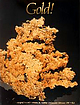
| arrison & J. Fuller Recent Discoveries W hat's new in gold? Venezuelan gold (by W. E. W ilson) .......Nugget," collected in 1865 at the Grit mine, El Dorado County, California, by Jules Fricot and donated...many different species these days, so what else is new? One must faking, so gold collectors must be appropriately...originated in an early (1857) article in Harper’s New Monthly Magazine. Out of curiosity I began searching...Harper’s article. John Dysart, Manager of the Reed Gold Mine State Historic Site, sent much additional information |


