 | | Journal (issue) |
| MINING WORLD CATALOG, SURVEY & DIRECTORY NUMBER Blue Pages Pink Section Yellow Pages DIRECTORY INDEX...231-26] > 68 United States Mining in 1960 State-by-state report from and MINING to zinc Alaska to Wyoming...Shipments by mines for 1958, 1959, 1960 B96 Open Pit Mine Production ef 3 Technological ; Advances...—==erererr Ofslo(Seep colitetol Mining Open Pit Mining World-Wide Mining Reports Africa-Asia-Caribbean-Europe...cross members without need for separate dry pump pit. Can be mounted inside flotation concentrate launders |
 | | Journal (issue) |
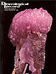
| LuminescentPhantom Quartz From Hudson,St. Croix County,Wisconsin William S. Cordua Dept. Plant and Earth...November-December, 1997 near Hudson, St. Croix County, Wisconsin has revealed some unexpectedly interesting...reached from Interstate 94. One takes Exit 2, marked County F and Carmichael Road, then turns south on Cannichael...and new books on minerals, mining, and mining history. These are on mining areas all over the U.S., and...photos, and mining company stock certificates. If interested in another source for mining/mineral history |
 | | Report (volume) |
| estimates for uranium-vanadium deposits on the Colorado Plateau, by A. L. Bush and H. K. Stager__ __ ___...the Goodrich quartzite, Palmer area, Marquette County, Michigan, by R. C. Vickers. --(G) Wall-rock control...deposits in Golden Gate Canyon, Jefferson County, Colorado, by John W. Adams and Frederick Stugard, ...uranium deposits in the Red Desert, SweBtwater County, Wyoming, by Donald G. Wyant, William N. Sharp...in oolitic limestone near I /Tayoworth, Johnson County, Wyoming, by R. R. Guilinger and P. K. Theobald |
 | | Report (issue) |
| 101 PRICE $3.00 AUGUST 1973 CONTENTS Page County Maps Showing Location of Operators: Beaver . .... . . . . 66 Page Commodities and Operators by County: Beaver . . . . . . . . . . . . . . . . . . . ...oil and gas industry as well as those engaged in mining activities of Utah. The directory is a general...which lists producers alphabetically by county, and within the county, by commodity and by operator. The compiler...Commission Mineral Property Tax Division; Utah Mining Association; and the Department of Natural Resources |
 | | Journal (article/letter/editorial) |
| Clays and Clay Minerals, Vol. 24, pp. 114-117. Pergamon Press 1976. Printed in Great Britain SCAN...(SEM) show the textures of ball clay, plastic refractory clay, flint clay, and of kaolins from Cornwall...The texture of ball clay is a swirl and ragged-flake pattern. Plastic refractory clay shows a transition...texture from ball clay to plastic, semi-plastic, to semi-flint, and flint-clay. Flint-clay texture exhibits...exhibits a matrix of tiny, compactly interlocked clay grains in which may be interspersed small, tight books |
 | | Journal (article/letter/editorial) |
| 12. General Distribution and Character of the Clay. Its Mineral Contents. Drift from the Southward...Contents of the Clay. Progress of the Submergence. Northern Limit of the Red Clay. Blue Clay of the Banffshire...Reappearance of the Glaciers, and Denudation of the Red Clay. Upper Limit of the Submergence. Geological Date...Nigg. 1. GENF~RALDISTRIBUTION AND CHARACTEROP THE CLAY. THE more we know of the Glacial period the more...On the eastern side of that county we find a well-marked bed of red clay, which covers much of the low |
 | | Report (issue) |
| ------Oligocene rhyolite in the Denver basin, Colorado, by G. A. Izett, G. R. Scott, and J. D. Obrad...rodents from the Troublesome Formation (Miocene) of Colorado, by G. E. Lewis. Age and stratigraphic relations...Economic geology White clay deposits near Mount Holly Springs, Cumberland County, Pa., by J. W. Hoster...uranium deposits, south end of the Uravan mineral belt, Colorado-Utah, by D. R. Shawe. 66 73 Sedimentation...Distribution of mercury in the Navajo Sandstone, Colorado Plateau region, by R. A. Cadigan ___________________ |
 | | Report (issue) |
| ...................................... Sumpter County.................................................................................... Vallecitos District..................................................................... Armargosa (River Valley) District............................. Other Deposits.................................................. Colorado................................................. Meigs-Attapulgus-Quincy District.............................. Twiggs Clay Belt.................... |
 | | Journal (article/letter/editorial) |
| Clays and Clay Minerals, Vol. 60, No. 2, 186–199, 2012. TRITIUM CONTENT OF CLAY MINERALS T H OM A S...Utah 84112, USA Abstract—The presence, percentage, origins, and rate of formation of clay minerals have...use of tritium as an indicator of the origin of clay minerals within such piles. Tritium values in pore...structural hydroxyl sites of clay minerals were examined to evaluate the origins of clay minerals within waste-rock...waste-rock piles located near Questa, New Mexico. Five clay minerals were identified: kaolinite, chlorite, illite |
 | | Report (issue) |
| 1.--Map showing location of 339 exploration or mining sites in Washington. ............................of 339 sites representing mineral activities for mining and mineral exploration in the State of Washington...of Geology and Earth Resources, annually reports mining, development, and mineral exploration activities...obtained from a voluntary questionnaire survey of mining companies and individuals, published information...were an incomplete measure of Washington state mining activities. These results were published annually |
| | Report (issue) |
| 1.--Map showing location of 339 exploration or mining sites in Washington. ............................of 339 sites representing mineral activities for mining and mineral exploration in the State of Washington...of Geology and Earth Resources, annually reports mining, development, and mineral exploration activities...obtained from a voluntary questionnaire survey of mining companies and individuals, published information...were an incomplete measure of Washington state mining activities. These results were published annually |
 | | Journal (article/letter/editorial) |
| COMPARISON OF GRADE MODELLING METHODS AT CHINA CLAY PIT, CORNWALL BLACKPOOL L.W. PALMER AND H.J. GLASS...of grade modelling methods at Blackpool china clay pit, Cornwall. Geoscience in South-West England, 13...kaolin resource at Blackpool Pit, St Austell, Cornwall. Although Blackpool pit is not currently in operation...interpreting grade data is an essential part of modern mining operations with a variety of different software...a kaolin deposit. Kaolin, known locally as china clay, has been mined in the St Austell area for the last |
 | | Journal (article/letter/editorial) |
| Postcard view of the Waukon iron mine, Allamakee County, cia. 1912. John Taylor collection. ARTHUR E ...Iowa Geological Survey. Localities by County Allamakee County Lansing, Lansing lead mines = Captain...smithsonite, sphalerite (Hey1 and West 1982). Appanoose County Centerville gypsum mine; abandoned underground...2002 405 Locality Cross-Reference Acme gravel pit, Muscatine Co. Downloaded by [University of Saskatchewan... Vernon, Van Buren Co. Coralville, Johnson Co. County Fairgrounds, Dubuque Co. Cresco, Howard Co. Decorah |
 | | Journal (article/letter/editorial) |
| ....................................... Miami district, Arizona .......................................Rita, New Mexico ......................... Ely district, Nevada ........................................simpleexampleof onekind of alterationbut eacfi district shows a dominanceof one or two of the above types...districts of which Morenci is an outstandingexample. The clay minerals occur in the sulphideore and are chara...characteristicallyearlier than sericite. The more important clay minerals include hydromuscovite,kaolinite, allophane |
 | | Journal (issue) |
| Articles The Bunker Hill mine, Kellogg, Shoshone County, Id a h o 339 by N. Radford and J. A. Crowley...Gagnon Minerals of the Yates uranium mine, Pontiac County, Quebec . 359 by D. L. Leavitt Shavano Peak ....1981 Bunker Hill the mine kellogg, shoshone county, idaho by Norman Radford P. O. Box N Osbum, Idaho...Bunker Hill mine in the famous Coeur D ’Alene district of Idaho has produced some of North America’s...part of the Coeur d’Alene mining district, Shoshone County, Idaho. The district is roughly 24 kilometers |
 | | Journal (issue) |
| News, P.O. Box 2043, Coeur d'Alene, ID 83816-2043 USA Phone: 208-664-2448 E-mail: lream@comtch.iea.com...to l cm+). The latter very high quality for this mining districL Anyone interested in Romanian minerals...believe that these were brought back to Belgium by mining engineers who have fled Zaire during the recent...Fifties, i.e. chiastolite crystals from Madera County, CA. They used to be very common, almost ubiquitous...Manhattan, NV, from the Twin Creek Mine, Humboldt County, NV. The crystals are about 3/g to 5/g inch (1 |
 | | Book (edition) |
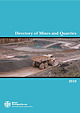
| Anhydrite Ball Clay Barytes Basalt (Northern Ireland) Bauxite (Northern Ireland) Chalk Chert China Clay China...China Clay Waste Clay & Shale Coal Coal, Deep mined Coal, Surface mined Coal Mine Methane (Mine Drainage Gas)...Robert Hunt to collect returns of the produce of the Clay Works and Quarries of the United Kingdom’. One objective...National, Regional and Local Planning project (‘County mineral resource maps’), required in advance of...planning authorities from the former Metropolitan and County councils. i This work was completed in early |
| | Report (issue) |
| Prepared in cooperation with the Colorado Geological Survey for the United States Department of Agriculture...Service Development of Industrial Minerals in Colorado Circular 1368 U.S. Department of the Interior...Survey Development of Industrial Minerals in Colorado By Belinda F. Arbogast, Daniel H. Knepper, William...John S. Dersch Prepared in cooperation with the Colorado Geological Survey for the United States Department..., 2011, Development of industrial minerals in Colorado: U.S. Geological Survey Circular 1368, 87 p. Library |
 | | Report (issue) |
| product has been prospected and mined to some extent. Clay deposits of commercial value are found in this formation...linegrained slate-colored plastic clay of good quality. The so-called Hint clay was formerly used to some extent...extent in the manufacture of brick, and the plastic clay is now shipped to Anaconda, Mont., where it is burned...activity and increased development of the clay resources of this district. LOCATION AND EXTENT. The area in...observed is situated in the eastern part of Cascade County, which is located near the center of Montana. It |
 | | Report (issue) |
| the use of products manufactured from clay. In some States clay products have been made in a variety of...by pipes made of cement and in part by ordinary clay tile. Tile of this kind is commonly known as drain...necessary to meet the home demand, considerable clay is mined in Florida and shipped to some of the Northern...Northern States, being sold under the name of ball clay and used for the manufacture of pottery. Upon his...localities in the northern part of the State where clay is abundant. The total number of factories in operation |
 | | Book (edition) |
| ethane Anhydrite Ball Clay Barytes Cal.cite Chalk Chert China Clay China Clay Waste Clay & Shale Coal Coal...Hunt to collect .returns of tl1e produce oft.he Clay Works and Qnarries of the lJnited Kingdom' . Tbe...heading 'Mining and quan-ying' , which includes the extraction of oil and gas. The GVA for 'Mining and quanying'... and for constructional fill, are included with clay. Sand is described as silica sai1d if it is used...govermnent (counties and districts), 11PAs are the county councils and National Park Autl101iti.es. Jn Scotland |
 | | Report (volume) |
| Woodrow, Haywood County___________ Mine of the Hand Clay Co. (Inc.)_____ 27 28 28 30 31 31 IV CONTENTS...Thomas mine___ _ 36 Pit of the Clay Products Co_ 36 Sprucepine, Mitchell County __ 36 Sprucepine mine-...Herren property________________ Birdtown, Swain County _____________ Cole & Black property____________...Mitchell County__________________ Jefferson, Ashe County ______________ Bare property_________________ Kaolins...rocks (partly pegmatites)--68 Troy, Montgomery County _ 68 Mount Gilead, Montgomery County____ 69 Property |
 | | Report (Issue volume) |
| of nonfuel minerals and a chapter on trends in mining and quarrying in the metals and industrial mineral...State mineral production and mineral production by county were prepared in the Division of Statistics and...Conservation, Division of Mines and Geology. Colorado: Colorado Geological Survey. Connecticut: State Geological...John L. Burnett .... . ..... . . . . . . . . . 97 Colorado, by Staff . . . . . . . . . . . . . . . . . ....this report. Name State____________ SECTION 2. County _ __ _ _ _ _ _ _ _ __ Stocks. production, end |
 | | Book (edition) |
| Methane Anhydrite Bal.I Clay Bai-ytes Calcite Chalk Chert China Clay China Clay Waste Clay & Shale Coal, Deep...includes the extraction of oil and gas. The GVA for 'Mining and quarrying' was £25 458 n1illion in 2005, or... and for constructional fill, are included with clay. Sand is described as silica sand if it is used...goven1n1ent (counties and districts), MPAs are the county councils and National Park Authorities. In Scotland...Belfast, although du·ectory entries are shown by county to give an indication of geographical variations |
 | | Book |
| Fetter Lalle, London EC4P .:lEE Pllhlisiled ill the USA h)' Chapman (Iml Hall 29 West 35th Street, ,\Iou...Sandstone-hosted uranium deposits of the western USA Concluding statement References ORES FORMED BY MET...towards the cost of travel: the Institution of Mining and Metallurgy, the British Council, BP Minerals...permission of the Economic Geology Publishing Company, USA. x Preface Why another book about Ore Deposits...question. Firstly our colleagues are predominantly mining engineers and minerals processing technologists |


