 | | Report (issue) | | Geology and Ore Deposits of the West Slope of the Mosquito Range By CHARLES H. BEHRE, JR. GEOLOGICAL SURVEY...the. Leadville, Colorado, mining district. Prepared in cooperation with the Colorado State Geological...Geological Survey Board and the Colorado Metal Mining Fund UNITED STATES GOVERNMENT PRINTING OFFICE, WASHINGTON...Deposits of Empire glacier___________ Deposits of Horseshoe glacier_________ Terraces related to glaciation...High-level terraces,_____________________________ "Lake beds".__________________________________ Stratigraphy |  | | Report (issue) | | Oxidized Zinc Deposits of the United States Part 3. Colorado By ALLEN V. HEYL GEOLOGICAL SURVEY BULLETIN...deposits and the resources of oxidized zin.c ores in Colorado UNITED STATES· GOVERNMENT PRINTING OFFICE, WASHINGTON...19180xidized zinc deposits of the United States. Part 3. Colorado. Washington, U.S. Govt. Print. Off., 1964. vi...Bibliography : p. 88-91. 1. Zinc ores-Colorado. 2. Zinc mines and mining-Colorado. I. Title. (Series) For sale...__ ___ __ __ __ __ __ _____ Kokomo (Ten ~ile) district _______ ._________________________ Breckenridge |  | | Report (issue) | | Bldg., 2600 corridor, 18th and CSts.,NW. DENVER, Colorado-Federal Bldg., Rm. 169,1961 Stout St. LOS ANGELES...Center, Rm. 1C402,12201 Sunrise Valley Dr. SALT LAKE CITY, Utah-Federal Bldg., Rm. 8105,125 South State...ROLLA, Missouri-1400 Independence Rd. DENVER, Colorado-Map Distribution, Bldg. 810, Federal Center FAIRBANKS...Replacement Deposits Part II Gold in the Tintic Mining District, Utah By HALT. MORRIS Gold Deposits in the Sneffels-Telluride...Juan Mountains, Colorado By FREDERICKS. FISHER Gold in the Alma Mining District, Colorado By DANIEL R. |  | | Report (issue) | | Carbonate-Hosted Sulfide Deposits of the Central Colorado Mineral Belt DAVID W . BEATY, GARY P . LANDIS...paralle l to host-rock bedding. Black Cloud mine, Leadville district. Sherman-type ore (bottom) in paleokarst...veined with ferroan dolomite. rv1oose mine, North Alma district. Photographs b)' \Villiarn Sacco, Peabody...Carbonate-hosted sulfide deposits of the central Colorado mine ral belt: Introduction, general discussion,...Regional geologic and tectonic setting of the central Colorado mineral belt . . . . Alan R. Wallace Paleozoic |  | | Report (issue) | | ................................... Tri-State district, Oklahoma, Kansas, and Missouri ................Clifton-Morenci district, Arizona .............................. Bisbee (Warren) district, Arizona .......Ely (Robinson) district, Nevada .............................. Leadville district, Colorado ..............Gilman (Red Cliff) district, Colorado ...................... Aspen district, Colorado ................................................. Eureka district, Nevada ............................................. |  | | Journal (article/letter/editorial) | | University] at 01:02 21 December 2014 79 Mine, Gila County, Arizona E veryone likes blue minerals....minerals of collector interest, including malachite, azurite, cuprite, smithsonite, hemimorphite, hydrozincite...including the Harborside mine at Brooksville, Hancock County, and the Lubec lead mine and prospects at Pembroke...Washington County. It has also been found at the old lead mines at Middletown, Middlesex County, Connecticut;...Easthampton, Hampshire County, Massachusetts; the old Gorham (Mascot mine), Coos County, New Hampshire; as |  | | Report (issue) | | AND ORE DEPOSITS OF TILE LEADVILLE MINING DISTRICT, COLORADO BY S. F. EMMONS, J. D. IRVING, AND G. F...High terrace gravel_ 15 Low terrace gravel_ _ 17 "Lake beds"_ 17 Character and distribu17 tion _ Deformation...Mount Zion porphyry_ 50 Other porphyries in Mosquito Range re51 gion _ Age relations of porphyries at...the Iron-Mikado fault 61 Colorado Prince anticline _ group _ 95 61 Mosquito Gulch fold-fault _ Faults...Faults in the eastern part of the district 95 62 Kokomo syncline_ Faults southeast_ of _ Leadville 62 the_ |  | | Report (issue) | | Geological of America, Boulder, INC. Place Colorado Printed in the United States by Edwards Inc...8137-1131-2 Published THE GEOLOGICAL Society Card Colorado Michigan Soctety 80301 48104 The publication...sis sa slocweessieece | OO BirindeR ever CMaOty Lake) ciseisele sees eee esis sisiecemecc ee |O BilwmomMountatny...oh ce bdd hos iad Rad Lakesacdeeerd 94 Steep Rock Lake .ssecececeveescssesssessereressesesveseses 97 SUdDULY...td"e 2a Ganielon aie ate aera e The teOrd—Blackey Lake. «.cislecta «ep c.ciels a sislateaicdibied laiatelel |  | | Book | | are not likely to underestimate the role of the mine and of the miner in the modern industrial world...brought to mind by reference to a coal mine or a copper mine is that of a vast labyrinth of underground...is — : INTRODUCTION 3 Yet today the term "mine" may be applied with equal justice to the great...producing oil or gas well can be referred to as a mine in the strict usage of that term, yet each carries...Throughout ony. the text the writer will use the terms "mine" and "mining" in the broadest sense, including |  | | Journal (volume) | | Coi'lcs, 10 Cts. Spring Craters. The hiatoric Lake BoDneville, whioh was the Urgest of the lakee of...Press by Jambs H. CaosBMAN.J Providence Mining District, SUaated on Providence MoDDtain, haa been subdivided...and the Arrow Mining Districts. Providence Mountain haa been previously described In article No...South is develsylvania. The General Custer is a gold mine developed oping in an industrial way very rapidly...Gold Belt Mining District, the collection of information regarding the foron is district, Providence Segregated |  | | Journal (volume) | | SATURDAY. JANUARY PubUsbers. TJie Dramlammon Mine. acquirement of several adjoining properties of...eDgraving protect the mine. panic. It have been made to spread reports of a to the mine and its man- efforts...peoted change in grade of ore. di- only the Newport mine, but rector in answer to inquiries re- now they...Coos Jubilee and other rich shoots might be cut in county, in which Marsh&eld is situated, has a the eOOfoot...Francisco, as does all the region west of the Coast Range. falling off meanwhile in the monthly runs. Mr. |
|


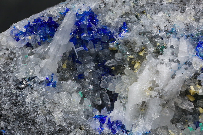
Continental Chief Mine, Dyer Mountain, Horseshoe District, Mosquito Range, Lake County, Colorado, USA