 | | Journal (article/letter/editorial) | | r------' .--. !i i , i ' i Boundary '---~ IDAHO Bonner_j l--;~u:d{ene\, I , L~ Coeur'cI'Alene...its pyromorphite, Idaho also boasts many other mineral species. ( :\.. -~:/ Idaho <....: (_ ", I...Power i..r v. ) 't,.,. 1. r': ~ Caribou Idaho 83816-2043 , • c-vz..J. '. 2",_J'-1 '\ o, ...INDEX BRIEFLY DESCRIBES the mineral localities in Idaho; all known localities that may have produced well-crystallized...localities for minerals that were first discovered in Idaho. Unfortunately for the field collector, most of |  | | Journal (article/letter/editorial) | | location a~ included at the end of each entry. Adair County Chariton River (40-04-05N 92-4 I -23W). septarian...septarian concretions about 2 miles north of the Macon county line. CALCITE crystals enclosing bundles of acicular...hematite, quartz (Broadhead 1873b, 1877). Audrain County Mexico, in fire clay pits and spoil piles: PYRITE...University Library] at 19:58 29 October 2014 Barton County McKarrow’s coal bank (37-37N 94-28W), 2.5 miles...pyrite, siderite (Broadhead 1873b). Bates County Panther Creek, northwest of Rockville in coal deposits: |  | | Book (edition) | | Idaho Minerals The complete Reference and Guide to the Minerals of Idaho Lanny R. Ream 1!11, ) a...PISTOLS Idaho Minerals Idaho Minerals The Complete Reference and Guide to the Minerals of Idaho with Special...Chapters on the Coeur d'Alene Mining District, the Blackbird Mining District, and the Sawtooth Mountains...Rerun Publishing P .O. Box 2043 Coeur d'Ale ne, Idaho 83814 Copyright © 1989 by L.R. Ream Publishing...R Ream Publishing P.O. Box 2043 Coeur d'Alene, Idaho 83814 (208) 667-0453 To those collectors who are |  | | Book (volume) | | Dahlonega Co. and Rabum Co., and the McDuffie County Belt extending through portions of McDuffie, Warren...Sphalerite. BALDWIN COUNTY MILLEDGEVILLE, at state farmjasper. BANKS COUNTY COMMERCE, along Hwy. 59...along adjoining Co. linerock crystal. BARROW COUNTY WINDER, along rd. to Jefferson and 1½ mi. inside...Guide for Rock Hounds in the United States BARTOW COUNTY AREA, Saltpeter Cave, as floatjasper. CARTERSVILLE:...agate, (banded, various colors), jasper. BIBB COUNTY MACON: at Holton Quarry, 7½ mi. NWagate; N |  | | Report (issue) | | . . . . . . . . . . . . . . . . . 1 Chapter I. Mining Districts of Counties and the State of Utah. .... . . . . . . . . . . . . . . . . . . . . . . 1 County Listings. . . . . . . . . . . . . . . . . . . ... . . . . . . . . . . . . . . . . 1 Chapter II. Mining Districts of Utah . . . . . . . . . . . . . . .... . . . . . . . 4 Mineral Localities Listed by County . . . . . . . . . . . . . . . . . . . . . . . .... . . . . . . . . . . . . . . . . . . 7 Beaver County . . . . . . . . . . . . . . . . . . . . . . . |  | | Journal (article/letter/editorial) | | `|ÇxÜtÄÉzç Éy g{x Spring Creek Area Last Chance Mining District Plumas County, California Gail E. Dunning...between 1905 and 1909, the mines of the Last Chance mining district produced significant quantities of copper...showing the location of the mines along Spring Creek. This material was reexamined in 1985 and a number...minerals are recorded in the literature from Plumas County. Smith (1970) recorded trace amounts of the element...1b. Map showing the location of the Last Chance Mining District. The results of our study indicate that |  | | Journal (article/letter/editorial) | | with its representation of mining tools clearly proclaim Montana’s mining origins. Montana’s production...published describing the occurrence, collecting, mining, and cutting of the two state gemstones. Figure...Granville Stuart established Montana’s first mining camp at Gold Creek in 1860. Geologic Provinces The state...view showing the Indian Queen mine ca. 1905 at Farlin, Beaverhead County. 208 ROCKS & MINERALS Downloaded...one. The mines at Butte in Silver Bow County and the Black Pine mine in Granite County have produced many |  | | Report (volume) | | location and means of access to all the metallic mining districts in the State, as well as a large number...to the hundreds of authors whose work during the last 100 years has made this report possible and desirable...documented summary of the beginning of Colorado mining history. Part of his summary is given here in the...had been recently found in the Tenmile district, Summit County. In his booklet, which today would be classed...lists of the mines and mining districts that were active at the time in Clear Creek, Gilpin, and Summit |  | | Book (volume) | | ...........................................160 Idaho .................................................................548 Table of Maps Page Alabama County Map ...................................................................................4 Alaska County and Stream Map ..................................Co. Mining Districts ............................................................22 Arizona County Map.........................23 Arizona – Cochise Co. Mining Districts .................................... |  | | Book (volume) | | ...........................................139 Idaho...................................................my trip (to include locations which interest me). Last year as I started this annual process, I decided...rights, so remember you were told. If in doubt, a county map will tell you who the legal owner is. Good...gemmy qualities for cutting and polishing. AUTAUGA COUNTY PRATTVILLE, N. 6 mi., and just E of the Birmingham...were well known to prehistoric Indians.) BARBOUR COUNTY BAKER HILL, SE 1 mi. : 1 in a deep ravine, as a |  | | Book (volume) | | ...........................................139 Idaho...................................................my trip (to include locations which interest me). Last year as I started this annual process, I decided...rights, so remember you were told. If in doubt, a county map will tell you who the legal owner is. Good...gemmy qualities for cutting and polishing. AUTAUGA COUNTY PRATTVILLE, N. 6 mi., and just E of the Birmingham...were well known to prehistoric Indians.) BARBOUR COUNTY BAKER HILL, SE 1 mi. : 1 in a deep ravine, as a |  | | Book (volume) | | instance, a single Spodumene crystal from the Etta Mine near Keystone on the east side of the Mount Rushmore...beds, excavations, etc.Selenite roses. BRULE COUNTY AREA: in the Oacoma zone of the Pierre Fm. On Elm...gray Barite rosette up to 5 or 6 inches. CAMPBELL COUNTY MOUND CITY, W to the Missouri R., regional hillsides...gravels, etc.petrified wood, wood opal. CORSON COUNTY LITTLE EAGLE: area ridges, slopes, stream beds...Hounds in the United States CUSTER COUNTY AREA: The November Mine, 1.2 mi. SE of the Needles Eye Tunnel | 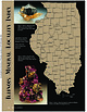 | | Journal (article/letter/editorial) | | Sphalerite and calcite, 5 cm across, Denton mine, Hardin County. Ross Lillie specimen. +!.+!+%% 34!2+ ...chalcopyrite, and sphalerite, 12.7 cm high, Hardin County. Marv Rausch specimen. 3(%,"9 -!#/50). /5 ....outwash deposits. The Illinois-Kentucky fluorspar district in the extreme southeast corner of the state has...to the mid-1970s were documented with the exact mine or in many cases even the correct subdistrict. In...Mississippi Valley zinc-lead district. This area has been an active mining district from about the middle of |  | | Report (issue) | | 1 D E J •LEGEND- MEXICO -^ Mining O Division Boundaries. Mining Division Offices. (6) PREFACE...a part of the Fourth Annual Report of the State Mining Bureau, by Henry G. Hanks, who was then State Mineralogist...''Minerals of California," of the California State Mining Bureau. In the thirty years which had elapsed since...published as Bulletin 91 of the California State Mining Bureau. Many additional species were included,...literature both before and after the date of the last edition has been greatly increased. Even with |  | | Report (issue) | | said to have been found in the mining the nugget Jim, Placer County, California, in 1871 by a small...Counties of California: Minerals and mineral lists Mining Districts of California Unvalidated entries in...The bibliography has been updated and expanded. County lists published by Collins (1) pp. 40-64, in Murdoch...resulting from references to the geographic term ''Mining District," especially in the pre-1920 literature. Widespread...rhyolite locality in Alameda County and the lawsonite type locality Marin County, which have been completely |  | | Book | | stumble over a valuable nugget and stake your own mining claim? Indeed it to is, and author book Jay...prospecting, he points out, is in abandoned mining districts, where valuable mineral ores are present...commercial ores and secondary minerals by state, county, township, and geologic range. For easy identification...RANSOM 1875-1948 An to the Eastern '‘Schoolmarm” Mining Camps of the Old West I I a s I \ h K... CONTENTS Preface ix PART I 1 Introduction to Mining and Mineralogy 2 Preparation for Mineral Collecting |  | | Journal (article/letter/editorial) | | collecting. Although Texas is not known for its mining industry, be cause of its large oil and gas exploration...Llano County in the early 1900s but was flooded by Lake Buchanan in 1938. The Terlingua mining district...minerals. Mining here was contin uous from 1900 to the middle 1940s; but the Mariposa mine, which produced...geologist. He last wrote for Rocks & Minerals on "The Weeks Pegmatite Mine, Wakefield, Carroll County, New Hampshire"...66, May/June 1991 197 LOCALITIES BY COUNTY Bastrop County KEY mm T * ? — — — — best occurrence |  | | Book (volume) | | Most specimen collecting is done in the Lead-Zinc mining dists. of northwestern Illinois, the glacial drift...600 to 800 feet thick in the north. ALEXANDER COUNTY FAYVILLE, area stream gravels⎯agate, jasper, rare...⎯agate, jasper; d RR siding of Clay⎯agate. CALHOUN COUNTY AREA, shores of the Mississippi R., in the Warsaw...crystals). CRAWFORD COUNTY PALESTINE, area deposits⎯Siderite. EDWARDS COUNTY AREA, T. 1 S, R. 10 E...deposits⎯Siderite. FULTON COUNTY FARMINGTON, W 6 mi. on Rte. 116 to the Rapatee No. 5 strip mine⎯pyritized gastropods |  | | Book (volume) | | Most specimen collecting is done in the Lead-Zinc mining dists. of northwestern Illinois, the glacial drift...600 to 800 feet thick in the north. ALEXANDER COUNTY FAYVILLE, area stream gravels⎯agate, jasper, rare...⎯agate, jasper; d RR siding of Clay⎯agate. CALHOUN COUNTY AREA, shores of the Mississippi R., in the Warsaw...crystals). CRAWFORD COUNTY PALESTINE, area deposits⎯Siderite. EDWARDS COUNTY AREA, T. 1 S, R. 10 E...deposits⎯Siderite. FULTON COUNTY FARMINGTON, W 6 mi. on Rte. 116 to the Rapatee No. 5 strip mine⎯pyritized gastropods |  | | Book | | P. Blake, professor of mineralogy, geology and mining at the College of California, parent to the University...California, and published in the fourth and sixth State Mining Bureau reports. Then beginning in 1914 with a volume...since 1964, the date of the cutoff for data in the last California state edition, plus some data from the...are reported by county of occurrence. Map 1-2 shows the county boundaries and county names. When possible...,o Map 1-2. Outline map of California showing county boundaries. __ _) 4 MINERALS OF CALIFORNIA |  | | Report (volume) | | 718 GEOLOGY AND ORE DEPOSITS OF THE ' CREEDE DISTRICT, COLORADO BY WILLIAM H. EMMONS AND ESPER S.................................................. Mining and treatment of ores............................................... '. ................ Willow Creek rhyolite......................................................... 49 Flow near mouth of Deerhorn Creek................................ 49 Outcrops, weathering............................................. Rat Creek quartz latite.................................. |  | | Report (issue) | | read Vonsen. p. 46. T'nder anatase, San Benito County, add, at end of sentence, 136. They do Louderhack...Louderhack and Bl'isdale (5) p. SSO. Fish Creek Mountains from p. 87. Celestite in Fish Mountains should...30 E... M.n., read p. 89." Under cerussite. Inyo County (1) for sec. U,. T. sec. IJ,, T. 6 S., R. 30 E...erytlirite. add Tuolumne County: erijthrite 189. arscnopyrite in the Josephine mine, Logan (16), p. p. 1...Lake County, Bradford oecurence sliould bo li.sted as 2. p. 210. !^^onazite, Itiverside County, reference | | | Book | | P. Blake, professor of mineralogy, geology and mining the at College of California, parent to the...mineralogist of California, and pub- and sixth State Mining Bureau reports. Then beginning volume prepared...literature since the date of the cutoff for data in the last California state edition, plus from the It is ...species are reported by 1-2 shows the county boundaries and county names. When possible, locations of mines...within a township is illustrated by Figure 1-1. county of occurrence. Map *M. Fleischer’s 1980 Glossary |  | | Book (volume) | | ASHTABULA COUNTY CONNEAUT, area pits, quarries, rd. cuts, etc.⎯cone-in-cone Calcite. CLERMONT COUNTY MILFORD...MILFORD, area creek gravels and alluvial deposits, rare⎯Diamond. CLINTON COUNTY WILMINGTON, area of Todd’s...Todd’s Ford, a mineral deposit⎯Hematite. COSHOCTON COUNTY AREA, townships of Washington, Virginia, Bedford...Keene, Mill Creek and Tuscarawas, as hard dark gray to black nodules⎯flint. CUYAHOGA COUNTY CHAGRIN FALLS...Geauga Co. line), area quarries⎯oilstone. DELAWARE COUNTY DELAWARE, area Co. exposures of blue clay, as clusters |  | | Book (edition) | | Tonopah-Belmont mine, Maricopa County; ca1cioaravaipaite from the Grand Reef mine, Graham County; carmichaelite...from Gamet Ridge, Apache County; shannonite from the Grand Reef mine, Graham County; wupatkiite from near...Mountain, Coconino County, and grandviewite from the Grandview mine, Coconino County. A few of the additional...or to 530 E. Hunt hwy, Ste. 103, PMB 425, Queen Creek, AZ 85243. 2 Mineral Species Found in Arizona...uranium deposits on the Colorado Plateau. Coconino County: near Tuba City (Anthony et aI., 2000). ACANTHITE |
|


