 | | Journal (issue) | | OREGON GEOLOGY published by the Oregon Department of Geology and Mineral Industries . VOLUME 48, NUMBER...SEPTEMBER 1986 . \ LOCATION MAP 1 ""'GOH OREGON GEOLOGY (lSSN 0164-3304) VOLUME 48, NUMBER 9 ... SEPTEMBER 1986 Published monthly by the Oregon Department of Geology and MineraI Industries (Volumes...Supervisor Second class postage paid at Portland, Oregon. Subscription rates: 1 year $6; 3 years, $15. Single...subscription orders, renewals, and changes of address to Oregon Geology, 910 State Office Building, Portland, OR |  | | Report (issue) | | Hydrothermal Alteration Mineralogy in Newberry 2 Drill Core, Newberry Volcano, Oregon by Keith E. Bargar and Terry...iMenlo Park, CA INTRODUCTION Newberry Volcano, located in central Oregon about 40 km south of Bend, lies...western end of a volcanic terrain that extends across much of the southeastern part of Oregon, and becomes...the west (Macleod and others, 1976). The caldera of Newberry Volcano contains several hot-springs, fumaroles...1981; MacLeod and Sammel, 1982). Accordingly, Newberry 2, a 932 m deep drill hole was drilled by the | 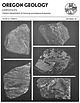 | | Journal (issue) | | OREGON GEOLOGY published by the Oregon Department of Geology and Mineral Industries VOLUME 43, NUMBER...NUMBER 9 SEPTEMBER 1981 OREGON GEOLOGY (ISSN 0164-3304) VOLUME 43, NUMBER 9 SEPTEMBER 1981 Published...Published monthly by the State of Oregon Department of Geology and Mineral Industries (Volumes 1 through 40 were...subscription orders, renewals, and changes of address to Oregon Ge%gy, 1005 State Office Building, Portland, OR...information contained herein. Credit given to the Oregon Department of Geology and Mineral Industries for |  | | Journal (issue) | | OREGOM GEOLOGY published by the Oregon Department of Geology and Mineral Industries VOLUME 44, NUMBER...NUMBER 11 NOVEMBER 19B2 '" ;. OREGON GEOLOGY (ISSN 0164-3304) VOLUME 44, NUMBER 11 NOVEMBER 1982 Published...Published monthly by the State of Oregon Department of Geology and Mineral Industries (Volumes I through...phone (503) 229-5580. OIL AND GAS NEWS Columbia County Reichhold Energy Corporation drilled Adams 34-28...recently completed redrill of Columbia County 4. Clatsop County Oregon Natural Gas Development Company's Patton |  | | Report (issue) | | REsOURCES OF OREGON I SIXTH SUPPLEMENT I January l, 1971 to Dec ember 31, 1975 STATE OF OREGON DEPAIItTME:NT...GEOLOGY AND MINI!:RAL 1978 INDUSTRIES STATE OF OREGON DEPARTMENT OF GEOLOGY AND MINERAL INDUSTRIES 1069...1069 State Office Building Portland, Oregon 97201 BULLETIN 97 BIBLIOGRAPHY of the GEOLOGY and MINERAL...MINERAL RESOURCES S i xt h of OREGON Supplement January 1, 1971 to December 31, 1975 Compiled by...Va. 22041 with the assistance of Ainslie Bricker Oregon Department of Geology and Mineral Industries Edited |  | | Report (issue) | | hydrothermal minerals in the Cascade Mountains of northern Oregon by Keith E. Bargar and Robert L. Oscarson Open-File...area ........................................ .6 Newberry volcano ........................................from outcrops and geothermal drill holes in the Oregon Cascade Mountains ................... 24 4. Scanning...specimens and late Tertiary volcanic rock outcrop samples in three areas of the Oregon Cascade Mountains (near...Breitenbush-Austin Hot Springs area, and Newberry Volcano). The Neogene to Holocene volcanic rocks contain euhedral to |  | | Report (issue) | | Cenozoic tectonics of the Cascade arc, Washington, Oregon, and California Ray E. Wells..................... and regional tectonic setting of the Cascade volcanic province Richard J. Blakely and Robert C. Jachens...circulation in the Cascade Range, north-central Oregon Steve E. Ingebritsen, David R. Sherrod, and Robert...Robert H. Mariner.. 122 Heat flow in the Oregon Cascade Range and its correlation with regional gravity...Range in Oregon David R. Sherrod and LedaBeth G. Pickthorn..................... 351 Volcanic history |  | | Report (issue) | | STATE OF OREGON DEPARTMENT OF GEOLOGY AND MINERAL INDUSTRIES 1005 State Office Building Portland, Oregon...BIBLIOGRAPHY OF THE GEOLOGY AND MINERAL RESOURCES OF OREGON Seventh Supplement January 1, 1976, to December...Geological Institute Debbie Burnetti, Editor and Oregon Department of Geology and Mineral Industries Klaus................ ............. .. iii Map showing Oregon counties . . . . . . . . . . . . . . . . . . ..... . . . . . . . . . . . . . . . . . .. . .. 25 County index . . . . . . . . . . . . . . . . . . . |  | | Journal (issue) | | OREGOM GEOLOGY published by the Oregon Department of Geology and Mineral Industries VOLUME 43, NUMBER...NUMBER 2 FEBRUARY 1981 OREGON CEOLOGY (ISSN 0164-3304) VOLUME 43, NUMBER 2 FEBRUARY 1981 Published monlh...monlh ly by the State of Oregon Department of Geology and Mineral Industries (Volumes I through 40 were...subscription orders. renewals, and changes of address to Oregon Geology, 1005 State Office Building, Pordand, OR...Springs and rotation of the Western Cascades of Oregon The Oregon Department of Geology and Mineral Industries |  | | Journal (article/letter/editorial) | | middle of the Mexican Volcanic Belt (MVB), a vast Miocene-Recent, E-W–oriented volcanic province spanning...(XRD) methods. Hydrothermal quartz, calcite, and pyrite, as well as other alteration mineral phases (e...active geothermal field located in the Mexican Volcanic Belt (MVB), 200 km northwest of Mexico City. With...geothermal field is distinguished by extensive Neogene volcanic rocks, dominated by andesitic and basaltic lavas...rocks of Late Mesozoic to Oligocene age. The pre-volcanic basement consists of gently folded shales, sandstones |  | | Report (issue) | | heulandite, and tiny cubic pyrite crystals, b. Framboidal clusters of pyrite crystals and natrojarosite...370 m) were collected for this investigation. Volcanic glass and open spaces of fractures, vesicles,...drill holes located both outside and within the caldera show the effects of hydrothermal alteration. The...(DonnellyNolan and others, 1990). The most recent volcanic activity (about 900 years ago), at Glass Mountain...Mountain, occurs in the vicinity of the 7 x 12 km caldera (Figure 2) (Donnelly-Nolan and others, 1990). Figure |  | | Journal (article/letter/editorial) | | elsevier.com/locate/oregeorev The Southeast Missouri (USA) Proterozoic iron metallogenic province—Types of...University of Central Missouri, Warrensburg, MO 64093, USA ARC Centre of Excellence in Ore Deposits, University...Available online 10 October 2013 Keywords: Missouri (USA) iron district Proterozoic Magnetite Hematite IOCG-IOA...IOCG-IOA a b s t r a c t The Southeast Missouri (USA) iron metallogenic province within the Mesoproterozoic...oxide magma, and/or by hydrothermal replacement of volcanic rocks. Iron oxides within all district deposits |  | | Report (issue) | | hot springs provided a basis for establishing national parks (e.g. Yellowstone) and spas, and in exceptional...heating (e.g. Boise, Idaho, and Klamath Falls, Oregon). But no large-scale, systematic efforts were made...made to assess and develop geothermal energy as a national resource. By the late 1960's, it was clear both...purchase gasoline for their automobiles. As part of a national effort to become less dependent upon petroleum...1970 studies of geothermal systems in Yellowstone National Park, probably the most abundantly endowed natural |  | | Report (issue) | | Reconnaissance geology of the Mount Edgecumbe volcanic field, Kruzof Island, southeastern Alaska, by...Concentric structure in elongate pillows, Amador County, Calif., by W. A. Duffield._______________________________...lapilli deposits from Central Pumice Cone, Newberry Caldera, Oreg., by M. W. Higgins______ Similarity...__________ Ultramafic xenoliths in basalt, Nye County, Nev., by N. J. Trask___-____-___________----_...Pink copper-bearing prehnite from Isle Royale National Park, Mich., by N. K. Huber_____________________________ |  | | Report (issue) | | Washington. Lower left: South Sister Volcano, Oregon, viewed from south. Devil’s Hill rhyodacite dome...the lava dome at Mount St. Helens, Washington, (USA), 1981-1983 ........ D. A. Swanson, D. Dzurisin...J. Casadevall, J. W. Ewert, and C. C. Heliker Volcanic activity at Santiaguito volcano, 1976-1984 oo...eruptions on the flanks of South Sister volcano, Oregon ......... William E. Scott Tephra deposits associated...structures in the 600-year-old lavas of the Inyo volcanic chain, eastern California ......... 0c ccc eee |  | | Journal (article/letter/editorial) | | volcaniclastic rocks from a sulfur- and pyrite-rich clay deposit in the Oregon Cascades. The deposit is located...fault zone west of Crater Lake, in Eocene-age volcanic rocks. Mineralogical relationships were used to...Black clay with elemental sulfur and up to 19 wt % pyrite. Low-sulfidation, mixed magmatic-meteoric fluids...containing reduced Fe-bearing rectorite and minor pyrite (4–5 wt %). White clay containing smectite and...from the oxidation of pyrite. Antibacterial activity is greatest in the pyrite-bearing clays but the |  | Mosser-Ruck, Régine, Pignatelli, Isabella, Bourdelle, Franck, Abdelmoula, Mustapha, Barres, Odile, Guillaume, Damien, Charpentier, Delphine, Rousset, Davy, Cathelineau, Michel, Michau, Nicolas (2016) Contribution of long-term hydrothermal experiments for understanding the smectite-to-chlorite conversion in geological environments. Contributions to Mineralogy and Petrology, 171 (11) doi:10.1007/s00410-016-1307-z | Journal (article/letter/editorial) | | Gray, 25030 Besançon Cedex, France 7 Institut National de Recherche et de Sécurité (I.N.R.S), Avenue...in numerous environments: hydrothermal altered volcanic rocks (Krismannsdottir 1979; Alt et al. 1986;...with less than 15 % mixed layers, in the altered volcanic sequence of the Chipilapa geothermal system in...mineral. It is the MX80 Na, Ca-bentonite (Wyoming, USA), which is mostly composed of montmorillonite (79...carbonates (2 %), mica (3 %) and other minerals (pyrite, phosphates and hematite, 2 %), all presenting |  | | Report (issue) | | Geological Survey (USGS). The USGS has three national programs in mineralrelated studies. The Development...This information is essential for formulating a national mineral policy and for identifying secure foreign...mineral resources in covered areas of Alaska. The National Mineral Resources Assessment Program (NAMRAP)...communities, and all those who are concerned with national mineral policy and land use decisions. These mineralresource...land. The result is an integrated approach to national mineral-resource problems. VI PROGRAM TUESDAY |  | | Journal (article/letter/editorial) | | Albite Sphene Epidote Actinolite Calcite Hematite Pyrite D l s t a n c ef r o m D l o r i t e I n t r u...fine-grained biotite, actinolite, chlorite, hematite, and pyrite. Thesesecondary minerals have crystallized along...hematite is commonly found in the rocks of Zones II-Y, pyrite is rare in the other zones. As already reported...metasandstones, Salton Sea geothermal field, Calience of pyrite in the diorite mass may suggestlocal cirfornia...to the thrust-faulted disturbed belt of Montana, USA. Societyof Economic Paleontologistsand Mineralogists |  | | Report (volume) | | ........................ 41 50. Dark-gray clay-pyrite rich matrix of the Osceola Mudflow..................................... 42 52. Typical smectite-pyrite alteration of andesite clast in the Osceola Mudflow..... 43 54. Back-scattered SEM image of smectite-pyrite alteration of andesite clast in the Osceola Mudflow...this alteration resulted in severely weakened volcanic edifices that were susceptible to failure and...and in the Osceola Mudflow, Washington altered volcanic rocks, one covering about 20 km2 on the north |  | | Book (volume) | | HALKA CHRONIC PAGES OF STONE GEOLOGY OF WESTERN NATIONAL PARKS & MONUMENTS 2: SERRA NEVADA, CASCADES,...Half Dome, Yosemite National Park. Inset: Jointed volcanic rock, Mount Rainier National Park. Manufactured...and Pacific Coast. 1. Geology—West (U.S.) 2. National parks and reserves—West (U.S.) 3. Natural monuments—West...Part 2. National Parks and Monuments Cabrillo National Monument Channel Islands National Park Crater...Crater Lake National Park Devils Postpile National Monument John Day Fossil Beds National Monument Lassen |  | | Report (issue) | | complex and difficult, and more critical to the National Welfare. W^ V. E. McKELVEY, Director III CONTENTS...___72 California ___________________________72 Oregon ____________________________________76 Regional...___123 Nevada _____________________________124 Oregon _____________________________124 Washington __...coordination, acquisition, and storage _ _______124 National water data exchange ____________126 Water-data...___________________127 Water use ________________________127 National water-quality programs _ _ _ _ _ __ _132 Marine |  | | Report (volume) | | Road) near town of Abel, Cleburne County. Absaroka Supergroup/Volcanic Supergroup U ABRK03 1. Eocene 2...10. Type area: Absaroka volcanic field, Yellowstone National Park, Park County, Wyo. Academy Church Shale...W1/2NW1/4NE1/4SE1/4 sec. 1, T. 3 s., R. 2 E., Carter County. Adams Formation ADMS01 1. Holocene 2. Alaska (SE)...Quadrangle, lat 45° N., long 70°50'-55' W., Oxford County. Adamstown Member (Frederick Limestone) U ADMS06...section W of Lime Kiln in Frederick Valley, Frederick County. Named for town of Adamstown. Adobe Town Member |  | | Book | | 75 CENOZOIC VOLCANISM IN THE NEWBERRY MOUNTAINS, SAN BERNARDINO COUNTY, CALIFORNIA . . . . . . . . .... • • • • • • • • • ♦ • ■ SAN DIEGO COUNTY, CALIFORNIA . . . . . . . . . . . . . . . . . ...transform system itself, local sedimentary basins and volcanic fields re l ated 3 to Neogene passage of the...oceanic hotspot tracks composed of seamounts and volcanic islands. Uncertainties about the timing of some...specifically from the potassium gradients in arc volcanic rocks (Keith, 1978). During latest Cretaceous |  | | Report (issue) | | ________________ Lithium investigations in sedimentary and volcanic rocks ______________________ Phosphate investigation...—— —— _______ California _______________-_—————— Oregon ___________——-——--———-_-Washington _——————————————————...______________________ Nevada _____________________ Oregon ________________———___ Washington _________________...Coordination ___ Water-data storage system _____—__ National Water Data Exchange _____ Urban water program...program ________—__ Water use _____________________ National water quality programs ______ The Regional Aquifer-System |
|


