Kintore-Kunanalling Goldfield, Coolgardie Shire, Western Australia, Australia
This page is currently not sponsored. Click here to sponsor this page.

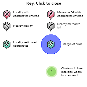
Key
Lock Map
| Latitude & Longitude (WGS84): | 30° 40' 58'' South , 121° 3' 58'' East |
|---|---|
| Latitude & Longitude (decimal): | -30.68294,121.06637 |
| GeoHash: | G#: qdw16ymff |
| Locality type: | Ore Field |
| Köppen climate type: | BSh : Hot semi-arid (steppe) climate |
The Kintore-Kunanalling Goldfield follows the north north-east to south south-east striking Kunanalling Shear Zone, with gold occurrences along its length. These start from the Northlander Group approximately 35 kilometres north of Coolgardie to the Castle Hill Group approximately 50 kilometres north of Coolgardie. Most deposits/mines are close to the west and east sides of the Coolgardie North Road which follows the trend of the Kunanalling Shear.
Kunanalling itself sits mid-way, and is a former town, now marked only be a set of hotel ruins. Kintore is at the northern end of the field at the intersection of the Jaurdi Hills Road, surrounded by historic mines, and newly discovered prospects of the Castle Hill Group.
Mining started in 1895, and is marked now by numerous shafts, near surface alluvial workings, and underground mines, accessing high grade shoots. The area was initially known as 25 Mile, its distance from Coolgardie. More recently from the 1990's several deposits were developed as open pits on low grade oxidised ore.
The area sits at the eastern edge of the Coolgardie Domain, dominated by the mafic and ultramafic rocks of the Hampton Hill Formation. The Kunanalling Shear is a prominent regional scale structural feature, as a 500 metres wide zone of folded, mafic to ultramafic volcanics, with minor black shales. This is cut by a series of brittle faults and shear zones. It is frequently intruded by dykes.
Exploration in the 1960's and 1970's was sporadic, and difficult with fragmented tenement ownership. In the early 1990's AFMECO Pty Ltd and Goldfields Pty Ltd began consolidating the tenements. From 2003, Cazaly Resources continued the consolidation. Cazaly became more interested in iron ore, than gold, and sold the leases to newly formed Phoenix Gold. Phoenix expanded the leases it controlled by purchasing the leases to the north-east on what is called the Zuleika Shear, and some leases further north-east around Ora Banda.
Commodity List
This is a list of exploitable or exploited mineral commodities recorded from this region.Mineral List
Mineral list contains entries from the region specified including sub-localities8 valid minerals.
Rock Types Recorded
Note: this is a very new system on mindat.org and data is currently VERY limited. Please bear with us while we work towards adding this information!
Rock list contains entries from the region specified including sub-localities
Select Rock List Type
Alphabetical List Tree DiagramLocalities in this RegionShow map
Australia
- Western Australia
- Coolgardie Shire
- Western Australia
- Coolgardie Shire
- Kintore-Kunanalling Goldfield
- Coolgardie Shire
This page contains all mineral locality references listed on mindat.org. This does not claim to be a complete list. If you know of more minerals from this site, please register so you can add to our database. This locality information is for reference purposes only. You should never attempt to
visit any sites listed in mindat.org without first ensuring that you have the permission of the land and/or mineral rights holders
for access and that you are aware of all safety precautions necessary.
References
Sort by Year (asc) | by Year (desc) | by Author (A-Z) | by Author (Z-A)
Phoenix Gold Ltd (2010), Prospectus, 20/10/2010 (Wilson, G., Independent Geologist's Report, Zuleika-Kunanalling Project Kalgoorlie Western Australia, 09/09/2010)


Catherwood Gold Mine, Catherwood Group, Kintore-Kunanalling Goldfield, Coolgardie Shire, Western Australia, Australia