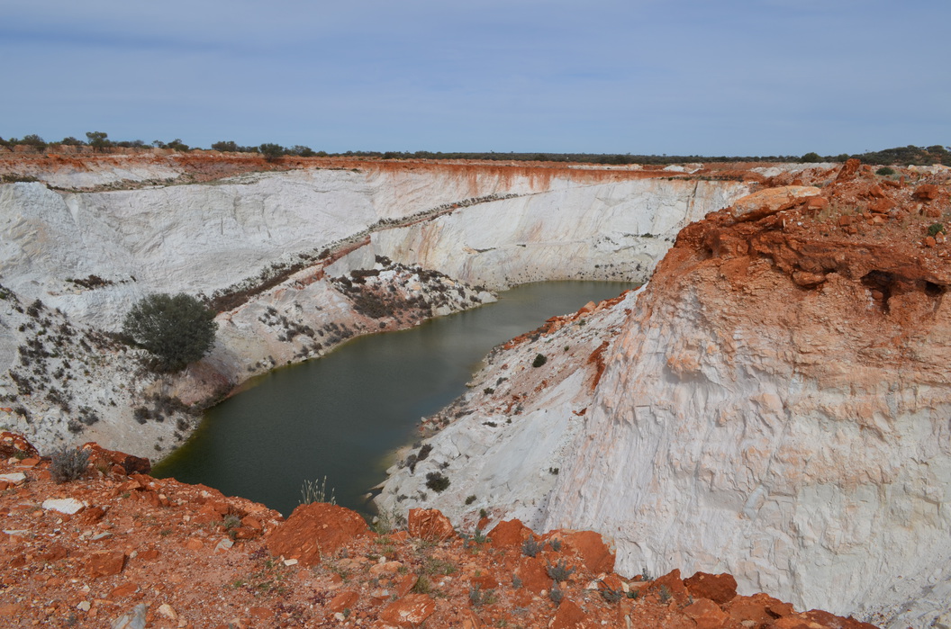
Turn of the Tide Gold Mine, Reedy's Goldfield, Cue Shire, Western Australia, Australia

| Latitude & Longitude (WGS84): | 27° 6' 9'' South , 118° 20' 26'' East |
|---|---|
| Latitude & Longitude (decimal): | -27.10266,118.34066 |
| GeoHash: | G#: qehjufj59 |
| Locality type: | Mine |
| Köppen climate type: | BWh : Hot deserts climate |
Appropriate to the mine's name, too much water was always a problem for this mine. The original prospectors were Bayley and Parkins, who took out ore from a prospecting shaft between 1916 to 1921. They obtained 307 tonnes of ore for 3201 oz averaging 10 oz/t.
Crushings were found for 1922 and 1924, but by whom is not known. At this time one source states there are thirty shafts covering a length of one mile, the deepest shaft to 120 feet.
Things really got going in June 1935 when the Turn of the Tide Gold Mines (Reedy's) Ltd was formed with 100 000 pounds capital. Most of this was spent erecting a gold processing plant, expanding the two head battery, and installing cyanide vats to cope with the fine gold. The leases covered 270 acres. Keeping the water levels down was a constant battle as noted in the mine managers weekly prosaic mine reports. The mine was a large low grade affair with gold leaders, and finely disseminated gold in kaolin. Gold was said to increase with the presence of tourmaline (probably schorl).
By mid 1937, the costs involved in keeping the water under control led the company to let the mine to tributors. The mine flooded as a result. Six months later new tributors called Maifri and Party took over with little more success. By 1939 the plant and machinery was being sold off, and another group of shareholders had their fingers burn't. The present open pit was developed in the 1980's or 90's and swallowed up the old workings.
Commodity List
This is a list of exploitable or exploited mineral commodities recorded at this locality.Mineral List
3 valid minerals.
Regional Geology
This geological map and associated information on rock units at or nearby to the coordinates given for this locality is based on relatively small scale geological maps provided by various national Geological Surveys. This does not necessarily represent the complete geology at this locality but it gives a background for the region in which it is found.
Click on geological units on the map for more information. Click here to view full-screen map on Macrostrat.org
| Archean 2500 - 4000 Ma ID: 788698 | felsic volcanic rocks 74291 Age: Archean (2500 - 4000 Ma) Description: Felsic volcanic and volcaniclastic rocks, locally amygdaloidal or fragmental; dacite, quartz-feldspar porphyry, tuff, agglomerate, andesitic lava, quartz-muscovite schist, felsic schist, felsic gneiss Comments: igneous felsic volcanic; igneous volcanic; synthesis of multiple published descriptions Lithology: Igneous felsic volcanic; igneous volcanic Reference: Raymond, O.L., Liu, S., Gallagher, R., Zhang, W., Highet, L.M. Surface Geology of Australia 1:1 million scale dataset 2012 edition. Commonwealth of Australia (Geoscience Australia). [5] |
| Neoarchean - Mesoarchean 2500 - 3200 Ma ID: 3188304 | Archean volcanic rocks Age: Archean (2500 - 3200 Ma) Comments: Yilgarn Craton Lithology: Greenstone belt; mafic-ultramafic volcanic rocks Reference: Chorlton, L.B. Generalized geology of the world: bedrock domains and major faults in GIS format: a small-scale world geology map with an extended geological attribute database. doi: 10.4095/223767. Geological Survey of Canada, Open File 5529. [154] |
Data and map coding provided by Macrostrat.org, used under Creative Commons Attribution 4.0 License
References


Turn of the Tide Gold Mine, Reedy's Goldfield, Cue Shire, Western Australia, Australia