| Locality | Latitude | Longitude | Distance | Bearing |
|---|
| Oxlow End Mine, Oxlow Rake, Peak Forest, High Peak, Derbyshire, England, UK | 53° 18' 55" N | 1° 49' 1" W | 1.3km (0.8 miles) | |
| Eldon Hill Mine, Peak Forest, High Peak, Derbyshire, England, UK | 53° 19' 36" N | 1° 49' 32" W | 1.5km (0.9 miles) | |
| North Grain Head Mine, Peak Forest, High Peak, Derbyshire, England, UK | 53° 19' 26" N | 1° 49' 0" W | 1.6km (1.0 miles) | |
| Eldon Hill Quarry, Peak Forest, High Peak, Derbyshire, England, UK | 53° 19' 45" N | 1° 49' 41" W | 1.6km (1.0 miles) | |
| Starvehouse Mine, Peak Forest, High Peak, Derbyshire, England, UK | 53° 19' 2" N | 1° 48' 27" W | 1.9km (1.2 miles) | |
| Bee Low Quarry, Peak Forest, High Peak, Derbyshire, England, UK | 53° 18' 32" N | 1° 51' 49" W | 1.9km (1.2 miles) | |
| Clear-the-way Mine, Oxlow Rake, Peak Forest, High Peak, Derbyshire, England, UK | 53° 19' 13" N | 1° 48' 28" W | 2.0km (1.2 miles) | |
| Slitherstone Mine, Peak Forest, High Peak, Derbyshire, England, UK | 53° 19' 45" N | 1° 48' 54" W | 2.1km (1.3 miles) | |
| Portaway Mine (Portway Mine), Peak Forest, High Peak, Derbyshire, England, UK | 53° 19' 31" N | 1° 48' 30" W | 2.2km (1.3 miles) | |
| Portaway Pit (Portway Pit; Gravel pit; Old Wham vein), Castleton, High Peak, Derbyshire, England, UK | 53° 19' 36" N | 1° 48' 30" W | 2.2km (1.4 miles) | |
| Cop Mine, Bradwell, Derbyshire Dales District, Derbyshire, England, UK | 53° 18' 59" N | 1° 47' 58" W | 2.4km (1.5 miles) | |
| Dove Holes Quarry, Peak Forest, High Peak, Derbyshire, England, UK | 53° 18' 1" N | 1° 51' 56" W | 2.5km (1.6 miles) | |
| Old Moor Mine, Castleton, High Peak, Derbyshire, England, UK | 53° 19' 26" N | 1° 47' 58" W | 2.6km (1.6 miles) | |
| Wham Engine Mine, Castleton, High Peak, Derbyshire, England, UK | 53° 19' 38" N | 1° 48' 1" W | 2.8km (1.7 miles) | |
| Barmoor Colliery, Chapel-en-le-Frith, High Peak, Derbyshire, England, UK | 53° 18' 46" N | 1° 52' 58" W | 3.1km (1.9 miles) | |
| Hazard Mine, Dirtlow Rake, Castleton, High Peak, Derbyshire, England, UK | 53° 19' 37" N | 1° 47' 39" W | 3.1km (1.9 miles) | |
| Hollandtwine Mine, Dirtlow Rake, Castleton, High Peak, Derbyshire, England, UK | 53° 19' 41" N | 1° 47' 28" W | 3.3km (2.1 miles) | |
| Bradwell Moor, Bradwell, Derbyshire Dales District, Derbyshire, England, UK | 53° 19' 12" N | 1° 47' 7" W | 3.4km (2.1 miles) | |
| Windy Knoll Quarry, Castleton, High Peak, Derbyshire, England, UK | 53° 20' 37" N | 1° 48' 43" W | 3.6km (2.2 miles) | |
| Dirtlow Stone Mine (incl. Bennett Grove; Bullock Grove), Dirtlow Rake, Castleton, High Peak, Derbyshire, England, UK | 53° 19' 47" N | 1° 47' 6" W | 3.8km (2.3 miles) | |
| Mam Tor Mine, Castleton, High Peak, Derbyshire, England, UK | 53° 20' 43" N | 1° 48' 38" W | 3.8km (2.3 miles) | |
| Winnats Pass, Castleton, High Peak, Derbyshire, England, UK | 53° 20' 25" N | 1° 47' 48" W | 3.8km (2.4 miles) | |
| Old Tor Mine, Castleton, High Peak, Derbyshire, England, UK | 53° 20' 29" N | 1° 47' 53" W | 3.9km (2.4 miles) | |
| Tideslow Rake, Tideswell, Derbyshire Dales District, Derbyshire, England, UK | 53° 18' 1" N | 1° 46' 56" W | 4.0km (2.5 miles) | |
| Blue John Mine (Blue John Cavern), Castleton, High Peak, Derbyshire, England, UK | 53° 20' 44" N | 1° 48' 12" W | 4.0km (2.5 miles) | |
| White Rake, Tideswell, Derbyshire Dales District, Derbyshire, England, UK | 53° 17' 54" N | 1° 46' 56" W | 4.0km (2.5 miles) | |
| Slate Scrin Mine, Castleton, High Peak, Derbyshire, England, UK | 53° 20' 17" N | 1° 47' 21" W | 4.0km (2.5 miles) | |
| Cowlow Nick, Castleton, High Peak, Derbyshire, England, UK | 53° 20' 17" N | 1° 47' 18" W | 4.1km (2.5 miles) | |
| Speedwell Mine (Oakden Level), Castleton, High Peak, Derbyshire, England, UK | 53° 20' 28" N | 1° 47' 31" W | 4.1km (2.6 miles) | |
| Mam Tor, Edale, High Peak, Derbyshire, England, UK | 53° 20' 56" N | 1° 48' 38" W | 4.1km (2.6 miles) | |
Minerals recorded nearby (within 4.1 km)
Rock types recorded nearby (within 4.1 km)
Entries shown in red are rocks recorded for this region.

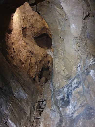


Speedwell Mine, Castleton, High Peak, Derbyshire, England, UK