| Locality | Latitude | Longitude | Distance | Bearing |
|---|
| Bimetallist Mine, Sneffels Mining District, Ouray County, Colorado, USA | 37° 58' 50" N | 107° 44' 8" W | 0.0km (0.0 miles) | |
| Happy Jack Mine, Sneffels Mining District, Ouray County, Colorado, USA | 37° 58' 22" N | 107° 43' 46" W | 1.0km (0.6 miles) | |
| Torpedo Eclipse Mine, Sneffels Mining District, Ouray County, Colorado, USA | 37° 58' 35" N | 107° 44' 51" W | 1.1km (0.7 miles) | |
| Monster Mine, Sneffels Mining District, Ouray County, Colorado, USA | 37° 58' 12" N | 107° 44' 1" W | 1.2km (0.7 miles) | |
| Wheel of Fortune Mine, Sneffels Mining District, Ouray County, Colorado, USA | 37° 58' 27" N | 107° 44' 49" W | 1.2km (0.7 miles) | |
| Upper Wheel of Fortune Mine, Sneffels Mining District, Ouray County, Colorado, USA | 37° 58' 18" N | 107° 44' 47" W | 1.3km (0.8 miles) | |
| Sneffels (Sneffels Camp), Sneffels Mining District, Ouray County, Colorado, USA | 37° 58' 30" N | 107° 44' 59" W | 1.4km (0.9 miles) | |
| Palmetto Mine, Sneffels Mining District, Ouray County, Colorado, USA | 37° 58' 3" N | 107° 44' 20" W | 1.4km (0.9 miles) | |
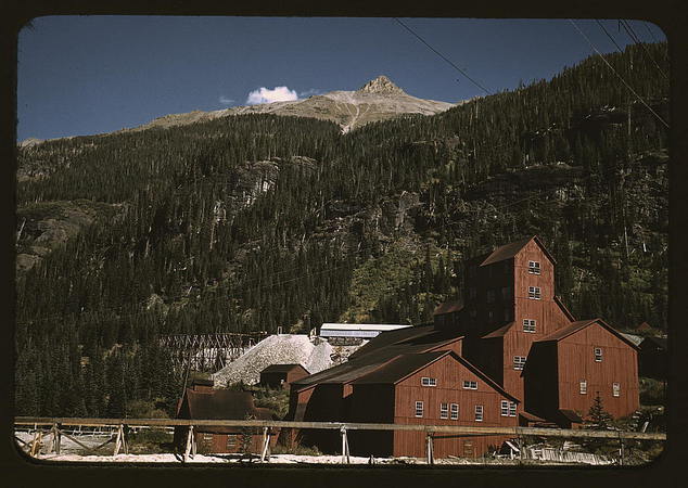
| Camp Bird Mine, Imogene Basin, Sneffels Mining District, Ouray County, Colorado, USA | 37° 58' 10" N | 107° 43' 32" W | 1.5km (0.9 miles) | |
| Revenue Mine, Sneffels Mining District, Ouray County, Colorado, USA | 37° 58' 24" N | 107° 45' 2" W | 1.5km (0.9 miles) | |
| Hawkeye Claims, Sneffels Mining District, Ouray County, Colorado, USA | 37° 58' 0" N | 107° 43' 59" W | 1.6km (1.0 miles) | |
| San Pedro Mine, Sneffels Mining District, Ouray County, Colorado, USA | 37° 57' 52" N | 107° 44' 40" W | 1.9km (1.2 miles) | |
| Atlas Mine, Sneffels Mining District, Ouray County, Colorado, USA | 37° 58' 15" N | 107° 45' 17" W | 2.0km (1.2 miles) | |
| US Depository Mine, Sneffels Mining District, Ouray County, Colorado, USA | 37° 57' 39" N | 107° 43' 54" W | 2.2km (1.4 miles) | |
| Senator Gulch, Ouray County, Colorado, USA | 37° 59' 7" N | 107° 42' 39" W | 2.2km (1.4 miles) | |
| Pink Rose Mine, Imogene Basin, Sneffels Mining District, Ouray County, Colorado, USA | 37° 57' 45" N | 107° 43' 26" W | 2.2km (1.4 miles) | |
| Ruby Trust Mine, Sneffels Mining District, Ouray County, Colorado, USA | 37° 58' 58" N | 107° 45' 41" W | 2.3km (1.4 miles) | |
| Mogul Prospect, Governor Basin, Sneffels Mining District, Ouray County, Colorado, USA | 37° 58' 34" N | 107° 45' 43" W | 2.3km (1.5 miles) | |
| Upper Atlas Mine, Sneffels Mining District, Ouray County, Colorado, USA | 37° 58' 0" N | 107° 45' 34" W | 2.6km (1.6 miles) | |
| Fredonia Mine, Sneffels Mining District, Ouray County, Colorado, USA | 37° 57' 43" N | 107° 45' 12" W | 2.6km (1.6 miles) | |
| Pilot Mine, Yankee Boy Basin, Sneffels Mining District, Ouray County, Colorado, USA | 37° 59' 5" N | 107° 45' 57" W | 2.7km (1.7 miles) | |
| Flagstaff Mine, Governor Basin, Sneffels Mining District, Ouray County, Colorado, USA | 37° 58' 47" N | 107° 46' 0" W | 2.7km (1.7 miles) | |
| Eldorado Mine, Yankee Boy Basin, Sneffels Mining District, Ouray County, Colorado, USA | 37° 59' 15" N | 107° 46' 4" W | 2.9km (1.8 miles) | |
| Governor Mine, Governor Basin, Sneffels Mining District, Ouray County, Colorado, USA | 37° 58' 41" N | 107° 46' 8" W | 2.9km (1.8 miles) | |
| Sidney Mine, Sneffels Mining District, Ouray County, Colorado, USA | 37° 57' 57" N | 107° 45' 53" W | 3.0km (1.9 miles) | |
| Yankee Boy Mine, Yankee Boy Basin, Sneffels Mining District, Ouray County, Colorado, USA | 37° 59' 25" N | 107° 46' 6" W | 3.1km (1.9 miles) | |
| Yellow Rose Mine, Imogene Basin, Sneffels Mining District, Ouray County, Colorado, USA | 37° 57' 17" N | 107° 43' 22" W | 3.1km (1.9 miles) | |
| Bankers Tunnel, Imogene Basin, Sneffels Mining District, Ouray County, Colorado, USA | 37° 57' 24" N | 107° 43' 4" W | 3.1km (1.9 miles) | |
| Lower Mountain Top Mine, Governor Basin, Sneffels Mining District, Ouray County, Colorado, USA | 37° 58' 32" N | 107° 46' 23" W | 3.3km (2.1 miles) | |
| Hidden Treasure Mine, Imogene Basin, Sneffels Mining District, Ouray County, Colorado, USA | 37° 57' 0" N | 107° 43' 56" W | 3.4km (2.1 miles) | |

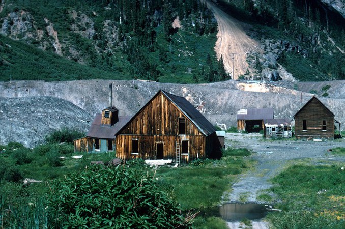


Sneffels, Sneffels Mining District, Ouray County, Colorado, USA