| Locality type: | Creek |
| Classification |
|---|
|
| Species: | Silver |
| Formula: | Ag |
| Confirmation |
|---|
|
| Validity: | Believed Valid |
| Data |
|---|
|
| Mineral Data: | Click here to view Silver data |
| Locality Data: | Click here to view Dismal Swamp Creek, Tenterfield district, Buller Co., New South Wales, Australia |
| Data Identifiers |
|---|
|
| Mindat Occurrence Record ID: | 942217 |
| Long-form Identifier: | 1:3:942217:9 |
| GUID (UUID V4): | 05bd8cd8-c24a-473f-9635-5ff9f442fcc8 |
| Nearest other occurrences of Silver |
|---|
|
|
| 2.1km (1.3 miles) | ⓘCarbine reef, Tenterfield district, Buller Co., New South Wales, Australia |
| 2.2km (1.4 miles) | ⓘSilver shaft, Tenterfield district, Buller Co., New South Wales, Australia |
| 3.7km (2.3 miles) | ⓘBill Wins reef, Tenterfield district, Buller Co., New South Wales, Australia |
| 3.8km (2.4 miles) | ⓘBasket Swamp North prospect 2, Tenterfield district, Buller Co., New South Wales, Australia |
| 4.0km (2.5 miles) | ⓘBasket Swamp North prospect 1, Tenterfield district, Buller Co., New South Wales, Australia |
| 4.0km (2.5 miles) | ⓘBasket Swamp Silver lodes (Basket Swamp Creek lode; Basket Creek lode), Tenterfield, Clive Co., New South Wales, Australia |
| 4.8km (3.0 miles) | ⓘAnnie reef (Annie Mine; Isobel Mine; Vickerys reef; Claverie & Nelmes Mine), Tenterfield district, Buller Co., New South Wales, Australia |
| 15.4km (9.6 miles) | ⓘWalsh and Co deposit, Drake district, Buller Co., New South Wales, Australia |
| 15.5km (9.6 miles) | ⓘJohnson & party reef, Drake district, Buller Co., New South Wales, Australia |
| 16.0km (9.9 miles) | ⓘHappy Valley reef (Hurleys reef), Drake district, Buller Co., New South Wales, Australia |
| References |
|---|
|
|
| Reference Search (possible matching items) |
|---|
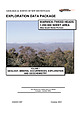 | | Report (Issue volume) | | OF NEW SOUTH WALES EXPLORATION DATA PACKAGE WARWICK-TWEED HEADS 1:250 000 SHEET AREA (New South Wales...mines and mineral occurrences of the Rivertree silver field Map 3 - Mines and mineral occurrences of...error or omission. Therefore, the State of New South Wales and its employees disclaim liability for any...Sydney. GS2001/087 1 VOLUME 1 SUMMARY The New South Wales portion of the WarwickTweed Heads 1:250 000...northeastern New South Wales and extends over a significantly mineralised portion of the southern New England | 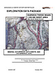 | | Report (Issue volume) | | GEOLOGICAL SURVEY OF NEW SOUTH WALES EXPLORATION DATA PACKAGE Quartz-jasper and quartz-sulphide veinlets...WARWICK-TWEED HEADS 1:250 000 SHEET AREA (New South Wales Portion) VOLUME 2 MINERAL OCCURRENCE DATA...mines and mineral occurrences of the Rivertree silver field. Map 3 - Mines and mineral occurrences of...error or omission. Therefore, the State of New South Wales and its employees disclaim liability for any...-1- VOLUME 2 CONTENTS GEOLOGICAL SURVEY OF NEW SOUTH WALES .......................................... |  | | Journal (article/letter/editorial) | | whole an elongatedarea 200 miles from north to south, and 50-100 miles from east to west, con- stituting...Tertiary in central-eastern Idaho, east of a north-south line granitic plutonsin Idaho (Table 1). Most of...(verbal commun., 1978) notes that dikes along the South Fork of the Payette River can be traced into a pluton... Tertiary plutons:A, Twin Springspluton; B, Dismal Swamp stock; C, Steel Mountain stock; D, Sawtooth...Canyon stock; H, Summit Creek stock; I, Pioneer Mountain stock; J, Lake Creek pluton; K, Mackay stock; |
|


