| Locality type: | Road Cutting |
| Classification |
|---|
|
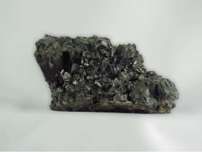
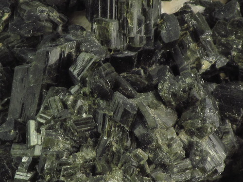
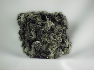
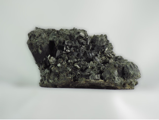
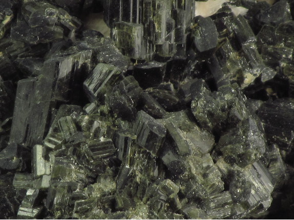
| Species: | Actinolite |
| Formula: | ◻Ca2(Mg4.5-2.5Fe0.5-2.5)Si8O22(OH)2 |
| Comments: | Dark green crystals to 12 mm associated with orange Calcite, Black Uvite Tourmaline and pale green Diopside. |
| Colour: | Dark green |
| Luminescent properties: | None Noted |
| Confirmation |
|---|
|
| Validity: | Believed Valid |
| Data |
|---|
|
| Mineral Data: | Click here to view Actinolite data |
| Locality Data: | Click here to view Highway 28 roadcut, Raglan Township, Brudenell-Lyndoch-and-Raglan, Renfrew County, Ontario, Canada |
| Photo Gallery | View Gallery (5 photos) |
| Data Identifiers |
|---|
|
| Mindat Occurrence Record ID: | 761297 |
| Long-form Identifier: | 1:3:761297:8 |
| GUID (UUID V4): | 3ca758ab-b12b-427c-89c9-14f45dbcbe42 |
| Nearest other occurrences of Actinolite |
|---|
|
|
| 9.2km (5.7 miles) | ⓘHighway 28 roadcut, Mayo Township, Hastings County, Ontario, Canada |
| 13.2km (8.2 miles) | ⓘCrawford Quarry, Quadeville area, Lyndoch Township, Brudenell-Lyndoch-and-Raglan, Renfrew County, Ontario, Canada |
| 13.8km (8.6 miles) | ⓘBruceton deposit, Quadeville area, Lyndoch Township, Brudenell-Lyndoch-and-Raglan, Renfrew County, Ontario, Canada |
| 14.5km (9.0 miles) | ⓘBessemer Mine, Mayo Township, Hastings County, Ontario, Canada |
| 17.9km (11.1 miles) | ⓘHighway 28 East tourmaline occurrence, Dungannon Township, Town of Bancroft, Hastings County, Ontario, Canada |
| 18.2km (11.3 miles) | ⓘYork River skarn, York River area, Dungannon Township, Town of Bancroft, Hastings County, Ontario, Canada |
| 23.3km (14.5 miles) | ⓘGraphite Road roadcut, Monteagle Township, Hastings Highlands Municipality, Hastings County, Ontario, Canada |
| 23.6km (14.7 miles) | ⓘTait farm, Dungannon Township, Town of Bancroft, Hastings County, Ontario, Canada |
| 23.6km (14.7 miles) | ⓘNear Graphite Road, Musclow Greenview Road roadcuts, Monteagle Township, Hastings Highlands Municipality, Hastings County, Ontario, Canada |
| 26.3km (16.3 miles) | ⓘHighway 62 north roadcut, Monteagle Township, Hastings Highlands Municipality, Hastings County, Ontario, Canada |
| References |
|---|
|
|


Highway 28 roadcut, Raglan Township, Brudenell-Lyndoch-and-Raglan, Renfrew County, Ontario, Canada