 | | Report (Issue volume) | | and mineral occurrences of the Rivertree silver field Map 3 - Mines and mineral occurrences of the Boonoo...metahydrothermal (eg the Lunatic gold-antimony field), granite-related, and hybrid metahydrothermal-granitic...greisens and stockworks at Wilsons Downfall, Back Creek and in the Tenterfield-Wallangarra area. They have...Paddys Flat, Pretty Gully, Lunatic and Macleod Creek area have been major gold producers and retain significant...Stanthorpe (Queensland) – Wilsons Downfall tin field. A network of watercourses draining an area of outcropping |  | | Report (issue) | | Director of the Geological Survey of Victoria, Australia. Sir ROBERT HADFIELD, Bart., lately President...Canada • • • • Australasia: Commonwealth of Australia, New Zealand , il' 57 ,I CONTENTS CHAPTER...those of the Dutch Indies, Germany, China and Australia. Before the war, smelting was carried on in Germany...days, are the United I{:ingdom, Germany, France, Australia, Austria-Hungary, Russia, Italy and Belgium. The... t912. British Empire : United Kingdom 5,254 Australia . 7,194 . India 323 Federated Malay States . 48 |  | Henley, H. F., Brown, R. E., Brownlow, J. W., Barnes, R. G., Stroud, W. J. (2001) Grafton-Maclean Metallogenic Map (SH/56-6, SH/56-7) Metallogenic Study and Mineral Deposit Data Sheets. Geological Survey of New South Wales | Report (issue) | | mineralisation. The Drake Volcanics, which lie on the northern margin of the area, represent the southern extension...well-developed contact metamorphic aureole around the northern and southwestern margins. Extensive mineralisation...(occurrence number 1028) 2. Webbs silver mine (1018) 3. Ottery mine (1312) 4. Butlers lode (1207) 5. Dutchmans.......................................... Morven Creek and Cooraldooral areas, and Sara beds ........................................... Dalmorton Gold Field ............................................... |  | | Book | | National Library of Australia Card Number and ISBN 0909223 04 1 Printed in Australia by Quadricolor Industries...Lune River; Carrick area; North coastal areas; Northern inland areas; North West; Southern; West Coast;...quarries; Zeolites; Tektites and darwin glass; Wolfram mines; Antimony mines; Scheelite mines; zinc mines;...Sisters Creek; North East; Other localities; 41 FOSSIL FIELDS — 45 Royslea Farm; Emery’s mine, Avoca;...been written previously to accurately pinpoint the field locations of these lapidary treasures, this book |  | | Book (edition) | | detail. They occur in almost every State and Territory, and are utilized in many, but the localities...John G. Smock, and that for the Eocky Mountain region by Mr. C. Whitman Cross. To these gentlemen is...miles; 3. Warrior, 5,000 square miUss. Tbe Coosa field coutuins two or three seam* 3 feet and up wards...at Broken Arrow aud Trout creek, in Sc. Clair county. The strata in this field are more faulted und broken...Cahaba field extends from the south prong of Canoe creek, in St. Clair county, to Ha\sop creek, in Bibb |  | | Journal (issue) | | mines of Western Australia. Western Australia Dept. of Mines, Report of the Western Australia Dept. of Mines...eral regions, numerous maps of min ing regions and mine workings and photo plates of mining camps and mines...Mining History of the Torrington Region of New South Wales. Australia by Eric L. Stevens 3 HISTORIC...HISTORIC MINERAL FEATURE The Field Collecting Odyssey or Peter B. Samuelson 28 by Jay L. Linil19er SIDEBAR...supplemented with mine tours, ally. it has been both a gratifying and anguishing experi field trips, and 01her |  | | Report (Issue volume) | | + 4, Mineral Fe # — of Australia and™ Papua New Guinea ...O02unse Geology of the Mineral Deposits of Australia and Papua New Guinea The COVER PHOTOGRAPH shows...Economic Geology of Australia Guinea — 1. Metals 6.* Economic Geology of Australia Guinea — 2. Coal 7...Economic Geology of Australia Guinea — 3. Petroleum 8.* Economic Geology of Australia Guinea — 4. Industrial...Industrial Minerals 9. Field Geologists’ Manual — Ist Eds M. Radmanovich and J.T. Woodcock Ed. G.J. Williams |  | | Report (Issue volume) | | and mineral occurrences of the Rivertree silver field. Map 3 - Mines and mineral occurrences of the Boonoo................................................4 Field Number ...................................................................................... 159 MINE RECORDS ..........................................and there has been only limited opportunity for field checking. There is still a need for systematic geological...have been supplemented by personal communications, field work by the authors, and certain other publications |  | | Journal (issue) | | rubber products especially built for LONG SERVICE Pioneer Belting was chosen fo convey these mountains of...morning may well have had a quarter-mile ride on Pioneer Belting. That doesn't make it sweeter—but it makes...operation was critical indeed; the decision to use PIONEER belting is evidence again of the extra service...service industrial men know they get from PIONEER products. Get this extra service yourself when you buy your...Call the PIONEER RUBBER MILLS main office, branch or distributor located nearest you: PIONEER RUBBER |  | | Journal (article/letter/editorial) | | B. Engineer Mine C. Atlin Camp D. Barkerville Wells Area E. Likely Area F. Stirrup Creek G. Dease Lake...Toodoggone Camp I. Bridge River Camp J. Harrison Gold Mine K. Hedley Camp (including Olalla) L. Stewart Camp...These explorers tended to travel through new territory in small groups, and once they got what they came...crystal 2 mm high, 5th level, Governor vein, Engineer mine, Taku Arm, Tagish Lake. This pseudohexagonal crystal...its tributaries eventually reached the Cariboo region, where the Volume 81, January/February 2006 15 |  | | Book | | Times, Singapore ; and journals in India and Australia—a course was pursued from South Africa through...through Ceylon, India, Burma, Malay Peninsula, Australia, New Zealand, and Canada. In the period mentioned...prosperity, it was clearly impracticable to visit every field of consequence ; but the omissions—amongst which...within a hundred miles of any noteworthy mining field unqualified for inclusion under the title of this... some of the minor gold and copper fields of Australia, which may be responsible for more valuable contributions |  | | Book (edition) | | MINERALOGY OF ARIZONA • Wu!fenite. Red Cloud mine, Si/...Period 20 Arizona Under Spanish Rule Arizona as a Territory 28 Statehood 48 PART 3 rr 22 NOTABLE ARIZONA...District, Cochise County 70 The Mammoth-St. Anthony Mine, Tiger, Pinal County 78 Uranium and Vanadium Deposits...Breccia Pipes 87 Pegmatites 88 "Mine Fire" Minerals, United Verde Mine, Jerome Arizona Meteorites PART...uranium and vanadium deposits; "mine fire" minerals at the United Verde mine in Jerome; and Arizona meteorites |  | | Report (volume) | | Whittteld. The Penokee Iron-Bearing Series of Northern "Wisconsin and Michigan, by Roland D. Irving and...of tie Great Sioux Reservation. A Report on the Region between the Grand and Morean Rivers, Dakota, liy...pp. Price 20 cents. 33. Notes on the Geology of Northern California, by J. S. Diller. 1886. 8°. 23 pp....cents. 40. Changes in River Courses in Washington Territory due to Glaciation, by Bailey Willis. 1887. 8°...cents. 65. Stratigraphy of the Bituminous Coal Field of Pennsylvania, Ohio, and West Virginia, by Israel |  | | Report (issue) | | MONOGRAPH 17 of Somepats oe ilar ce| + in Australia mail iii DOOO38J0754 oA., eet OF ROME prhge...IMPORTANT MINERAL DEPOSITS IN AUSTRALIA Cover Picture—The Argyle Diamond mine Photo by courtesy of Ashton...DISCOVERY OF SOME IMPORTANT MINERAL DEPOSITS IN AUSTRALIA Editors K. R. GLASSON J. H. RATTIGAN INCORPORATED...House, 191 Royal Parade, Parkville, Victoria, Australia 3052 1990 © Copyright By THE AUSTRALASIAN ...any of its publications | National Library of Australia Card No. ISBN 6 949106 57 7 Typeset by Abb-typesetting |  | | Report (volume) | | Section showing distribution of copper in Castle Dome mine (coordinate W. 1800)--------------------------------...Section showing distribution of copper in Castle Dome mine (coordinate W. 2920)---------------------------------...Before mining operations were started; B, After mine was developed______________________________________________...quadrangle. The Pinal schist, the oldest rock in the region, is composed of metamorphosed sedimentary and igneous...masses of granite porphyry south and east of the mine. The copper mineralization followed the intrusion |  | | Report (issue) | | development of the geological structure of the region. ___ . 97 Distribution of the faults ___ .... ____...-- - ___ •••• _•. _•.. _. ___ . ___ . __ . Grey mine _. . . . ___ . _____ . _.. ____ .. _. ___ . ___...mines-Continued. United Globe mines-Continued. Buffalo mine _. .- . _____ ..... _... ______________________...Billings mine _____________ . ______________ . __ .. _____ .. _____________ . _____ Big Johnnie mine _____.... ____________· _. __ .. ____________ ~ Buckeye mine ..... ______ .... _. _________________ . ___ .: | | | Book (edition) | | zy MINERALOGY OF ARIZONA Wulfenite. Red Cloud mine, Silver district, Trigo Mountains, La Paz County...Period 20 Arizona Under Spanish Rule Arizonaasa Territory 28 Statehood PART 3 NOTABLE AND wu MINERALOGY...District, Cochise County The Mammoth-St. Anthony Mine, Tiger, Pinal County Uranium and Vanadium Deposits...Breccia Pipes 87 Pegmatites 88 “Mine Fire” Minerals, United Verde Mine, Jerome Arizona Meteorites 93 PART...uranium and vanadium deposits; “mine fire” minerals at the United Verde mine in Jerome; and Arizona meteorites |  | | Report (volume) | | Scanlan conglomerate__ ._____________________ ___ Pioneer formation_______________________________________...deposit--_________--_--___-__-__---__--_--_-__-Workman Creek area...._________________________________ ____ Hope...geology and mine workings, Red Bluff mine area. v 47. Geologic map and sections of the Workman Creek area,...of the Dripping Spring quartz^ ite, Sierra Ancha region, Ariz____ __ _______ ", 54. Scatter diagrams showing...adit-___________________ ' 60. Maps of mine workings A, B, and C, Red Bluff mine.___ v( 61. Composite map of the |  | | Report (volume) | | rocks, including the Lower Mississippian McGowan Creek Formation and the Upper Mississippian White Knob...Gordon P. Eaton, Director Published in the Central Region, Denver, Colorado Manuscript approved for publication...understanding of the important ore deposits in the region proved invaluable to the success of this project...quadrangle, Idaho: U.S. Geological Survey Miscellaneous Field Studies Map MF-2160-A, scale 1:250,000. Winkler...Deposits of the Muldoon-Star Hope Area, Southern Pioneer Mountains, SouthCentral Idaho By Gary R. Winkler |  | | Book (edition) | | enabled to bring into view the discoveries in this field, subject added up to date. and to give a ...also added to the catalogue a number of rare min- region, erals, and some new to science. Among leyite...localities in From Mr. G. of the neighboring gold region. als at is of mineral B. Hanna, of the U. S...both free and in association with pysite and chalcopyrite, &e., as be seen by a glance at the cata- ...superficial deposits, in the common ores, chalcopyrite and barnhardtite {copper pyrites or yd- low | 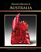 | | Journal (issue) | | Mineral Collections in Australia A Supplement To The Mineralogical Record, September–October 2020 ... Mineral Collections in Australia Organized by Robert Sielecki Designed by Wendell Wilson with Photography...September–October, 2020 Mineral Collections in Australia A Supplement to The Mineralogical Record September–October...1700 level, Zinc Corporation mine, Broken Hill, New South Wales, Australia. Collection of the Australian...Kalgoorlie, Western Australia; Lee Spencer collection, John Chapman photo. • 2.5 cm, Top Camp mine, Western Ausytralia |  | | Report (issue) | | ............................................. Northern Taos Range .....................................Primero and Canada Pinabete............. Cabresto Creek ................................................................. 34 Prospects south of Cabresto Creek, opposite the Hornet prospect ................................... 35 Prospects south of Cabresto Creek, between the Hornet prospect and Bonito Canyon ............. 35 Spanish Main prospect ["Govenor's Mine"(?)] ....................................... 36 |  | | Journal (article/letter/editorial) | | named: pyrite, arsenopyrite, galena, sphalerite, chalcopyrite, bismuth minerals, pyrrhotite, tetrahedrite-tennantite...JamesA. Noblefor the resultsof yearsof work in the mine and laboratory. Noble'sresultsin generalagree with...in magnetite. In someof the outlyingparts of the mine there is no closerelationbetweengold and arsenopyrite...a studyof assaysof ore from theGeorgeGold-Copper Mine of Stewart,BritishColumbia, showsthat gold is associated...amountof arsenopyrite in the ore. In someareasof the mine arsenopyrite carriesmore gold than in others,but |  | | Report (volume) | | survey of some national forest lands in the Boulder-Pioneer wilderness study area, central Idaho, that is being...designation. Mineral Resources of the Boulder-Pioneer Wilderness Study Area, Blaine and Custer Counties... BUREAU OF MINES A. Geology of the Boulder-Pioneer wilderness study area, Blaine and Custer Counties... Idaho B. Aeromagnetic studies of the Boulder-Pioneer wilderness study area, Blaine and Custer Counties...evaluation of the mineral resources of the Boulder-Pioneer wilderness study areas, Blaine and Custer Counties |  | | Report (volume) | | ................................. Yukon-Tanana region.............................................. THE........... Petersou Creek............................................ Windfall Creek.....................34 35 36 36 Montana Creek............................................. Lemon Creek......................... 36 37 Salmon Creek............................................. Gold Creek.................................................. 37 37 Sheep Creek.............................................. Douglas |
|


Pioneer Mine, Hatches Creek Wolfram Field, Hatches Creek, Barkly Region, Northern Territory, Australia