| Classification |
|---|
|
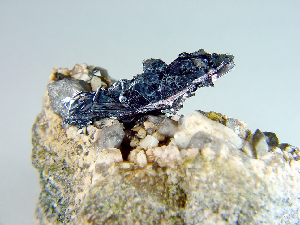
| Species: | Molybdenite |
| Formula: | MoS2 |
| Confirmation |
|---|
|
| Validity: | Believed Valid |
| Associated Minerals Based on Photo Data: |
|---|
|
| Microcline | ⓘ2 photos of Molybdenite associated with Microcline at this locality. |
| Smoky Quartz | ⓘ2 photos of Molybdenite associated with Smoky Quartz at this locality. |
| Data |
|---|
|
| Mineral Data: | Click here to view Molybdenite data |
| Locality Data: | Click here to view Middle Moat Mountain locality, Hale's Location, Carroll County, New Hampshire, USA |
| Photo Gallery | View Gallery (2 photos) |
| Data Identifiers |
|---|
|
| Mindat Occurrence Record ID: | 561549 |
| Long-form Identifier: | 1:3:561549:0 |
| GUID (UUID V4): | 3cf7c828-5527-4c87-a077-4393ac0ce111 |
| Nearest other occurrences of Molybdenite |
|---|
|
|
| 3.0km (1.8 miles) | ⓘNorth Moat Mountain localities, Bartlett, Carroll County, New Hampshire, USA |
| 3.3km (2.1 miles) | ⓘGovernment pit, Albany, Carroll County, New Hampshire, USA |
| 27.6km (17.2 miles) | ⓘEastman Quarry, Deer Hill, Stow, Oxford County, Maine, USA |
| 27.6km (17.2 miles) | ⓘIntergalactic Pit, Deer Hill, Stow, Oxford County, Maine, USA |
| 37.0km (23.0 miles) | ⓘEstes Quarry, West Baldwin, Baldwin, Cumberland County, Maine, USA |
| 38.8km (24.1 miles) | ⓘOssipee, Carroll County, New Hampshire, USA |
| 41.7km (25.9 miles) | ⓘTwin Mountain Quarry, Carroll, Coos County, New Hampshire, USA |
| 42.5km (26.4 miles) | ⓘHam and Weeks Mine, Wakefield, Carroll County, New Hampshire, USA |
| 47.8km (29.7 miles) | ⓘSongo Pond Quarry (Kimball Ledge Quarry), Albany, Oxford County, Maine, USA |
| 48.1km (29.9 miles) | ⓘCoppermine Brook Mine, Franconia, Grafton County, New Hampshire, USA |
| References |
|---|
|
|


Middle Moat Mountain locality, Hale's Location, Carroll County, New Hampshire, USA