 | | Journal (article/letter/editorial) | | VOLCANIC DOME-HOSTED PRECIOUS METAL DEPOSITS IN BOLIVIA CHARLES G. CUNNINGHAM, U.S. GeologicalSurvey,959...Piso10, Av. 16 de Julio 1616, El Prado,La Paz, Bolivia Josf•PINTOV•SQUEZ, UnitedNationsDepartmentof ...r Development(DTCD), Casilla 2096, SantaCruz, Bolivia AND GEORGE E. ERICKSEN U.S. GeologicalSurvey...underlainchieflyby a thick sequenceof southwestern Bolivia are associated with volcanic intenselyfoldedlower...Introduction lera Occidental near the western border of Bolivia, andthe world-famousPulacayosilverdepositandthe | 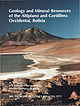 | | Report (volume) | | Cordillera Occidental, Bolivia By U.S. GEOLOGICAL SURVEY and SERVICIO GEOLOGICO DE BOLIVIA With a section on...Cordillera Occidental, Bolivia I by U.S. Geological Survey and Servicio Geol6gico de Bolivia; with a section...mineral resources-Bolivia-Cordillera Occidental. 3. Geology-Altiplano. 4. Geology-Bolivia-Cordillera Occidental...Geological Survey (U.S.) II. Servicio Geol6gico de Bolivia. Ill. Series. QE75.B9 no. 1975 [TN39.A4] 557.3s--dc20...cooperation between the Servicio Geologico de Bolivia and the U.S. Geological Survey. The geologic research |  | | Report (issue) | | S. Geological Survey and Servicio Geologico de Bolivia in cooperation with the Trade Development Program................................. 1 Department of Oruro......................................100 Department...the U.S. Geological Survey-Servicio Geol6gico de Bolivia as part of the Mineral Resource Evaluation of the...reports in the files of the Servicio Geologico de Bolivia located in their main office in La Paz. All of...States, and the Servicio Geol6gico de Bolivia in La Paz, Bolivia. This report is an edited version of |  | | Report (volume) | | no.: B 19.3:2119 1. Volcanic ash, tuff, etc.-Bolivia-Composition. 2. Geology, StratigraphicTertiary...plagioclase, biotite, hornblende, clinopyroxene, quartz, and potassium feldspar, are similar to those of...of altered samples, which also contain secondary quartz, have high Si0 2 abundances, which reflect silicification...Geological Survey and the Servicio Geologico de Bolivia ( 1992) conducted a mineral resource assessment...Altiplano and Cordillera Occidental in southwestern Bolivia during 1990-91. During fieldwork for the assessment |  | | Journal (article/letter/editorial) | | Metallogenetic Epochs and Provinces of Bolivia The Tin-Province (Part I) The Metallogenetic Provinces...the Altiplano (Part II) F. A~LFELD Cochabamba, Bolivia Partf. An attempt is made to solve the relationships...formation of ore deposits using the Bolivian tin-province as an example. In the eastern Cordillera we are...old geotectonic zone of weakness divides the tin district into two parts which differ from each other in...tin-silver mineralization is discussed. Within the tin-province three metallogenic epochs are recognized, with |  | | Journal (article/letter/editorial) | | Vol. 83, 1988, pp. 1721-1736 BatopilasMining District, Chihuahua,Mexico GREGG WILKERSON, U.S. Departmentof...asthe majorand almostexclusiveore mineralin the district. Since no large-scalemining or exploration effort...CREEL ß FIG. 1. Location of the Batopilasmining district in the Sierra Madre Occidental, southwestern Chihuahua...units in the intrudedby quartz diorite, granodiorite,and quartz mining district. monzoniteplutons.Mineral...(1979) recognizedtwo families of intertopilasmining district are basedon Brodie (1909a andb). The firstSpanishsettlementin |  | Groepper, H., Calvo, M., Crespo, H., Bisso, C. R., Cuadra, W. A, Dunkerley, P. M., Aguirre, E. (1991) The epithermal gold-silver deposit of Choquelimpie, northern Chile. Economic Geology, 86 (6) 1206-1221 doi:10.2113/gsecongeo.86.6.1206 | Journal (article/letter/editorial) | | Vilacollo.It is located of the border with Bolivia (Fig. 1). The mine and * Present address: 4 Hazlewood Drive...CACACHARA LOCURA NEGRtLLOS -16 ø 16o CARANGAS TODOS SANTOS PORPHYRY COPPER DEPOSIT i CUAJONE li...li TOQUEPAL A iii MOCHA k BOLIVIA iv Co. COLORADO v QDA. BLANCA ...•t •'i COLLAHUASI vii OUELLAVECO...various projects were plant wasbuilt alongsidethe mine during 1988. Proplannedto treat the old sulfidicdumpsby...were intermittently mined by the 60 km from the mine at a lower elevation.Total productionby all pre |  | | Journal (article/letter/editorial) | | AUGUST, TIN-SILVER SOCIETY NO. 5 1948 OF ORURO, BOLIVIA.* CHACE. PART I. CONTENTS. PAGE Abstract...351 353 354 356 357 367 Production of the Oruro District 374 377 ...................................iin'-silveroresof Oruro, Bolivia,occurin complexveinsthat are found in and adjacentto small stocksof quartz latite...Publishedwith the permissionof Compafiia Minera de Oruro. sertation, Harvard University. 333 Abstract of...sulpho-stannates on a relatively simpleearly mineralizationof quartz, pyrite, and cassiterite. The fractureswere causedby |  | | Journal (article/letter/editorial) | | compact masses with kutnohorite, rhodochrosite, quartz, and minor sulfides (Dunn 1976). Rhodonite has...unusual rhodonite on galena specimen from the North mine, Broken Hill, New South Wales, Australia; field...Figure 2 (right). A fine 13.4-cm rhodonite and quartz specimen from the Chuiricu prospect, Dos de Mayo...Rhodonite also has been reported from the Stinson mine on Jenny Jump Mountain, Warren County, New Jersey...lapidary-grade massive rhodonite occurs in an old manganese mine north of Kid’s Store, Nelson County, Virginia, and |  | | Journal (article/letter/editorial) | | Québec H3A 2A7, Canada Abstract The El Mochito mine, located in west-central Honduras, exploits a Zn-Pb-Ag...various rock types occurring in the El Mochito district were evaluated, and the data was used to infer...and Stratigraphy El Mochito, the largest operating mine in Central America, is located in the Central Cordillera...region forms part of the Chortis block, a major province of the Caribbean plate, which in Honduras is cut...Mochito comprises quartz sandstones and conglomerates of the Jurassic (?) Todos Santos Formation, limestones |  | | Journal (article/letter/editorial) | | as well as the Mesozoic cover of these areas (Todos Santos Formation, Cretaceous carbonate rocks, and Paleogene...eastern Veracruz south of the Salina del Istmo province (Figure 1), about 60 km north of the Chiapas Massif... it holds isolated outcrops of the syn-rift Todos Santos Formation, overlain by Kimmeridgian shallow-water...c sandstone. (3) The framework grains contain: quartz (~30–40% of the total framework grains), feldspar...ultramafic lithic grains (~1–4%); polycrystalline quartz (~0.3–2.4%), and translucent heavy minerals (~0 |  | | Report (chapter) | | Plain on the west; (2) a NW-trending Volcanic Province; (3) an east –west trending Central Cordillera...pebbles and conglomerates derived from the Volcanic Province. It is the fore-arc basin of the Central American...American subduction zone. The Volcanic Province is a chain of active volcanoes to the south and Cenozoic...4, Macal Fm, Carbon– Permian sedimentary; 5, Todos Santos Fm, Jurassic–Cretaceous sedimentary rocks; 6...unconformity separates it from the overlying Todos Santos Formation. The Chochal Formation is part of |  | | Journal (issue) | | Islet Famous mineral localities: the Silver Islet mine, O n ta rio ............... 49 by W. E. Wilson ...Batopilas Famous mineral localities: the Batopilas District, Chihuahua, M e x ic o .........................photo © SILVER crystals, 3.3 by 4.5 cm, from the mine, Kongsberg, Norway. (See the this issue.) Keith...silver mines at all in Asia. He does mention a silver mine in Macedonia that used to yield a talent of the...Phidon of Aegina around 869 B.C., and yet the district did not reach its peak in activity and production |  | | Journal (article/letter/editorial) | | AND NATURAL RESOURCES OF BOLIVIA.1 South American States the Republic of Bolivia ranks next in size to Brazil...times larger than France. The mountain system of Bolivia consists of two ranges, the Andes in the west and...and Consular Reports, No, 4584, Annual Series, " Bolivia." Downloaded by [] at 17:49 13 June 2016 THE...THE GEOGRAPHY AND NATURAL RESOURCES OF BOLIVIA. 7 broad. The principal peaks are Mount Sorata, 21,490...Cruz, Mojos and Beni. The navigable streams of Bolivia cover an area of 5625 miles and flow in the direction |  | | Journal (article/letter/editorial) | | acrosscentral Guatemala. Massive galena-sphalerite-pyrite-quartz mineralization is concentrated alongbeddingplanesand...the PaleozoicSanta Rosa Group and the Mesozoic Todos Santos-Cobfin-Ixcoyrocks (Fig. 3). The basalSanta Rosa...CobfinFormation (Siesser,1967, p. 50). The contactbetweenthe Todos Santosand Cobfin-Ixcoy is locallya slightangularunconformity...the top of the Ch6chal Formation in the Chiantla district, Anderson (1969, p. 62) has found a 200 m shale-...includesall depositssouthof the Cob/m area. The Chiantla district includesall depositsin the zone extending northwest |  | | Journal (article/letter/editorial) | | 1888, spent a few weeks in the vicinity of Todos Santos bay (Ensenada) and the m ountains to the east...which have escaped erosion, as at Sausal and Todos Santos, 60 miles south of the boundary. At Cape Colnett...about the lim it of the northern or m ountainous province. From San Quentin south ward, as far as examined...observations in the vicinity of Ensenada de Todos Santos, divides the topographic features of the peninsular...described as stretching from La Purissim a to Todos Santos (of the south), a distance of 150 to 200 miles |  | | Report (volume) | | _________ Siria mine ________________________ ------------- __ ----Los Hornitos mine ______ ;_______...mine____________________________________ La Uni6n mine ________________ -----------------------(}uatem...______ __ ____ ______ _ 48 48 49 50 51 51 51 La Paz mine ______ ---------------------------Cabanas distr...district___________________________________ La Joya mine ____ ----------------------------La Corona depos...----------Pasasaguas district ___ ----------------------------El Retiro district _________ -- __ ----_------- |  | Ortega-Flores, Berlaine, Martini, Michelangelo, Solari, Luigi, Colás, Vanessa, Guerrero-Moreno, Sandra, Centeno-Garcia, Elena, Silva-Romo, Gilberto, Grajales-Nishimura, Manuel (2020) Reply to Molina-Garza et al. (2019) “Discussion of: Ortega-Flores et al. (2018) provenance analysis of Oligocene sandstone from the Cerro Pelón area, southern Gulf of Mexico”. International Geology Review, 62 (4) 421-427 doi:10.1080/00206814.2019.1616621 | Journal (article/letter/editorial) | | indicate the location of the Zicapa, Chivillas and Todos Santos formations. Cam: Campeche; Chi: Chiapas; Oax:...Mesozoic sedimentary covers represented by the Todos Santos, Chivillas, and Zicapa formations (Figure 1)...sedimentary covers represented by the Chivillas, Todos Santos, and Zicapa formations (Figure 1). Oaxacan...K-feldspar, antiperthitic plagioclase, rutilated quartz that display a typical blue colour at the outcrop...exolutions, antiperthitic plagioclase, and rutilated quartz have been reported exclusively for granulite-facies |  | | Journal (article/letter/editorial) | | de Angeles, named by Carpenter, is a sequence of quartz conglomerates and red beds. The next stratigraphic...still older Jurassic-Neocomian red beds of the Todos Santos Formation. Wilson's, and Meyerhoff and Morris's...and southern Mexico, is the Jurassic-Neocomian Todos Santos Formation. This formation apparently does not...Coban Group ( = Yoja in part) and to the posi-Todos Santos or Metapan red beds. The Metapan red beds (which...has been considered to be Todos Santos but is much younger than the Todos Santos. 4. The Cantarranas Formation |  | Mendoza-Rosales, Claudia C., Centeno-García, Elena, Silva-Romo, Gilberto, Campos-Madrigal, Emiliano, Bernal, Juan Pablo (2010) Barremian rift-related turbidites and alkaline volcanism in southern Mexico and their role in the opening of the Gulf of Mexico. Earth and Planetary Science Letters, 295 (3) 419-434 doi:10.1016/j.epsl.2010.04.020 | Journal (article/letter/editorial) | | to basalts from the Central Atlantic Magmatic Province (CAMP), and to the Cretaceous Peri-Atlantic Alkaline...(McHone, 2000), forming a large continental igneous province (CAMP) with its highest peak of volcanism at about...graben-fills associated to the opening of the gulf (Todos Santos Formation in Chiapas, Blair, 1987, 1988; Huizachal...Jurassic fluvial–lacustrine succession of the Todos Santos Formation that belongs to the Maya Terrane (Fig...metamorphic, feldspar, mono- and polycrystalline quartz grains, and shale/limestone intraclasts. They contain |  | | Report (issue) | | ·Geology and Paleontology of the Santa Maria District California By W. P. WOODRING and M. N. BRAMLETTE...formation, including Tinaquaic sandstone member and Todos Santos claystone member ________________________________...member) _____ ~ ________ _ Basin facies, including Todos Santos claystone member ________________ _ Pliocene...4. 5. 6. 7. 8. 9. Geologic map of Santa Maria district, Santa Barbara County, Calif. (5 sheets)_____..._ In pocket Structure sections of Santa Maria district, Santa Barbara County, CaliL _ _ _ _ _ _ _ _ _ |  | | Journal (article/letter/editorial) | | borderland (the southern portion of a submarine province of ridges and basins west of northern Baja California)...south-southeast from Mas Los Coronados to Bahia Todos Santos, (2) southeast-northwest faults within the borderland...zone between Tslas Los Coronados, and Bahia Todos Santos 12. Heat-flow measurements and seismic refraction...borderland, the southern portion of a submarine province of ridges and basins lying west of northern Baja...Baja California, Mexico, and south of Bahia Todos Santos (Figs. 1,2). The usual abrupt transition at the |  | | Journal (article/letter/editorial) | | Basin and Range province. Walker Lake Basin is situated near the western end of this province, separated from...contrast, the Wassuk Range is dominated by Cretaceous quartz monzonitic plutons that have intruded Triassic-Jurassic...in rift basins: a comparison of the Jurassic Todos Santos Formation, Chiapas, Mexico, with Quaternary...Significance of the Upper Jurassic-Lowermost Cretaceous Todos Santos and San Ricardo Formations, Chiapas, Mexico...sedimentation, Jurassic-Lowermost Cretaceous Todos Santos Formation, Chiapas, Mexico. J. Sediment. Petrol |  | Kamenov, G., Macfarlane, A. W., Riciputi, L. (2002) Sources of Lead in the San Cristobal, Pulacayo, and PotosiMining Districts, Bolivia, and a Reevaluation of Regional Ore Lead IsotopeProvinces. Economic Geology, 97 (3) 573-592 doi:10.2113/gsecongeo.97.3.573 | Journal (article/letter/editorial) | | Cristobal, Pulacayo, and Potosí Mining Districts, Bolivia, and a Reevaluation of Regional Ore Lead Isotope...sources of ore metals in southwest to south-central Bolivia, including the very large recently discovered silver-zinc...deposit at San Cristobal, the Pulacayo polymetallic district, and the giant Potosí silver-tin-base metal deposit...rocks in western Bolivia. On this basis we identify a new ore lead isotope province extending from San...eastern Altiplano and into southern Perú. This province is coincident with but smaller than the extent |  | Ocampo-Díaz, Yam Zul Ernesto, Torres-Sánchez, Sonia Alejandra, Augustsson, Carita, Barboza-Gudiño, José Rafael, García-Díaz, José Luis, Talavera-Mendoza, Oscar, Aceves de Alba, Jorge, Castro-Larragoitia, Javier, Martínez-Paco, Margarita, Saucedo, Ricardo, Aguillón-Robles, Alfredo (2019) Provenance and tectonic setting of the Jurassic Huayacocotla Formation and Alamitos Sandstone, Central Mexico. Geochemistry, 79 (2) 369-383 doi:10.1016/j.chemer.2019.05.004 | Journal (article/letter/editorial) | | fragments are totally dominated by volcanic fragments. Quartz cathodoluminescence colours and textures from the...but also indicates the presence of metamorphic quartz. Similarly, the geochemical composition is more...version of this article). cathodoluminescence of quartz for the two units. strike-slip basins were situated...(Fig. 1). The continental La Boca, La Joya, and Todos Santos formations, as well as the deep-marine siliciclastic... Colour cathodoluminescence images of detrital quartz from eight samples of the Alamitos Sandstone were |
|


