 | | Report (issue) | | Milford Granite from the Milford Quadrangle, Massachusetts, yielded a 620 + 15 my, Precambrian, zircon...are mapped as the Boylston Formation by Grew (1970) and the Boylston south of Worcester is equivalent to...was mapped previously as Oakdale Quartzite or Worcester Phyllite by Emerson, 1917. (1976). It comprises... forms the Tower Hill Quartzite Member of the Boylston Formation of Grew (1970), and constitutes Unit...the upper part, medium-gray sericite^staurolite-andalusite phyllitic schist in the middle part, and medium-gray |  | | Journal (article/letter/editorial) | | \~'acliusett-Coldhrookk aqueduct tunnel in Central Massachusetts. I n that capacity he liad opportunity to examine...Bibliography. I CALLAQHAN, GEOLOQY OF CEXTRAL MASSACHUSETTS 29 I FIO. 1.-Areal geologic mnp ndapted from...1 is the Worcester phyllite of Emerson (7, pp. 3-28; 2, pp. 60-61, 77, $25). An andalusite phyllite occurring...occurring between the quartzite and granite is the Boylston schist of Emerson (2, 67-68), Igneous rocks are...lami~intionand even distinct bedding in outcrops in the Worcester Bnsin. White quartz lenses or veins are nearly |  | | Report (issue) | | Geology of Massachusetts E. Stratigraphy of the Milford-Dedharn Zone, Eastern Massachusetts: An Avalonian... Stratigraphy of the Nashoba Zone, Eastern Massachusetts: An Enigmatic Terrane G. Stratigraphy of the...Belt, Central Massachusetts H. Structural and Metamorphic History of Eastern Massachusetts I. Intrusive...Intrusive Rocks of Eastern Massachusetts J. Radiometric Ages of Rocks in Massachusetts L.S. GEOLOGICAL SURVEY...PROFESSIONAL PAPER 1366-E-J The Bedrock Geology of Massachusetts NORMAN L. HATCH, JR., Editor E. Stratigraphy |  | | Report (issue) | | Bedrock Geoloqy of the Nashua River Area, Massachusetts - New Hampshire By Gilpin Rile Robinson, Jr...ZONE 12 ROCKS IN THE NASHUA RIVER AREA 15 WORCESTER FORMATION 18 Nomenclature, Historical Background... 78 Garnet Zone 80 Andalusite Zone 80 Retrograde alteration of andalusite schists 82 Staurolite-Kyanite...alteration of andalusite schists -io Worcester Formation 97 Staurolite-Kyanite/Andalusite (Actinolite)...SYNTHESIS 102 ENVIRONMENT OF DEPOSITION 108 Worcester Formation 108 Merrimack and Oakdale Formations |  | | Report (issue) | | GEOLOGIC MAP OF THE CLINTON QUADRANGLE, WORCESTER COUNTY, MASSACHUSETTS BY JOHN H. PECK 1975 Explanation...at depth which might be the cause of 22 the andalusite grade metamorphism in the surrounding rocks....large porphyroblasts of chiastolite and 12 andalusite. 13 retrograde alteration to chlorite are abundant...oriented porphyroblasts of chiastolite 19 or pink andalusite. 20 The porphyroblasts (many of which are altered...the andalusite isograd and 23 the phyllite in the upper parts of graded beds has no andalusite but |  | | Book | | MASSACHUSETTS MINERALAND FOSSIL LOCALITIES Compiled by Peter P. Gleba 'I!~·· . \. i r,'"--""'4' I...publication. Peter P. Gleba December 2008 Quincy, Massachusetts Member Boston Mineral Club Reprinted by permission...is some of the most valuable real estate in Massachusetts. Calculating it another way, [Peter Gleba] said...is some of the most valuable real estate in Massachusetts. It has access, it has convenience, it has exposure...window of his car as he passed west of the Massachusetts state lottery offices and saw a spreading rust |  | | Report (volume) | | OTIS SMITH, Director Bulletin 597 GEOLOGY OF MASSACHUSETTS AND RHODE ISLAND BY B. K. EMERSON WASHINGTON............................................ Worcester County, Mass.......................................member........................... Northeastern Massachusetts..................................... General..................................... Western Massachusetts...............................................district............................. Eastern Massachusetts............................................ |  | | Report (issue) | | Commonwealth of Massachusetts Department of Public Works H* A* MacDonald, Commissioner U. S. Department...Spodumene deposits in the Leominster-Sterling Area, Massachusetts by M. P. Billings and C. W. Wolfe Contents...Spodumene deposits in the Leominster-Sterling area, Massachusetts; by M. P. Billings and C. W. Wolfe. Scope of...long been known to occur at several places in Massachusetts. So far as available data show, the spodumene-bearing...as part of a cooperative project between the Massachusetts Department of Public Works and the United Spates |  | | Report (issue) | | Silurian stratigraphy of northeastern Aroostook County, Maine 1 . David C. Roy and Ely Mencher Discussion:...Silurian stratigraphy of northeastern Aroostook County, Maine... Louis Pavlides Lower Devonian Seboomook...Shride Pre-Silurian stratigraphy of northeastern Massachusetts .Kenneth G. Bell and Donald C. Alvord Stratigraphic...Wachusett-Marlborough Tunnel, east-central Massachusetts .James W. Skehan. S.J.. and A. Adel Abu-moustafa...stratigraphy in the Brimfield area, Connecticut and Massachusetts .John D. Peper and M. H. Pease, Jr. Pre-Silurian |  | | Journal (article/letter/editorial) | | Ore Knob copper mine in the eastern part of the county has produced chalcocite, bornite, pyrite, pyrrhotite...Mountain. BURKE—Three diamonds have been found in this county. One specimen is at the State Museum in Raleigh...reported from this county. CAMDEN—The Pamlico Formation characterizes this coastal plain county. Shell beds...Little Buck Creek. Much corundum is found in this county, usually associated with the large peridotite masses...sand dunes characteristic of many parts of the county. Beds of shell marl are not uncommon. DARE—Among |  | | Report (issue) | | Geology of the land area of the Boston 2° sheet, Massachusetts, Connecticut, Rhode Island and 10- New Hampshire... 16 17 18 U. S. Geological Survey Boston, Massachusetts 19 ,U. S. Geological Survey* OPEN FILE REPORT...GEOLOGY OF THE LAND AREA OF THE BOSTON 2° SHEET, MASSACHUSETTS, CONNECTICUT, RHODE ISLAND AND NEW HAMPSHIRE...foliated and deformed gneisses 16 and schists of andalusite to sillimanite metamorphic grade. 17 Newbury...Milford Granite from the Milford quadrangle, Massachusetts, yielded 19 a 620 + 15 my,Precambrian,zircon |  | | Book | | GENERALIZED BEDROCK GEOLOGIC EASTERN MA5SACHUSSETS WORCESTER .W o] ~P- FM V/C/N/TY ^^o Red beds MAP...Department of Geology Boston University Boston, Massachusetts 02215 to; PREFACE In 1966, John Rodgers...Davis in the Connecticut Valley of western Massachusetts, and gradually extended itself. oo over New...Brown University The Foxboro Co., Foxborough, Massachusetts Geography, University of Toronto U. S. G, S...Boston State College Botany, University of Massachusetts, Amherst Marine Sciences, Virginia Institute |  | | Report (issue) | | occurrence Lundy road-cut Doughboy Point andalusite Port Felix andalusite Cribbons (Crebbing) Point Malignant...Eagle Head copper mine 7. Guysborough area 8. Andalusite occurrences 9. Arisaig area 10. - Orwell Bay...Limestone quarry, Marble Mountain, Cape Breton Island Andalusite crystals in schist, Port Felix, Nova Scotia A...specimens of specularite, siderite, arsenopyrite, and andalusite can be collected. In the Antigonish-Amherst region...Canada, PA 17862) 28 61 km Inverness/Victoria county line. Bucklaw Salt Spring The salt is composed |  | | Report (issue) | | . . . . . • . . . . . . . . . Doughboy Point andalusite • . . . . • • . . . • . • • . • . • . . . . .... • . . . . . . . • . . • . Port Felix andalusite..... . . . • . . . . . • . • • • . . . . . . . . .... . . . . . . . . . . . . . • . . . . . . • 3.Andalusite occurrences . . . . . . . . . . . . . . . . .......................................... 41 Andalusite crystals in schist, Port Felix, Nova Scotia ...specimens of specularite, siderite, arsenopyrite, and andalusite can be collected. In the Antigonish-Amherst region |  | | Report (issue) | | alteration zones in the Nesbit Mine area, Union County, North Carolina 18 11. Generalized geologic map...gold nugget in Little Meadow Creek in Cabarrus County. This discoveryinitiated America's first gold rush...gnywacke- or turbidite- hostedlocles 18 Southeastern USA 19 Nova Scotia 20 Ballerat-Bendigo, Australia 21...lode deposits 22 Trans-Baikal, Russia 23 Southwest USA 24 Hokkaido, Japan 2S Porgera, New Guinea + 26PlacerMagadan...Carolina may have been by the Indians in Cherokee County before white settlers arrived. There are also reports |  | | Journal (article/letter/editorial) | | A I N E M I N E R A L S — F r o m famous Oxford County. 12 b e a u t i f u l specimens, including tourmaline...Correspondence welcomed. Canner Incorporated, 9 0 9 Boylston, Boston 15, Mass. CRYSTALS W I T H P H A N T...g a r n e t , sphalerite, scheelite, epidote, andalusite, c o r u n d u m , beryl, tourmaline, or other |  | | Book | | Co. Hematite CALERA, Shelby Co. Wavkllite CLAY COUNTY, Sec. 24. T. 19 S R., 7 E. STATUARY, Coosa Co...Co., (W. border of* Marble Crystalline TALLADEGA COUNTY Marble, (crystalline) VALLEY HEAD, DeKalb Co. Hematite...Feldspar HISSOP, Coosa Co., (near) Beryl JACKSON COUNTY Hematite KENNEDYS, Clay Co., (near) Magnetite MILLERVILLE...DELANEY, Madison Co. Quartz, (clear crystals) GARLAND COUNTY Quartz Crystals HOT SPRINGS, Garland Co. Malachite...Malachite HOT SPRINGS DISTRICT Quartz Xls LAWRENCE COUNTY Pearls LITTLE ROCK Quartz Crystals MAGNET COVE, |  | | Report (volume) | | classn_____ classification Co_______. Company, County Coll______ Collections Conini_____ Committee Cominuii____...well at the Jayhawk Ordnance Works in Cherokee County, Kans.: Kansas Univ. Geol. Survey Bull. 47, pt...C. K., 1. 1. The geology of Long Reach, King's County, New Brunswick: Royal Soc. Canada Trans. 3d ser...the Pennsylvanian section of eastern Vermilion County, 111., and Vermillion, Warren, and Fountain Counties...cobalt deposits in the Blackbird district, Lemhi County, Idaho/: Idaho Bur. Mines and Geology Pamph. 61 |  | | Book (edition) | | CongresS; J / in the year 1834, Commonwealth of Massachusetts, Commonwealth in the Clerk's Office of the ...Secretary of the of said i ; District of Massachusetts. by Edward D. Bangs, in the name and District...Excellency, John davis, Esq. Governor of Massachusetts. I HAVE the honor to present you with the second...the 3d of March , 1830, the Legislature of Massachusetts passed a Resolve, authorizing and requesting...to the Antiquarian Society at Worcester; One copy to the Massachusetts Historical Society One copy to |  | | Report (volume) | | Bull.; County Rpt.-Maryland Department of Geology, Mines and Water Resources Bulletin; County Report...resources of the valley-fill deposits of Allegheny County, Pennsylvania: Pa. Geol. Survey, 4th ser. Bull...Permian age in the northwestern Marfa Basin, Hudspeth County, Texas [abs.]: Geol. Soc. Am. Bull., v. 60, no...[Mississippi-Gulf Oil Company No. 1 Pope, Covington County, Miss.], in Mississippi Geological Society Guidebook...Mar. 1949. 2. A suggested origin for the Shelby County, Alabama, limonite ores: Econ. Geology, v. 44, |  | | Report (volume) | | Boletfn de Minas, nos. 2, 8. Habana, Cuba. Delaware County Institute of Science: Proceedings, vol. 8, no....Geological Survey: Supplementary Report, Harlan County. Frankfort, Ky. Lake Superior Mining Institute:...Chicago, 111. West Virginia Geological Survey: County Reports, Braxton-Clay. Morgantown, W. 'Va. Wyoming...357-401, 64 figs., November 20, 1916... 41. The Boyd County mastodon, Tetrabelodon-osborni: Nebraska Geol....district of the Great Falls coal field, Cascade County, Montana (abstract by R. W. S.) : Washington Acad |  | | Report (issue) | | so-called Pennsylvanian basins of southeastern Massachusetts. Three papers deal with the geology of alkali...alkali plutonic-volcanic areas in Massachusetts and New Hampshire. High-grade and low-grade (prehnite-pumpellyite)...(prehnite-pumpellyite) metamorphism in Massachusetts and Maine, respectively, are the subjects of two of the papers...and the geology of the Ayer Granodiorite of Massachusetts. JOHN R,. GRIFELN STUDIES IN NEW ENGLAND...Brownlow V1 Vil iX Part I. Geology of eastern Massachusetts INaTOROVGNNE TON “5. B bo 8 OR Bo ee ek 5 ee |  | | Journal (issue) | | Speer Minerals from the Old Sulphur Mine, Louisa County, Virginia Richard S. Mitchell and Arthur S. Katz...CRYSTALLIZED TURQUOISE from near Lynch Station, Campbell County, is Virginia's unique contribution to the mineral...Specimens from the Rutherford pegmatites, in Amelia County, are famous for the per fection of their thin...the same county. It also has been observed in pegmatites in Powhatan County, Spotsylvania County, and elsewhere...the world have specimens of allanite from Amherst County, Virginia. The mineral is usually black and is |  | | Book (volume) | | Duane L. Leavitt The Bennett Pegmatite, Oxford County, Maine . ........................................of Geology at Smith College in Northampton, Massachusetts. He began teaching there in 1931 and he retired...permanent photographic exhibits in the northeastern USA. The Shaubs have been active in ornithological research...tourmalinebearing Himalaya pegmatite at Mesa Grande, San Diego County, California. Most recently, Gene was gratified...Maine's treasure chest; Gems and minerals of Oxford County, second edition: Quicksilver Publications, West |  | | Report (issue) | | POTENTIAL OF EPA REGION 1 Connecticut Maine Massachusetts New Hampshire Rhode Island Vermont OPEN-FILE...POTENTIAL OF EPA REGION 1 Connecticut, Maine, Massachusetts, New Hampshire, Rhode Island, and Vermont R...Preliminary Geologic Radon Potential Assessment of Massachusetts R. Randall Schumann and Linda C.S. Gundersen...aerial radioactivity, and indoor radon data by county. Because of constraints on the scales of maps presented...The reports are available in county formats and State summaries. The county reports typically contain both |
|


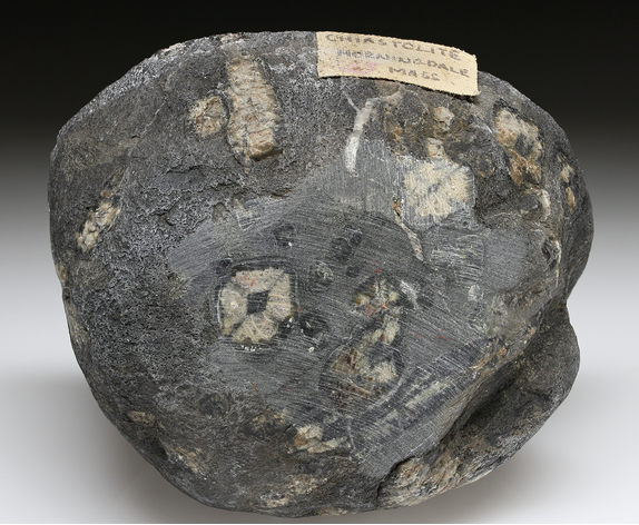


Boylston, Worcester County, Massachusetts, USA