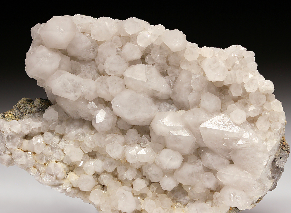
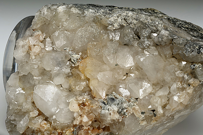
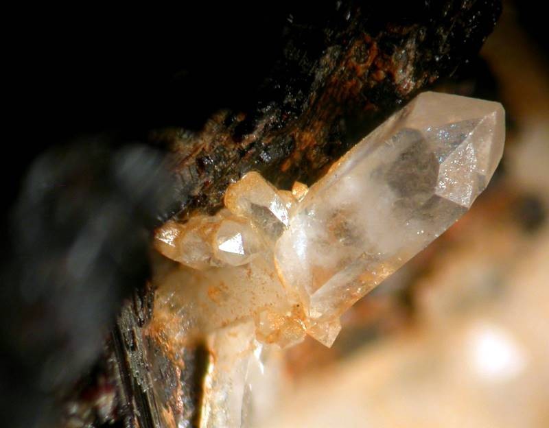
Locality type: Road Cutting Classification Species: Quartz Formula: SiO2 Formation: Primary Comments: Crystals usually as a druse, rarely >2.5 cm. Several crystals were found to be translucent, milky white from the base to about three quarters of the height, with the tip becoming completely transparent towards its termination. Associated in the hydrothermal veins with barite, calcite, fluorite, galena, pyrite, sphalerite, and zeolites. Habit: massive in schist, pegmatite and granite. Elongated prismatic in hydrothermal veins, typically as a druse lining open spaces. Dauphine and Japan-law twins, bowtie aggregates. Colour: colorless, milky, pale smoky Abundance at site: Very common Confirmation Validity: Confirmed Confirmation Methods: Visually Identified Associated Minerals Based on Photo Data: Sphalerite ⓘ 34 photos of Quartz associated with Sphalerite at this locality.Fluorite ⓘ 26 photos of Quartz associated with Fluorite at this locality.Calcite ⓘ 17 photos of Quartz associated with Calcite at this locality.Galena ⓘ 17 photos of Quartz associated with Galena at this locality.Pyrite ⓘ 17 photos of Quartz associated with Pyrite at this locality.Heulandite-Ca ⓘ 16 photos of Quartz associated with Heulandite-Ca at this locality.Stilbite Subgroup ⓘ 11 photos of Quartz associated with Stilbite Subgroup at this locality.Harmotome ⓘ 10 photos of Quartz associated with Harmotome at this locality.Albite ⓘ 10 photos of Quartz associated with Albite at this locality.Heulandite Subgroup ⓘ 7 photos of Quartz associated with Heulandite Subgroup at this locality.Data Mineral Data: Click here to view Quartz data Locality Data: Click here to view Thomaston Dam railroad cut, Thomaston Dam, Thomaston, Litchfield County, Connecticut, USA Photo Gallery View Gallery (3 photos) Data Identifiers Mindat Occurrence Record ID: 13186 Long-form Identifier: 1:3:13186:9 GUID (UUID V4 ): 5fc35e83-025a-436d-88e6-1f428b12a2e3 Nearest other occurrences of Quartz
0.8km (0.5 miles) ⓘ Thomaston Dam pegmatite, Thomaston Dam, Thomaston, Litchfield County, Connecticut, USA 1.6km (1.0 miles) ⓘ State Routes 8 and 222 interchange, Thomaston, Litchfield County, Connecticut, USA 5.0km (3.1 miles) ⓘ Reynolds Bridge, Thomaston, Litchfield County, Connecticut, USA 5.5km (3.4 miles) ⓘ Rock Brook, Harwinton, Litchfield County, Connecticut, USA 5.9km (3.7 miles) ⓘ Waterbury Road quarry, Thomaston, Litchfield County, Connecticut, USA 7.1km (4.4 miles) ⓘ Morris Dam Quarry (East Morris Dam), Morris, Litchfield County, Connecticut, USA 7.7km (4.8 miles) ⓘ State Routes 8 and 118 interchange, Harwinton, Litchfield County, Connecticut, USA 7.8km (4.9 miles) ⓘ Pegmatite quarry and ultramafic rock, Harwinton, Litchfield County, Connecticut, USA 10.3km (6.4 miles) ⓘ South Main Street construction site, Torrington (Wolcottville), Litchfield County, Connecticut, USA 10.7km (6.7 miles) ⓘ State Route 8 exit 37, Watertown, Litchfield County, Connecticut, USA References Year ⬇ Author Title Publisher


Thomaston Dam railroad cut, Thomaston Dam, Thomaston, Litchfield County, Connecticut, USA