 | | Book (edition) | | j3 ROADSIDE EOLOGY of Northern and Central California David Alt and Donald W. Hyndman Mountain Press...David D. Roadside geology of Northern and Central California / David Alt and Donald W. Hyndman. p. cm. - (Roadside...0-87842-409-1 (alk. paper) 1. Geology-California-Guidebooks. 2. California-Guidebooks. I. Hyndman, Donald W...Leggett Coast Range ,.~ Reno 1 Calpella Lake Ta hoe Point Yosemit Nation Basin and Range San Francisco...Bakersfield • San Luis Obispo Roads and Sections of Roadside Geology of Northern and Central California. Contents |  | | Book | | UNIVERSITY . Berkeley OF CALIFORNIA PRESS London . Los Angeles CALIFORNIA NATURAL HISTORY GUIDES Arthur...University of California Press. University of California Press Berkeley and Los Angeles, California University...University of California Press London, England Copyright © 1993 by Paul Henson and Donald J. Usner Illustrations...illustration s by Valerie A. Kells. p. cm.—(California natural history guides) Includes bibliographical...index. ISBN 978-0-520-20510-9 1. Natural history—California—Big Sur. III. Series. 1993 QH105.C2H46 1. Usner |  | | Report (issue) | | Gneissic Rocks Near The San Andreas Fault From Bodega Head to Cajon Pass, California GEOLOGICAL SURVEY ...Gneissic Rocks Near The San Andreas Fault From Bodega Head to Cajon Pass, California By DONALD C. ROSS GEOLOGICAL...Central Coast Ranges.__________________________ Quartz diorite of Bodega Head_______________ Granitic...__________ Microscopic description.________________ Quartz diorite of Ben Lomond-. ______ Alaskite of Smith...___ Distinguishing features __________________ Quartz diorite of Cordell Bank,______________ Southern |  | | Report (volume) | | Geology in Canada: Hume, G. S., Gunning, H. G., 5. California, southern, pegmatites: 3. Arciniega, V. M. Geology...Hershey, H. G. , 2. scale: Spieker, E. M., 3. Iron-range rocks, origin: Tanton, Distribution in geologic...Science and hobby: Meen, V. B. , 1. Pegmatites, California, southern: Mineralogy and the field geologist...Schultz, P. R. Thrust faulting, mechanisms, Rocky Mts., discovery challenge: theories: Longwell, C. R....Gravenor, Cuebec, St. Lawrence Lowlands, C. P., 15. California, Barstow quadrangle: Trenton group, Ordovician: |  | | Report (issue) | | Gastropods and Biostratigraphy of the Kern River Area, California By W. 0. ADDICOTT GEOLOGICAL SURVEY PROFESSIONAL...Round Mountain Silt_ _________________________ _ Santa Margarita Formation _____________________ _ Biostratigraphy...Round Mountain Silt __________________________ _ Santa Margarita Formation _____________________ _ 1 1...Olcese Sand and Round Mountain Silt ___________ _ Santa Margarita Formation _____________________ _ Correlation...occurrences of mollusks__________________ Index map of California showing principai fossil localities--------- |  | | Book | | our region. -Tom Demere Curator of Paleontology San Diego Natural History Museum A D A 150 MILLION YEAflS...IN SEDIMENTARY llOCKS M uch of the story of San Diego's prehistoric landscape is captured in the...sedimentary rocks of the region upon which 95% of county residents live. Landforms have risen and fallen...better qualified to tell this exciting story of San Diego's prehistory than earth scientist Pat Abbott...want to start learning about San Diego's geologic THE RJSE AND FALL OF SAN DIEGO 150 MILLION YEARS OF |  | | Report (issue) | | and correlation.__________ __________________ California..--__------_---_______________-__ Washington...exposures are limited almost entirely to the sea cliffs along the Pacific Ocean in Tillamook and Lincoln...of the Temblor formation, middle Miocene, in California. The biologic affinities of the Astoria species...formation were measured in the Newport area, Lincoln County, and the faunas collected from them are discussed...to describe species in his collections at the California Academy of Sciences and for the use of his doctorate |  | | Journal (article/letter/editorial) | | complex: architecture of the Franciscan Complex, California, at multiple length and time scales John Wakabayashi...and Environmental Sciences, California State University, Fresno, CA, USA Published online: 03 Feb 2015...complex: architecture of the Franciscan Complex, California, at multiple length and time scales, International...complex: architecture of the Franciscan Complex, California, at multiple length and time scales John Wakabayashi*...and Environmental Sciences, California State University, Fresno, CA, USA Downloaded by [ECU Libraries] |  | | Report (issue) | | PHYSICAL SCIENCES LIBRARY >ologic in San Fra to Northerij^aJ^L to the Sierra Nevada Special Publication...the Seismological Society of America, San Francisco, California, March 1991. This guidebook is available...NORTHERN CALIFORNIA: San Francisco to the Sierra Nevada Editors DORIS SLOAN University of California, Berkeley...and DAVID L. WAGNER Division of Mines and California Department Geology of Conservation OF MINES...C\j IN NORTHERN CALIFORNIA Geological Setting of the San Francisco Bay Area. \2j San Francisco to Point |  | | Book | | ROADSIDE 4% JrEoLocy or SOUTHERN CALIFORNIA ARTHUR GIBBS SYLVESTER AND ELIZABETH O’ BLACK GANS IGagsine... IGagsine ~%_ JEOLOGY of SOUTHERN CALIFORNIA ARTHUR GIBBS SYLVESTER ILLUSTRATED BY ELIZABETH O’BLACK...based on the 2010 Geologic Map of California, published by the California Geological Survey, and on maps...Elizabeth, 1971- Title: Roadside geology of southern California / Arthur Gibbs Sylvester and Elizabeth O’Black...paper) Subjects: LCSH: Geology—California, Southern—Guidebooks. | California, Southern—Guidebooks. Classification: |  | | Report (volume) | | been called Mabb amygdaloid.] Belongs to Bohemian Range group. Is younger than Baltic West amygda loid...sandstone. Permian : Central northern Oklahoma (Bay County). C. N. Gould, 1900 (Kans. Univ. Quart., vol. 9...dolomite. Permian : Central northern Texas (Fisher County). M. G. Cheney, 1929 (Univ. Tex. Bull. 2913, p...is. McCloud limestone. Permian ( ?) : Northern California (Redding region). H. W. Fairbanks, July 1894...Perm. (?). McCloud shales. Permian : Northern California (Redding region). H. W. Fairbanks, July 1894 |  | | Report (issue) | | EXAMINED LATERALLY ALONG THE COAST NEAR SANTA BARBARA, CALIFORNIA By Caroline M. Isaacs Open-File Report...endorsement by the U.S. Geological Survey. Menlo Park, California May 1980 TABLE OF CONTENTS Page LIST OF FIGURES.......... Mechanism of Quartz Formation ........... Silica Transfer During Quartz Formation ...... Porosity...Porosity Reduction During Quartz Formation ..... Formation of Unusual Quartz Cherts ......... Dolomitization................. Timing of Opal-CT Formation and Quartz Formation ..................... Background on "Ordering" |  | | Report (volume) | | "Names and Definitions of the Geological Units of California," Bulletin 826, by M. Grace Wilmarth. This work...reference for geologists who worked exclusively in California. The first exhaustive con1pilation, M. Grace...Bull. 1060-D, p. 193, 252-253, pl. 7. In Nemaha County, Kans., member is basal unit of Howard limestone...Aarde farm, sec. 4, T. 26 S., R. 11 E., Greenwood County. Aaron Slatet Precambrian or Paleozoic: Central...Pittsylvania and Halifax Counties, overlies Hyco quartz porphyry. Varies from nearly pure greenstone to |  | Canet, Carles, Prol-Ledesma, Rosa María, Proenza, Joaquín Antonio, Rubio-Ramos, Marco Antonio, Forrest, Matthew J., Torres-Vera, Marco Antonio, Rodríguez-Díaz, Augusto Antonio (2005) Mn–Ba–Hg mineralization at shallow submarine hydrothermal vents in Bahía Concepción, Baja California Sur, Mexico. Chemical Geology, 224 (1) 96-112 doi:10.1016/j.chemgeo.2005.07.023 | Journal (article/letter/editorial) | | hydrothermal vents in Bahı́a Concepción, Baja California Sur, Mexico Carles Canet a,*, Rosa Marı́a Prol-Ledesma...Barcelona, Spain c Moss Landing Marine Labs, California, USA d Instituto Potosino de Investigación Cientı́fica...Camino a la Presa San José 2055, Lomas 4a sección San Luis Potosı́ 78216, San Luis Potosı́, México...Banda, at the northwestern coast of the Baja California Peninsula (Vidal et al., 1978). Geothermal springs...Late Miocene extension that affected the Gulf of California area (Ledesma-Vázquez and Jonson, 2001). In |  | | Journal (issue) | | Oregon tsunami hazard signs officially adopted by California, Washington, Alaska, and Hawaii Undersea earthquakes...tsunami hazard zone and evacuation route signs for California, Washington, Alaska, and Hawaii. This means that...of Coquille Point and the city of Bandon in Coos County. This Oregon Department of Transportation photo...paleoliquefaction evidence in the central Cascadia margin, USA by Curt D. Peterson, Portland State University, Portland...planners to rely on probabilistic models based on a range of earthquake scenarios (Geomatrix Consultants, |  | | Report (volume) | | 250-12,460 ft, sec. 14, T. 45 S., R. 27 E., Lee County, Fla. Named for the nearby Able Canal. The Able...H-20, northwest of Wattsville, northern Accomack County, Va. Reference sections: facies E and F, sand pits...Wattsville, Persimmon Point, and Accomack, Accomack County, Va. The informal Accomack beds of Mixon and others...and west of the Ames Ridge shoreline in Accomack County, Va., and are well developed from Wallops Station...Turnpike exchange, Annandale quadrangle, Fairfax County, Va. The Accotink Schist, here named, is the lower |  | | Report (issue) | | RESOURCES GEOLOGY OF EEL RIVER VALLEY AREA HUMBOLDT COUNTY. CALtFOBNIA BULLETIN 164 IS53 DIVISION OF... THE LIBRARY OF THE UNIVERSITY OF CALIFORNIA DAVIS STATE OF CALIFORNIA EARL WARREN, Governor DEPARTMENT...Director OF MINES DIVISION FERRY BUILDING, SAN FRANCISCO OLAF SAN FRANCISCO P. 11 JENKINS. Chief BULLETIN...AREA HUMBOLDT COUNTY, CALIFORNIA By BURDETTE A. OGLE LIBRARY UNIVERSll Y OF CALIFORNIA DAVIS 1953...Honorable Earl Warren Governor of the State of California Sir: I have the honor to transmit herewith Bulletin |  | | Book | | Clarence R. Allen), Living with Earthquakes in California, and Living 111ith Earthquakes in the Pacific...and Eastern North America 19 3 San Andreas system and Basin and Range 79 4 Caribbean Plate and Middle...the United States (Owens Valley and San Andreas faults, California, and Wasatch fault, Utah), Alexander...a careful description of active features of the San Andreas fault (Wa11ace, 1949) and the surface rupture...North Anatolian fault, with implications for the San Andreas fault (Wallace, 1968), and the 1739 Pinglu |  | | Report (issue) | | ernary geology ----------------------Basin and Range region ----------------------Mineral resource studies...----Arizona ---------------------------------California ------------------------------Nevada -------...onnecticut Valley, urban area project __ Front Range urban corridor, Colorado __ Baltimore-Washington...l cooperators --------------------------State, county, and local cooperators -----------Other cooperators...and tectonic features, central Sierra Nevada, California F. C. W. Dodge reports that the distribution |  | | Report (issue) | | Survey 345 Middlefield Road, MS 977 Menlo Park, California 94025 (415) 329-5606 Program elements 1.2, II...mechanics 4. Modeling geologic deformation rates in the San Francisco Bay region RESULTS 1. I demonstrated that...calculations to model long-term geologic slip rates in the San Francisco Bay region. Major strike-slip faults will...and S.J. Nava (1992). The St. George (Washington County), Utah, earthquake of September 2, 1992, Wasatch...1974, Geology and mineral resources of Churchill County, Nevada. Nevada Bureau of Mines and Geology Bulletin |  | | Report (volume) | | ___-_-_____-_-_-_----__-_Basalt flows of Mount Simeon._____________________________ Intrusive rocks_...Alluvium________-____-______-_.___-____ ____.___ Beach deposits.-______________________________________...rocks have been moderately deformed and intruded by quartz diorite stocks and by dikes, sills, and plugs of...of mountains known as the Aleutian Eange. This range is bordered on the north by the extensive Bering...to an altitude of about 3,000 to 7,000 feet. The range has been deeply eroded by streams, glaciers, and |  | | Journal (article/letter/editorial) | | northeast of the town of Granite Falls, Snohomish County. The specimens were fusulinids, tiny shellbuilding...British Columbia, Washington, Oregon and northern California were more similar to ROCKS AND MINERALS fusulinids...Snohomish two quarries here. One extends south County, the writer found fusulinids to from the highway...Creek Naval Radio Station. Palmer Mountain, King County In the summer of 1949 fusulinids were found in...Palmer Mountain near the community of Grotto in King County. These were identified as Neoschtvagerina and Schtvagerina |  | | Journal (issue) | | Oil-Filled Callianassa Burrows on a Texas Barrier-Island Beach . . ........ . Anthony F. Amos, Steven C. Rabalais...Rbyolite Clast Populations and Tectonics in the California Continental Borderland . . ....... . ..........EDWARDS, B. D., AND GORSLINE, D. S., 1979, Santa Cruz Basin, California Borderland: Dominance of Slope Processes...Canada U.S. Geological Survey, Menlo Parle, California University of Minnesota, Duluth, Minnesota ...Menlo Park, California ROBERT E. GARRISON WOLFGANG SCHLAGER University of California, Santa Cruz, California |  | | Journal (article/letter/editorial) | | CALIFORNIA FOSSIL MARINE VEIRTE:BRATES By KEN! FRAZIER 4564 32nd St., San Diego, Calif. 92116 Between...Between Los Angeles and San Diego, there are a number of beach cliffs, terraces, and hill cuts, whioh contain...This new site is located about 40 miles north of San Diego, and approx. half a mile north and east of...through the deposit. Quartz, quartz with amethyst, and a fairly large number of quartz crystals. An interesting...found near Minas Gerais, Brazil? That the largest quartz weighed 78 ton, found in Kazakhstan, USSR 1958 |  | | Journal (issue) | | have been offered by our friends in the Montgomery County Club. And Pat Rehill continues to offer her wonderful...minerals/fossils, etc. Once a place is mined, or a beach location for fossils is eroded, there is no way...Sims reported that a sonic boom was heard in California, which was said to have been meteorites passing...self-collected Miocene era, fossil shark teeth from Calvert Cliffs, MD. * Pat Rehill showed a variety of fossil shark...collect fossil shark teeth at the Brownie Beach Cliffs, Calvert County, MD. She also showed a Travel Channel |
|

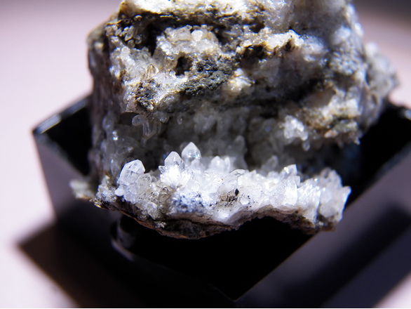


Beach cliffs, San Simeon, Santa Lucia Mts, San Luis Obispo County, California, USA