 | | Journal (article/letter/editorial) |
| 00:52 01 June 2016 Wyoming Mineral Locality Index Figure 1. Index map of Wyoming counties, with exposures...exposures of Precambrian and volcanic rocks. 1 he Wyoming mineral locality index is designed to provide mineral...interesting mineral occurrences in the state of Wyoming. Five publications were used extensively in compiling...view of the Tenderfoot mine (about 19131, Esterbrook copper district, Albany County. John Taylor collection...1 inch equals 4 miles) of the entire state of Wyoming in book form. The Wwming Atlas and Gazetteer can |
 | | Journal (article/letter/editorial) |
| University, P.O. Box 173480, Bozeman, MT 59717, USA Department of Chemistry and Biochemistry, University...of Montana, 32 Campus Drive, Missoula, MT 59812, USA; ranalda.tsosie@umontana.edu Correspondence: amoorenall@yahoo...Formation. Two of the top 10 producing oil fields in Wyoming are located approximately 50 km west of two abandoned...in Mississippian aged paleokarst in Montana and Wyoming have hydrocarbon residue present and contain anomalous...both the Pryor Mountain U-V Mining District (PMD), Montana (MT) and the Little Mountain U-V Mining District |
 | | Report (issue) |
| ............................................. Wyoming .................................................the type locality at the Durkee opal mine near Durkee, Baker County, Oregon. The name was derived from...Deffeyes (1959) described material from Nevada and Wyoming. Unlike the type erionite, these subsequent occurrences... potassium feldspar, calcite, searlesite, and fluorite. Associated zeolites are chabazite, clinoptilolite...Christmas, Gila County (NWl/4sec. 1,T. 4 S., R. 15 E.) 4. Near Kearny, Pinal County (NW1/4NW1/4 sec |
 | | Report (issue) |
| between footwall and hanging wall seams, Carroll mine.______--_-_____________________________________...47. Cross section through Crooks Gap area, Fremont County, Wyo__ __________-______-___--_--__------------_...roll, Rex No. 1 mine- ______ 50. Fault in back of stoped-out ore roll, Rex No. 1 mine- ___---___-_---...of Eocene age in uplifted fault block at RanRex mine.- _____________________________________________...of part of the Ridenour mine showing uraniferous copper vein and outline of mine workings. ________ 54 |
 | | Journal (article/letter/editorial) |
| this rift projected northward through Colorado, Wyoming, Idaho, Montana, British Columbia, Yukon Territory...tensional features that controlled .depositionof the fluorite are not merely local normal faults but parts of...rhyolitic and basaltic lava flows (Lipman, Rocky Mountain front to the east and a Miocene 1969), alkalic...Mountains; 2. Eagle Mountains. New Mexico: 3. Fluorite Ridge; 4. CooksPeak; 5. Burro Mountains;6. Gila;...10. Gallinas; 11. Zuni; 12. Questa (molybdenum,fluorite). Colorado: 13. Wagon Wheel Gap; 14. Poncha Springs; |
 | | Report (issue) |
| National Forest RARE II and Wilderness lands in Wyoming Compiled by Myra K. Vaag 1 and Kristine K. Wise.......................................... Bruce Mountain (2-028).........................................Creek/Dell Creek/Game Creek (4-102).... Munger Mountain (4-103)........................................... North Fork Sheep Creek (4-109).................................... Southern Wyoming Range (4-110)........................................ Pennock Mountain (2-073)...................................... |
 | | Report (issue) |
| THE GEOLOGICAL SURVEY OF WYOMING HORACE D. THOMAS, State Geologist BULLETIN 51 A FIELD GUIDE TO THE...ROCKS AND MINERALS OF WYOMING by William H. Wilson THE GEOLOGICAL SURVEY OF WYOMING HORACE D. THOMAS,...' 0 MINERALS OF WYOMING By WILLIAM H. WILSO. UN IVERSITY OF WYOMING LARAMIE, WYOMING A GUST, 1965 This...the Department of Geology at the University of Wyoming ( 19 17-631. For more than fift y years his life...life has been devoted toward the understanding of Wyoming geology. but perhaps more important has been his |
 | | Report (volume) |
| AND MINERAL DEPOSITS OF THE SNOWMASS MOUNTAIN AREA GUNNISON COUNTY, COLORADO BY JOHN W. VANDERWILT Prepared...---_-_-_______.__________ Granite of Treasure Mountain stock. _____--______._ _ ______ General character______...igneous rocks Continued. Granite of Treasure Mountain stock Continued. i Mode of occurrence---.-.--...____i_..___.._.._..__ Granodiorite of Snowmass Mountain stock,________-_----_-_ Location and access_-_---_-____-_--__..._-_-_______-__-_____ Elk Mountain fault zone.__.__--_--_-._----___--_------.-_Treasure Mountain dome _-_-_____- |
 | | Report (issue) |
| ....................................... Steel Mountain (4-BAA)................................................................................ Scout Mountain (4-152)............................................ Elkhorn Mountain (4-156)........................................... Oxford Mountain (4-157)........................................... Clarkston Mountain (4-159).................................................................................. Red Mountain (4-170)...................................... |
 | | Report (issue) |
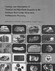
| 10 12 13 1 . Asbestos ore 2. Lead ore, Balmat mine, N. Y. 3. Chromite-chromium ore, Washington 4....Manganese nodules, ocean floor 13. Botryoidal fluorite ore, Poncha Springs, Colo. 14. Tungsten ore. North...the Southern Bear Lodge Mountains, Northeastern Wyoming By MORTIMER H. STAATZ GEOLOGY AND RESOURCES OF...the southern Bear Lodge Mountains, northeastern Wyoming (Geological Survey Professional Paper 1049-D) Bibliography:...16:1049-D 1. Thorium ores Wyoming Bear Lodge Mountains. 2. Earth, Rare Wyoming Bear Lodge Mountains. I |
 | | Report (issue) |
| Platte River Adjacent Wilderness Study Area, Jackson County, Colorado By Robert P. Dickerson 1 and John R....Adjacent (CO-010-104) Wilderness Study Area, Jackson County, Colorado. ABSTRACT The Platte River Adjacent...Area (CO-010-104) consists of 30 acres in Jackson County, Colorado, No mineral occurences, energy resources...located 16 mi (miles) north of Walden in Jackson County, Colorado (see figure 1). It consists of 30 acres... 106°15' I 1 WYOMING O|0 U U MANY VALUES PEGMATITE ^ COLORADO __ ___CARBON COUNTY " JACKSON"C~OUNTY |
 | | Report (issue) |
| comparison with related rocks elsewhere in Colorado and Wyoming UNITED STATES GOVERNMENT PRINTING OFFICE,...monzonite and granodiorite augen gneiss of Buffalo Mountain .............................. Equigranular quartz...................................... Accessory fluorite ............................... Economic implications...with other igneous rocks of Colorado and nearby Wyoming ................... Sherman-Silver Plume dichotomy...monzonite and granodiorite augen gneiss of Buffalo Mountain cut by quartz latite dike ............... Geologic |
 | | Report (issue) |
| West and East Palisades Roadless Areas, Idaho and Wyoming White Cloud-Boulder Roadless Area 553 113°45'...Vanadium Copper w Tungsten Gold Zn zinc Lead Mine or deposit Mine Volcanic rocks (Tertiary) Intrusive rocks...of leadzinc-silver ore, mostly in the Phi Kappa mine, and an additional 2.5 million tons of demonstrated...these metals and for tungsten, molybdenum, and fluorite. The survey indicates substantiated resource potential...4000 ft. Canyons on the northeast side of the mountain crest have been glaciated for their entire length |
 | | Report (issue) |
| ............................................. Wyoming..................................................Adams Gap and Shinbone Creek Roadless Areas, Clay County, Alabama: U.S. Geological Survey OpenFile Report...and Adams Gap RARE II Further Planning Area, Clay County, Alabama: U.S. Bureau of Mines Open-File Report...Adams Gap and Shinbone Creek Roadless Areas, Clay County, Alabama: U.S. Geological Survey Miscellaneous...Adams Gap and Shinbone Creek Roadless Areas, Clay County, Alabama: U.S. Geological Survey Miscellaneous |
 | | Report (issue) |
| Franklin Mountains....................... Luna County............................. Silver City region...Sierra County, N. Mex.; B, Paleozoic rocks on granite at Capitol Dome, Florida Mountains, Luna County, N...limestone at Palomas Gap, Caballos Mountains, Sierra County, N. Mex.. XVIII. A, Limestones from Ordovician...Pennsylvanian on granite, Sheep Mountain, San Andres Mountains, Socorro County, N. Mex.; B, East face of...San Andres Mountains at Rhodes Canyon, Socorro County, N.Mex.......................... XIX. A, North |
 | | Journal (article/letter/editorial) |
| view showing the Indian Queen mine ca. 1905 at Farlin, Beaverhead County. 208 ROCKS & MINERALS Downloaded...mines at Butte in Silver Bow County and the Black Pine mine in Granite County have produced many fine crystal...Beaverhead County, the pegmatites of Jefferson County, and the Snowbird mine in Mineral County continue...Highlands Centennial Nugget in 1989 in Silver Bow County. The seventh largest gold nugget found in Montana;...should be sent to the author. LOCATIONS BY COUNTY Beaverhead County Anderson deposit, sec. 16, T. 12 S., R |
 | | Report (volume) |
| material from amygdales in a basaltic rock from Wyoming (Pirsson, 1890; Schaller, 1932). Occurrences of...1. 2. 3. 4. 5. 6. 7. 8. Near Vaughn, Cascade County. .. Tuff and tuffaceous siltstone and sandstone...FormaR. 14 E., Chouteau County. tion of Eocene age. Near Harlem, Blaine County..... Bentonite in the Bearpaw...Bearpaw Shale of Cretaceous age. Near Turner, Blaine County ... ....do..............-.---.----. Near Livingston...Group of Cretaceous age. 1 Near Joliet, Carbon County...... Bentonite in the Claggett Formation of Cretaceous |
 | | Report (issue) |
| Laramie Mountains, Albany and Platte Counties, Wyoming By George L» Snyder Open File Report 84- 358^A...Laramie Mountains, Albany and Platte Counties, Wyoming By George L. Snyder This Open-File Report shows...across the central Laramie Mountains of eastern Wyoming. Although the geologic maps are detailed, the mapping...1/2' quadrangle, Wyoming. (AS) C. Geologic map of Dodge Ranch 7 1/2' quadrangle, Wyoming. (DR) D. Geologic...quadrangle, Wyoming. (BCP) E. Geologic map of Moonshine Peak 7 1/2' quadrangle, Wyoming. (MP) F. Geologic |
 | | Journal (article/letter/editorial) |
| Washington State University, Pullman, Washington 99164, USA *Corresponding author. E-mail: sahuson@hotmail.com...Canyon Formation of southwest Montana and western Wyoming were used to evaluate the use of X-ray powder diffraction...1695 © The Meteoritical Society, 2009. Printed in USA. 1696 S. A. Huson et al. Fig. 1. a) Geologic...samples. 1 = Shoshone Canyon (SH), 2 = Sheep Mtn (SM), 3 = Benbow Mine (BM), 4 = UPR, 5 = Church Buttes (CB)...Meramecian) Mission Canyon Formation in western Wyoming and southwestern Montana records shallow water |
 | | Report (issue) |
| Deposits of the St. Regis-Superior Area Mineral County, Montana By ARTHUR B. CAMPBELL CONTRIBUTIONS TO..._-----_-_-_-_-_------.___----------------Boyd Mountain fault._____________________j.__________ Siegel...deposits_________________________________________ Iron Mountain mine_--_-____--_---_-_-____--_-------_----Nancy...deposits________________________________________ Little Pittsburg mine ______________________________________ Copper d...Mineral County, Mont. 29. Geologic maps and sections of the Iron Mountain mine, Iron Mountain mining district |
 | | Report (volume) |
| resources-Colorado--Jackson County. 2. Mines and mineral resources-Colorado-Routt County. 3. Geology-Colorado--Jackson...Geology-Colorado--Jackson County. 4. GeologyColorado--Routt County. I. Patten, Lowell L. II. Daniels, Jeffrey J. III...by George L. Snyder ....................... . (B) Mine appraisal, by Lowell L. Patten .................... . 3. Photograph of Gilpin Lake to Big Agnes Mountain . . . . . 107-109. Maps showing: 107. Location...Walden, Colorado, immediately south of the Colorado-Wyoming State line. Almost all of this wilderness area |
 | | Report (volume) |
| MONTANA J J -"-'-·--1 WYOMING Mineral Resources of the Pryor Mountain, Burnt Timber Canyon, and...Wilderness Study Areas, Carbon County, Montana, and Big Horn County, Wyoming By CHARLES G. PATIERSON, MARGO...STUDY AREASSOUTH-CENTRAl MONTANA AND NORTH-CENTRAl WYOMING DEPARTMENT OF THE INTERIOR DONAlD PAUl HODEl...Pryor Mountain, Burnt Timber Canyon, and Big Horn Tack-On Wilderness Study Areas, Carbon County, Montana...Montana, and Big Horn County, Wyoming. (Mineral resources of wilderness study areas--south-central Montana |
 | | Report (issue) |
| ...................................... Ragged Mountain Wilderness (NF-181)......................... Raggeds...(2-184).................................... Electric Mountain (2-185)................................... Clear......................................... Priest Mountain (2-191)..................................... Salt...(2-193)..................................... Nick Mountain (2-194)............................................... Gothic Mountain (2-199)..................................... Whetstone Mountain (2-200)...... |
 | | Report (volume) |
| rocks of Conejos age._ 'Treasure Mountain quartz latite Sheep Mountain andesite__-____ Alboroto quartz...manganese--__----_-----------_------_--____-__-_____ Fluorite......_______________-______________ Sulphur.....the relation of the San Juan region to the other mountain masses of Colorado.__________ 10 3. Drainage map...formation_____ FIGURE 1. Comparative sections of Treasure Mountain quartz latite__ 2. Comparative sections of Piedra...mountains furnish excellent summer pasturage for sheep and cattle. There are many mining towns in the mountains |
 | | Report (volume) |
| geology of part of the North Park basin Jackson County, Colorado UNITED STATES GOVERNMENT PRINTING OFFICE............................. 102 Independence Mountain area.______--------.___-____---_.__ Pearl area...1. Geologic map of the Pearl and Independence Mountain quadrangles, Colorado. 2. Geologic map of the...quadrangles, Colorado. 3. Geologic map of .the Pitchpine Mountain and Delaney Butte quadrangles, Colorado. 4. Generalized...northwestern part of the North Park basin, Jackson County, Colo. North Park is a large intermontane topographic |


