McMahon Ridge, Goldfield Mining District, Esmeralda County, Nevada, USAi
| Regional Level Types | |
|---|---|
| McMahon Ridge | Ridge |
| Goldfield Mining District | Mining District |
| Esmeralda County | County |
| Nevada | State |
| USA | Country |
This page is currently not sponsored. Click here to sponsor this page.


Latitude & Longitude (WGS84):
37° 42' 36'' North , 117° 14' 0'' West
Latitude & Longitude (decimal):
Locality type:
Köppen climate type:
Nearest Settlements:
| Place | Population | Distance |
|---|---|---|
| Goldfield | 268 (2011) | 0.3km |
| Silver Peak | 107 (2011) | 35.6km |
| Tonopah | 2,478 (2011) | 39.7km |
Structure: The most productive mines in Goldfield form an arcuate belt that trends generally north from the Goldfield Main District, then northeast through the Adams and Conqueror mines area, and then easterly through McMahon Ridge and Black Butte. This belt of gold deposits coincides with the western and northern limits of an inferred intrusive-related, ring-fracture system and is host to nearly all of the most productive gold ore bodies known in the District. Tertiary deposits are domed and faulted by steeply dipping post Miocene: N-S and E-W faults.
Alteration: Large envelopes of intense argillic alteration surround most of the ore zones with silicification of core ore zones.
Tectonics: volcanic center, Basin and Range
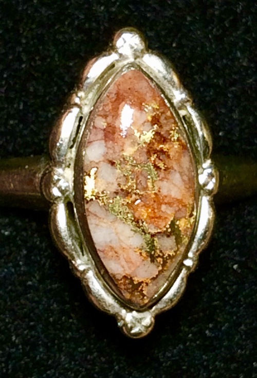
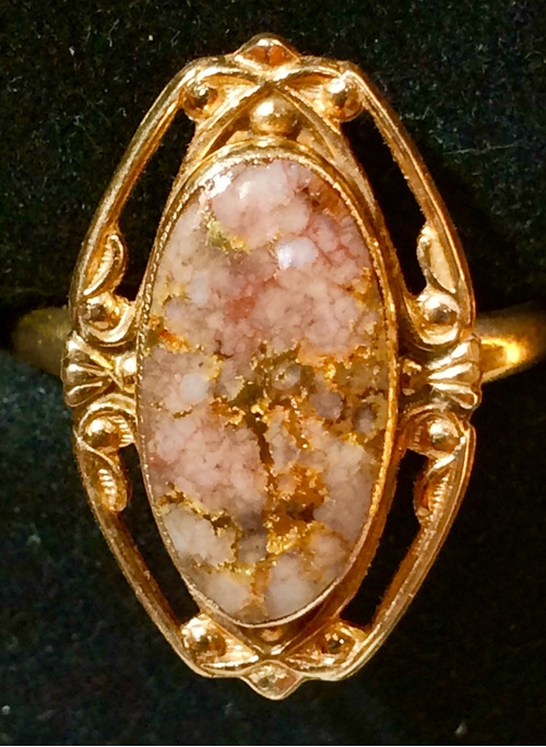
Commodity: Ore Materials: gold Gangue Materials: quartz, alunite, barite, gypsum, limonite, kaolin
Deposit: The drill-defined part of the McMahon Ridge mineralized area has the following dimensions: 4,800 ft long and open, 800 ft down dip and open, and average 100 ft thick. The mineralized area at McMahon Ridge is formed by a series of east-west trending and northeast trending veins and breccia zones hosted by Milltown andesite. Almost all of the precious and base metal production recorded from the Goldfield mining district has come from rich epithermal bonanza ore bodies in the area northeast of the Goldfield town site. These ore bodies occur within silicified hydrothermal alteration zones. Mineralization in the argillized wall rock envelopes appears to be leakage zones emanating from core silicified zones. Ore zones are commonly associated with silicification and/or free quartz surrounded by large envelopes of intense argillic alteration. In the main district, gold-copper ores were found in a series of pipe-like shoots referred to locally as ledges, the most productive of which occurred where the east-west striking Goldfield structural trend intersects a mile-long arcuate section of inferred intrusive-related ring-fracture zone. Although the major ore bodies are hosted in a complex intersecting set of faults and fracture zones, the ore-bearing structures are generally north-south trending and sub-parallel to the strike of the ring-fracture zone in that location.
Deposit type: Epithermal quartz-alunite Au
Development: At McMahon Ridge, Metallic Ventures was running a 25,000-foot drilling program in 2004 and was planning to implement a feasibility study of the Gemfield and McMahon Ridge deposits by the third quarter of 2004. In April 2004, high-grade gold was intersected during infill drilling at McMahon Ridge and along structures in the main district at its Goldfield Project in Nevada. Highlights of the McMahon infill drilling include RC drill hole MCM-333 intersecting 30 ft grading 15.04 g/t Au including 5 ft grading 68.72 g/t Au, MCM-343 intersecting 115 ft grading 4.11 g/t Au including 5 ft grading 22.29 g/t Au, and MCM-344 intersecting 115 ft grading 15.09 g/t Au including 15 ft grading 98.4 g/t Au. The McMahon Ridge drill hole data base will be taken into a prefeasibility study whereby minable ounces of gold will be calculated in 2004.
Geology: The Goldfield mining district is located at the site of a complex and long-lived igneous intrusive and volcanic center that is defined by eruptive vents and curviplanar faults. The local volcanic stratigraphy, a moderately well-defined ring-fracture zone, concentric structural doming, high sulfidation-style quartz-alunite hydrothermal alteration, and widespread copper-gold mineralization are all genetically related to the emplacement of a large dominantly andesitic igneous complex and the most significant components of which are late Oligocene to early Miocene in age.
Ore(s): The ore-bearing structures are generally north-south trending and sub-parallel to the strike of the ring-fracture zone.
Select Mineral List Type
Standard Detailed Gallery Strunz Chemical ElementsCommodity List
This is a list of exploitable or exploited mineral commodities recorded from this region.Mineral List
Mineral list contains entries from the region specified including sub-localities10 valid minerals.
Rock Types Recorded
Note: data is currently VERY limited. Please bear with us while we work towards adding this information!
Rock list contains entries from the region specified including sub-localities
Select Rock List Type
Alphabetical List Tree DiagramDetailed Mineral List:
| ⓘ Alunite Formula: KAl3(SO4)2(OH)6 Reference: U.S. Geological Survey (2005) Mineral Resources Data System: U.S. Geological Survey, Reston, Virginia. |
| ⓘ Baryte Formula: BaSO4 Reference: U.S. Geological Survey (2005) Mineral Resources Data System: U.S. Geological Survey, Reston, Virginia. |
| ⓘ Chlorargyrite Formula: AgCl Reference: U.S. Geological Survey (2005) Mineral Resources Data System: U.S. Geological Survey, Reston, Virginia. |
| ⓘ Galena Formula: PbS Reference: Econ Geol (1989) 84:2115-2138 |
| ⓘ Gold Formula: Au Reference: U.S. Geological Survey (2005) Mineral Resources Data System: U.S. Geological Survey, Reston, Virginia. |
| ⓘ Goldfieldite ? Formula: (Cu4◻2)(Cu4Cu+2)Te4S12S Reference: Econ Geol (1989) 84:2115-2138 |
| ⓘ Gypsum Formula: CaSO4 · 2H2O Reference: U.S. Geological Survey (2005) Mineral Resources Data System: U.S. Geological Survey, Reston, Virginia. |
| ⓘ 'Limonite' Reference: U.S. Geological Survey (2005) Mineral Resources Data System: U.S. Geological Survey, Reston, Virginia. |
| ⓘ Pyrite Formula: FeS2 Reference: U.S. Geological Survey (2005) Mineral Resources Data System: U.S. Geological Survey, Reston, Virginia. |
| ⓘ Quartz Formula: SiO2 Reference: U.S. Geological Survey (2005) Mineral Resources Data System: U.S. Geological Survey, Reston, Virginia. |
| ⓘ Sphalerite Formula: ZnS Reference: Econ Geol (1989) 84:2115-2138 |

List of minerals arranged by Strunz 10th Edition classification
| Group 1 - Elements | |||
|---|---|---|---|
| ⓘ | Gold | 1.AA.05 | Au |
| Group 2 - Sulphides and Sulfosalts | |||
| ⓘ | Galena | 2.CD.10 | PbS |
| ⓘ | Goldfieldite ? | 2.GB.05 | (Cu4◻2)(Cu4Cu+2)Te4S12S |
| ⓘ | Pyrite | 2.EB.05a | FeS2 |
| ⓘ | Sphalerite | 2.CB.05a | ZnS |
| Group 3 - Halides | |||
| ⓘ | Chlorargyrite | 3.AA.15 | AgCl |
| Group 4 - Oxides and Hydroxides | |||
| ⓘ | Quartz | 4.DA.05 | SiO2 |
| Group 7 - Sulphates, Chromates, Molybdates and Tungstates | |||
| ⓘ | Alunite | 7.BC.10 | KAl3(SO4)2(OH)6 |
| ⓘ | Baryte | 7.AD.35 | BaSO4 |
| ⓘ | Gypsum | 7.CD.40 | CaSO4 · 2H2O |
| Unclassified Minerals, Rocks, etc. | |||
| ⓘ | 'Limonite' | - | |
List of minerals for each chemical element
| H | Hydrogen | |
|---|---|---|
| H | ⓘ Alunite | KAl3(SO4)2(OH)6 |
| H | ⓘ Gypsum | CaSO4 · 2H2O |
| O | Oxygen | |
| O | ⓘ Quartz | SiO2 |
| O | ⓘ Alunite | KAl3(SO4)2(OH)6 |
| O | ⓘ Baryte | BaSO4 |
| O | ⓘ Gypsum | CaSO4 · 2H2O |
| Al | Aluminium | |
| Al | ⓘ Alunite | KAl3(SO4)2(OH)6 |
| Si | Silicon | |
| Si | ⓘ Quartz | SiO2 |
| S | Sulfur | |
| S | ⓘ Sphalerite | ZnS |
| S | ⓘ Galena | PbS |
| S | ⓘ Pyrite | FeS2 |
| S | ⓘ Alunite | KAl3(SO4)2(OH)6 |
| S | ⓘ Baryte | BaSO4 |
| S | ⓘ Gypsum | CaSO4 · 2H2O |
| S | ⓘ Goldfieldite | (Cu4◻2)(Cu4Cu2+)Te4S12S |
| Cl | Chlorine | |
| Cl | ⓘ Chlorargyrite | AgCl |
| K | Potassium | |
| K | ⓘ Alunite | KAl3(SO4)2(OH)6 |
| Ca | Calcium | |
| Ca | ⓘ Gypsum | CaSO4 · 2H2O |
| Fe | Iron | |
| Fe | ⓘ Pyrite | FeS2 |
| Cu | Copper | |
| Cu | ⓘ Goldfieldite | (Cu4◻2)(Cu4Cu2+)Te4S12S |
| Zn | Zinc | |
| Zn | ⓘ Sphalerite | ZnS |
| Ag | Silver | |
| Ag | ⓘ Chlorargyrite | AgCl |
| Te | Tellurium | |
| Te | ⓘ Goldfieldite | (Cu4◻2)(Cu4Cu2+)Te4S12S |
| Ba | Barium | |
| Ba | ⓘ Baryte | BaSO4 |
| Au | Gold | |
| Au | ⓘ Gold | Au |
| Pb | Lead | |
| Pb | ⓘ Galena | PbS |
References
Sort by
Year (asc) Year (desc) Author (A-Z) Author (Z-A)Ransome, F. L. (1909), Geol. and Ore Deposits of Goldfield, Nev.: USGS Prof. Paper 66, 258 p.
Searls, F. Jr., (1948), Geol and Ore Deposits of Goldfield, Nev.: Nevada Univ. Bull., v.42, no. 5, Geology and Mining Ser. 48, 24 p.
Koschmann, A. H. and Bergendahl, M. H., (1968); Principal Gold Producing Districts of the United States: USGS Prof. Paper 610
Spurr, J E, (1905), The Ores of Goldfield, Nev.: USGS Bull. No. 260, p. 132-139.
Lincoln, F C, (1923), Mining Dist and Min. Res. Nev.: Reno, Nev. Newsletter Pub., p. 67-73
Albers, J.P. and Stewart, J.H., (1972), Geology and Mineral Deposits of Esmeralda County, Nevada: NBMG Bull. 78, p. 67-69
Steven Ristorcelli, Scott Hardy, and Neil Prenn, (2003), Geology and Mineralization of the Goldfield Area, Esmeralda,County, Nevada; Geological Society of Nevada Special Publication No. 37: Spring 2003 Field Trip Guidebook Gold Deposits of the Goldfield, Midway and Thunder Mountain Areas
Long, K.R., DeYoung, J.H., Jr., and Ludington, S.D., (1998), Database of significant deposits of gold, silver, copper, lead, and zinc in the United States; Part A, Database description and analysis; part B, Digital database: U.S. Geological Survey Open-File Report 98-206, 33 p., one 3.5 inch diskette.
Other Databases
| Link to USGS MRDS: | 10310418 |
|---|
Localities in this Region
- Nevada
- Esmeralda County
- Goldfield Mining District
- McMahon Ridge
- Goldfield Mining District
- Esmeralda County
Other Regions, Features and Areas containing this locality
North America PlateTectonic Plate
- Antler Foreland BasinBasin
- Basin and Range BasinsBasin
- Mojave DomainDomain
USA
- Sierra NevadaMountain Range
This page contains all mineral locality references listed on mindat.org. This does not claim to be a complete list. If you know of more minerals from this site, please register so you can add to our database. This locality information is for reference purposes only. You should never attempt to
visit any sites listed in mindat.org without first ensuring that you have the permission of the land and/or mineral rights holders
for access and that you are aware of all safety precautions necessary.
Quick NavTopCommoditiesMineral ListRock TypesReferencesOther DatabasesLocalities in RegionOther Regions


Daisy mine, McMahon Ridge, Goldfield Mining District, Esmeralda County, Nevada, USA