Badgebup Gold Mine, Katanning Shire, Western Australia, Australia


| Latitude & Longitude (WGS84): | 33° 32' 29'' South , 117° 54' 27'' East |
|---|---|
| Latitude & Longitude (decimal): | -33.54125,117.90741 |
| GeoHash: | G#: qd5c5n181 |
| Locality type: | Mine |
| Köppen climate type: | Csb : Warm-summer Mediterranean climate |
Glengarry Resources developed the Dingo open pit, and Jinkas open pit in the 1990's, producing 20 000 ounces of gold from an oxide resource. Low gold prices forced the site to close. Great Southern Resources acquired the tenements in 2001, and in August 2010 went into a joint venture with Ausgold Limited which eventually took over the project.
It has been called the Katanning Gold Project or South Boddington Gold Project, although its links to the Boddington Gold Mine elsewhere in the South West Region is tenuous. Badgebup is of aboriginal meaning referring to a nearby well as 'place of wild rushes'. Ausgold has conducted much exploration with a plan to eventually resume mining.
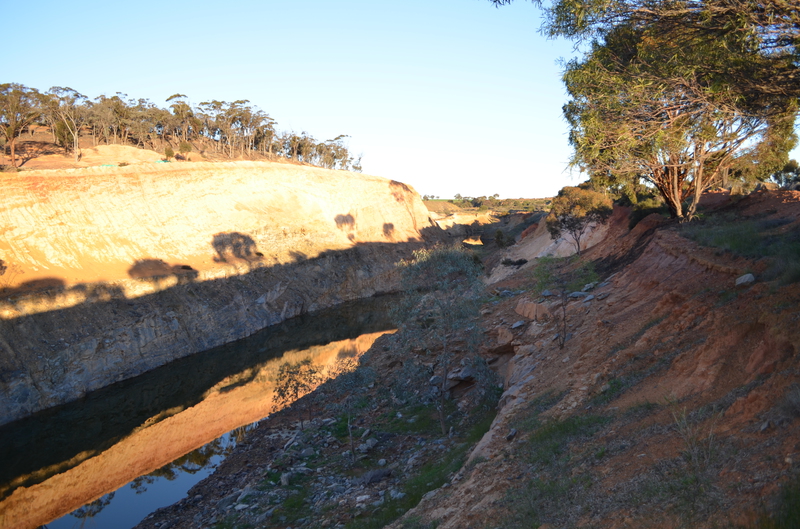
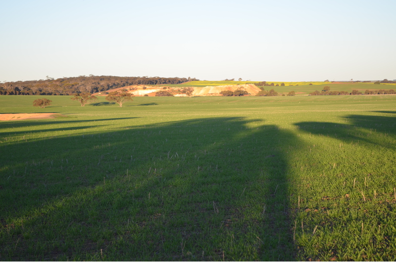
The mines are 36 kilometres east north-east of Katanning. Badgebup consists of a historic church, and grain handling facility. About 5 kilometres north of Badgebup along minor roads is the Dingo pit, 500 metres east of the road bordering a wheat field. A further 2 kilometres north is the co-joined Jinkas pits, with offices, processing plant remnants and tailings immediately south. The mine borders the east side of the road.
The site is unusual as it is separated from the greenstone belts of the Eastern Goldfields and Mid West. The only comparable gold mine is Griffins Find near Lake Grace. The Badgebup mines and prospects are in the Katanning Greenstone Belt, inamongst wheat farms.
The gold is hosted in granulites (adamellite) intruded by a granitic rock thought to be the source of the mineralising fluids. Two parallel corridors with discontinuous mineralisation has been identified over an 18 kilometre strike. The Western Corridor contains Dingo, Jackson and Lone Tree prospects. The Eastern Corridor contains Olympia, Jinkas, Neighbours, White Dam and Fraser prospect.
Gold is found in the Hanging Wall mafic contact with the granitic rock. The mineralised mafic rock zone is 10 to 20 metres thick containing 1 to 3 g/t Au and 0.5% Cu. Gold is disseminated with no veining. It is associated with magnetite, pyrite, pyrrhotite, minor chalcopyrite and trace molybedum and tungsten.
A scoping study by the company states the location has the 'potential' for 189 370 ounces of gold over a four year mine life plan.
Map- shows the location of the Jinkas pits.
Commodity List
This is a list of exploitable or exploited mineral commodities recorded at this locality.Mineral List
7 valid minerals.
Rock Types Recorded
Select Rock List Type
Alphabetical List Tree DiagramRegional Geology
This geological map and associated information on rock units at or nearby to the coordinates given for this locality is based on relatively small scale geological maps provided by various national Geological Surveys. This does not necessarily represent the complete geology at this locality but it gives a background for the region in which it is found.
Click on geological units on the map for more information. Click here to view full-screen map on Macrostrat.org
| Neoarchean - Mesoarchean 2500 - 3200 Ma ID: 3189638 | Archean crystalline metamorphic rocks Age: Archean (2500 - 3200 Ma) Comments: Yilgarn Craton Lithology: Amphibolite/granulite grade orthogneiss Reference: Chorlton, L.B. Generalized geology of the world: bedrock domains and major faults in GIS format: a small-scale world geology map with an extended geological attribute database. doi: 10.4095/223767. Geological Survey of Canada, Open File 5529. [154] |
| Archean 2500 - 4000 Ma ID: 907779 | gneiss, granulite, migmatite 74310 Age: Archean (2500 - 4000 Ma) Description: Banded granitic gneiss (monzogranitic to granodioritic), quartzofeldspathic gneiss with mafic bands, migmatite, granofels, mafic and felsic granulites, hypersthene-plagioclase-quartz granulite; schist, pelitic or mafic granofels Comments: high grade metamorphic rock; synthesis of multiple published descriptions Lithology: High grade metamorphic rock Reference: Raymond, O.L., Liu, S., Gallagher, R., Zhang, W., Highet, L.M. Surface Geology of Australia 1:1 million scale dataset 2012 edition. Commonwealth of Australia (Geoscience Australia). [5] |
Data and map coding provided by Macrostrat.org, used under Creative Commons Attribution 4.0 License
References
External Links
http://www.mininglink.com.au/site/Katanning_Gold_Project


Badgebup Gold Mine, Katanning Shire, Western Australia, Australia