Col d'Envalira, Pas de La Casa, Encamp, Andorrai
| Regional Level Types | |
|---|---|
| Col d'Envalira | Mountain Pass |
| Pas de La Casa | Mountain Pass |
| Encamp | Parish |
| Andorra | Country |
This page is currently not sponsored. Click here to sponsor this page.
Latitude & Longitude (WGS84):
42° 32' 25'' North , 1° 43' 8'' East
Latitude & Longitude (decimal):
Type:
Köppen climate type:
Mindat Locality ID:
261215
Long-form identifier:
mindat:1:2:261215:0
GUID (UUID V4):
b33c07b0-0935-44bf-b885-caf605b3634f
The Col d'Envalira (properly Port d'Envalira) is a step in the Pyrenees. It is located in the Principality of Andorra between the resorts of Soldeu and Pas de la Casa near the border with France. With its 2,409 meters is the highest pass of the entire chain of the Pyrenees, as well as the highest in Europe to be open year-round.
Since September 29, 2002, the Envalira Tunnel (below this pass) has been open for traffic at an altitude of about 2,000 meters above sea level.
Select Mineral List Type
Standard Detailed Gallery Strunz Chemical ElementsGallery:
List of minerals arranged by Strunz 10th Edition classification
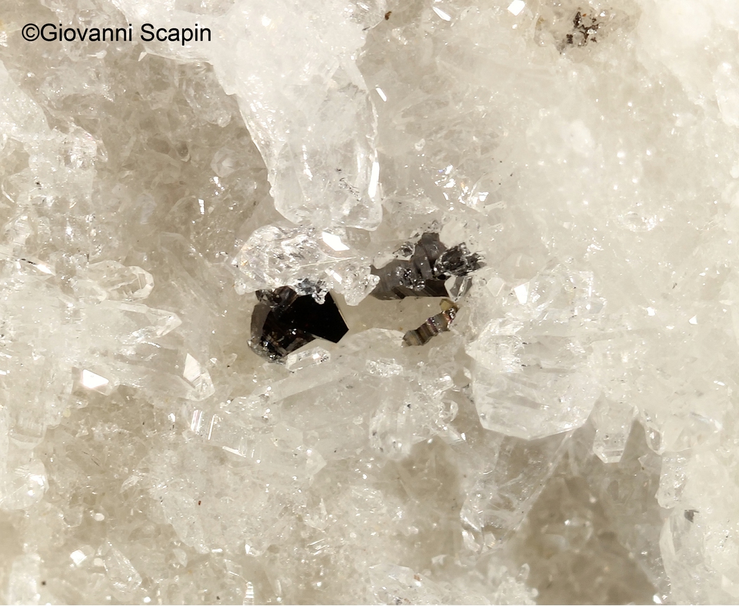
| Group 4 - Oxides and Hydroxides | |||
|---|---|---|---|
| ⓘ | Anatase | 4.DD.05 | TiO2 |
Other Databases
| Wikipedia: | https://en.wikipedia.org/wiki/Port_d%27Envalira |
|---|---|
| Wikidata ID: | Q738592 |
Other Regions, Features and Areas containing this locality
This page contains all mineral locality references listed on mindat.org. This does not claim to be a complete list. If you know of more minerals from this site, please register so you can add to our database. This locality information is for reference purposes only. You should never attempt to
visit any sites listed in mindat.org without first ensuring that you have the permission of the land and/or mineral rights holders
for access and that you are aware of all safety precautions necessary.


Col d'Envalira, Pas de La Casa, Encamp, Andorra